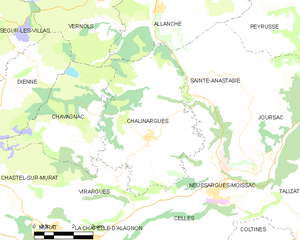
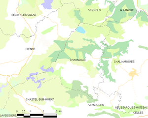
canton of Murat (canton de Murat)

- canton of France
- Country:

- Capital: Murat
- Coordinates: 45° 6' 38" N, 2° 52' 10" E


- GPS tracks (wikiloc): [Link]
- Population: 8253
- Wikipedia en: wiki(en)
- Wikipedia: wiki(fr)
- Wikidata storage: Wikidata: Q60017
- INSEE canton code: [1507]
Includes regions:


Celles
- former commune in Cantal, France
- Country:
- Postal Code: 15170
- Coordinates: 45° 6' 54" N, 2° 57' 15" E
- GPS tracks (wikiloc): [Link]
- Area: 18.35 sq km
- Population: 217

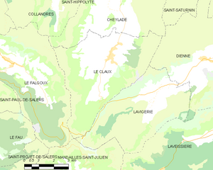
Le Claux
- commune in Cantal, France
- Country:
- Postal Code: 15400
- Coordinates: 45° 9' 35" N, 2° 42' 19" E
- GPS tracks (wikiloc): [Link]
- Area: 28.07 sq km
- Population: 188
- Web site: [Link]


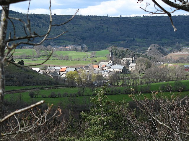
Murat
- former commune in Cantal, France
- Country:
- Postal Code: 15300
- Coordinates: 45° 6' 36" N, 2° 52' 7" E
- GPS tracks (wikiloc): [Link]
- Area: 6.47 sq km
- Population: 1833


La Chapelle-d'Alagnon
- commune in Cantal, France
- Country:
- Postal Code: 15300
- Coordinates: 45° 6' 28" N, 2° 53' 47" E
- GPS tracks (wikiloc): [Link]
- Area: 9.2 sq km
- Population: 246

Neussargues-Moissac
- former commune in Cantal, France
- Country:
- Postal Code: 15170
- Coordinates: 45° 7' 42" N, 2° 58' 34" E
- GPS tracks (wikiloc): [Link]
- Area: 13.62 sq km
- Population: 996
Laveissenet
- commune in Cantal, France
- Country:
- Postal Code: 15300
- Coordinates: 45° 4' 54" N, 2° 53' 20" E
- GPS tracks (wikiloc): [Link]
- Area: 10.79 sq km
- Population: 123


Cheylade
- commune in Cantal, France
- Country:
- Postal Code: 15400
- Coordinates: 45° 12' 34" N, 2° 42' 57" E
- GPS tracks (wikiloc): [Link]
- Area: 32.81 sq km
- Population: 229
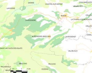
Albepierre-Bredons
- commune in Cantal, France
- Country:
- Postal Code: 15300
- Coordinates: 45° 4' 39" N, 2° 49' 55" E
- GPS tracks (wikiloc): [Link]
- Area: 34.42 sq km
- Population: 243
- Web site: [Link]


Dienne
- commune in Cantal, France
- Country:
- Postal Code: 15300
- Coordinates: 45° 9' 31" N, 2° 47' 13" E
- GPS tracks (wikiloc): [Link]
- Area: 46.33 sq km
- Population: 271


Lavigerie
- commune in Cantal, France
- Country:
- Postal Code: 15300
- Coordinates: 45° 8' 18" N, 2° 44' 40" E
- GPS tracks (wikiloc): [Link]
- Area: 24.25 sq km
- Population: 103


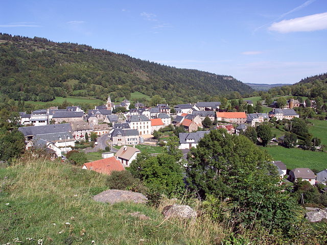
Laveissière
- commune in Cantal, France
- Country:
- Postal Code: 15300
- Coordinates: 45° 6' 58" N, 2° 48' 22" E
- GPS tracks (wikiloc): [Link]
- Area: 34.93 sq km
- Population: 547
- Web site: [Link]

Chalinargues
- former commune in Cantal, France
- Country:
- Postal Code: 15170
- Coordinates: 45° 9' 18" N, 2° 55' 55" E
- GPS tracks (wikiloc): [Link]
- Area: 27.55 sq km
- Population: 427


Chastel-sur-Murat
- former commune in Cantal, France
- Country:
- Postal Code: 15300
- Coordinates: 45° 7' 27" N, 2° 51' 26" E
- GPS tracks (wikiloc): [Link]
- Area: 13.79 sq km
- Population: 118

Chavagnac
- former commune in Cantal, France
- Country:
- Postal Code: 15300
- Coordinates: 45° 9' 13" N, 2° 52' 55" E
- GPS tracks (wikiloc): [Link]
- AboveSeaLevel: 1095 м m
- Area: 16.58 sq km
- Population: 108


Virargues
- commune in Cantal, France
- Country:
- Postal Code: 15300
- Coordinates: 45° 7' 30" N, 2° 54' 37" E
- GPS tracks (wikiloc): [Link]
- Area: 11.03 sq km
- Population: 133