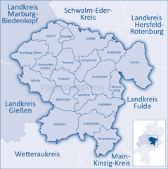
Vogelsbergkreis (Vogelsbergkreis)
- district in Hesse, Germany
Vogelsbergkreis, located in Hessen, Germany, is known for its beautiful landscapes, natural attractions, and a variety of hiking opportunities. Here are some highlights and tips for hiking in this region:
Scenic Trails
-
Vogelsberg Volcanic Trail: A popular route that showcases the unique volcanic landscapes of the region. It offers stunning views of the mountains and the surrounding countryside. The trail is well-marked and accessible for hikers of different experience levels.
-
Hoherodskopf: This is one of the highest points in the Vogelsberg, offering several trails of varying difficulty. The lookout tower at the top provides panoramic views of the surrounding area, making it a popular destination for hikers and photographers.
-
Milseburg: Another prominent mountain in the area, featuring trails that lead to its summit. The Milseburg Shrine at the top is a notable landmark. The ascent offers beautiful views and a rewarding experience upon reaching the top.
Nature Reserves and Parks
- Vogelsberg Nature Park: This protected area is great for those looking to immerse themselves in nature. It features diverse flora and fauna, as well as numerous trails. It's an excellent place for birdwatching and enjoying the tranquil environment.
Tips for Hiking in Vogelsbergkreis
-
Preparation: Make sure to check trail maps and conditions before you head out. Weather can change quickly in the mountains, so dress in layers and bring essential gear (water, snacks, first-aid kit).
-
Trail Markings: The trails are generally well-marked, but it's best to carry a map or a GPS device, especially for longer hikes.
-
Local Recommendations: Seek advice from locals or visitor centers on lesser-known trails, as they may offer hidden gems that provide a quieter hiking experience.
-
Safety: Always inform someone about your hiking plans and estimated return time. Mobile reception can vary, so don’t rely solely on your phone for navigation.
-
Respect Nature: Follow the Leave No Trace principles. Stay on marked paths, respect wildlife, and clean up after yourself.
Vogelsbergkreis is a fantastic destination for outdoor enthusiasts, offering a mix of challenging terrains and gentle walks through beautiful scenery. Enjoy your hiking adventure!
- Country:

- Capital: Lauterbach
- Licence Plate Code: VB
- Coordinates: 50° 38' 27" N, 9° 23' 59" E


- GPS tracks (wikiloc): [Link]
- AboveSeaLevel: 371 м m
- Area: 1458.96 sq km
- Web site: http://www.vogelsbergkreis.de/
- Wikipedia en: wiki(en)
- Wikipedia: wiki(de)
- Wikidata storage: Wikidata: Q7901
- Wikipedia Commons Category: [Link]
- Freebase ID: [/m/01fn4f]
- GeoNames ID: Alt: [2816883]
- VIAF ID: Alt: [147762571]
- OSM relation ID: [62543]
- GND ID: Alt: [4108347-7]
- archINFORM location ID: [8356]
- Library of Congress authority ID: Alt: [n82000782]
- TGN ID: [7090706]
- NUTS code: [DE725]
- German district key: 06535
Includes regions:


Romrod
- town in Vogelsbergkreis in Hesse, Germany
Romrod is a small town located in the state of Hesse, Germany, and while it may not be as well known as some larger hiking destinations, it offers access to beautiful landscapes and a variety of trails for outdoor enthusiasts. Here’s what you can expect when hiking in and around Romrod:...
- Country:

- Postal Code: 36329
- Local Dialing Code: 06636
- Licence Plate Code: VB
- Coordinates: 50° 43' 0" N, 9° 13' 0" E


- GPS tracks (wikiloc): [Link]
- AboveSeaLevel: 334 м m
- Area: 54.43 sq km
- Population: 2690
- Web site: [Link]

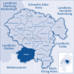
Schotten
- town in Vogelsbergkreis in Hesse, Germany
Schotten is a picturesque town located in Hesse, Germany, surrounded by the scenic landscapes of the Vogelsberg Mountains. The region offers a variety of hiking opportunities suitable for different skill levels. Here are some highlights for hiking in Schotten:...
- Country:

- Postal Code: 63679
- Local Dialing Code: 06044
- Licence Plate Code: VB
- Coordinates: 50° 30' 0" N, 9° 7' 0" E


- GPS tracks (wikiloc): [Link]
- AboveSeaLevel: 330 м m
- Area: 133.56 sq km
- Population: 10102
- Web site: [Link]


Antrifttal
- municipality in Vogelsbergkreis in Hesse, Germany
Antrifttal is a picturesque valley located in the German state of Hesse, particularly known for its beautiful landscapes and outdoor activities, including hiking. If you’re considering hiking in Antrifttal, here are some key points to consider:...
- Country:

- Postal Code: 36326
- Local Dialing Code: 06692; 06635; 06631
- Licence Plate Code: VB
- Coordinates: 50° 46' 0" N, 9° 11' 0" E


- GPS tracks (wikiloc): [Link]
- AboveSeaLevel: 298 м m
- Area: 26.59 sq km
- Population: 1864
- Web site: [Link]


Alsfeld
- town in Vogelsbergkreis in Hesse, Germany
Alsfeld, located in the state of Hesse, Germany, is a charming town with picturesque landscapes and a rich historical background that offers great opportunities for hiking enthusiasts. Here are some highlights for hiking in and around Alsfeld:...
- Country:

- Postal Code: 36304
- Local Dialing Code: 06698; 06639; 06631
- Licence Plate Code: VB
- Coordinates: 50° 45' 4" N, 9° 16' 16" E


- GPS tracks (wikiloc): [Link]
- AboveSeaLevel: 268 м m
- Area: 129.69 sq km
- Population: 15997
- Web site: [Link]


Schlitz
- town in Vogelsbergkreis in Hesse, Germany
Schlitz, located in the state of Hesse, Germany, is a charming town known for its picturesque landscapes and rich history. It's surrounded by beautiful woodlands and rolling hills, making it a great destination for hiking enthusiasts....
- Country:

- Postal Code: 36110
- Local Dialing Code: 06642
- Licence Plate Code: VB
- Coordinates: 50° 40' 0" N, 9° 34' 0" E


- GPS tracks (wikiloc): [Link]
- AboveSeaLevel: 245 м m
- Area: 142.09 sq km
- Population: 9685
- Web site: [Link]

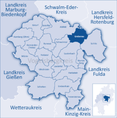
Grebenau
- town in Vogelsbergkreis in Hesse, Germany
Grebenau is a lesser-known but beautiful area for hiking, located in Germany, specifically within the state of Hesse. Nestled in the scenic hills and lush forests, Grebenau offers a variety of trails that cater to different skill levels and preferences....
- Country:

- Postal Code: 36323
- Local Dialing Code: 06646
- Licence Plate Code: VB
- Coordinates: 50° 45' 0" N, 9° 28' 0" E


- GPS tracks (wikiloc): [Link]
- AboveSeaLevel: 286 м m
- Area: 55.37 sq km
- Population: 2388
- Web site: [Link]


Herbstein
- town in Vogelsbergkreis in Hesse, Germany
Herbstein is a charming town located in the Vogelsberg mountains of Hesse, Germany. This region offers a variety of hiking opportunities for outdoor enthusiasts, combining picturesque landscapes, lush forests, and diverse wildlife. Here are some highlights about hiking in Herbstein:...
- Country:

- Postal Code: 36358
- Local Dialing Code: 06647; 06643
- Licence Plate Code: VB
- Coordinates: 50° 33' 0" N, 9° 21' 0" E


- GPS tracks (wikiloc): [Link]
- AboveSeaLevel: 461 м m
- Area: 79.98 sq km
- Population: 4801
- Web site: [Link]

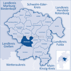
Ulrichstein
- town in Vogelsbergkreis in Hesse, Germany
Ulrichstein is a charming town located in the Vogelsberg mountain range of Hesse, Germany. It's renowned for its beautiful landscapes and extensive hiking trails that cater to a variety of skill levels. Here’s what you can expect when hiking in Ulrichstein:...
- Country:

- Postal Code: 35327
- Local Dialing Code: 06645
- Licence Plate Code: VB
- Coordinates: 50° 35' 0" N, 9° 12' 0" E


- GPS tracks (wikiloc): [Link]
- AboveSeaLevel: 566 м m
- Area: 65.61 sq km
- Population: 2995
- Web site: [Link]


Kirtorf
- town in Vogelsbergkreis in Hesse, Germany
Kirtorf, a charming town located in the state of Hesse, Germany, offers a variety of scenic hiking opportunities for enthusiasts of all levels. The area is characterized by its beautiful landscapes, including rolling hills, lush forests, and open fields, making it an ideal backdrop for outdoor activities....
- Country:

- Postal Code: 36320
- Local Dialing Code: 06635
- Licence Plate Code: VB
- Coordinates: 50° 46' 0" N, 9° 6' 0" E


- GPS tracks (wikiloc): [Link]
- AboveSeaLevel: 266 м m
- Area: 79.88 sq km
- Population: 3164
- Web site: [Link]


Feldatal
- municipality in Vogelsbergkreis in Hesse, Germany
Feldatal, located in the state of Hesse, Germany, offers a wonderful hiking experience with its lush landscapes, scenic views, and a variety of trails suited for different skill levels. Here are some key highlights for hiking in this region:...
- Country:

- Postal Code: 36325
- Local Dialing Code: 06637
- Licence Plate Code: VB
- Coordinates: 50° 39' 0" N, 9° 10' 0" E


- GPS tracks (wikiloc): [Link]
- AboveSeaLevel: 385 м m
- Area: 55.69 sq km
- Population: 2491
- Web site: [Link]


Lautertal
- municipality in Vogelsbergkreis in Hesse, Germany
Lautertal is a picturesque valley located in the southern part of Hesse, Germany, known for its stunning natural landscapes, lush forests, and impressive geological formations. It offers a variety of hiking opportunities suitable for all experience levels. Here are some highlights and tips for hiking in Lautertal:...
- Country:

- Postal Code: 36369
- Local Dialing Code: 06643
- Licence Plate Code: VB
- Coordinates: 50° 35' 0" N, 9° 17' 0" E


- GPS tracks (wikiloc): [Link]
- AboveSeaLevel: 477 м m
- Area: 53.61 sq km
- Population: 2338
- Web site: [Link]
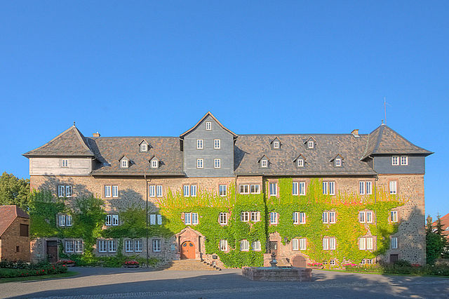

Lauterbach
- seat of Vogelsbergkreis and town in Hesse, Germany
Lauterbach, located in Hesse, Germany, is a charming town surrounded by beautiful natural landscapes, making it a great destination for hiking enthusiasts. Situated at the edge of the Vogelsberg mountain range, there are various trails that cater to different skill levels, from gentle walks to more challenging hikes....
- Country:

- Postal Code: 36341
- Local Dialing Code: 06638; 06641
- Licence Plate Code: VB
- Coordinates: 50° 38' 16" N, 9° 23' 40" E


- GPS tracks (wikiloc): [Link]
- AboveSeaLevel: 296 м m
- Area: 102 sq km
- Population: 14126
- Web site: [Link]


Homberg (Ohm)
- town in Vogelsbergkreis in Hesse, Germany
Homberg (Ohm) is a picturesque town located in the German state of Hesse, surrounded by beautiful landscapes that make it a great destination for hiking enthusiasts. The area features a mix of rolling hills, forests, and charming villages, providing various trails that cater to different hiking levels....
- Country:

- Postal Code: 35315
- Local Dialing Code: 06633
- Licence Plate Code: VB
- Coordinates: 50° 43' 0" N, 9° 0' 0" E


- GPS tracks (wikiloc): [Link]
- AboveSeaLevel: 259 м m
- Area: 88 sq km
- Population: 7445
- Web site: [Link]


Schwalmtal
- municipality in Vogelsbergkreis in Hesse, Germany
Schwalmtal, located in the state of Hesse, Germany, offers beautiful landscapes and a variety of hiking opportunities for outdoor enthusiasts. The region is characterized by its picturesque valleys, forests, and charming villages, making it an ideal spot for both casual walkers and more serious hikers....
- Country:

- Postal Code: 36318
- Local Dialing Code: 06638; 06630
- Licence Plate Code: VB
- Coordinates: 50° 41' 0" N, 9° 18' 0" E


- GPS tracks (wikiloc): [Link]
- AboveSeaLevel: 332 м m
- Area: 54.21 sq km
- Population: 2788
- Web site: [Link]


Freiensteinau
- municipality in Vogelsbergkreis in Hesse, Germany
Freiensteinau, located in the state of Hesse, Germany, offers a variety of hiking opportunities that showcase the natural beauty of the region. Nestled in the picturesque countryside, the area features lush forests, hills, and charming landscapes, making it ideal for hikers of all skill levels....
- Country:

- Postal Code: 36399
- Local Dialing Code: 06666
- Licence Plate Code: VB
- Coordinates: 50° 26' 0" N, 9° 24' 0" E


- GPS tracks (wikiloc): [Link]
- AboveSeaLevel: 448 м m
- Area: 65.67 sq km
- Population: 3086
- Web site: [Link]


Gemünden
- municipality in Vogelsbergkreis in Hesse, Germany
Gemünden (Felda) is a charming town located in the central part of Germany, specifically in Hesse. It lies near various natural landscapes, making it an attractive destination for hiking enthusiasts. If you're planning to hike in this area, here are some details to help you enjoy your experience:...
- Country:

- Postal Code: 35329
- Local Dialing Code: 06634
- Licence Plate Code: VB
- Coordinates: 50° 42' 0" N, 9° 3' 0" E


- GPS tracks (wikiloc): [Link]
- AboveSeaLevel: 259 м m
- Area: 55 sq km
- Population: 2704
- Web site: [Link]


Grebenhain
- municipality in Vogelsbergkreis in Hesse, Germany
Grebenhain, located in the picturesque Vogelsberg mountain range in Hesse, Germany, offers a variety of hiking opportunities that cater to different skill levels and interests. The region is known for its beautiful landscapes, rich nature, and charming villages, making it a perfect destination for outdoor enthusiasts....
- Country:

- Postal Code: 36355
- Local Dialing Code: 06668; 06644; 06643
- Licence Plate Code: VB
- Coordinates: 50° 29' 20" N, 9° 20' 9" E


- GPS tracks (wikiloc): [Link]
- AboveSeaLevel: 437 м m
- Area: 91.62 sq km
- Population: 4604
- Web site: [Link]


Mücke
- municipality in Vogelsbergkreis in Hesse, Germany
Mücke is a small municipality in the state of Hesse, Germany, known for its picturesque landscapes and proximity to the natural beauty of the surrounding area. While Mücke itself may not be a significant hiking destination compared to larger national parks or reserves, it serves as a great base for various hiking opportunities in the nearby regions....
- Country:

- Postal Code: 35325
- Local Dialing Code: 06400
- Licence Plate Code: VB
- Coordinates: 50° 37' 0" N, 9° 2' 0" E


- GPS tracks (wikiloc): [Link]
- AboveSeaLevel: 280 м m
- Area: 86.24 sq km
- Population: 9300
- Web site: [Link]


Wartenberg
- municipality in Vogelsbergkreis in Hesse, Germany
Wartenberg, located in Hesse, Germany, offers a range of hiking opportunities that allow you to explore its beautiful landscapes, the scenic forested areas, and charming villages. Here are some highlights and tips for hiking in Wartenberg:...
- Country:

- Postal Code: 36367
- Local Dialing Code: 06648; 06641
- Licence Plate Code: VB
- Coordinates: 50° 37' 0" N, 9° 26' 0" E


- GPS tracks (wikiloc): [Link]
- AboveSeaLevel: 328 м m
- Area: 39.54 sq km
- Population: 3904
- Web site: [Link]
Shares border with regions:


Fulda
- district in Hesse, Germany
Fulda is a beautiful district located in Hesse, Germany, known for its scenic landscapes, historical sites, and outdoor activities, including hiking. Here are some key aspects of hiking in Fulda:...
- Country:

- Capital: Fulda
- Licence Plate Code: FD
- Coordinates: 50° 33' 37" N, 9° 41' 10" E


- GPS tracks (wikiloc): [Link]
- AboveSeaLevel: 297 м m
- Area: 1380.40 sq km
- Population: 216093
- Web site: [Link]
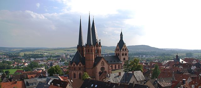

Main-Kinzig-Kreis
- district in Hesse, Germany
Main-Kinzig-Kreis, located in the state of Hesse, Germany, offers a diverse array of hiking opportunities suitable for various skill levels and preferences. The region is characterized by beautiful landscapes, including forests, rivers, hills, and quaint villages, making it a great destination for outdoor enthusiasts. Here are some highlights:...
- Country:

- Capital: Gelnhausen
- Licence Plate Code: MKK
- Coordinates: 50° 12' 4" N, 9° 11' 51" E


- GPS tracks (wikiloc): [Link]
- AboveSeaLevel: 202 м m
- Area: 1397.52 sq km
- Population: 407619
- Web site: [Link]
