Main-Kinzig-Kreis (Main-Kinzig-Kreis)
- district in Hesse, Germany
Main-Kinzig-Kreis, located in the state of Hesse, Germany, offers a diverse array of hiking opportunities suitable for various skill levels and preferences. The region is characterized by beautiful landscapes, including forests, rivers, hills, and quaint villages, making it a great destination for outdoor enthusiasts. Here are some highlights:
Trails and Routes
-
The Kinzig Valley Trail (Kinzig-Tal-Weg):
- This scenic trail follows the Kinzig River and passes through charming towns and stunning nature. It is well-marked and provides a mix of woodland paths and open fields.
-
The Hohe Strasse (High Road):
- A popular route that traverses the ridge with lovely panoramic views over the valley. This trail is ideal for those seeking a combination of nature and vistas.
-
Quality Trails:
- The region has several certified quality hiking trails, such as the "Premiumwanderweg," which are known for their excellent path maintenance, well-arranged signage, and various points of interest along the way.
Scenic Highlights
-
Spessart Nature Park: Part of the Spessart region, this area offers dense forests and is home to a variety of wildlife, providing excellent opportunities for both hiking and bird-watching.
-
Historical Sites: Along the trails, hikers can encounter historical buildings, ruins, and local cultural sites, such as castles and old mills, that add context to the hiking experience.
Practical Information
-
Signage: Many trails are well-marked with signs indicating distances and times, making navigation easier for hikers.
-
Local Amenities: The area boasts numerous small towns where hikers can find accommodations, restaurants, and shops to restock supplies or refuel after a day on the trails.
-
Seasonal Considerations: Each season presents different hiking experiences – spring and summer are great for wildflowers and lush greenery, while fall offers stunning foliage.
Tips for Hiking in Main-Kinzig-Kreis
- Make sure to have a map or a hiking app for the trails you plan to explore.
- Always check the weather conditions before heading out and dress accordingly.
- Carry enough water and snacks, especially for longer hikes, as not all trails have facilities nearby.
- Respect nature and local wildlife by sticking to designated paths and taking your litter with you.
Overall, Main-Kinzig-Kreis is a fantastic destination for hikers looking to enjoy the natural beauty and cultural richness of Germany. Whether you're looking for a challenging hike or a leisurely walk, you'll find plenty to explore in this picturesque region.
- Country:

- Capital: Gelnhausen
- Licence Plate Code: MKK
- Coordinates: 50° 12' 4" N, 9° 11' 51" E


- GPS tracks (wikiloc): [Link]
- AboveSeaLevel: 202 м m
- Area: 1397.52 sq km
- Population: 407619
- Web site: http://www.main-kinzig-kreis.de
- Wikipedia en: wiki(en)
- Wikipedia: wiki(de)
- Wikidata storage: Wikidata: Q7911
- Wikipedia Commons Category: [Link]
- Freebase ID: [/m/01dk_3]
- GeoNames ID: Alt: [2874242]
- BnF ID: [12192332d]
- VIAF ID: Alt: [133707596]
- OSM relation ID: [62694]
- GND ID: Alt: [4037117-7]
- archINFORM location ID: [2509]
- Library of Congress authority ID: Alt: [n82003867]
- ISNI: Alt: [0000 0004 4910 5997]
- NUTS code: [DE719]
- German district key: 06435
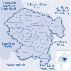
Includes regions:


Maintal
- town in Main-Kinzig-Kreis in Hesse, Germany
Maintal is a picturesque town in Hesse, Germany, situated along the banks of the Main River, just east of Frankfurt. The region offers some beautiful opportunities for hiking, thanks to its scenic landscapes, lush forests, and proximity to the river....
- Country:

- Postal Code: 63477
- Local Dialing Code: 06181; 06109
- Licence Plate Code: MKK
- Coordinates: 50° 9' 0" N, 8° 50' 0" E


- GPS tracks (wikiloc): [Link]
- AboveSeaLevel: 100 м m
- Area: 32.4 sq km
- Population: 38930
- Web site: [Link]


Biebergemünd
- municipality in Main-Kinzig-Kreis in Hesse, Germany
Biebergemünd is a picturesque municipality in the region of Hesse, Germany, surrounded by beautiful natural landscapes that make it an inviting destination for hiking enthusiasts. Here are some key aspects of hiking in Biebergemünd:...
- Country:

- Postal Code: 63599
- Local Dialing Code: 06050
- Licence Plate Code: MKK
- Coordinates: 50° 10' 0" N, 9° 17' 0" E


- GPS tracks (wikiloc): [Link]
- AboveSeaLevel: 167 м m
- Area: 78.55 sq km
- Population: 8397
- Web site: [Link]


Rodenbach
- municipality in Main-Kinzig-Kreis in Hesse, Germany
Rodenbach, located in the Hesse region of Germany, offers several opportunities for hiking enthusiasts. The area is characterized by picturesque landscapes, including hills, forests, and streams, which provide a beautiful backdrop for outdoor activities. Here are some aspects to consider when hiking in and around Rodenbach:...
- Country:

- Postal Code: 63517
- Local Dialing Code: 06184
- Licence Plate Code: MKK
- Coordinates: 50° 9' 0" N, 9° 2' 0" E


- GPS tracks (wikiloc): [Link]
- AboveSeaLevel: 147 м m
- Area: 16.74 sq km
- Population: 11194
- Web site: [Link]


Steinau an der Straße
- town in Main-Kinzig-Kreis in Hesse, Germany
 Hiking in Steinau an der Straße
Steinau an der Straße is a picturesque town located in the state of Hesse, Germany. It's surrounded by beautiful natural landscapes, making it an excellent location for hiking enthusiasts. Here are some details and tips for hiking in and around Steinau an der Straße:...
- Country:

- Postal Code: 36396
- Local Dialing Code: 06663
- Coordinates: 50° 19' 0" N, 9° 28' 0" E


- GPS tracks (wikiloc): [Link]
- AboveSeaLevel: 175 м m
- Area: 104.86 sq km
- Population: 10344
- Web site: [Link]


Erlensee
- town in Main-Kinzig-Kreis in Hesse, Germany
Erlensee is a beautiful area located in Hesse, Germany, known for its picturesque landscapes and outdoor recreational opportunities. If you’re planning a hiking trip in this region, here are some aspects to consider:...
- Country:

- Postal Code: 63526
- Local Dialing Code: 06183
- Licence Plate Code: MKK
- Coordinates: 50° 9' 48" N, 8° 58' 51" E


- GPS tracks (wikiloc): [Link]
- AboveSeaLevel: 110 м m
- Area: 18.59 sq km
- Population: 14005
- Web site: [Link]


Hanau
- city in Main-Kinzig-Kreis in Hesse, Germany
Hanau, located in the state of Hesse, Germany, offers a variety of hiking opportunities that cater to different skill levels. The region's picturesque landscapes, rich history, and cultural heritage make it an appealing destination for hikers. Here are some key highlights:...
- Country:

- Postal Code: 63457; 63456; 63454; 63452; 63450
- Local Dialing Code: 06181
- Licence Plate Code: HU
- Coordinates: 50° 8' 0" N, 8° 55' 0" E


- GPS tracks (wikiloc): [Link]
- AboveSeaLevel: 104 м m
- Area: 76.49 sq km
- Population: 96130
- Web site: [Link]
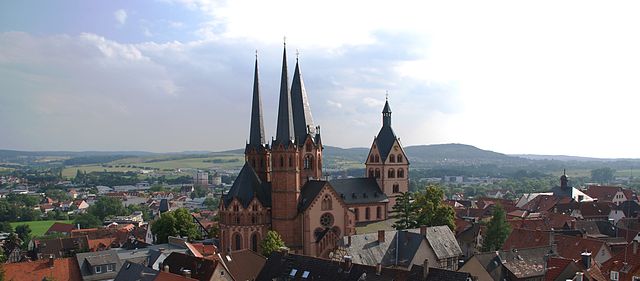

Gelnhausen
- seat of Main-Kinzig-Kreis and town in Hesse, Germany
Gelnhausen, located in the Hesse region of Germany, offers a variety of hiking opportunities for outdoor enthusiasts. The area is characterized by its scenic landscapes, which include rolling hills, woodlands, and historical landmarks. Here’s an overview of what you can expect when hiking in and around Gelnhausen:...
- Country:

- Postal Code: 63571
- Local Dialing Code: 06051
- Coordinates: 50° 12' 10" N, 9° 11' 26" E


- GPS tracks (wikiloc): [Link]
- AboveSeaLevel: 159 м m
- Area: 45.18 sq km
- Population: 22873
- Web site: [Link]


Nidderau
- town in Main-Kinzig-Kreis in Hesse, Germany
Nidderau, located in Hesse, Germany, offers a variety of hiking opportunities set against a backdrop of picturesque landscapes. The region is known for its charming rural scenery, woodlands, and the Nidder River, making it a lovely destination for hikers of all levels. Here are some highlights to consider when hiking in Nidderau:...
- Country:

- Postal Code: 61130
- Local Dialing Code: 06187
- Licence Plate Code: MKK, GN, HU, SLÜ
- Coordinates: 50° 15' 0" N, 8° 54' 0" E


- GPS tracks (wikiloc): [Link]
- AboveSeaLevel: 127 м m
- Area: 47 sq km
- Population: 20051
- Web site: [Link]


Langenselbold
- town in Main-Kinzig-Kreis in Hesse, Germany
Langenselbold is a charming town in the Main-Kinzig district of Hesse, Germany, and while it may not be as widely known for hiking as some other regions, it offers access to beautiful natural landscapes and trails suitable for various levels of hikers....
- Country:

- Postal Code: 63505
- Local Dialing Code: 06184
- Coordinates: 50° 11' 0" N, 9° 2' 0" E


- GPS tracks (wikiloc): [Link]
- AboveSeaLevel: 124 м m
- Area: 26.23 sq km
- Population: 13944
- Web site: [Link]


Birstein
- municipality in Main-Kinzig-Kreis in Hesse, Germany
Birstein is located in the state of Hesse, Germany, and is surrounded by beautiful natural landscapes that provide excellent opportunities for hiking. The region is characterized by rolling hills, dense forests, and picturesque countryside, making it an attractive destination for outdoor enthusiasts....
- Country:

- Postal Code: 63633
- Local Dialing Code: 06054
- Licence Plate Code: MKK
- Coordinates: 50° 21' 11" N, 9° 18' 33" E


- GPS tracks (wikiloc): [Link]
- AboveSeaLevel: 270 м m
- Area: 86.63 sq km
- Population: 6223
- Web site: [Link]


Bad Soden-Salmünster
- town in Main-Kinzig-Kreis in Hesse, Germany
 Hiking in Bad Soden-Salmünster
Bad Soden-Salmünster, located in the picturesque Spessart region of Germany, is a fantastic destination for hiking enthusiasts. The area is known for its natural beauty, charming villages, and a well-maintained network of trails suitable for various skill levels. Here are some highlights of hiking in this region:...
- Country:

- Postal Code: 63628
- Local Dialing Code: 06056
- Coordinates: 50° 16' 0" N, 9° 22' 0" E


- GPS tracks (wikiloc): [Link]
- AboveSeaLevel: 153 м m
- Area: 58.62 sq km
- Population: 13399
- Web site: [Link]


Wächtersbach
- town in Main-Kinzig-Kreis in Hesse, Germany
Wächtersbach is a picturesque town located in the state of Hesse, Germany. Surrounded by beautiful natural landscapes, it offers a variety of hiking opportunities for enthusiasts of all skill levels. Here are some highlights and tips for hiking in and around Wächtersbach:...
- Country:

- Postal Code: 63607
- Local Dialing Code: 06053
- Licence Plate Code: MKK
- Coordinates: 50° 16' 0" N, 9° 18' 0" E


- GPS tracks (wikiloc): [Link]
- AboveSeaLevel: 164 м m
- Area: 50.79 sq km
- Population: 12501
- Web site: [Link]

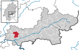
Bruchköbel
- town in Main-Kinzig-Kreis in Hesse, Germany
Bruchköbel, located in the state of Hesse, Germany, offers a variety of outdoor experiences, including hiking. The region surrounding Bruchköbel is characterized by its picturesque landscapes, forests, and nature reserves, making it a great destination for hiking enthusiasts of all levels....
- Country:

- Postal Code: 63486
- Local Dialing Code: 06185; 06183; 06181
- Coordinates: 50° 11' 0" N, 8° 55' 0" E


- GPS tracks (wikiloc): [Link]
- AboveSeaLevel: 113 м m
- Area: 29.67 sq km
- Population: 20390
- Web site: [Link]


Schlüchtern
- town in Main-Kinzig-Kreis in Hesse, Germany
Schlüchtern is a charming town located in the state of Hesse, Germany, and is surrounded by beautiful natural landscapes ideal for hiking enthusiasts. The region features a variety of trails that cater to different skill levels, from leisurely walks to more challenging hikes, making it a great destination for both casual hikers and seasoned adventurers....
- Country:

- Postal Code: 36381
- Local Dialing Code: 06661
- Coordinates: 50° 21' 0" N, 9° 31' 0" E


- GPS tracks (wikiloc): [Link]
- AboveSeaLevel: 207 м m
- Area: 113.30 sq km
- Population: 16660
- Web site: [Link]
Bad Orb
- town in Main-Kinzig-Kreis in Hesse, Germany
Bad Orb, located in the beautiful Spessart region of Germany, is a great destination for hiking enthusiasts. The area is known for its picturesque landscapes, lush forests, and serene trails, making it perfect for both beginners and experienced hikers....
- Country:

- Postal Code: 63619
- Local Dialing Code: 06052
- Coordinates: 50° 13' 0" N, 9° 21' 0" E


- GPS tracks (wikiloc): [Link]
- AboveSeaLevel: 189 м m
- Area: 47.78 sq km
- Population: 9917
- Web site: [Link]


Schöneck, Hesse
- municipality in Main-Kinzig-Kreis in Hesse, Germany
Schöneck, located in the state of Hesse, Germany, is a beautiful area ideal for hiking enthusiasts. This charming town is set in the picturesque landscape of the Vogelsberg Mountains, which are known for their varied topography, lush forests, and stunning natural vistas....
- Country:

- Postal Code: 61137
- Local Dialing Code: 06187
- Licence Plate Code: MKK
- Coordinates: 50° 12' 5" N, 8° 51' 15" E


- GPS tracks (wikiloc): [Link]
- AboveSeaLevel: 141 м m
- Area: 21.49 sq km
- Population: 11902
- Web site: [Link]


Jossgrund
- municipality in Main-Kinzig-Kreis in Hesse, Germany
Jossgrund, located in the picturesque Spessart region of Germany, offers a variety of hiking opportunities that cater to different skill levels and preferences. Here are some key points to consider when planning a hiking trip in Jossgrund:...
- Country:

- Postal Code: 63637
- Local Dialing Code: 06059
- Licence Plate Code: MKK
- Coordinates: 50° 10' 45" N, 9° 27' 30" E


- GPS tracks (wikiloc): [Link]
- AboveSeaLevel: 317 м m
- Area: 50.61 sq km
- Population: 3468
- Web site: [Link]


Brachttal
- municipality in Main-Kinzig-Kreis in Hesse, Germany
Brachttal, located in the picturesque region of Hesse, Germany, offers a variety of hiking opportunities that showcase its beautiful landscapes, lush forests, and charming villages. Here are some highlights for hiking in Brachttal:...
- Country:

- Postal Code: 63636
- Local Dialing Code: 06054; 06053
- Licence Plate Code: MKK
- Coordinates: 50° 18' 12" N, 9° 17' 52" E


- GPS tracks (wikiloc): [Link]
- AboveSeaLevel: 225 м m
- Area: 30.85 sq km
- Population: 5137
- Web site: [Link]


Niederdorfelden
- municipality in Main-Kinzig-Kreis in Hesse, Germany
Niederdorfelden, a small town in Hesse, Germany, offers a charming setting for hiking enthusiasts. While it may not be as famous as other hiking destinations, its surrounding landscapes and rural trails provide opportunities for enjoyable outdoor activities. Here are some aspects to consider when hiking in and around Niederdorfelden:...
- Country:

- Postal Code: 61138
- Local Dialing Code: 06101
- Licence Plate Code: MKK
- Coordinates: 50° 11' 42" N, 8° 48' 0" E


- GPS tracks (wikiloc): [Link]
- AboveSeaLevel: 111 м m
- Area: 6.55 sq km
- Population: 3930
- Web site: [Link]


Ronneburg
- municipality in Main-Kinzig-Kreis in Hesse, Germany
Ronneburg, located in the state of Hesse, Germany, is known for its picturesque landscapes and historical significance, making it a great destination for hiking enthusiasts. The area is characterized by rolling hills, dense forests, and charming villages, providing a variety of hiking options suitable for different skill levels....
- Country:

- Postal Code: 63549
- Local Dialing Code: 06184
- Licence Plate Code: MKK
- Coordinates: 50° 14' 0" N, 9° 3' 0" E


- GPS tracks (wikiloc): [Link]
- AboveSeaLevel: 169 м m
- Area: 14.25 sq km
- Population: 3413
- Web site: [Link]


Freigericht
- municipality in Main-Kinzig-Kreis in Hesse, Germany
Freigericht, located in the Main-Kinzig-Kreis district of Hesse, Germany, offers a variety of beautiful hiking opportunities amidst picturesque landscapes. The region is characterized by its rolling hills, lush forests, and charming villages. Here are some key points about hiking in Freigericht:...
- Country:

- Postal Code: 63579
- Local Dialing Code: 06055
- Licence Plate Code: MKK
- Coordinates: 50° 8' 30" N, 9° 7' 40" E


- GPS tracks (wikiloc): [Link]
- AboveSeaLevel: 158 м m
- Area: 33.42 sq km
- Population: 14415
- Web site: [Link]


Sinntal
- municipality in Main-Kinzig-Kreis in Hesse, Germany
Sinntal, located in the Spessart region of Germany, offers a variety of scenic hiking trails that cater to different skill levels. The area is characterized by its lush forests, rolling hills, and the picturesque Sinn River, making it an excellent destination for nature enthusiasts....
- Country:

- Postal Code: 36391
- Local Dialing Code: 09741; 06665; 06664
- Licence Plate Code: MKK
- Coordinates: 50° 16' 0" N, 9° 38' 0" E


- GPS tracks (wikiloc): [Link]
- AboveSeaLevel: 371 м m
- Area: 111.83 sq km
- Population: 8946
- Web site: [Link]
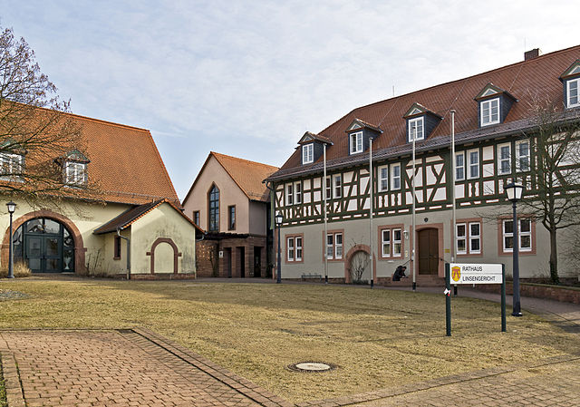

Linsengericht
- municipality in Main-Kinzig-Kreis in Hesse, Germany
Linsengericht, located in the state of Hesse, Germany, offers a variety of scenic hiking options for outdoor enthusiasts. The region combines beautiful landscapes, charming villages, and well-marked hiking trails, making it a great destination for hikers of all levels. Here are some highlights to help you plan your hiking excursion in Linsengericht:...
- Country:

- Postal Code: 63589
- Local Dialing Code: 06051
- Licence Plate Code: MKK
- Coordinates: 50° 10' 0" N, 9° 13' 0" E


- GPS tracks (wikiloc): [Link]
- AboveSeaLevel: 166 м m
- Area: 29.82 sq km
- Population: 9877
- Web site: [Link]

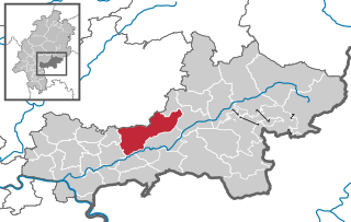
Gründau
- municipality of Germany
Gründau, located in the Hessen region of Germany, offers a variety of hiking opportunities that are suitable for all levels of experience. The area is known for its picturesque landscapes, including lush forests, rolling hills, and scenic views of the surrounding countryside....
- Country:

- Postal Code: 63584
- Local Dialing Code: 06058; 06051
- Licence Plate Code: MKK
- Coordinates: 50° 13' 0" N, 9° 9' 0" E


- GPS tracks (wikiloc): [Link]
- AboveSeaLevel: 135 м m
- Area: 67.64 sq km
- Population: 14791
- Web site: [Link]


Flörsbachtal
- municipality in Main-Kinzig-Kreis in Hesse, Germany
Flörsbachtal is a picturesque valley located in the Spessart region of Germany, known for its stunning natural beauty and well-marked hiking trails. Here are some highlights and tips for hiking in Flörsbachtal:...
- Country:

- Postal Code: 63639
- Local Dialing Code: 06057
- Licence Plate Code: MKK
- Coordinates: 50° 7' 0" N, 9° 26' 0" E


- GPS tracks (wikiloc): [Link]
- AboveSeaLevel: 307 м m
- Area: 52.11 sq km
- Population: 2311
- Web site: [Link]


Hasselroth
- municipality in Main-Kinzig-Kreis in Hesse, Germany
Hasselroth, a charming village located in the state of Hesse, Germany, is surrounded by beautiful countryside that offers a variety of hiking opportunities. While it may not be as well-known as larger hiking regions, it still provides access to scenic trails and picturesque landscapes....
- Country:

- Postal Code: 63594
- Local Dialing Code: 06055
- Licence Plate Code: MKK
- Coordinates: 50° 10' 0" N, 9° 6' 0" E


- GPS tracks (wikiloc): [Link]
- AboveSeaLevel: 130 м m
- Area: 18.93 sq km
- Population: 7337
- Web site: [Link]


Großkrotzenburg
- municipality in Main-Kinzig-Kreis in Hesse, Germany
Großkrotzenburg, located in the state of Hesse, Germany, offers some lovely hiking opportunities for both beginners and experienced hikers. The area features diverse landscapes, from beautiful wooded areas to charming countryside views....
- Country:

- Postal Code: 63538
- Local Dialing Code: 06186
- Licence Plate Code: MKK
- Coordinates: 50° 5' 0" N, 8° 59' 0" E


- GPS tracks (wikiloc): [Link]
- AboveSeaLevel: 112 м m
- Area: 7.47 sq km
- Population: 7589
- Web site: [Link]


Neuberg
- municipality in Main-Kinzig-Kreis in Hesse, Germany
Neuberg, located in the state of Hesse, Germany, offers a variety of hiking opportunities that cater to different skill levels and preferences. The area is characterized by beautiful landscapes, including forests, hills, and picturesque villages, making it an appealing destination for outdoor enthusiasts....
- Country:

- Postal Code: 63543
- Local Dialing Code: 06183
- Licence Plate Code: MKK
- Coordinates: 50° 12' 0" N, 8° 59' 0" E


- GPS tracks (wikiloc): [Link]
- AboveSeaLevel: 156 м m
- Area: 10.54 sq km
- Population: 5391
- Web site: [Link]


Hammersbach
- municipality in Main-Kinzig-Kreis in Hesse, Germany
Hammersbach is a picturesque area located in Germany, specifically in the Bavarian Alps, near the town of Grainau and close to the Zugspitze, which is the highest peak in Germany. The region offers a variety of hiking opportunities suitable for different skill levels. Here are some highlights:...
- Country:

- Postal Code: 63546
- Local Dialing Code: 06185
- Licence Plate Code: MKK
- Coordinates: 50° 13' 0" N, 8° 59' 0" E


- GPS tracks (wikiloc): [Link]
- AboveSeaLevel: 140 м m
- Area: 20.15 sq km
- Population: 4843
- Web site: [Link]
Spessart
- unincorporated area in Main-Kinzig-Kreis in Hesse, Germany
Gutsbezirk Spessart, located in the Spessart mountain range in Bavaria, Germany, offers a diverse and beautiful landscape for hiking enthusiasts. The region is characterized by its dense forests, rolling hills, and charming villages. Here are some highlights and tips for hiking in this area:...
- Country:

- Coordinates: 50° 14' 57" N, 9° 28' 29" E


- GPS tracks (wikiloc): [Link]
- Area: 89.29 sq km
- Population: 0
Shares border with regions:
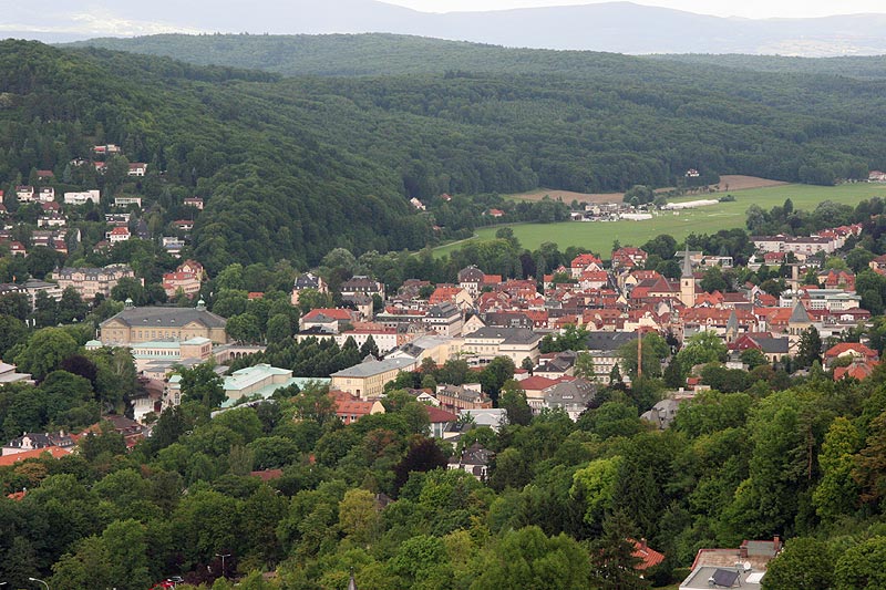

Bad Kissingen
- district in Bavaria, Germany
Bad Kissingen, located in Bavaria, Germany, is a beautiful spa town known for its healing mineral waters and lovely natural surroundings. The area's scenic landscapes make it an excellent destination for hiking enthusiasts. Here are some key points about hiking in Bad Kissingen:...
- Country:

- Capital: Bad Kissingen
- Licence Plate Code: HAB; BRK; KG
- Coordinates: 50° 15' 0" N, 10° 0' 0" E


- GPS tracks (wikiloc): [Link]
- AboveSeaLevel: 330 м m
- Area: 1137.00 sq km
- Population: 99022
- Web site: [Link]
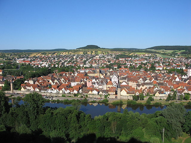

Main-Spessart
- district in Bavaria, Germany
Main-Spessart is a beautiful region located in Bavaria, Germany, known for its scenic landscapes, charming villages, and rich cultural heritage. It's a fantastic destination for hiking enthusiasts, offering a variety of trails that cater to different skill levels. Here’s what you can expect when hiking in Main-Spessart:...
- Country:

- Capital: Karlstadt am Main
- Licence Plate Code: MSP
- Coordinates: 49° 55' 12" N, 9° 45' 0" E


- GPS tracks (wikiloc): [Link]
- AboveSeaLevel: 313 м m
- Area: 1321.4186 sq km
- Population: 125915
- Web site: [Link]


Aschaffenburg
- district in Bavaria, Germany
Aschaffenburg, located in Bavaria, Germany, is known for its beautiful landscapes and proximity to the Spessart mountain range, making it a great destination for hiking enthusiasts. The region offers a mix of nature, historic sites, and charming villages, providing a variety of hiking experiences....
- Country:

- Capital: Aschaffenburg
- Licence Plate Code: ALZ; AB
- Coordinates: 50° 4' 48" N, 9° 10' 12" E


- GPS tracks (wikiloc): [Link]
- AboveSeaLevel: 246 м m
- Area: 699.00 sq km
- Population: 152367


Frankfurt
- city in Germany
Hiking in Frankfurt offers a unique blend of urban and natural experiences. While Frankfurt itself is a bustling financial hub, it is also surrounded by beautiful landscapes that are great for outdoor enthusiasts. Here are some key points to consider:...
- Country:

- Postal Code: 65929–65936; 60308–60599
- Local Dialing Code: 069; 6101; 6109
- Licence Plate Code: F
- Coordinates: 50° 6' 49" N, 8° 40' 47" E


- GPS tracks (wikiloc): [Link]
- AboveSeaLevel: 112 м m
- Area: 248.31 sq km
- Population: 736414
- Web site: [Link]
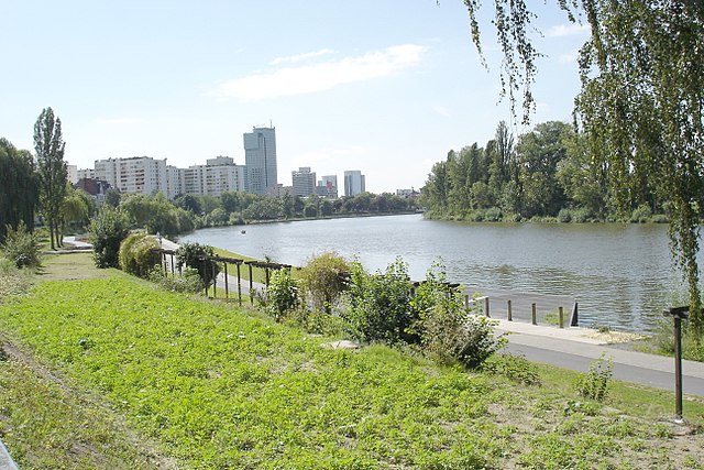

Offenbach am Main
- city in Hesse, Germany
Offenbach am Main, located in Hesse, Germany, is not a major hiking destination compared to other regions in Germany, but it offers some pleasant options for outdoor enthusiasts. While the city itself is more urban, there are several nearby areas where you can enjoy hiking and nature....
- Country:

- Postal Code: 63075; 63073; 63071; 63069; 63067; 63065
- Local Dialing Code: 069
- Licence Plate Code: OF
- Coordinates: 50° 6' 0" N, 8° 46' 0" E


- GPS tracks (wikiloc): [Link]
- AboveSeaLevel: 98 м m
- Area: 44.89 sq km
- Population: 124589
- Web site: [Link]


Fulda
- district in Hesse, Germany
Fulda is a beautiful district located in Hesse, Germany, known for its scenic landscapes, historical sites, and outdoor activities, including hiking. Here are some key aspects of hiking in Fulda:...
- Country:

- Capital: Fulda
- Licence Plate Code: FD
- Coordinates: 50° 33' 37" N, 9° 41' 10" E


- GPS tracks (wikiloc): [Link]
- AboveSeaLevel: 297 м m
- Area: 1380.40 sq km
- Population: 216093
- Web site: [Link]
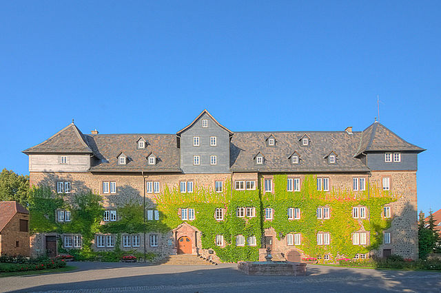
Vogelsbergkreis
- district in Hesse, Germany
Vogelsbergkreis, located in Hessen, Germany, is known for its beautiful landscapes, natural attractions, and a variety of hiking opportunities. Here are some highlights and tips for hiking in this region:...
- Country:

- Capital: Lauterbach
- Licence Plate Code: VB
- Coordinates: 50° 38' 27" N, 9° 23' 59" E


- GPS tracks (wikiloc): [Link]
- AboveSeaLevel: 371 м m
- Area: 1458.96 sq km
- Web site: [Link]

Wetteraukreis
- district in Hesse, Germany
Wetteraukreis, located in the state of Hesse, Germany, offers a diverse range of landscapes and hiking opportunities that cater to outdoor enthusiasts of all levels. With its rolling hills, picturesque villages, lush forests, and scenic meadows, the region provides a delightful backdrop for exploring nature....
- Country:

- Capital: Friedberg
- Licence Plate Code: FB
- Coordinates: 50° 20' 0" N, 8° 45' 9" E


- GPS tracks (wikiloc): [Link]
- AboveSeaLevel: 137 м m
- Area: 1101.71 sq km
- Web site: [Link]

Offenbach
- district in Hesse, Germany
Offenbach, located in the state of Hesse, Germany, is surrounded by scenic areas that offer a variety of hiking opportunities. Although it is an urban district, its proximity to nature parks and the countryside makes it a great base for hikers....
- Country:

- Capital: Offenbach am Main
- Licence Plate Code: OF
- Coordinates: 50° 1' 6" N, 8° 47' 8" E


- GPS tracks (wikiloc): [Link]
- AboveSeaLevel: 143 м m
- Area: 356.29 sq km
- Population: 336265
- Web site: [Link]

