Fulda (Landkreis Fulda)
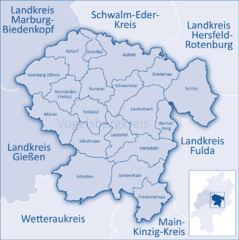
- district in Hesse, Germany
Fulda is a beautiful district located in Hesse, Germany, known for its scenic landscapes, historical sites, and outdoor activities, including hiking. Here are some key aspects of hiking in Fulda:
Scenic Trails
-
Vorderrhön Nature Park: Part of the larger Rhön biosphere reserve, this area offers various hiking trails that wind through hilly terrain, lush valleys, and picturesque forests. Trails here can range from easy walks to more challenging hikes.
-
Fulda River Path: This scenic route follows the Fulda River, providing a serene setting for hikers. It features gentle paths ideal for leisurely strolls and offers beautiful views of the surrounding countryside.
-
Historic Trails: There are several themed trails that offer insights into the region's history, culture, and natural beauty. Look for trails that connect to historic towns or key landmarks within the Fulda district.
Nature and Wildlife
- The region is home to diverse flora and fauna. While hiking, you may encounter various bird species, deer, and other wildlife, particularly in designated natural parks.
Hiking Clubs and Events
- Fulda has various hiking clubs that organize regular hikes and events, allowing both locals and visitors to explore the trails in a community setting. It’s a great way to meet fellow hiking enthusiasts.
Planning Your Hike
-
Trail Maps: Make sure to obtain trail maps, which can be found at local tourist information centers or online. These maps will help you navigate the area and find trails suited to your skill level.
-
Trail Difficulty: Trails vary in difficulty, so it’s essential to choose one that matches your fitness level and experience. Be mindful of the weather conditions, as they can affect trail accessibility.
-
Safety Precautions: Always carry enough water, snacks, a first-aid kit, and a fully charged mobile phone. It’s also advisable to inform someone about your hiking plan, especially if you’re venturing into more remote areas.
-
Leave No Trace: Follow Leave No Trace principles to preserve the natural beauty of the area and ensure that future hikers can enjoy it as well.
Local Attractions
- After a hike, consider exploring the town of Fulda itself, which is known for its baroque architecture, such as the Fulda Cathedral and the Palace, as well as beautiful parks and gardens.
In conclusion, hiking in Fulda offers a great mix of natural beauty, historical exploration, and opportunities for community engagement. It's an excellent destination for outdoor enthusiasts of all levels.
- Country:

- Capital: Fulda
- Licence Plate Code: FD
- Coordinates: 50° 33' 37" N, 9° 41' 10" E


- GPS tracks (wikiloc): [Link]
- AboveSeaLevel: 297 м m
- Area: 1380.40 sq km
- Population: 216093
- Web site: http://www.landkreis-fulda.de/
- Wikipedia en: wiki(en)
- Wikipedia: wiki(de)
- Wikidata storage: Wikidata: Q7899
- Wikipedia Commons Category: [Link]
- Wikipedia Commons Maps Category: [Link]
- Freebase ID: [/m/01cx67]
- GeoNames ID: Alt: [3220993]
- VIAF ID: Alt: [154765161]
- OSM relation ID: [62700]
- GND ID: Alt: [4018863-2]
- archINFORM location ID: [2421]
- Library of Congress authority ID: Alt: [n80038207]
- NUTS code: [DE732]
- German district key: 06631
Includes regions:


Ebersburg
- municipality in Landkreis Fulda in Hesse, Germany
Ebersburg, located in the scenic region of Hesse, Germany, offers a variety of hiking opportunities for outdoor enthusiasts. The area is characterized by its rolling hills, lush forests, and picturesque landscapes, making it a great destination for both casual hikers and those looking for more challenging trails....
- Country:

- Postal Code: 36157
- Local Dialing Code: 06656
- Licence Plate Code: FD
- Coordinates: 50° 28' 0" N, 9° 48' 0" E


- GPS tracks (wikiloc): [Link]
- AboveSeaLevel: 362 м m
- Area: 37.05 sq km
- Population: 4567
- Web site: [Link]


Eiterfeld
- municipality in Landkreis Fulda in Hesse, Germany
Eiterfeld is located in the scenic region of Hesse, Germany, and offers a variety of hiking opportunities for outdoor enthusiasts. The area is characterized by its beautiful landscapes, rolling hills, and lush forests, making it an excellent destination for hikers of all levels....
- Country:

- Postal Code: 36132
- Local Dialing Code: 06672
- Licence Plate Code: FD
- Coordinates: 50° 46' 0" N, 9° 48' 0" E


- GPS tracks (wikiloc): [Link]
- AboveSeaLevel: 343 м m
- Area: 89.83 sq km
- Population: 7070
- Web site: [Link]


Petersberg, Hesse
- municipality in Landkreis Fulda in Hesse, Germany
Petersberg, located in Hesse, Germany, offers a variety of hiking opportunities for outdoor enthusiasts. The region is characterized by its picturesque landscapes, including rolling hills, dense forests, and scenic views. Here are some highlights and tips for hiking in Petersberg:...
- Country:

- Postal Code: 36100
- Local Dialing Code: 0661
- Licence Plate Code: FD
- Coordinates: 50° 34' 0" N, 9° 43' 0" E


- GPS tracks (wikiloc): [Link]
- AboveSeaLevel: 333 м m
- Area: 35.51 sq km
- Population: 15783
- Web site: [Link]


Fulda
- seat of Landkreis Fulda and city in Hesse, Germany
Fulda, located in the state of Hesse, Germany, is a charming city surrounded by beautiful landscapes, making it an excellent destination for hiking enthusiasts. The region offers a mix of well-marked trails, historical sites, and picturesque scenery, which makes for a memorable hiking experience....
- Country:

- Postal Code: 36001–36043
- Local Dialing Code: 0661
- Licence Plate Code: FD
- Coordinates: 50° 33' 10" N, 9° 40' 39" E


- GPS tracks (wikiloc): [Link]
- AboveSeaLevel: 261 м m
- Area: 104.04 sq km
- Population: 67973
- Web site: [Link]
Kalbach
- municipality in Landkreis Fulda in Hesse, Germany
Kalbach, located in the Hessian region of Germany, offers a variety of hiking opportunities. The area is characterized by scenic landscapes that include rolling hills, lush forests, and picturesque villages. Here are some highlights and tips for hiking in Kalbach:...
- Country:

- Postal Code: 36148
- Local Dialing Code: 09742; 06655
- Licence Plate Code: FD
- Coordinates: 50° 24' 13" N, 9° 41' 2" E


- GPS tracks (wikiloc): [Link]
- AboveSeaLevel: 382 м m
- Area: 70.64 sq km
- Population: 6320
- Web site: [Link]

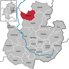
Burghaun
- municipality in Landkreis Fulda in Hesse, Germany
Burghaun is a charming community located in the state of Hesse, Germany. Nestled in a picturesque landscape, it offers a variety of hiking opportunities for outdoor enthusiasts of all skill levels. Here’s a breakdown of what you can expect when hiking in and around Burghaun:...
- Country:

- Postal Code: 36151
- Local Dialing Code: 06653; 06652
- Licence Plate Code: FD
- Coordinates: 50° 42' 0" N, 9° 43' 0" E


- GPS tracks (wikiloc): [Link]
- AboveSeaLevel: 261 м m
- Area: 65.04 sq km
- Population: 6346
- Web site: [Link]

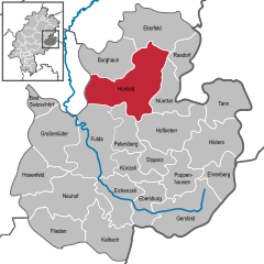
Hünfeld
- town in Landkreis Fulda in Hesse, Germany
Hünfeld, located in the state of Hesse, Germany, is a charming town surrounded by the picturesque landscapes of the Rhön mountains and the nearby Vogelsberg hills. The area offers a variety of hiking opportunities suitable for all skill levels, from easy strolls to more challenging hikes....
- Country:

- Postal Code: 36088
- Local Dialing Code: 06652
- Coordinates: 50° 40' 0" N, 9° 46' 0" E


- GPS tracks (wikiloc): [Link]
- AboveSeaLevel: 261 м m
- Area: 119.77 sq km
- Population: 15843
- Web site: [Link]

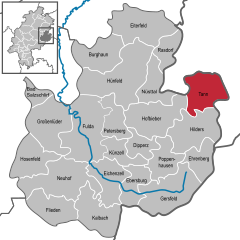
Tann, Hesse
- town in Landkreis Fulda in Hesse, Germany
Tann, located in Hesse, Germany, is a charming town that offers beautiful hiking opportunities, especially for nature lovers and outdoor enthusiasts. The region is characterized by its picturesque landscapes, rolling hills, and lush forests....
- Country:

- Postal Code: 36142
- Local Dialing Code: 06682
- Licence Plate Code: FD
- Coordinates: 50° 39' 0" N, 10° 1' 0" E


- GPS tracks (wikiloc): [Link]
- AboveSeaLevel: 371 м m
- Area: 60.45 sq km
- Population: 4430
- Web site: [Link]


Gersfeld
- town in Landkreis Fulda in Hesse, Germany
Gersfeld is a charming town located in the Bavarian region of Germany, nestled in the foothills of the Rhön Mountains. It offers a fantastic hiking experience with a variety of trails that cater to different skill levels and interests. Here are some highlights of hiking in and around Gersfeld:...
- Country:

- Postal Code: 36129
- Local Dialing Code: 06656; 06654
- Licence Plate Code: FD
- Coordinates: 50° 27' 0" N, 9° 55' 0" E


- GPS tracks (wikiloc): [Link]
- AboveSeaLevel: 486 м m
- Area: 89.37 sq km
- Population: 5475
- Web site: [Link]

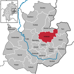
Hofbieber
- municipality in Landkreis Fulda in Hesse, Germany
Hofbieber, located in the state of Hesse, Germany, is a charming destination for hiking enthusiasts. Nestled in the beautiful Rhön mountain range, Hofbieber offers a mix of scenic landscapes, lush forests, and traditional villages, providing a rich experience for hikers of all levels....
- Country:

- Postal Code: 36145
- Local Dialing Code: 06657
- Licence Plate Code: FD
- Coordinates: 50° 35' 11" N, 9° 50' 7" E


- GPS tracks (wikiloc): [Link]
- AboveSeaLevel: 380 м m
- Area: 87.2 sq km
- Population: 5927
- Web site: [Link]


Ehrenberg
- municipality in Landkreis Fulda in Hesse, Germany
Ehrenberg, located in the state of Hesse, Germany, is a charming area known for its beautiful landscapes and hiking opportunities. The region is characterized by rolling hills, forests, and picturesque valleys, making it an excellent destination for outdoor enthusiasts....
- Country:

- Postal Code: 36115
- Local Dialing Code: 06683; 06681
- Licence Plate Code: FD
- Coordinates: 50° 31' 34" N, 10° 0' 51" E


- GPS tracks (wikiloc): [Link]
- AboveSeaLevel: 580 м m
- Area: 40.81 sq km
- Population: 2615
- Web site: [Link]
Dipperz
- municipality in Landkreis Fulda in Hesse, Germany
Dipperz is a small municipality located in the state of Hesse, Germany. It is situated near the beautiful landscapes of the wider region, which offers various opportunities for hiking. Here are some highlights and tips for hiking in and around Dipperz:...
- Country:

- Postal Code: 36160
- Local Dialing Code: 06657
- Licence Plate Code: FD
- Coordinates: 50° 32' 36" N, 9° 47' 45" E


- GPS tracks (wikiloc): [Link]
- AboveSeaLevel: 360 м m
- Area: 30.05 sq km
- Population: 3458
- Web site: [Link]


Bad Salzschlirf
- municipality in Landkreis Fulda in Hesse, Germany
Bad Salzschlirf is a lovely destination for hiking enthusiasts, located in Hesse, Germany. Nestled in a picturesque region, it offers a combination of natural beauty, historical sites, and wellness facilities. Here’s what you can expect when hiking in and around Bad Salzschlirf:...
- Country:

- Postal Code: 36364
- Local Dialing Code: 06648
- Licence Plate Code: FD
- Coordinates: 50° 37' 0" N, 9° 30' 0" E


- GPS tracks (wikiloc): [Link]
- AboveSeaLevel: 280 м m
- Area: 13.04 sq km
- Population: 3326
- Web site: [Link]


Neuhof
- municipality in Landkreis Fulda in Hesse, Germany
Neuhof is a small district in the municipality of Hünfeld, located in the state of Hesse, Germany. The surrounding region provides a beautiful backdrop for hiking enthusiasts. Here are some highlights and tips for hiking in and around Neuhof:...
- Country:

- Postal Code: 36119
- Local Dialing Code: 06669; 06655; 0661
- Licence Plate Code: FD
- Coordinates: 50° 26' 0" N, 9° 37' 0" E


- GPS tracks (wikiloc): [Link]
- AboveSeaLevel: 294 м m
- Area: 90.28 sq km
- Population: 10871
- Web site: [Link]


Nüsttal
- municipality in Landkreis Fulda in Hesse, Germany
Nüsttal, located in the state of Hesse, Germany, offers a variety of hiking opportunities amidst its beautiful natural landscapes. The area is characterized by its rolling hills, dense forests, and quaint villages, making it a great destination for both experienced hikers and beginners....
- Country:

- Postal Code: 36167
- Local Dialing Code: 06684; 06652
- Licence Plate Code: FD
- Coordinates: 50° 38' 0" N, 9° 51' 0" E


- GPS tracks (wikiloc): [Link]
- AboveSeaLevel: 361 м m
- Area: 45.50 sq km
- Population: 2804
- Web site: [Link]

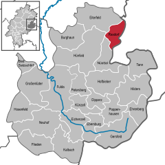
Rasdorf
- municipality in Landkreis Fulda in Hesse, Germany
Rasdorf, located in the scenic region of Hesse, Germany, offers a variety of hiking opportunities that cater to both casual walkers and experienced trekkers. The area is characterized by its beautiful landscapes, rolling hills, forests, and charming villages. Here are some key aspects you might find interesting about hiking in and around Rasdorf:...
- Country:

- Postal Code: 36169
- Local Dialing Code: 06651
- Licence Plate Code: FD
- Coordinates: 50° 43' 0" N, 9° 54' 0" E


- GPS tracks (wikiloc): [Link]
- AboveSeaLevel: 333 м m
- Area: 30.07 sq km
- Population: 1624
- Web site: [Link]

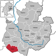
Flieden
- municipality in Landkreis Fulda in Hesse, Germany
Flieden is a charming area located in Hesse, Germany, known for its scenic landscapes, rolling hills, and picturesque villages. Hiking in this region offers an excellent opportunity to explore the natural beauty and local culture. Here’s an overview of what you can expect when hiking in Flieden:...
- Country:

- Postal Code: 36103
- Local Dialing Code: 0 66 55
- Licence Plate Code: FD
- Coordinates: 50° 25' 26" N, 9° 34' 0" E


- GPS tracks (wikiloc): [Link]
- AboveSeaLevel: 299 м m
- Area: 49.65 sq km
- Population: 8701
- Web site: [Link]
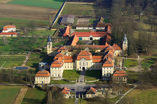

Eichenzell
- municipality in Landkreis Fulda in Hesse, Germany
Eichenzell, located in the Fulda district of Hesse, Germany, offers a variety of hiking opportunities that allow you to explore the beautiful landscapes of the region. The area is characterized by its rolling hills, dense forests, and picturesque views, making it a great destination for outdoor enthusiasts....
- Country:

- Postal Code: 36124
- Local Dialing Code: 0661; 06659
- Licence Plate Code: FD
- Coordinates: 50° 29' 0" N, 9° 42' 0" E


- GPS tracks (wikiloc): [Link]
- AboveSeaLevel: 314 м m
- Area: 55.96 sq km
- Population: 10975
- Web site: [Link]


Großenlüder
- municipality in Landkreis Fulda in Hesse, Germany
Großenlüder, located in Hesse, Germany, offers beautiful hiking opportunities amidst picturesque landscapes and charming natural features. The region is characterized by lush forests, rolling hills, and scenic views, making it an excellent destination for both casual walkers and more experienced hikers....
- Country:

- Postal Code: 36137
- Local Dialing Code: 06648
- Licence Plate Code: FD
- Coordinates: 50° 35' 33" N, 9° 32' 32" E


- GPS tracks (wikiloc): [Link]
- AboveSeaLevel: 251 м m
- Area: 73.92 sq km
- Population: 8544
- Web site: [Link]


Hilders
- municipality in Landkreis Fulda in Hesse, Germany
Hilders, located in the beautiful Rhön region of Germany, offers a picturesque setting for hiking enthusiasts. The area is characterized by rolling hills, dense forests, and stunning vistas, making it an ideal spot for outdoor activities....
- Country:

- Postal Code: 36115
- Local Dialing Code: 06681
- Licence Plate Code: FD
- Coordinates: 50° 34' 19" N, 10° 0' 11" E


- GPS tracks (wikiloc): [Link]
- AboveSeaLevel: 450 м m
- Area: 70.38 sq km
- Population: 4600
- Web site: [Link]


Poppenhausen (Wasserkuppe)
- municipality in Landkreis Fulda in Hesse, Germany
 Hiking in Poppenhausen (Wasserkuppe)
Poppenhausen, located in the scenic region of Hesse, Germany, is a great destination for hiking enthusiasts. Nestled near the eastern edge of the Rhön Mountains, it offers a variety of trails that showcase the beauty of the surrounding landscape, characterized by rolling hills, forests, and meadows....
- Country:

- Postal Code: 36163
- Local Dialing Code: 06658
- Licence Plate Code: FD
- Coordinates: 50° 29' 18" N, 9° 52' 9" E


- GPS tracks (wikiloc): [Link]
- AboveSeaLevel: 524 м m
- Area: 40.77 sq km
- Population: 2609
- Web site: [Link]

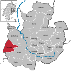
Hosenfeld
- municipality in Landkreis Fulda in Hesse, Germany
Hosenfeld, located in the state of Hesse, Germany, offers a serene and picturesque environment for hiking enthusiasts. The region is characterized by its beautiful landscapes, including forests, rolling hills, and charming countryside views. Here are some key points to know about hiking in and around Hosenfeld:...
- Country:

- Postal Code: 36154
- Local Dialing Code: 06650
- Licence Plate Code: FD
- Coordinates: 50° 31' 0" N, 9° 29' 0" E


- GPS tracks (wikiloc): [Link]
- AboveSeaLevel: 367 м m
- Area: 50.71 sq km
- Population: 4668
- Web site: [Link]


Künzell
- municipality in Landkreis Fulda in Hesse, Germany
Künzell is a beautiful area located in the Hesse region of Germany, near the city of Fulda. It offers a variety of hiking opportunities for outdoor enthusiasts. Here are some highlights and tips for hiking in Künzell:...
- Country:

- Postal Code: 36093
- Local Dialing Code: 0661
- Licence Plate Code: FD
- Coordinates: 50° 32' 39" N, 9° 43' 5" E


- GPS tracks (wikiloc): [Link]
- AboveSeaLevel: 336 м m
- Area: 30.29 sq km
- Population: 16527
- Web site: [Link]
Shares border with regions:


Rhön-Grabfeld
- district in Bavaria, Germany
Rhön-Grabfeld is a picturesque region located in Bavaria, Germany, renowned for its scenic landscapes, rolling hills, and rich natural beauty. It comprises part of the UNESCO Biosphere Reserve Rhön, which is characterized by its unique geology, biodiversity, and well-maintained hiking trails....
- Country:

- Capital: Bad Neustadt an der Saale
- Licence Plate Code: MET; KÖN; NES
- Coordinates: 50° 19' 48" N, 10° 15' 0" E


- GPS tracks (wikiloc): [Link]
- AboveSeaLevel: 320 м m
- Area: 1022.00 sq km
- Population: 77197
- Web site: [Link]
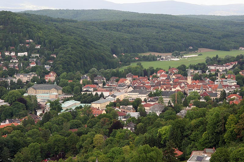

Bad Kissingen
- district in Bavaria, Germany
Bad Kissingen, located in Bavaria, Germany, is a beautiful spa town known for its healing mineral waters and lovely natural surroundings. The area's scenic landscapes make it an excellent destination for hiking enthusiasts. Here are some key points about hiking in Bad Kissingen:...
- Country:

- Capital: Bad Kissingen
- Licence Plate Code: HAB; BRK; KG
- Coordinates: 50° 15' 0" N, 10° 0' 0" E


- GPS tracks (wikiloc): [Link]
- AboveSeaLevel: 330 м m
- Area: 1137.00 sq km
- Population: 99022
- Web site: [Link]


Thuringia
- state of Germany
Thuringia, located in central Germany, is an excellent destination for hiking enthusiasts. Known for its diverse landscapes, lush forests, historical sites, and picturesque villages, Thuringia offers numerous trails that cater to different skill levels and interests. Here are some highlights and tips for hiking in the region:...
- Country:

- Capital: Erfurt
- Coordinates: 50° 51' 40" N, 11° 3' 7" E


- GPS tracks (wikiloc): [Link]
- AboveSeaLevel: 266 м m
- Area: 16171.0 sq km
- Population: 2161000
- Web site: [Link]
Wartburgkreis
- district in Thuringia, Germany
Wartburgkreis, located in Thuringia, Germany, offers a variety of hiking opportunities amidst stunning natural landscapes, historical sites, and diverse ecosystems. The region is known for its scenic beauty, characterized by rolling hills, dense forests, and beautiful valleys....
- Country:

- Coordinates: 50° 55' 12" N, 10° 15' 0" E


- GPS tracks (wikiloc): [Link]
- AboveSeaLevel: 344 м m
- Area: 1307.43 sq km
- Population: 125655
- Web site: [Link]
Schmalkalden-Meiningen
- district in Thuringia, Germany
 Hiking in Schmalkalden-Meiningen
Schmalkalden-Meiningen, located in the state of Thuringia, Germany, offers a variety of hiking opportunities that cater to both casual walkers and experienced hikers. The region is characterized by its picturesque landscapes, including forests, hills, and historical towns, making it an attractive destination for outdoor enthusiasts. Here are some key highlights:...
- Country:

- Licence Plate Code: SM
- Coordinates: 50° 40' 12" N, 10° 25' 12" E


- GPS tracks (wikiloc): [Link]
- AboveSeaLevel: 478 м m
- Area: 1210.73 sq km
- Population: 124623
- Web site: [Link]
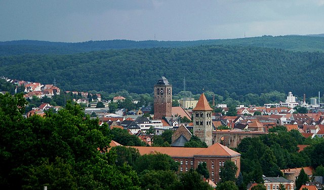
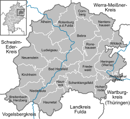
Hersfeld-Rotenburg
- district in Hesse, Germany
Hersfeld-Rotenburg is a beautiful district in the state of Hesse, Germany, known for its diverse landscapes, historical sites, and excellent hiking opportunities. The region is characterized by rolling hills, deep forests, and picturesque valleys, making it an ideal destination for outdoor enthusiasts and hikers....
- Country:

- Capital: Bad Hersfeld
- Licence Plate Code: ROF; HEF
- Coordinates: 50° 52' 18" N, 9° 42' 58" E


- GPS tracks (wikiloc): [Link]
- AboveSeaLevel: 197 м m
- Area: 1097.15 sq km
- Population: 120165
- Web site: [Link]
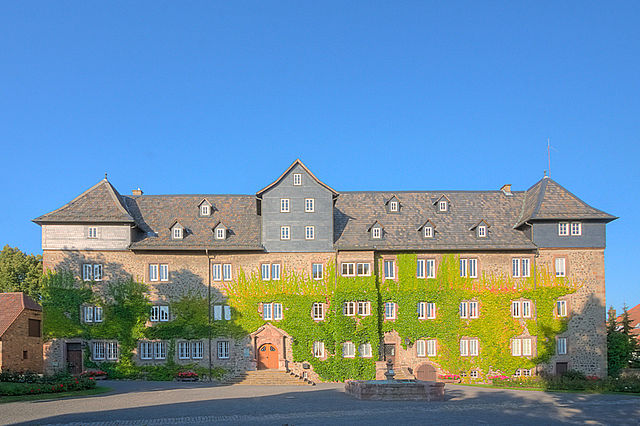
Vogelsbergkreis
- district in Hesse, Germany
Vogelsbergkreis, located in Hessen, Germany, is known for its beautiful landscapes, natural attractions, and a variety of hiking opportunities. Here are some highlights and tips for hiking in this region:...
- Country:

- Capital: Lauterbach
- Licence Plate Code: VB
- Coordinates: 50° 38' 27" N, 9° 23' 59" E


- GPS tracks (wikiloc): [Link]
- AboveSeaLevel: 371 м m
- Area: 1458.96 sq km
- Web site: [Link]

Main-Kinzig-Kreis
- district in Hesse, Germany
Main-Kinzig-Kreis, located in the state of Hesse, Germany, offers a diverse array of hiking opportunities suitable for various skill levels and preferences. The region is characterized by beautiful landscapes, including forests, rivers, hills, and quaint villages, making it a great destination for outdoor enthusiasts. Here are some highlights:...
- Country:

- Capital: Gelnhausen
- Licence Plate Code: MKK
- Coordinates: 50° 12' 4" N, 9° 11' 51" E


- GPS tracks (wikiloc): [Link]
- AboveSeaLevel: 202 м m
- Area: 1397.52 sq km
- Population: 407619
- Web site: [Link]


Bavaria
- state in Germany
Hiking in Bavaria is a fantastic experience, offering a diverse range of landscapes, stunning views, and well-marked trails. Here are some key highlights and tips for hiking in Bavaria:...
- Country:

- Capital: Munich
- Coordinates: 48° 46' 39" N, 11° 25' 52" E


- GPS tracks (wikiloc): [Link]
- AboveSeaLevel: 503 м m
- Area: 70551 sq km
- Population: 12930751
- Web site: [Link]

