Wahlenheim (Wahlenheim)

- commune in Bas-Rhin, France
- Country:

- Postal Code: 67170
- Coordinates: 48° 45' 50" N, 7° 41' 6" E


- GPS tracks (wikiloc): [Link]
- Area: 2.55 sq km
- Population: 408
- Web site: http://www.wahlenheim.fr/
- Wikipedia en: wiki(en)
- Wikipedia: wiki(fr)
- Wikidata storage: Wikidata: Q21593
- Wikipedia Commons Category: [Link]
- Freebase ID: [/m/03m9cn7]
- Freebase ID: [/m/03m9cn7]
- GeoNames ID: Alt: [6441396]
- GeoNames ID: Alt: [6441396]
- SIREN number: [216705103]
- SIREN number: [216705103]
- BnF ID: [15271652s]
- BnF ID: [15271652s]
- VIAF ID: Alt: [242371867]
- VIAF ID: Alt: [242371867]
- INSEE municipality code: 67510
- INSEE municipality code: 67510
Shares border with regions:
Batzendorf
- commune in Bas-Rhin, France
- Country:
- Postal Code: 67500
- Coordinates: 48° 47' 1" N, 7° 42' 20" E
- GPS tracks (wikiloc): [Link]
- Area: 6.74 sq km
- Population: 992
- Web site: [Link]


Bernolsheim
- commune in Bas-Rhin, France
- Country:
- Postal Code: 67170
- Coordinates: 48° 45' 22" N, 7° 41' 23" E
- GPS tracks (wikiloc): [Link]
- Area: 3.39 sq km
- Population: 609
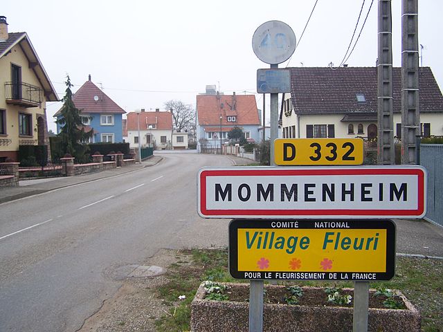

Mommenheim
- commune in Bas-Rhin, France
- Country:
- Postal Code: 67670
- Coordinates: 48° 45' 27" N, 7° 38' 39" E
- GPS tracks (wikiloc): [Link]
- Area: 8.16 sq km
- Population: 1793

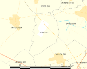
Hochstett
- commune in Bas-Rhin, France
- Country:
- Postal Code: 67170
- Coordinates: 48° 46' 41" N, 7° 40' 35" E
- GPS tracks (wikiloc): [Link]
- Area: 2.13 sq km
- Population: 353


Rottelsheim
- commune in Bas-Rhin, France
- Country:
- Postal Code: 67170
- Coordinates: 48° 45' 24" N, 7° 42' 52" E
- GPS tracks (wikiloc): [Link]
- Area: 2.39 sq km
- Population: 318
- Web site: [Link]