Waldeck-Frankenberg (Landkreis Waldeck-Frankenberg)
- district in Hesse, Germany
Waldeck-Frankenberg, located in the federal state of Hesse, Germany, is known for its stunning natural landscapes, charming villages, and rich cultural heritage, making it an excellent destination for hiking enthusiasts.
Key Features:
-
Natural Beauty: The region is characterized by diverse landscapes, including rolling hills, dense forests, shimmering lakes, and picturesque valleys. The area is part of the larger Kellerwald-Edersee National Park, which offers a variety of stunning scenery and biodiversity.
-
Hiking Trails: There are numerous well-marked hiking trails in Waldeck-Frankenberg suitable for all skill levels:
- Kellerwaldsteig: This long-distance trail encircles the Kellerwald National Park and provides a mix of easy walks and more challenging hikes with beautiful views of the surrounding landscapes.
- Edersee Circular Walks: The Edersee offers various circular hiking routes alongside the lake, providing access to scenic viewpoints and opportunities to enjoy the water.
-
Cultural Experiences: Besides the natural attractions, the region is dotted with historical sites and charming towns. Exploring the towns of Bad Wildungen, Frankenberg, and Korbach can enhance your hiking adventure, offering local cuisine and cultural insights.
-
Wildlife and Flora: The area is known for its rich flora and fauna. The Kellerwald's ancient beech forests are a UNESCO World Heritage Site, and hikers may also encounter local wildlife such as deer, wild boar, and a variety of bird species.
-
Seasonal Considerations: The best times to hike in Waldeck-Frankenberg are generally late spring through early autumn (May to October) when the weather is mild, and the trails are accessible. However, winter hiking can also be enjoyable, especially in snowy conditions, depending on the trail and weather conditions.
Tips for Hiking in Waldeck-Frankenberg:
- Prepare Adequately: Always check weather conditions before heading out. Bring appropriate gear, including good hiking shoes, water, and snacks.
- Respect Nature: Follow the Leave No Trace principles, ensuring you pack out what you pack in. Stay on marked trails to protect the local ecosystem.
- Plan Your Route: Familiarize yourself with the trail maps available at tourist information centers, or use a reliable hiking app for navigation.
- Stay Hydrated and Energized: Especially in warmer weather, be sure to drink plenty of water and take breaks as needed.
With its breathtaking scenery and well-maintained trails, Waldeck-Frankenberg offers a delightful hiking experience for nature lovers and adventurers alike.
- Country:

- Capital: Korbach
- Licence Plate Code: WA; FKB; KB
- Coordinates: 51° 16' 9" N, 8° 51' 24" E


- GPS tracks (wikiloc): [Link]
- AboveSeaLevel: 374 м m
- Area: 1848.60 sq km
- Population: 157293
- Web site: http://www.landkreis-waldeck-frankenberg.de/
- Wikipedia en: wiki(en)
- Wikipedia: wiki(de)
- Wikidata storage: Wikidata: Q7893
- Wikipedia Commons Category: [Link]
- Wikipedia Commons Maps Category: [Link]
- Freebase ID: [/m/01ft_s]
- GeoNames ID: Alt: [3220997]
- VIAF ID: Alt: [243437560]
- OSM relation ID: [62563]
- GND ID: Alt: [4064378-5]
- archINFORM location ID: [4478]
- TGN ID: [7077053]
- NUTS code: [DE736]
- German district key: 06635
Includes regions:


Frankenau
- town in Landkreis Waldeck-Frankenberg in Hesse, Germany
Frankenau, located in the picturesque region of Hesse, Germany, is a fantastic destination for hiking enthusiasts. Nestled near the Kellerwald-Edersee National Park, the area boasts a range of trails that cater to various skill levels, making it an excellent spot for both beginners and experienced hikers....
- Country:

- Postal Code: 35109–35110
- Local Dialing Code: 06455
- Licence Plate Code: KB
- Coordinates: 51° 6' 0" N, 8° 56' 0" E


- GPS tracks (wikiloc): [Link]
- AboveSeaLevel: 430 м m
- Area: 57.29 sq km
- Population: 2908
- Web site: [Link]

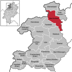
Bad Arolsen
- town in Landkreis Waldeck-Frankenberg in Hesse, Germany
Bad Arolsen, located in the northern part of Hesse, Germany, is a charming town surrounded by beautiful countryside, making it a great destination for hiking enthusiasts. The area offers a variety of trails that cater to different skill levels, allowing hikers to explore both scenic landscapes and historical sites....
- Country:

- Postal Code: 34454
- Local Dialing Code: 02993; 05696; 05691
- Licence Plate Code: KB
- Coordinates: 51° 22' 40" N, 9° 1' 0" E


- GPS tracks (wikiloc): [Link]
- AboveSeaLevel: 286 м m
- Area: 126.32 sq km
- Population: 15452
- Web site: [Link]

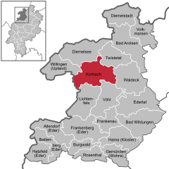
Korbach
- seat of Landkreis Waldeck-Frankenberg and town in Hesse, Germany
Korbach, located in the state of Hesse, Germany, is a great destination for hiking enthusiasts. The region is surrounded by beautiful landscapes, including woods, hills, and the scenic Sauerland mountains. Here are some highlights and tips for hiking in and around Korbach:...
- Country:

- Postal Code: 34497
- Local Dialing Code: 05631
- Licence Plate Code: KB
- Coordinates: 51° 16' 19" N, 8° 52' 23" E


- GPS tracks (wikiloc): [Link]
- AboveSeaLevel: 384 м m
- Area: 123.98 sq km
- Population: 23515
- Web site: [Link]


Twistetal
- municipality in Landkreis Waldeck-Frankenberg in Hesse, Germany
Twistetal, a valley located in Germany, offers beautiful hiking opportunities for outdoor enthusiasts. Nestled in the Rothaargebirge mountain range, it's part of the larger Sauerland region, known for its stunning landscapes, forests, and rich natural heritage....
- Country:

- Postal Code: 34477
- Local Dialing Code: 05695
- Licence Plate Code: KB
- Coordinates: 51° 19' 0" N, 8° 57' 0" E


- GPS tracks (wikiloc): [Link]
- AboveSeaLevel: 272 м m
- Area: 74.0 sq km
- Population: 4395
- Web site: [Link]


Willingen
- municipality in Landkreis Waldeck-Frankenberg in Hesse, Germany
Willingen, located in the Sauerland region of Germany, is a popular destination for hiking enthusiasts. The area is known for its beautiful landscapes, diverse flora and fauna, and well-maintained hiking trails. Here are some highlights and tips for hiking in Willingen:...
- Country:

- Postal Code: 34508
- Local Dialing Code: 05632
- Licence Plate Code: KB
- Coordinates: 51° 17' 42" N, 8° 36' 29" E


- GPS tracks (wikiloc): [Link]
- AboveSeaLevel: 550 м m
- Area: 80.26 sq km
- Population: 6069
- Web site: [Link]


Bad Wildungen
- town in Landkreis Waldeck-Frankenberg in Hesse, Germany
Bad Wildungen, located in the state of Hesse, Germany, is a charming spa town renowned for its beautiful landscapes and diverse hiking opportunities. Here are some key points about hiking in Bad Wildungen:...
- Country:

- Postal Code: 34521–34537
- Local Dialing Code: 05621
- Licence Plate Code: KB, FKB, WA
- Coordinates: 51° 7' 0" N, 9° 7' 0" E


- GPS tracks (wikiloc): [Link]
- AboveSeaLevel: 275 м m
- Area: 120.08 sq km
- Population: 16777
- Web site: [Link]


Volkmarsen
- town in Landkreis Waldeck-Frankenberg in Hesse, Germany
Volkmarsen, located in the state of Hesse, Germany, is a great destination for hiking enthusiasts. Nestled in the beautiful landscape of the Rothaargebirge and close to the Kellerwald-Edersee National Park, there are various trails that offer a range of experiences, from gentle walks to more challenging hikes. Here are some highlights of hiking in Volkmarsen:...
- Country:

- Postal Code: 34471
- Local Dialing Code: 05693
- Licence Plate Code: KB
- Coordinates: 51° 23' 0" N, 9° 7' 0" E


- GPS tracks (wikiloc): [Link]
- AboveSeaLevel: 259 м m
- Area: 67.47 sq km
- Population: 6847
- Web site: [Link]
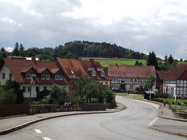
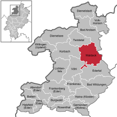
Waldeck
- town in Landkreis Waldeck-Frankenberg in Hesse, Germany
Waldeck, located in the state of Hesse, Germany, is known for its beautiful landscapes and outdoor recreational opportunities, making it a great destination for hiking enthusiasts. Here are some highlights about hiking in this region:...
- Country:

- Postal Code: 34513
- Local Dialing Code: 05634
- Coordinates: 51° 12' 0" N, 9° 4' 0" E


- GPS tracks (wikiloc): [Link]
- AboveSeaLevel: 404 м m
- Area: 115.73 sq km
- Population: 6759
- Web site: [Link]
Battenberg (Eder)
- town in Landkreis Waldeck-Frankenberg in Hesse, Germany
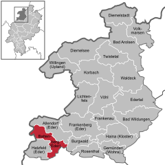
Battenberg (Eder) is a charming small town located in the scenic Sauerland region of Germany. It's a lovely spot for hiking, as it offers access to a variety of trails that cater to different skill levels and preferences. Here are some highlights and tips for hiking in the area:...
- Country:

- Postal Code: 35088
- Local Dialing Code: 06452
- Licence Plate Code: KB
- Coordinates: 51° 1' 0" N, 8° 39' 0" E


- GPS tracks (wikiloc): [Link]
- AboveSeaLevel: 340 м m
- Area: 64.73 sq km
- Population: 5292
- Web site: [Link]


Diemelstadt
- town in Landkreis Waldeck-Frankenberg in Hesse, Germany
Diemelstadt, located in the northern part of Hesse, Germany, offers a range of beautiful hiking opportunities, surrounded by picturesque landscapes, dense forests, and charming villages. Here are some highlights and tips for hiking in the area:...
- Country:

- Postal Code: 34474
- Local Dialing Code: 05694; 05642; 05641; 02992
- Coordinates: 51° 27' 36" N, 8° 58' 48" E


- GPS tracks (wikiloc): [Link]
- AboveSeaLevel: 304 м m
- Area: 82.58 sq km
- Population: 5190
- Web site: [Link]

Burgwald
- municipality in Landkreis Waldeck-Frankenberg in Hesse, Germany
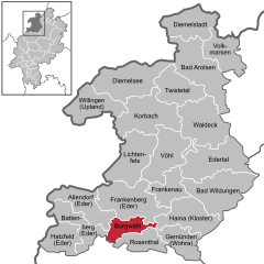
Burgwald, located in Hesse, Germany, is a beautiful area known for its diverse landscapes, rich flora and fauna, and well-maintained trails that attract hikers of all experience levels. Here are some key points about hiking in Burgwald:...
- Country:

- Postal Code: 35099
- Local Dialing Code: 06457; 06451
- Licence Plate Code: KB
- Coordinates: 51° 0' 58" N, 8° 45' 59" E


- GPS tracks (wikiloc): [Link]
- AboveSeaLevel: 375 м m
- Area: 41.29 sq km
- Population: 4984
- Web site: [Link]


Hatzfeld
- town in Landkreis Waldeck-Frankenberg in Hesse, Germany
Hatzfeld, located in the Hessen region of Germany, offers various hiking opportunities that cater to different levels of experience and fitness. The surrounding countryside features scenic landscapes, including rolling hills, woodlands, and picturesque farmlands, making it an attractive destination for nature enthusiasts....
- Country:

- Postal Code: 35116
- Local Dialing Code: 06467
- Licence Plate Code: KB
- Coordinates: 51° 0' 0" N, 8° 33' 0" E


- GPS tracks (wikiloc): [Link]
- AboveSeaLevel: 358 м m
- Area: 58.51 sq km
- Population: 3029
- Web site: [Link]


Frankenberg
- town in Landkreis Waldeck-Frankenberg in Hesse, Germany
Frankenberg, located in the state of Hesse, Germany, offers some lovely hiking opportunities that cater to different skill levels and preferences. This charming town is surrounded by scenic landscapes, including rolling hills, forests, and picturesque countryside, making it an ideal spot for outdoor enthusiasts....
- Country:

- Postal Code: 35066
- Local Dialing Code: 06451
- Coordinates: 51° 3' 32" N, 8° 47' 48" E


- GPS tracks (wikiloc): [Link]
- AboveSeaLevel: 296 м m
- Area: 124.87 sq km
- Population: 17855
- Web site: [Link]


Allendorf
- municipality in Landkreis Waldeck-Frankenberg in Hesse, Germany
Allendorf (Eder) is a charming village located in the heart of the German state of Hesse, surrounded by beautiful natural landscapes that are ideal for hiking. The region features picturesque countryside, forested areas, and scenic trails that cater to various levels of hikers, from beginners to more experienced adventurers....
- Country:

- Postal Code: 35108
- Local Dialing Code: 06452; 06451
- Licence Plate Code: KB
- Coordinates: 51° 2' 0" N, 8° 41' 0" E


- GPS tracks (wikiloc): [Link]
- AboveSeaLevel: 306 м m
- Area: 41.79 sq km
- Population: 5602
- Web site: [Link]

Edertal
- municipality in Landkreis Waldeck-Frankenberg in Hesse, Germany
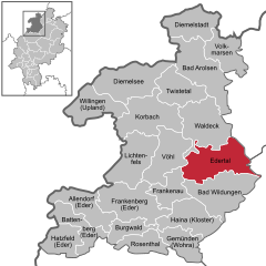
Edertal, located in the picturesque region of Hesse, Germany, is known for its stunning landscapes and outdoor recreational opportunities, making it a fantastic destination for hiking enthusiasts. Here are some highlights and useful information about hiking in Edertal:...
- Country:

- Postal Code: 34549
- Local Dialing Code: 05621; 05623
- Licence Plate Code: KB
- Coordinates: 51° 10' 0" N, 9° 6' 0" E


- GPS tracks (wikiloc): [Link]
- AboveSeaLevel: 226 м m
- Area: 115.72 sq km
- Population: 6301
- Web site: [Link]

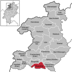
Rosenthal
- town in Landkreis Waldeck-Frankenberg in Hesse, Germany
Rosenthal, located in Hesse, Germany, is a picturesque area that offers a variety of hiking opportunities for outdoor enthusiasts. The region is characterized by its scenic landscapes, including rolling hills, forests, and charming villages....
- Country:

- Postal Code: 35119
- Local Dialing Code: 06458
- Licence Plate Code: KB
- Coordinates: 50° 58' 0" N, 8° 52' 0" E


- GPS tracks (wikiloc): [Link]
- AboveSeaLevel: 294 м m
- Area: 51.54 sq km
- Population: 2188
- Web site: [Link]


Gemünden
- town in Landkreis Waldeck-Frankenberg in Hesse, Germany
Gemünden (Wohra) is a charming town in Hesse, Germany, surrounded by picturesque landscapes ideal for hiking enthusiasts. Nestled in the foothills of the Rothaar Mountains, this area boasts a variety of hiking trails that cater to different skill levels, making it a great destination for both casual walkers and serious hikers....
- Country:

- Postal Code: 35285
- Local Dialing Code: 06453
- Licence Plate Code: KB
- Coordinates: 50° 58' 0" N, 8° 58' 0" E


- GPS tracks (wikiloc): [Link]
- AboveSeaLevel: 249 м m
- Area: 58.67 sq km
- Population: 3816
- Web site: [Link]


Vöhl
- municipality in Landkreis Waldeck-Frankenberg in Hesse, Germany
Vöhl is a charming town located in the region of Hesse, Germany, known for its beautiful natural surroundings, particularly near the Edersee, which is one of the largest artificial lakes in Europe. The area around Vöhl offers a variety of hiking opportunities suitable for all levels of hikers....
- Country:

- Postal Code: 34516
- Local Dialing Code: 05635
- Licence Plate Code: KB
- Coordinates: 51° 12' 0" N, 8° 56' 0" E


- GPS tracks (wikiloc): [Link]
- AboveSeaLevel: 302 м m
- Area: 98.81 sq km
- Population: 5608
- Web site: [Link]


Bromskirchen
- municipality in Landkreis Waldeck-Frankenberg in Hesse, Germany
Bromskirchen is a small village located in the state of Hesse, Germany, surrounded by beautiful natural landscapes that are great for hiking. The area offers a variety of trails suitable for different skill levels, ranging from easy walks to more challenging hikes, allowing you to enjoy the scenic beauty of the Rothaargebirge mountain range....
- Country:

- Postal Code: 59969
- Local Dialing Code: 02984
- Licence Plate Code: KB
- Coordinates: 51° 5' 42" N, 8° 37' 37" E


- GPS tracks (wikiloc): [Link]
- AboveSeaLevel: 498 м m
- Area: 35.23 sq km
- Population: 1804
- Web site: [Link]


Lichtenfels
- town in Landkreis Waldeck-Frankenberg in Hesse, Germany
Lichtenfels in Hesse, Germany, offers some beautiful hiking opportunities, particularly for those looking to explore scenic landscapes, charming villages, and natural beauty. While the town itself is small, it's located near various trails that provide access to the broader region....
- Country:

- Postal Code: 35104
- Local Dialing Code: 06454
- Licence Plate Code: KB
- Coordinates: 51° 9' 0" N, 8° 48' 0" E


- GPS tracks (wikiloc): [Link]
- AboveSeaLevel: 410 м m
- Area: 96.73 sq km
- Population: 4136
- Web site: [Link]

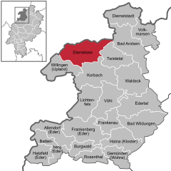
Diemelsee
- municipality in Landkreis Waldeck-Frankenberg in Hesse, Germany
Diemelsee, located in the North Rhine-Westphalia region of Germany, is a fantastic destination for hiking enthusiasts due to its beautiful natural landscapes and well-marked trails. The municipality is situated around the Diemelsee reservoir and is surrounded by the rolling hills of the Sauerland region, offering stunning views and varied topography....
- Country:

- Postal Code: 34519
- Local Dialing Code: 05633
- Licence Plate Code: KB
- Coordinates: 51° 22' 0" N, 8° 48' 0" E


- GPS tracks (wikiloc): [Link]
- AboveSeaLevel: 405 м m
- Area: 121.70 sq km
- Population: 4803
- Web site: [Link]


Haina
- municipality in Landkreis Waldeck-Frankenberg in Hesse, Germany
Haina, located in the Dominican Republic, is not only known for its historical significance but also for its beautiful natural landscapes, making it a great destination for hiking enthusiasts. Here are some key points about hiking in the Haina area:...
- Country:

- Postal Code: 35114
- Local Dialing Code: 06456
- Licence Plate Code: KB
- Coordinates: 51° 2' 0" N, 8° 58' 0" E


- GPS tracks (wikiloc): [Link]
- AboveSeaLevel: 337 м m
- Area: 91.28 sq km
- Population: 3490
- Web site: [Link]
Shares border with regions:

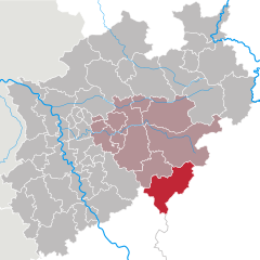
Siegen-Wittgenstein
- district in North Rhine-Westphalia, Germany
Siegen-Wittgenstein is a beautiful region located in North Rhine-Westphalia, Germany, characterized by its lush landscapes, rolling hills, and dense forests. This area is perfect for hiking enthusiasts, offering a variety of trails suitable for all skill levels....
- Country:

- Licence Plate Code: BLB; SI
- Coordinates: 50° 55' 12" N, 8° 10' 12" E


- GPS tracks (wikiloc): [Link]
- AboveSeaLevel: 616 м m
- Area: 1132.89 sq km
- Population: 275909
- Web site: [Link]

Kassel
- district in Hesse, Germany
Kassel, located in the northern part of Hesse, Germany, offers a variety of hiking trails that immerse you in nature and the area's rich cultural heritage. Here are some highlights to consider when hiking in and around Kassel:...
- Country:

- Capital: Kassel
- Licence Plate Code: WOH; HOG; KS
- Coordinates: 51° 18' 40" N, 9° 29' 9" E


- GPS tracks (wikiloc): [Link]
- AboveSeaLevel: 273 м m
- Area: 1292.76 sq km
- Population: 234206
- Web site: [Link]

