Kassel Government Region (Regierungsbezirk Kassel)

- administrative subdivision and region of Hesse, Germany
 Hiking in Kassel Government Region
Kassel is a beautiful region in Germany known for its picturesque landscapes, rich history, and ample opportunities for hiking. Located in the heart of Germany, Kassel offers access to various trails that range from easy walks to more challenging hikes, all set against the backdrop of the lush natural beauty of the surrounding hills and forests.
Key Hiking Areas in Kassel:
-
Kellerwald-Edersee National Park: This national park is located a short drive from Kassel and offers a variety of trails through ancient forests. This area is known for its diverse flora and fauna, as well as stunning views of the Edersee lake. Trails range in difficulty, making it suitable for all hikers.
-
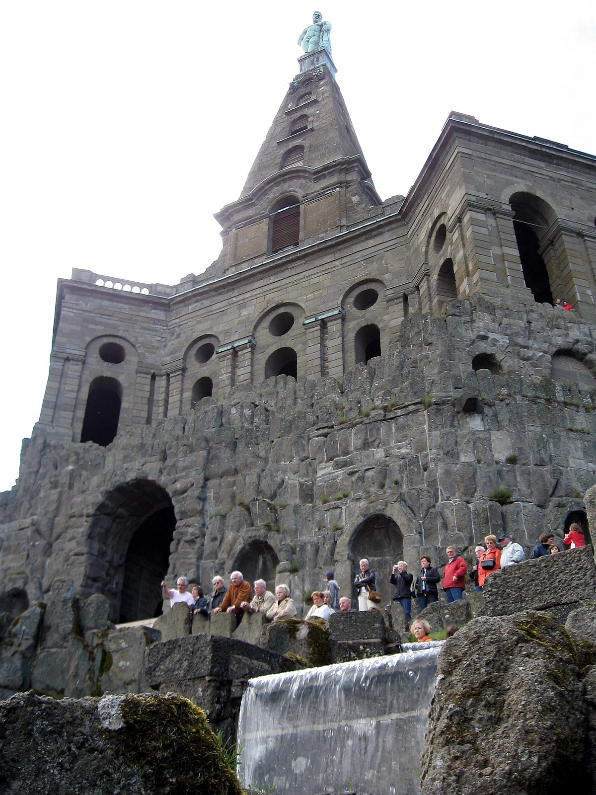
Habichtswald Nature Park: Just to the west of Kassel, this park features well-marked trails that wind through mixed hardwood forests and offer breathtaking vistas. The park is home to the famous Wilhelmshöhe Mountain, which is crowned by the impressive Hercules monument.
-
Wilhelmshöhe Park: This UNESCO World Heritage site is perfect for more leisurely hiking. The park features beautifully designed landscapes, grand fountains, and historical buildings. The trails here are more about enjoying the art and architecture in nature.
-
The Reinhardswald: This extensive forest area is located south of Kassel and offers many hiking trails. It is rich in legends and folklore, making it an intriguing place to explore. The trails provide a mix of serene forest paths and panoramic views.
-
The Habichtswald trail: This is a popular circular route that typically takes about four to five hours to complete, providing hikers with a great opportunity to experience the landscape, wildlife, and historical landmarks along the way.
Tips for Hiking in Kassel:
- Trail Maps: Make sure to carry a good map or use a hiking app, as many trails are well-marked but can involve some navigation through various routes.
- Best Time to Hike: Spring (April to June) and fall (September to October) are particularly beautiful times to hike in the region, with mild weather and stunning natural colors.
- Gear: Wear comfortable hiking shoes, and the weather can be unpredictable, so be prepared with layers and a rain jacket.
- Stay Hydrated: Bring plenty of water, especially on longer hikes, and consider packing snacks to enjoy a break with a view.
Local Amenities:
Kassel offers a range of amenities and facilities for hikers, including guest houses, restaurants, and shops where you can rest and refuel. There's also a strong local culture that appreciates outdoor activities, making it a welcoming place for hikers of all skill levels.
Whether you're a beginner or an experienced hiker, the Kassel region has something to offer for everyone. Enjoy the beautiful trails and the rich landscapes in this charming part of Germany!
- Country:

- Capital: Kassel
- Coordinates: 51° 10' 12" N, 9° 25' 12" E


- GPS tracks (wikiloc): [Link]
- AboveSeaLevel: 312 м m
- Area: 8288.7 sq km
- Population: 1220000
- Web site: http://www.rp-kassel.de/
- Wikipedia en: wiki(en)
- Wikipedia: wiki(de)
- Wikidata storage: Wikidata: Q7928
- Wikipedia Commons Category: [Link]
- Wikipedia Commons Maps Category: [Link]
- Freebase ID: [/m/01b6h5]
- GeoNames ID: Alt: [2892513]
- VIAF ID: Alt: [234476393]
- OSM relation ID: [286675]
- GND ID: Alt: [17428-2]
- Library of Congress authority ID: Alt: [n84208750]
- NUTS code: [DE73]
Includes regions:

Kassel
- city in Hesse, Germany
Hiking in Kassel
Kassel, located in northern Hesse, Germany, offers a variety of hiking opportunities that cater to different skill levels and preferences. Here are some highlights about hiking in and around Kassel:...
- Country:
- Postal Code: 34128; 34117
- Local Dialing Code: 0561
- Licence Plate Code: KS
- Coordinates: 51° 18' 57" N, 9° 29' 53" E
- GPS tracks (wikiloc): [Link]
- AboveSeaLevel: 175 м m
- Area: 106.78 sq km
- Population: 199062
- Web site: [Link]

Kassel
- district in Hesse, Germany
Hiking in Kassel
Kassel, located in the northern part of Hesse, Germany, offers a variety of hiking trails that immerse you in nature and the area's rich cultural heritage. Here are some highlights to consider when hiking in and around Kassel:...
- Country:
- Capital: Kassel
- Licence Plate Code: WOH; HOG; KS
- Coordinates: 51° 18' 40" N, 9° 29' 9" E
- GPS tracks (wikiloc): [Link]
- AboveSeaLevel: 273 м m
- Area: 1292.76 sq km
- Population: 234206
- Web site: [Link]


Waldeck-Frankenberg
- district in Hesse, Germany
Hiking in Waldeck-Frankenberg
Waldeck-Frankenberg, located in the federal state of Hesse, Germany, is known for its stunning natural landscapes, charming villages, and rich cultural heritage, making it an excellent destination for hiking enthusiasts....
- Country:
- Capital: Korbach
- Licence Plate Code: WA; FKB; KB
- Coordinates: 51° 16' 9" N, 8° 51' 24" E
- GPS tracks (wikiloc): [Link]
- AboveSeaLevel: 374 м m
- Area: 1848.60 sq km
- Population: 157293
- Web site: [Link]
Schwalm-Eder-Kreis
- district in Hesse, Germany
Hiking in Schwalm-Eder-Kreis
Schwalm-Eder-Kreis, located in central Germany in the state of Hesse, is an excellent destination for hiking enthusiasts. The region offers a diverse landscape, featuring rolling hills, lush forests, charming villages, and local cultural sights, making it ideal for both casual walkers and experienced hikers....
- Country:
- Capital: Homberg (Efze)
- Licence Plate Code: HR
- Coordinates: 51° 2' 6" N, 9° 24' 3" E
- GPS tracks (wikiloc): [Link]
- AboveSeaLevel: 181 м m
- Population: 180279
- Web site: [Link]


Werra-Meißner-Kreis
- district in Hesse, Germany
Hiking in Werra-Meißner-Kreis
The Werra-Meißner-Kreis in Germany is an excellent destination for hiking enthusiasts, offering a mix of natural beauty, diverse landscapes, and cultural heritage. Here are some key points to consider when hiking in this region:...
- Country:
- Capital: Eschwege
- Licence Plate Code: ESW
- Coordinates: 51° 11' 19" N, 10° 3' 12" E
- GPS tracks (wikiloc): [Link]
- AboveSeaLevel: 257 м m
- Area: 1024.70 sq km
- Web site: [Link]
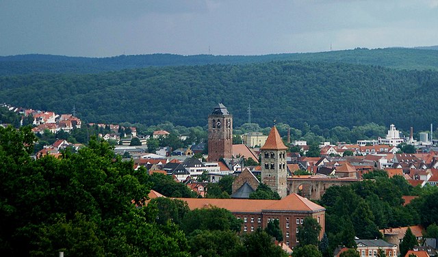
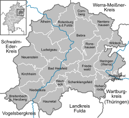
Hersfeld-Rotenburg
- district in Hesse, Germany
Hiking in Hersfeld-Rotenburg
Hersfeld-Rotenburg is a beautiful district in the state of Hesse, Germany, known for its diverse landscapes, historical sites, and excellent hiking opportunities. The region is characterized by rolling hills, deep forests, and picturesque valleys, making it an ideal destination for outdoor enthusiasts and hikers....
- Country:
- Capital: Bad Hersfeld
- Licence Plate Code: ROF; HEF
- Coordinates: 50° 52' 18" N, 9° 42' 58" E
- GPS tracks (wikiloc): [Link]
- AboveSeaLevel: 197 м m
- Area: 1097.15 sq km
- Population: 120165
- Web site: [Link]


Fulda
- district in Hesse, Germany
Hiking in Fulda
Fulda is a beautiful district located in Hesse, Germany, known for its scenic landscapes, historical sites, and outdoor activities, including hiking. Here are some key aspects of hiking in Fulda:...
- Country:
- Capital: Fulda
- Licence Plate Code: FD
- Coordinates: 50° 33' 37" N, 9° 41' 10" E
- GPS tracks (wikiloc): [Link]
- AboveSeaLevel: 297 м m
- Area: 1380.40 sq km
- Population: 216093
- Web site: [Link]
Shares border with regions:


Lower Franconia
- administrative region of Franconia in Bavaria, Germany
Hiking in Lower Franconia
Lower Franconia, located in the northern part of Bavaria, Germany, is a great destination for hiking enthusiasts. This region is known for its diverse landscapes that range from rolling hills to picturesque vineyards and nature reserves, offering a variety of trails suitable for different skill levels....
- Country:
- Capital: Würzburg
- Coordinates: 50° 1' 28" N, 9° 55' 55" E
- GPS tracks (wikiloc): [Link]
- AboveSeaLevel: 289 м m
- Area: 8530.99 sq km
- Population: 1298849
- Web site: [Link]