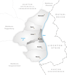
Werdenberg Constituency (Wahlkreis Werdenberg)
- district in Switzerland
 Hiking in Werdenberg Constituency
Werdenberg, located in the northeastern part of Switzerland, is a picturesque area ideal for hiking enthusiasts. Known for its scenic beauty, medieval architecture, and varied terrain, it offers numerous trails suitable for different skill levels.
Highlights of Hiking in Werdenberg:
-
Scenic Views: The region features stunning landscapes, including rolling hills, valleys, and the nearby Rhine River. Many trails offer breathtaking panoramic views of the surrounding Alps.
-
Trails for All Levels: Whether you're a beginner or an experienced hiker, you can find suitable trails. There are easy walks through charming towns and more challenging hikes that venture into the hills.
-
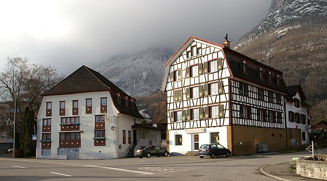
Historical Sites: Some trails lead to historical sites, such as the beautiful medieval town of Werdenberg with its well-preserved castle. Exploring these areas adds an enriching cultural element to your hiking experience.
-
Nature Reserves: The area is home to various nature reserves, providing opportunities for bird watching and enjoying the local flora and fauna. The surrounding landscapes are often filled with wildflowers in spring and summer.
-
Accessibility: Many trails can be accessed from public transportation, making it easy to reach hiking starting points without a car. This includes connections from nearby towns.
-
Seasonal Hiking: Each season offers a unique experience. In the summer, lush greenery and wildflowers abound; in autumn, you'll be treated to beautiful fall colors, while winter offers opportunities for snowshoeing and winter hikes.
Recommendations:
-
Trail Maps: Always have up-to-date trail maps or a hiking app handy. Local visitor centers can provide excellent resources and information.
-
Weather Preparedness: The weather can change quickly in the region, so be prepared with appropriate clothing and gear.
-
Stay Hydrated and Nourished: Bring water and snacks as some trails may not have places to stop for refreshments.
-
Respect Wildlife: If you're lucky enough to encounter local wildlife, maintain a safe distance and do not disturb them.
Overall, hiking in Werdenberg can be an enjoyable experience, combining natural beauty, rich history, and a range of outdoor activities. Whether you're looking for a peaceful walk or an adventurous trek, you'll find something that suits your style in this charming Swiss region.
- Country:

- Licence Plate Code: SG
- Coordinates: 47° 10' 10" N, 9° 27' 41" E


- GPS tracks (wikiloc): [Link]
- AboveSeaLevel: 444 м m
- Area: 206.48 sq km
- Wikipedia en: wiki(en)
- Wikipedia: wiki(de)
- Wikidata storage: Wikidata: Q75069
- Wikipedia Commons Category: [Link]
- Freebase ID: [/m/063yxx7]
- GeoNames ID: Alt: [2658018]
- archINFORM location ID: [42750]
Includes regions:


Wartau
- municipality in Switzerland
Wartau, located in the canton of St. Gallen in Switzerland, is a beautiful destination for hiking enthusiasts. The region boasts stunning landscapes, including rolling hills, picturesque valleys, and views of the Swiss Alps....
- Country:

- Postal Code: 9478
- Local Dialing Code: 081
- Licence Plate Code: SG
- Coordinates: 47° 4' 59" N, 9° 29' 0" E


- GPS tracks (wikiloc): [Link]
- AboveSeaLevel: 472 м m
- Area: 41.74 sq km
- Population: 5296
- Web site: [Link]


Grabs
- municipality in Switzerland
Grabs is a picturesque village located in the canton of St. Gallen in Switzerland, making it an excellent base for hiking enthusiasts. The region is characterized by its stunning Alpine scenery, charming villages, and a variety of hiking trails suitable for different skill levels....
- Country:

- Postal Code: 9472
- Local Dialing Code: 081
- Licence Plate Code: SG
- Coordinates: 47° 10' 59" N, 9° 27' 0" E


- GPS tracks (wikiloc): [Link]
- AboveSeaLevel: 1082 м m
- Area: 54.65 sq km
- Population: 6951
- Web site: [Link]


Gams
- municipality in the canton of St. Gallen, Switzerland
Gams, located in the beautiful region of the Canton of St. Gallen in Switzerland, offers a variety of hiking opportunities suitable for all levels of outdoor enthusiasts. Nestled in the foothills of the Alps, this picturesque village is surrounded by stunning landscapes, rolling hills, and lush forests....
- Country:

- Postal Code: 9473
- Local Dialing Code: 081
- Licence Plate Code: SG
- Coordinates: 47° 12' 42" N, 9° 25' 49" E


- GPS tracks (wikiloc): [Link]
- AboveSeaLevel: 718 м m
- Area: 22.28 sq km
- Population: 3404
- Web site: [Link]


Buchs
- municipality in the canton of St. Gallen, Switzerland
Buchs, located in the canton of St. Gallen, Switzerland, is a great starting point for hiking enthusiasts. Nestled in the Rhine Valley and surrounded by beautiful landscapes, it offers a variety of hiking trails that cater to different skill levels. Here are some highlights:...
- Country:

- Postal Code: 9470
- Local Dialing Code: 081
- Licence Plate Code: SG
- Coordinates: 47° 9' 57" N, 9° 27' 46" E


- GPS tracks (wikiloc): [Link]
- AboveSeaLevel: 519 м m
- Area: 15.95 sq km
- Population: 12612
- Web site: [Link]


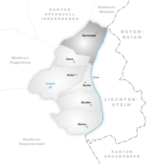
Sennwald
- municipality in Switzerland
Sennwald is a picturesque municipality located in the Canton of St. Gallen, Switzerland. It is surrounded by breathtaking landscapes and offers a variety of hiking opportunities that cater to different skill levels. Here’s what you can expect when hiking in Sennwald:...
- Country:

- Postal Code: 9466
- Local Dialing Code: 081
- Licence Plate Code: SG
- Coordinates: 47° 14' 38" N, 9° 28' 37" E


- GPS tracks (wikiloc): [Link]
- AboveSeaLevel: 441 м m
- Area: 41.53 sq km
- Population: 5564
- Web site: [Link]


Sevelen
- municipality in the canton of St. Gallen, Switzerland
Sevelen, located in the canton of St. Gallen in Switzerland, is a picturesque village surrounded by stunning natural landscapes, making it a great destination for hiking enthusiasts. Here are some key points to consider if you're planning to hike in Sevelen:...
- Country:

- Postal Code: 9475
- Local Dialing Code: 081
- Licence Plate Code: SG
- Coordinates: 47° 7' 14" N, 9° 29' 8" E


- GPS tracks (wikiloc): [Link]
- AboveSeaLevel: 681 м m
- Area: 30.34 sq km
- Population: 5049
- Web site: [Link]
