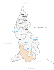
Wartau (Wartau)

- municipality in Switzerland
 Hiking in Wartau
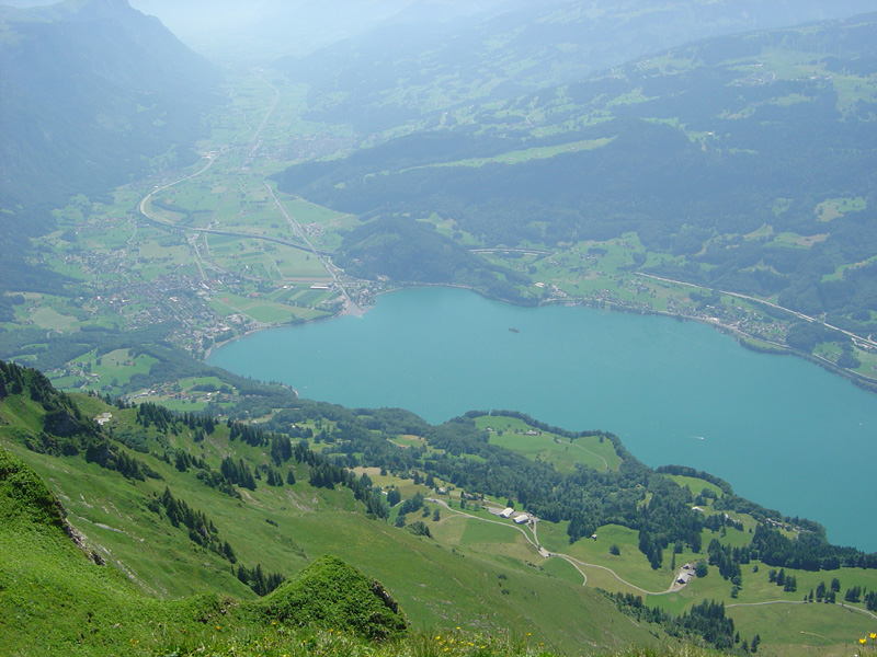
Wartau, located in the canton of St. Gallen in Switzerland, is a beautiful destination for hiking enthusiasts. The region boasts stunning landscapes, including rolling hills, picturesque valleys, and views of the Swiss Alps.
Hiking Trails:
-
Panoramic Trails: Wartau offers a variety of panoramic hikes where you can take in spectacular views. Trails often overlook the Rhine Valley, providing breathtaking backdrops for your hike.
-
Forest Trails: There are numerous paths through lush forests, perfect for those looking to immerse themselves in nature. These trails are often more shaded, making them ideal during warmer months.
-
Cultural Trails: Some routes might lead to traditional villages or historical sites, offering a look into the local culture and architecture along with the natural scenery.
Difficulty Levels:
The hikes around Wartau vary in difficulty, making them suitable for all levels, from beginners to experienced hikers. You'll find well-marked paths and clear signage, which helps you navigate the area easily.
Best Time to Visit:
Late spring through early autumn (May to October) is typically the best time for hiking in Wartau, as the weather is usually milder, and the trails are accessible.
Preparation Tips:
- Gear Up: Wear sturdy shoes with good grip. A waterproof jacket and layers are advisable as mountain weather can change quickly.
- Hydration and Snacks: Carry enough water and light snacks to keep your energy levels up.
- Navigation Tools: Even though trails are well-marked, it's a good idea to have a map or GPS with you.
- Local Regulations: Be aware of local wildlife and respect any guidelines about staying on trails, especially in more sensitive ecological areas.
Additional Activities:
In addition to hiking, Wartau's natural environment is great for other outdoor activities such as mountain biking, bird watching, and photography.
Overall, Wartau is an excellent destination for enjoying the natural beauty of Switzerland. Whether you’re seeking a short excursion or a multi-day journey, you’ll find plenty to explore in this beautiful region!
- Country:

- Postal Code: 9478
- Local Dialing Code: 081
- Licence Plate Code: SG
- Coordinates: 47° 4' 59" N, 9° 29' 0" E


- GPS tracks (wikiloc): [Link]
- AboveSeaLevel: 472 м m
- Area: 41.74 sq km
- Population: 5296
- Web site: http://www.wartau.ch
- Wikipedia en: wiki(en)
- Wikipedia: wiki(de)
- Wikidata storage: Wikidata: Q66788
- Wikipedia Commons Category: [Link]
- Freebase ID: [/m/0gn8td]
- GeoNames ID: Alt: [2658049]
- BnF ID: [15041504p]
- VIAF ID: Alt: [150118111]
- OSM relation ID: [1683961]
- archINFORM location ID: [11103]
- Library of Congress authority ID: Alt: [n82070672]
- HDS ID: [1351]
- Swiss municipality code: [3276]
- Digital Atlas of the Roman Empire ID: [42777]
Shares border with regions:

Triesen
- municipality of Liechtenstein
Hiking in Triesen
Triesen, a charming municipality located in Liechtenstein, offers some wonderful hiking opportunities for outdoor enthusiasts. Nestled in the Rhine Valley, surrounded by scenic landscapes and the backdrop of the Alps, Triesen presents a variety of hiking trails suitable for different skill levels....
- Country:

- Postal Code: 9495
- Local Dialing Code: 7002
- Coordinates: 47° 6' 0" N, 9° 31' 0" E
- GPS tracks (wikiloc): [Link]
- AboveSeaLevel: 512 м m
- Area: 26.4 sq km
- Web site: [Link]


Balzers
- municipality of Liechtenstein
Hiking in Balzers
Balzers is a beautiful municipality in Liechtenstein, known for its scenic landscapes, historic sites, and outdoor activities, including hiking. Situated in the Rhine Valley, Balzers offers a range of hiking trails suitable for all skill levels, from leisurely walks to more challenging hikes....
- Country:
- Postal Code: 9496
- Local Dialing Code: 7003
- Coordinates: 47° 4' 0" N, 9° 30' 0" E
- GPS tracks (wikiloc): [Link]
- AboveSeaLevel: 472 м m
- Area: 19.6 sq km
- Population: 4583
- Web site: [Link]

Walenstadt
- municipality in Switzerland
Hiking in Walenstadt
Walenstadt is a charming town located in the canton of St. Gallen, Switzerland, known for its picturesque views of the surrounding mountains and Lake Walensee. The area offers a variety of hiking opportunities for different skill levels, making it a great destination for outdoor enthusiasts. Here are some highlights and tips for hiking in and around Walenstadt:...
- Country:
- Postal Code: 8880
- Local Dialing Code: 081
- Licence Plate Code: SG
- Coordinates: 47° 7' 24" N, 9° 18' 54" E
- GPS tracks (wikiloc): [Link]
- AboveSeaLevel: 613 м m
- Area: 45.81 sq km
- Population: 5598
- Web site: [Link]


Sargans
- municipality in Switzerland
Hiking in Sargans
Sargans, located in the eastern part of Switzerland, offers a variety of beautiful hiking trails suitable for different skill levels, making it a great destination for outdoor enthusiasts. Nestled in the foothills of the Alps, Sargans provides stunning views of the surrounding mountains and valleys....
- Country:
- Postal Code: 7320
- Local Dialing Code: 081
- Licence Plate Code: SG
- Coordinates: 47° 2' 53" N, 9° 26' 23" E
- GPS tracks (wikiloc): [Link]
- AboveSeaLevel: 483 м m
- Area: 9.48 sq km
- Population: 6118
- Web site: [Link]

Mels
- municipality in Switzerland
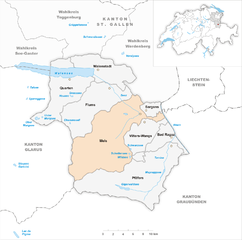
Hiking in Mels
Mels is a picturesque village located in the canton of St. Gallen in Switzerland, surrounded by beautiful landscapes and accessible hiking trails. The area offers a variety of hiking routes suitable for different skill levels, from leisurely strolls to more challenging treks. Here are some highlights for hiking in Mels:...
- Country:
- Postal Code: 8887
- Local Dialing Code: 081
- Licence Plate Code: SG
- Coordinates: 47° 2' 59" N, 9° 25' 0" E
- GPS tracks (wikiloc): [Link]
- AboveSeaLevel: 1579 м m
- Area: 140.00 sq km
- Population: 8610
- Web site: [Link]


Sevelen
- municipality in the canton of St. Gallen, Switzerland
Hiking in Sevelen
Sevelen, located in the canton of St. Gallen in Switzerland, is a picturesque village surrounded by stunning natural landscapes, making it a great destination for hiking enthusiasts. Here are some key points to consider if you're planning to hike in Sevelen:...
- Country:
- Postal Code: 9475
- Local Dialing Code: 081
- Licence Plate Code: SG
- Coordinates: 47° 7' 14" N, 9° 29' 8" E
- GPS tracks (wikiloc): [Link]
- AboveSeaLevel: 681 м m
- Area: 30.34 sq km
- Population: 5049
- Web site: [Link]

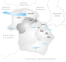
Flums
- municipality in Switzerland
Hiking in Flums
Flums is a picturesque village located in the Swiss canton of St. Gallen, surrounded by stunning landscapes and mountainous terrain, making it a fantastic destination for hikers of all levels. Here’s a brief overview of what you can expect when hiking in Flums:...
- Country:
- Postal Code: 8890
- Local Dialing Code: 081
- Licence Plate Code: SG
- Coordinates: 47° 5' 34" N, 9° 20' 38" E
- GPS tracks (wikiloc): [Link]
- AboveSeaLevel: 1124 м m
- Area: 75.03 sq km
- Population: 4941
- Web site: [Link]