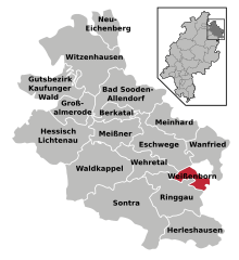
Werra-Meißner-Kreis (Werra-Meißner-Kreis)

- district in Hesse, Germany
 Hiking in Werra-Meißner-Kreis
The Werra-Meißner-Kreis in Germany is an excellent destination for hiking enthusiasts, offering a mix of natural beauty, diverse landscapes, and cultural heritage. Here are some key points to consider when hiking in this region:
Scenic Landscapes
-
Natural Beauty: The area is characterized by rolling hills, valleys, and dense forests. The Meißner mountain range is especially notable, providing stunning views and opportunities for a variety of trails.
-
Protected Areas: Parts of the region are designated as protected areas, such as the Meißner-Kaufunger Wald Nature Park, which is home to diverse flora and fauna.
Trail Network
-
Marked Trails: The region boasts a well-developed network of marked hiking trails, ranging from easy walks to more challenging hikes. These trails often connect picturesque villages and offer opportunities to explore local history.
-
Legendary Routes: One popular trail is the “Wanderweg” around the Meißner, which features beautiful vistas and interesting landmarks. Other notable routes may connect to historical sites, lookout points, and traditional half-timbered houses.
Cultural Experiences
-
Local Villages: Hiking in the Werra-Meißner-Kreis allows you to explore charming villages, where you can experience local culture, cuisine, and crafts.
-
Historical Significance: The region has historical significance, with several well-preserved medieval towns and historical sites along the trails. Keep an eye out for local museums and heritage sites.
Preparation and Safety
-
Weather Considerations: As with any hiking trip, check the weather before heading out, as conditions can change quickly in mountainous areas.
-
Gear and Supplies: Ensure you have appropriate hiking gear, including sturdy footwear, navigation tools (maps or GPS), and supplies such as water and snacks.
-
Guided Tours: If you are unfamiliar with the area or prefer a more structured experience, consider joining a guided hiking tour. Local guides can provide valuable insights about the region's history and natural wonders.
Accessibility
-
Getting There: The Werra-Meißner-Kreis is accessible by public transport from larger cities in the region. If driving, there are parking facilities near many trailheads.
-
Accommodations: There are various accommodation options, including hotels, guesthouses, and camping sites, catering to different budgets and preferences.
Hiking in the Werra-Meißner-Kreis is a fantastic way to immerse yourself in nature, enjoy physical activity, and experience the culture of this beautiful part of Germany. Whether you're a seasoned hiker or a beginner, there are suitable trails for everyone!
- Country:

- Capital: Eschwege
- Licence Plate Code: ESW
- Coordinates: 51° 11' 19" N, 10° 3' 12" E


- GPS tracks (wikiloc): [Link]
- AboveSeaLevel: 257 м m
- Area: 1024.70 sq km
- Web site: http://www.werra-meissner.de/
- Wikipedia en: wiki(en)
- Wikipedia: wiki(de)
- Wikidata storage: Wikidata: Q7896
- Wikipedia Commons Category: [Link]
- Wikipedia Commons Maps Category: [Link]
- Freebase ID: [/m/01fv82]
- GeoNames ID: Alt: [3220999]
- VIAF ID: Alt: [150203085]
- OSM relation ID: [62586]
- GND ID: Alt: [4065653-6]
- archINFORM location ID: [9242]
- Library of Congress authority ID: Alt: [n88135959]
- TGN ID: [7077052]
- NUTS code: [DE737]
- German district key: 06636
Includes regions:
Kaufunger Wald
- unincorporated area in Werra-Meißner-Kreis in Hesse, Germany
Hiking in Kaufunger Wald
Gutsbezirk Kaufunger Wald is a protected area in Germany known for its beautiful forests, diverse wildlife, and numerous hiking trails. It is located near the city of Kassel in the state of Hesse and is part of the larger Kaufunger Wald nature reserve....
- Country:
- Coordinates: 51° 17' 0" N, 9° 44' 37" E
- GPS tracks (wikiloc): [Link]
- Area: 50.32 sq km
- Population: 0


Wanfried
- town in the district Werra-Meißner-Kreis, Regierungsbezirk Kassel, Hesse, Germany
Hiking in Wanfried
Wanfried is a charming small town located in the state of Hesse, Germany, nestled in the scenic Werra Valley. The area around Wanfried offers a variety of hiking opportunities, appealing to both casual walkers and more experienced trekkers....
- Country:
- Postal Code: 37281
- Local Dialing Code: 05655
- Licence Plate Code: ESW
- Coordinates: 51° 11' 0" N, 10° 10' 0" E
- GPS tracks (wikiloc): [Link]
- AboveSeaLevel: 190 м m
- Area: 46.9 sq km
- Population: 4151
- Web site: [Link]


Eschwege
- seat of Werra-Meißner-Kreis and town in Hesse, Germany
Hiking in Eschwege
Eschwege, a charming town located in northern Hesse, Germany, is surrounded by picturesque landscapes and offers several opportunities for hiking enthusiasts. Here are some key highlights and recommendations for hiking in and around Eschwege:...
- Country:
- Postal Code: 37269
- Local Dialing Code: 05652; 05651
- Licence Plate Code: ESW, WIZ
- Coordinates: 51° 11' 17" N, 10° 3' 10" E
- GPS tracks (wikiloc): [Link]
- AboveSeaLevel: 211 м m
- Area: 63.27 sq km
- Population: 19647
- Web site: [Link]


Neu-Eichenberg
- municipality in Werra-Meißner-Kreis in Hesse, Germany
Hiking in Neu-Eichenberg
Neu-Eichenberg is a small town located in the Göttingen district of Lower Saxony, Germany. It offers picturesque landscapes and trails suitable for hiking enthusiasts of various skill levels. Here are some points to consider when hiking in the Neu-Eichenberg area:...
- Country:
- Postal Code: 37249
- Local Dialing Code: 05542; 05504
- Licence Plate Code: ESW
- Coordinates: 51° 23' 0" N, 9° 53' 0" E
- GPS tracks (wikiloc): [Link]
- AboveSeaLevel: 316 м m
- Area: 27.53 sq km
- Population: 1827
- Web site: [Link]


Meinhard
- municipality in Werra-Meißner-Kreis in Hesse, Germany
Hiking in Meinhard
Meinhard, located in the state of Hesse, Germany, offers a range of hiking opportunities suitable for different experience levels. The area is characterized by its scenic landscapes, including forests, hills, and rivers, making it a great destination for outdoor enthusiasts....
- Country:
- Postal Code: 37276
- Local Dialing Code: 05651
- Licence Plate Code: ESW
- Coordinates: 51° 13' 0" N, 10° 4' 0" E
- GPS tracks (wikiloc): [Link]
- AboveSeaLevel: 159 м m
- Area: 59.52 sq km
- Population: 4616
- Web site: [Link]


Großalmerode
- town in Werra-Meißner-Kreis in Hesse, Germany
Hiking in Großalmerode
Großalmerode, located in the state of Hesse, Germany, is a charming town situated in a beautiful natural setting that offers a variety of hiking opportunities for enthusiasts of all levels. The region is characterized by its rolling hills, forests, and scenic views, making it an appealing destination for outdoor activities....
- Country:
- Postal Code: 37247
- Local Dialing Code: 05604
- Licence Plate Code: ESW
- Coordinates: 51° 15' 27" N, 9° 47' 4" E
- GPS tracks (wikiloc): [Link]
- AboveSeaLevel: 374 м m
- Area: 37.62 sq km
- Population: 6389
- Web site: [Link]


Sontra
- town in Werra-Meißner-Kreis in Hesse, Germany
Hiking in Sontra
Sontra, located in the German state of Hesse, offers beautiful hiking opportunities for outdoor enthusiasts. The region is characterized by its lush landscapes, rolling hills, and dense forests. Here are some key points to consider when hiking in Sontra:...
- Country:
- Postal Code: 36205
- Local Dialing Code: 05653
- Licence Plate Code: ESW
- Coordinates: 51° 4' 0" N, 9° 56' 0" E
- GPS tracks (wikiloc): [Link]
- AboveSeaLevel: 265 м m
- Area: 111.29 sq km
- Population: 7856
- Web site: [Link]


Waldkappel
- town in Werra-Meißner-Kreis in Hesse, Germany
Hiking in Waldkappel
Waldkappel is a picturesque area located in Germany, known for its natural beauty and opportunities for hiking. The region is part of the larger Odenwald mountain range, which offers a variety of trails suitable for different skill levels. Here are some highlights regarding hiking in Waldkappel:...
- Country:
- Postal Code: 37284
- Local Dialing Code: 05656
- Licence Plate Code: ESW
- Coordinates: 51° 9' 0" N, 9° 53' 0" E
- GPS tracks (wikiloc): [Link]
- AboveSeaLevel: 257 м m
- Area: 96.48 sq km
- Population: 4309
- Web site: [Link]


Hessisch Lichtenau
- town in Werra-Meißner-Kreis in Hesse, Germany
Hiking in Hessisch Lichtenau
Hessisch Lichtenau is a charming town located in the northeastern part of Hesse, Germany, surrounded by beautiful natural landscapes that are ideal for hiking. The region offers a variety of trails that cater to both beginners and experienced hikers....
- Country:
- Postal Code: 37235
- Local Dialing Code: 05602
- Licence Plate Code: ESW, WIZ
- Coordinates: 51° 12' 0" N, 9° 43' 0" E
- GPS tracks (wikiloc): [Link]
- AboveSeaLevel: 387 м m
- Area: 105.87 sq km
- Population: 12100
- Web site: [Link]


Bad Sooden-Allendorf
- town in Werra-Meißner-Kreis in Hesse, Germany
Hiking in Bad Sooden-Allendorf
Bad Sooden-Allendorf is a picturesque town located in the Werra-Meißner district of Hesse, Germany. The area is known for its beautiful landscapes, rich history, and a variety of hiking opportunities that cater to both beginners and experienced hikers. Here are some highlights of hiking in this region:...
- Country:
- Postal Code: 37242
- Local Dialing Code: 05652
- Licence Plate Code: ESW
- Coordinates: 51° 17' 0" N, 9° 59' 0" E
- GPS tracks (wikiloc): [Link]
- AboveSeaLevel: 162 м m
- Area: 73.53 sq km
- Population: 8492
- Web site: [Link]


Witzenhausen
- town in Werra-Meißner-Kreis in Hesse, Germany
Hiking in Witzenhausen
Witzenhausen is a charming town located in the northern part of Hesse, Germany, known for its scenic beauty and hiking opportunities. It is surrounded by lush greenery, rolling hills, and picturesque landscapes that make it an ideal destination for outdoor enthusiasts....
- Country:
- Postal Code: 37213–37218
- Local Dialing Code: 05542
- Coordinates: 51° 20' 30" N, 9° 51' 25" E
- GPS tracks (wikiloc): [Link]
- AboveSeaLevel: 147 м m
- Area: 126.69 sq km
- Population: 15092
- Web site: [Link]


Ringgau
- municipality in Werra-Meißner-Kreis in Hesse, Germany
Hiking in Ringgau
Ringgau is a beautiful region located in Hesse, Germany, known for its picturesque landscapes, charming villages, and rich cultural heritage. It's part of the larger area of the Eichsfeld mountains and offers a range of hiking trails suitable for all experience levels. Here are some highlights and tips for hiking in Ringgau:...
- Country:
- Postal Code: 37296
- Local Dialing Code: 05659; 05658
- Licence Plate Code: ESW
- Coordinates: 51° 5' 0" N, 10° 4' 0" E
- GPS tracks (wikiloc): [Link]
- AboveSeaLevel: 379 м m
- Area: 66.81 sq km
- Population: 2924
- Web site: [Link]

Weißenborn
- municipality in Werra-Meißner-Kreis in Hesse, Germany
Hiking in Weißenborn
Weißenborn is a quaint village nestled in the picturesque landscapes of Hesse, Germany. Located near the scenic Eder River and surrounded by lush forests, rolling hills, and charming countryside, it offers a variety of hiking opportunities for both novice and experienced hikers. Here are some key aspects to consider when hiking in this area:...
- Country:
- Postal Code: 37299
- Local Dialing Code: 05659
- Licence Plate Code: ESW
- Coordinates: 51° 7' 0" N, 10° 7' 0" E
- GPS tracks (wikiloc): [Link]
- AboveSeaLevel: 280 м m
- Area: 15.6 sq km
- Population: 1018
- Web site: [Link]


Berkatal
- municipality in Werra-Meißner-Kreis in Hesse, Germany
Hiking in Berkatal
Berkatal, located in Indonesia, is known for its natural beauty and rich biodiversity, making it a great destination for hiking enthusiasts. Hiking in this region offers various trails that cater to different skill levels, from beginners to more experienced hikers....
- Country:
- Postal Code: 37297
- Local Dialing Code: 05657
- Licence Plate Code: ESW
- Coordinates: 51° 14' 0" N, 9° 55' 0" E
- GPS tracks (wikiloc): [Link]
- AboveSeaLevel: 234 м m
- Area: 19.56 sq km
- Population: 1503
- Web site: [Link]


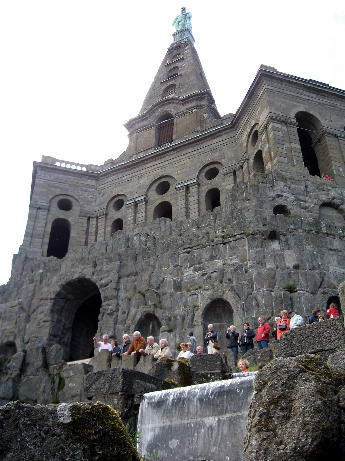
Meißner
- municipality in Werra-Meißner-Kreis in Hesse, Germany
Hiking in Meißner
Hiking in Meißner, Hesse, offers a wonderful experience for outdoor enthusiasts with its beautiful landscapes, diverse trails, and rich cultural history. The Meißner massif, part of the larger Hessian Highlands, features scenic views, lush forests, and opportunities to explore unique flora and fauna....
- Country:
- Postal Code: 37290
- Local Dialing Code: 05657
- Licence Plate Code: ESW
- Coordinates: 51° 12' 0" N, 9° 56' 0" E
- GPS tracks (wikiloc): [Link]
- AboveSeaLevel: 270 м m
- Area: 44.81 sq km
- Population: 3005
- Web site: [Link]


Wehretal
- municipality in Werra-Meißner-Kreis in Hesse, Germany
Hiking in Wehretal
Wehretal is a beautiful area located in the state of Hesse, Germany. It features stunning landscapes, lush forests, and serene hiking trails, making it a great destination for outdoor enthusiasts. Here are some key points about hiking in Wehretal:...
- Country:
- Postal Code: 37287
- Local Dialing Code: 05658; 05651
- Licence Plate Code: ESW
- Coordinates: 51° 9' 0" N, 10° 0' 0" E
- GPS tracks (wikiloc): [Link]
- AboveSeaLevel: 179 м m
- Area: 39.20 sq km
- Population: 5004
- Web site: [Link]


Herleshausen
- municipality in Werra-Meißner-Kreis in Hesse, Germany
Hiking in Herleshausen
Herleshausen is a quaint town located near the border of Germany and is a part of the scenic landscape of the Werra valley. The area is known for its beautiful hiking trails that cater to various skill levels, making it an excellent destination for both novice and experienced hikers....
- Country:
- Postal Code: 37293
- Local Dialing Code: 05654
- Licence Plate Code: ESW
- Coordinates: 51° 1' 0" N, 10° 10' 0" E
- GPS tracks (wikiloc): [Link]
- AboveSeaLevel: 336 м m
- Area: 59.52 sq km
- Population: 2787
- Web site: [Link]
Shares border with regions:


Göttingen district
- district in Lower Saxony, Germany
Hiking in Göttingen district
Göttingen, located in Lower Saxony, Germany, is surrounded by a variety of beautiful landscapes that are perfect for hiking enthusiasts. The district offers a mix of wooded areas, rolling hills, and scenic vistas, making it an excellent destination for hikers of all levels. Here are some highlights of hiking in the Göttingen district:...
- Country:
- Capital: Göttingen
- Licence Plate Code: GÖ; OHA; HMÜ; DUD
- Coordinates: 51° 30' 0" N, 9° 55' 12" E
- GPS tracks (wikiloc): [Link]
- AboveSeaLevel: 155 м m
- Area: 1117.00 sq km
- Population: 327065
- Web site: [Link]


Eisenach
- municipality in Thuringia, Germany
Hiking in Eisenach
Eisenach, located in central Germany, is surrounded by stunning landscapes and rich history, making it an excellent destination for hiking enthusiasts. Here’s what you need to know about hiking in and around Eisenach:...
- Country:
- Postal Code: 99817
- Local Dialing Code: 036928; 036920; 03691
- Licence Plate Code: EA
- Coordinates: 50° 58' 29" N, 10° 19' 28" E
- GPS tracks (wikiloc): [Link]
- AboveSeaLevel: 215 м m
- Area: 104.17 sq km
- Population: 42417
- Web site: [Link]

Kassel
- district in Hesse, Germany
Hiking in Kassel
Kassel, located in the northern part of Hesse, Germany, offers a variety of hiking trails that immerse you in nature and the area's rich cultural heritage. Here are some highlights to consider when hiking in and around Kassel:...
- Country:
- Capital: Kassel
- Licence Plate Code: WOH; HOG; KS
- Coordinates: 51° 18' 40" N, 9° 29' 9" E
- GPS tracks (wikiloc): [Link]
- AboveSeaLevel: 273 м m
- Area: 1292.76 sq km
- Population: 234206
- Web site: [Link]