Wetteraukreis (Wetteraukreis)
- district in Hesse, Germany
Wetteraukreis, located in the state of Hesse, Germany, offers a diverse range of landscapes and hiking opportunities that cater to outdoor enthusiasts of all levels. With its rolling hills, picturesque villages, lush forests, and scenic meadows, the region provides a delightful backdrop for exploring nature.
Hiking Trails
-
Wetterau Trail (Wetterau-Pfad): This long-distance trail spans approximately 80 kilometers and showcases the beauty of the Wetterau region. The route takes hikers through charming towns, vineyards, and the beautiful countryside, with plenty of spots for rest and enjoying nature.
-
Nidda Valley Path (Niddatalweg): This scenic trail follows the Nidda River and offers a mix of serene waterside views and forested sections. It is a great choice for both casual hikers and families, providing an opportunity to enjoy the tranquility of the river environment.
-
Vogelsberg Mountain Range: Just a short distance from Wetteraukreis, the Vogelsberg offers a variety of hiking paths that lead through volcanic landscapes, dense forests, and panoramic viewpoints. The “Vogelsberg Trail” is particularly popular, offering several stages that can be hiked individually or as a multi-day trek.
Highlights & Attractions
-
Historical Towns: The region is dotted with charming towns like Bad Nauheim, Büdingen, and Friedberg, each offering historical architecture and local culture. It's common to find hiking trails that connect these towns, allowing for exploration of both nature and history.
-
Nature Reserves: Wetteraukreis is home to various nature reserves, such as the "Naturpark Hoher Vogelsberg," where hikers can experience diverse flora and fauna, making it ideal for wildlife spotting.
-
Culinary Stops: Many hiking routes pass through local vineyards and farms, offering opportunities to sample regional specialties, including wines and traditional German cuisine.
Best Time to Hike
The best time for hiking in Wetteraukreis is typically from spring (April to June) to autumn (September to October), when the weather is mild and the landscapes are most vibrant. Summer can be warm, while winter may bring snow, making some trails more challenging.
Tips for Hikers
- Preparation: Always check the weather forecast before heading out and dress in layers to accommodate changing conditions.
- Hydration & Snacks: Carry sufficient water and snacks, especially on longer hikes.
- Maps & Guides: While many trails are well-marked, having a map or a hiking app can enhance navigation and ensure you don't miss out on hidden gems along the way.
Whether you’re looking for a leisurely stroll or a challenging hike, Wetteraukreis has something to offer every adventurer. Enjoy the natural beauty and rich culture of this charming German region!
- Country:

- Capital: Friedberg
- Licence Plate Code: FB
- Coordinates: 50° 20' 0" N, 8° 45' 9" E


- GPS tracks (wikiloc): [Link]
- AboveSeaLevel: 137 м m
- Area: 1101.71 sq km
- Web site: http://www.wetteraukreis.de/
- Wikipedia en: wiki(en)
- Wikipedia: wiki(de)
- Wikidata storage: Wikidata: Q7910
- Wikipedia Commons Category: [Link]
- Freebase ID: [/m/01dwjk]
- GeoNames ID: Alt: [2809976]
- BnF ID: [11999967n]
- VIAF ID: Alt: [126689775]
- OSM relation ID: [62519]
- GND ID: Alt: [4065856-9]
- archINFORM location ID: [11072]
- Library of Congress authority ID: Alt: [n82059471]
- TGN ID: [4012207]
- NUTS code: [DE71E]
- German district key: 06440
Includes regions:


Bad Vilbel
- town in Wetteraukreis in Hesse, Germany
Bad Vilbel, located in the heart of Hesse, Germany, is surrounded by beautiful nature and offers several hiking opportunities. Nestled near the Nidda River and close to the Frankfurter Wald, hikers can enjoy a mix of scenic views, lush forests, and charming local culture....
- Country:

- Postal Code: 61118
- Local Dialing Code: 06101
- Licence Plate Code: FB
- Coordinates: 50° 10' 39" N, 8° 44' 8" E


- GPS tracks (wikiloc): [Link]
- AboveSeaLevel: 111 м m
- Area: 26 sq km
- Population: 33745
- Web site: [Link]


Bad Nauheim
- town in Wetteraukreis in Hesse, Germany
Bad Nauheim, located in Hesse, Germany, is known for its picturesque landscapes and therapeutic mineral springs. It's a great place for hiking, offering a variety of trails that cater to different skill levels. Here are some highlights for hiking in Bad Nauheim:...
- Country:

- Postal Code: 61231
- Local Dialing Code: 06032
- Licence Plate Code: FB
- Coordinates: 50° 22' 0" N, 8° 45' 0" E


- GPS tracks (wikiloc): [Link]
- AboveSeaLevel: 148 м m
- Area: 32550000 sq km
- Population: 32102
- Web site: [Link]
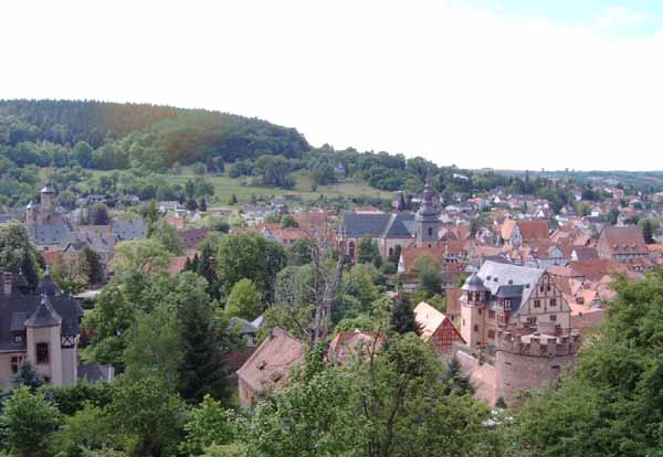

Büdingen
- town in Wetteraukreis in Hesse, Germany
Büdingen is a charming town in the state of Hesse, Germany, known for its medieval architecture and beautiful landscapes. Hiking in and around Büdingen offers a variety of trails that cater to different skill levels and interests....
- Country:

- Postal Code: 63654
- Local Dialing Code: 06042
- Coordinates: 50° 17' 27" N, 9° 6' 45" E


- GPS tracks (wikiloc): [Link]
- AboveSeaLevel: 134 м m
- Area: 122.87 sq km
- Population: 22043
- Web site: [Link]


Altenstadt, Hesse
- municipality in Wetteraukreis in Hesse, Germany
Altenstadt, located in the state of Hesse, Germany, offers a charming setting for hiking enthusiasts. The region is characterized by its picturesque landscapes, rolling hills, and a mix of forests and meadows, making it a delightful destination for outdoor activities....
- Country:

- Postal Code: 63674
- Local Dialing Code: 06047
- Licence Plate Code: FB
- Coordinates: 50° 17' 8" N, 8° 56' 42" E


- GPS tracks (wikiloc): [Link]
- AboveSeaLevel: 120 м m
- Area: 30.08 sq km
- Population: 12063
- Web site: [Link]
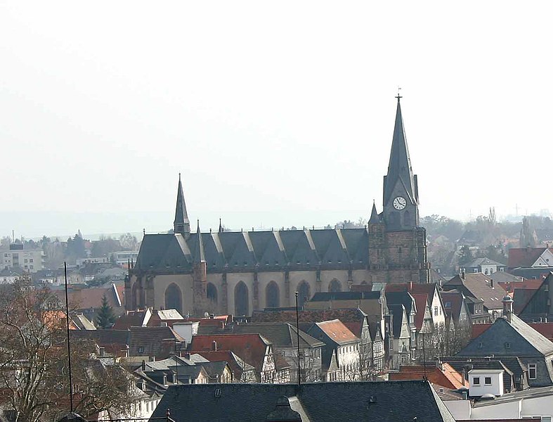
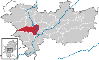
Friedberg
- seat of Wetteraukreis and town in Hesse, Germany
Friedberg is a charming town located in Hesse, Germany, surrounded by beautiful landscapes that offer various hiking opportunities. The region is characterized by its picturesque rolling hills, forests, and fertile fields, making it an excellent destination for outdoor enthusiasts....
- Country:

- Postal Code: 61169
- Local Dialing Code: 06031
- Licence Plate Code: FB, BÜD
- Coordinates: 50° 20' 7" N, 8° 45' 18" E


- GPS tracks (wikiloc): [Link]
- AboveSeaLevel: 140 м m
- Area: 50 sq km
- Population: 28962
- Web site: [Link]


Gedern
- town in Wetteraukreis in Hesse, Germany
Gedern is a charming town located in the state of Hesse, Germany, surrounded by beautiful landscapes that are ideal for hiking enthusiasts. Nestled in the Vogelsberg Mountains, Gedern offers a variety of trails that cater to different skill levels and interests. Here are some highlights for hiking in the Gedern area:...
- Country:

- Postal Code: 63688
- Local Dialing Code: 06045
- Licence Plate Code: FB
- Coordinates: 50° 25' 28" N, 9° 11' 59" E


- GPS tracks (wikiloc): [Link]
- AboveSeaLevel: 357 м m
- Area: 75.24 sq km
- Population: 7387
- Web site: [Link]
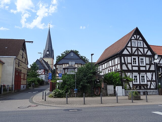

Echzell
- municipality in Wetteraukreis in Hesse, Germany
Echzell is a charming municipality located in the state of Hesse, Germany. It offers a variety of hiking opportunities that cater to different skill levels and interests. The natural surroundings are characterized by picturesque landscapes, rolling hills, and mature forests that provide plenty of beautiful trails....
- Country:

- Postal Code: 61209
- Local Dialing Code: 06035; 06008
- Licence Plate Code: FB
- Coordinates: 50° 23' 0" N, 8° 53' 0" E


- GPS tracks (wikiloc): [Link]
- AboveSeaLevel: 131 м m
- Area: 37.61 sq km
- Population: 5796
- Web site: [Link]

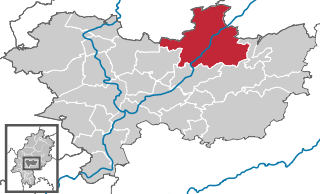
Nidda
- town in Wetteraukreis in Hesse, Germany
Hiking in Nidda, located in Hesse, Germany, offers a wonderful opportunity to explore the scenic beauty of the region. Nidda is surrounded by lush landscapes, rolling hills, and picturesque towns, making it a great destination for nature lovers and outdoor enthusiasts....
- Country:

- Postal Code: 63667
- Local Dialing Code: 06043
- Licence Plate Code: FB
- Coordinates: 50° 24' 46" N, 9° 0' 33" E


- GPS tracks (wikiloc): [Link]
- AboveSeaLevel: 131 м m
- Area: 118.34 sq km
- Population: 17334
- Web site: [Link]


Butzbach
- town in Wetteraukreis in Hesse, Germany
Butzbach, located in Hesse, Germany, is surrounded by picturesque landscapes, making it an excellent destination for hiking enthusiasts. The area offers a variety of trails that cater to different skill levels, from leisurely walks to more challenging hikes....
- Country:

- Postal Code: 35510
- Local Dialing Code: 06033
- Licence Plate Code: FB
- Coordinates: 50° 26' 12" N, 8° 39' 44" E


- GPS tracks (wikiloc): [Link]
- AboveSeaLevel: 199 м m
- Area: 106.60 sq km
- Population: 26016
- Web site: [Link]


Karben
- town in Wetteraukreis in Hesse, Germany
Karben is a charming town located in the Wetteraukreis district in Hesse, Germany, and offers several opportunities for hiking enthusiasts. The surrounding area is characterized by a mix of lush greenery, picturesque fields, and forested areas, making it an appealing destination for outdoor activities....
- Country:

- Postal Code: 61184
- Local Dialing Code: 06039
- Licence Plate Code: FB
- Coordinates: 50° 13' 56" N, 8° 46' 5" E


- GPS tracks (wikiloc): [Link]
- AboveSeaLevel: 110 м m
- Area: 43.94 sq km
- Population: 22049
- Web site: [Link]

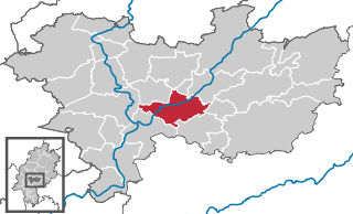
Florstadt
- town in Wetteraukreis in Hesse, Germany
Florstadt is a charming town located in the state of Hesse, Germany. It offers a variety of opportunities for hiking enthusiasts due to its scenic landscapes, walking trails, and proximity to nature. Here are some key points about hiking in and around Florstadt:...
- Country:

- Postal Code: 61197
- Local Dialing Code: 06041; 06035
- Licence Plate Code: FB
- Coordinates: 50° 18' 57" N, 8° 51' 47" E


- GPS tracks (wikiloc): [Link]
- AboveSeaLevel: 156 м m
- Area: 39.60 sq km
- Population: 8702
- Web site: [Link]


Münzenberg
- town in Wetteraukreis in Hesse, Germany
Münzenberg, located in Hessen, Germany, offers some picturesque hiking opportunities characterized by its historical sites and scenic landscapes. Here are a few highlights about hiking in the area:...
- Country:

- Postal Code: 35516
- Local Dialing Code: 06033; 06004
- Licence Plate Code: FB
- Coordinates: 50° 27' 12" N, 8° 46' 34" E


- GPS tracks (wikiloc): [Link]
- AboveSeaLevel: 205 м m
- Area: 31.63 sq km
- Population: 5684
- Web site: [Link]


Rockenberg
- municipality in Wetteraukreis in Hesse, Germany
Rockenberg, located in the Wetterau district of Hesse, Germany, is a charming area that's not only picturesque but also offers some great opportunities for hiking enthusiasts. Here are some key points to consider if you're planning a hiking trip in Rockenberg:...
- Country:

- Postal Code: 35519
- Local Dialing Code: 06033
- Licence Plate Code: FB
- Coordinates: 50° 25' 50" N, 8° 44' 13" E


- GPS tracks (wikiloc): [Link]
- AboveSeaLevel: 164 м m
- Area: 16.14 sq km
- Population: 4378
- Web site: [Link]


Rosbach vor der Höhe
- town in Wetteraukreis in Hesse, Germany
 Hiking in Rosbach vor der Höhe
Rosbach vor der Höhe, located in the Wetteraukreis district of Hesse, Germany, offers a variety of beautiful hiking opportunities for outdoor enthusiasts. The town is surrounded by scenic landscapes, rolling hills, and wooded areas, making it an excellent place for hiking....
- Country:

- Postal Code: 61191
- Local Dialing Code: 06003
- Licence Plate Code: FB, BÜD
- Coordinates: 50° 18' 12" N, 8° 41' 23" E


- GPS tracks (wikiloc): [Link]
- AboveSeaLevel: 178 м m
- Area: 45 sq km
- Population: 12266
- Web site: [Link]
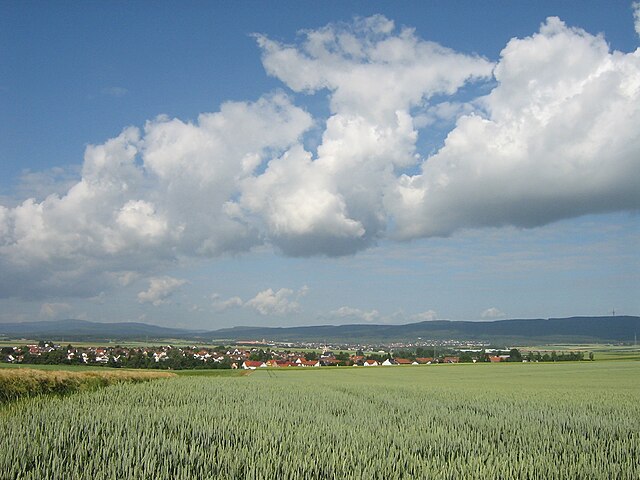

Wöllstadt
- municipality in Wetteraukreis in Hesse, Germany
Wöllstadt is a charming village located in the Wetteraukreis district of Hesse, Germany. While it may not be as widely known as some of the larger hiking destinations, it offers beautiful landscapes and access to various trails that can provide both peaceful walks and more challenging hikes....
- Country:

- Postal Code: 61206
- Local Dialing Code: 06034
- Licence Plate Code: FB
- Coordinates: 50° 16' 54" N, 8° 46' 14" E


- GPS tracks (wikiloc): [Link]
- AboveSeaLevel: 145 м m
- Area: 15.38 sq km
- Population: 6447
- Web site: [Link]


Ranstadt
- municipality in Wetteraukreis in Hesse, Germany
Ranstadt, a small municipality in the Wetterau district of Hesse, Germany, offers a variety of hiking options for outdoor enthusiasts. While it may not be as prominent as larger hiking destinations, it is characterized by beautiful landscapes and scenic trails that cater to different skill levels....
- Country:

- Postal Code: 63691
- Local Dialing Code: 06041
- Licence Plate Code: FB
- Coordinates: 50° 21' 0" N, 8° 59' 0" E


- GPS tracks (wikiloc): [Link]
- AboveSeaLevel: 188 м m
- Area: 34.26 sq km
- Population: 5029
- Web site: [Link]

Niddatal
- town in Wetteraukreis in Hesse, Germany
Niddatal, located in Germany, is a beautiful area well-suited for hiking enthusiasts. It offers a range of trails that cater to different skill levels, from leisurely walks to more challenging hikes. The scenic landscapes typically feature rolling hills, lush forests, and meandering streams, making it a picturesque destination for both casual walkers and serious hikers....
- Country:

- Postal Code: 61194
- Local Dialing Code: 06034
- Licence Plate Code: FB
- Coordinates: 50° 16' 0" N, 8° 49' 0" E


- GPS tracks (wikiloc): [Link]
- AboveSeaLevel: 189 м m
- Area: 40.21 sq km
- Population: 9533
- Web site: [Link]


Ortenberg
- town in Wetteraukreis in Hesse, Germany
Ortenberg, located in Hesse, Germany, is a charming town that offers a variety of hiking opportunities for outdoor enthusiasts. Nestled in the beautiful landscape of the Wetterau region, it provides access to picturesque trails, scenic views, and a mix of natural and cultural attractions....
- Country:

- Postal Code: 63683
- Local Dialing Code: 06046
- Licence Plate Code: FB
- Coordinates: 50° 21' 21" N, 9° 3' 19" E


- GPS tracks (wikiloc): [Link]
- AboveSeaLevel: 136 м m
- Area: 54.70 sq km
- Population: 9036
- Web site: [Link]
Limeshain
- municipality in Wetteraukreis in Hesse, Germany
Limeshain is a charming municipality in the state of Hesse, Germany, located near the scenic Vogelsberg Mountains. This region offers various hiking trails that allow you to explore its natural beauty, historical landmarks, and charming villages....
- Country:

- Postal Code: 63694
- Local Dialing Code: 06048; 06047
- Licence Plate Code: FB
- Coordinates: 50° 15' 38" N, 8° 59' 26" E


- GPS tracks (wikiloc): [Link]
- AboveSeaLevel: 127 м m
- Area: 12.52 sq km
- Population: 5619
- Web site: [Link]


Glauburg
- municipality in Wetteraukreis in Hesse, Germany
Glauburg, located in the Wetterau region of Hesse, Germany, is an excellent destination for hiking enthusiasts. The area is characterized by its scenic landscapes, rich history, and diverse trails suitable for various experience levels. Here are some key points to consider when hiking in Glauburg:...
- Country:

- Postal Code: 63695
- Local Dialing Code: 06041
- Licence Plate Code: FB
- Coordinates: 50° 19' 0" N, 9° 0' 0" E


- GPS tracks (wikiloc): [Link]
- AboveSeaLevel: 131 м m
- Area: 12.67 sq km
- Population: 3054
- Web site: [Link]

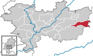
Kefenrod
- municipality in Wetteraukreis in Hesse, Germany
Kefenrod is a charming village located in the Wetterau region of Hesse, Germany. It offers picturesque landscapes, rolling hills, and a variety of hiking opportunities. Here are some highlights and tips for hiking in and around Kefenrod:...
- Country:

- Postal Code: 63699
- Local Dialing Code: 06054; 06049
- Licence Plate Code: FB
- Coordinates: 50° 20' 38" N, 9° 12' 38" E


- GPS tracks (wikiloc): [Link]
- AboveSeaLevel: 263 м m
- Area: 30.66 sq km
- Population: 2721
- Web site: [Link]

Hirzenhain
- municipality in Wetteraukreis in Hesse, Germany
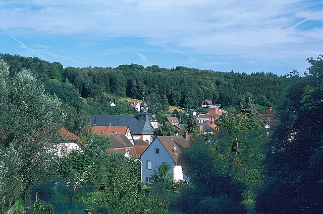
Hirzenhain is a charming village located in the Hessen region of Germany, known for its picturesque landscapes and outdoor recreational opportunities. Hiking in and around Hirzenhain offers a variety of trails that cater to different skill levels, making it a great destination for both novice and experienced hikers....
- Country:

- Postal Code: 63697
- Local Dialing Code: 06045
- Licence Plate Code: FB
- Coordinates: 50° 24' 0" N, 9° 8' 0" E


- GPS tracks (wikiloc): [Link]
- AboveSeaLevel: 294 м m
- Area: 16.11 sq km
- Population: 2882
- Web site: [Link]

Reichelsheim
- town in Wetteraukreis in Hesse, Germany
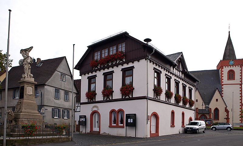
Reichelsheim, located in the Wetterau region of Hesse, Germany, is a beautiful destination for hiking enthusiasts. This area is characterized by gentle hills, lush forests, and picturesque landscapes, offering a variety of trails suitable for hikers of all levels. Here are some highlights for hiking in Reichelsheim:...
- Country:

- Postal Code: 61203
- Local Dialing Code: 06035
- Licence Plate Code: FB
- Coordinates: 50° 21' 25" N, 8° 52' 21" E


- GPS tracks (wikiloc): [Link]
- AboveSeaLevel: 128 м m
- Area: 27.60 sq km
- Population: 6813
- Web site: [Link]


Ober-Mörlen
- municipality in Wetteraukreis in Hesse, Germany
Ober-Mörlen, located in the state of Hesse in Germany, is a charming village surrounded by picturesque landscapes, rolling hills, and lush forests, making it an excellent destination for hiking enthusiasts. Here are some details that might interest you if you're considering hiking in this area:...
- Country:

- Postal Code: 61239
- Local Dialing Code: 06002
- Licence Plate Code: FB
- Coordinates: 50° 22' 25" N, 8° 41' 27" E


- GPS tracks (wikiloc): [Link]
- AboveSeaLevel: 240 м m
- Area: 37.65 sq km
- Population: 5740
- Web site: [Link]


Wölfersheim
- municipality in Wetteraukreis in Hesse, Germany
Wölfersheim is a picturesque town located in the state of Hesse, Germany, surrounded by beautiful landscapes that are ideal for hiking enthusiasts. The region offers a variety of trails suited for different skill levels and preferences....
- Country:

- Postal Code: 61200
- Local Dialing Code: 06036
- Licence Plate Code: FB
- Coordinates: 50° 24' 0" N, 8° 49' 0" E


- GPS tracks (wikiloc): [Link]
- AboveSeaLevel: 142 м m
- Area: 43.15 sq km
- Population: 9911
- Web site: [Link]
Shares border with regions:


Frankfurt
- city in Germany
Hiking in Frankfurt offers a unique blend of urban and natural experiences. While Frankfurt itself is a bustling financial hub, it is also surrounded by beautiful landscapes that are great for outdoor enthusiasts. Here are some key points to consider:...
- Country:

- Postal Code: 65929–65936; 60308–60599
- Local Dialing Code: 069; 6101; 6109
- Licence Plate Code: F
- Coordinates: 50° 6' 49" N, 8° 40' 47" E


- GPS tracks (wikiloc): [Link]
- AboveSeaLevel: 112 м m
- Area: 248.31 sq km
- Population: 736414
- Web site: [Link]

Main-Kinzig-Kreis
- district in Hesse, Germany
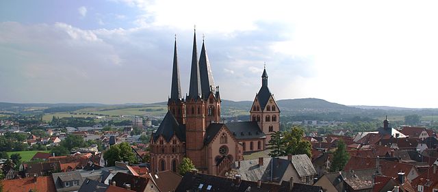
Main-Kinzig-Kreis, located in the state of Hesse, Germany, offers a diverse array of hiking opportunities suitable for various skill levels and preferences. The region is characterized by beautiful landscapes, including forests, rivers, hills, and quaint villages, making it a great destination for outdoor enthusiasts. Here are some highlights:...
- Country:

- Capital: Gelnhausen
- Licence Plate Code: MKK
- Coordinates: 50° 12' 4" N, 9° 11' 51" E


- GPS tracks (wikiloc): [Link]
- AboveSeaLevel: 202 м m
- Area: 1397.52 sq km
- Population: 407619
- Web site: [Link]
