
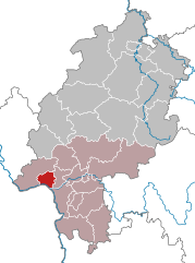
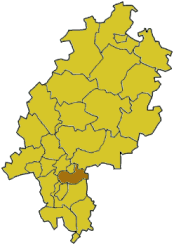
Darmstadt Government Region (Regierungsbezirk Darmstadt)

- administrative subdivision and region of Hesse, Germany
 Hiking in Darmstadt Government Region
Darmstadt, located in the southern part of Hesse, Germany, offers various hiking opportunities that cater to different skill levels and preferences. The surrounding region is characterized by beautiful landscapes, including forests, hills, and scenic views, making it an excellent destination for outdoor enthusiasts.
Popular Hiking Areas:
-
Darmstadt Forest (Darmstädter Wald):
- A large expanse of forest located northwest of the city, the Darmstadt Forest offers numerous trails for both casual walkers and more serious hikers. The combination of tall trees, wildlife, and well-marked paths makes it a fantastic spot for enjoying nature close to the city.
-
Odenwald:
- Just a short drive from Darmstadt, the Odenwald is a popular hiking destination with a variety of trails ranging from easy walks to more challenging hikes. The trails here often lead through charming villages, vineyards, and along ridges that offer stunning views of the surrounding countryside.
-
Kellerwald:
- Located to the north of Darmstadt, this forested area comprises several trails that are perfect for day hikes. The paths wind through dense woods and often feature picnic spots, making it ideal for family outings.
-
Trail Systems:
- The area features various well-marked long-distance trails, such as the "Nibelungensteig," which is a long-distance cultural path. Hikers can explore historical sites while enjoying the region's natural beauty.
Tips for Hiking in Darmstadt:
- Best Times to Hike: Spring (April to June) and Autumn (September to November) are ideal times for hiking due to mild weather and the beautiful foliage.
- Trail Conditions: Always check the trail conditions before heading out, especially after heavy rains or during winter.
- Equipment: Ensure you have proper hiking boots, a map or GPS, and enough water and snacks for your hike.
- Local Regulations: Be aware of any local regulations about trail use, especially in protected areas.
Conclusion:
Whether you’re a local resident or just visiting, hiking around Darmstadt offers an enriching experience with plenty of options to explore the great outdoors. Enjoy the invigorating exercise, fresh air, and the beautiful landscapes the region has to offer!
- Country:

- Capital: Darmstadt
- Coordinates: 50° 4' 48" N, 8° 45' 0" E


- GPS tracks (wikiloc): [Link]
- AboveSeaLevel: 179 м m
- Area: 7444.88 sq km
- Web site: http://www.rpda.de/
- Wikipedia en: wiki(en)
- Wikipedia: wiki(de)
- Wikidata storage: Wikidata: Q7932
- Wikipedia Commons Category: [Link]
- Freebase ID: [/m/01b6k6]
- GeoNames ID: Alt: [2938912]
- VIAF ID: Alt: [148983267]
- OSM relation ID: [286590]
- GND ID: Alt: [64404-3]
- Library of Congress authority ID: Alt: [n85040937]
- NUTS code: [DE71]
- BabelNet ID: [01189000n]
Includes regions:

Wiesbaden
- capital of the German state of Hesse
Hiking in Wiesbaden
Wiesbaden, the capital of the state of Hesse in Germany, offers a variety of hiking opportunities that cater to different skill levels and preferences. Nestled near the picturesque Rheingau region and surrounded by beautiful natural landscapes, it's an excellent destination for outdoor enthusiasts....
- Country:
- Postal Code: 55252; 55246; 65183–65207
- Local Dialing Code: 611; 6134; 6127; 6122
- Licence Plate Code: WI
- Coordinates: 50° 4' 57" N, 8° 14' 24" E
- GPS tracks (wikiloc): [Link]
- AboveSeaLevel: 117 м m
- Area: 203.93 sq km
- Population: 277619
- Web site: [Link]
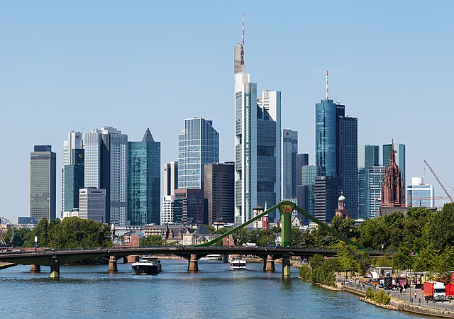

Frankfurt
- city in Germany
Hiking in Frankfurt
Hiking in Frankfurt offers a unique blend of urban and natural experiences. While Frankfurt itself is a bustling financial hub, it is also surrounded by beautiful landscapes that are great for outdoor enthusiasts. Here are some key points to consider:...
- Country:
- Postal Code: 65929–65936; 60308–60599
- Local Dialing Code: 069; 6101; 6109
- Licence Plate Code: F
- Coordinates: 50° 6' 49" N, 8° 40' 47" E
- GPS tracks (wikiloc): [Link]
- AboveSeaLevel: 112 м m
- Area: 248.31 sq km
- Population: 736414
- Web site: [Link]
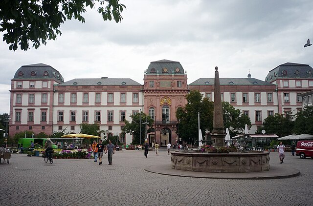

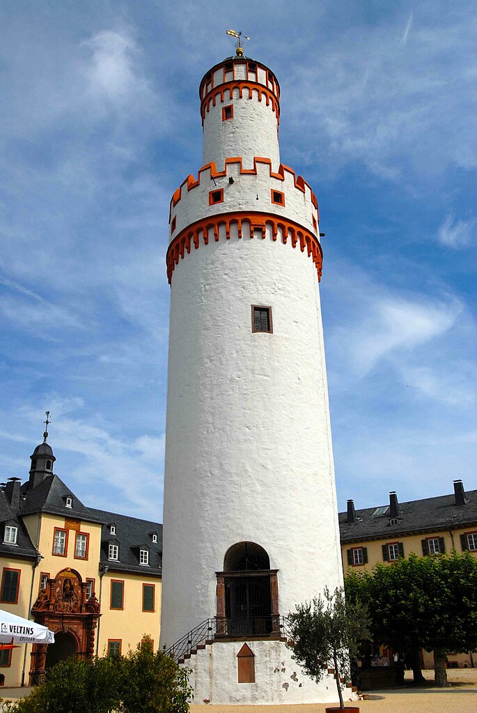
Darmstadt
- city in Hessen, Germany
Hiking in Darmstadt
Darmstadt, located in the southern part of Hesse, Germany, is surrounded by beautiful landscapes that offer great hiking opportunities. The area is characterized by its mix of nature, cultural landmarks, and historical sites. Here are some highlights for hiking in and around Darmstadt:...
- Country:
- Postal Code: 64283–64297
- Local Dialing Code: 06159; 06150; 06151
- Licence Plate Code: DA
- Coordinates: 49° 52' 0" N, 8° 39' 0" E
- GPS tracks (wikiloc): [Link]
- AboveSeaLevel: 144 м m
- Area: 122.09 sq km
- Population: 157437
- Web site: [Link]
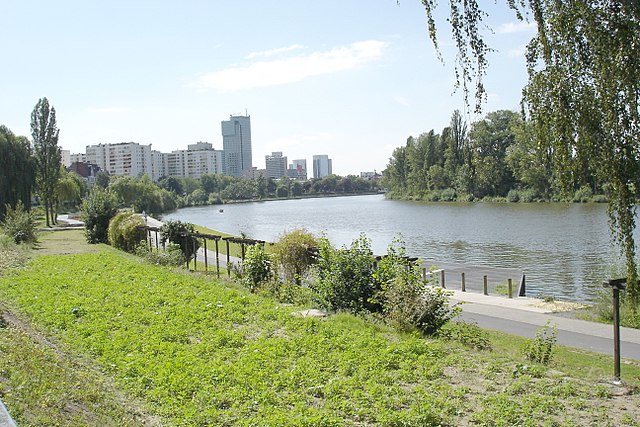

Offenbach am Main
- city in Hesse, Germany
Hiking in Offenbach am Main
Offenbach am Main, located in Hesse, Germany, is not a major hiking destination compared to other regions in Germany, but it offers some pleasant options for outdoor enthusiasts. While the city itself is more urban, there are several nearby areas where you can enjoy hiking and nature....
- Country:
- Postal Code: 63075; 63073; 63071; 63069; 63067; 63065
- Local Dialing Code: 069
- Licence Plate Code: OF
- Coordinates: 50° 6' 0" N, 8° 46' 0" E
- GPS tracks (wikiloc): [Link]
- AboveSeaLevel: 98 м m
- Area: 44.89 sq km
- Population: 124589
- Web site: [Link]


Rheingau-Taunus-Kreis
- district in Hesse, Germany
Hiking in Rheingau-Taunus-Kreis
The Rheingau-Taunus-Kreis region in Germany is an excellent destination for hiking enthusiasts, offering a diverse landscape that includes rolling hills, vineyards, and dense forests. Located in the state of Hesse, this area is known for its natural beauty and cultural significance, making it a great spot for both experienced hikers and those new to the activity....
- Country:
- Capital: Bad Schwalbach
- Licence Plate Code: RÜD
- Coordinates: 50° 8' 54" N, 8° 4' 24" E
- GPS tracks (wikiloc): [Link]
- AboveSeaLevel: 308 м m
- Web site: [Link]

Hochtaunuskreis
- district in Hesse, Germany
Hiking in Hochtaunuskreis
Hochtaunuskreis, located in the state of Hesse, Germany, is a fantastic area for hiking enthusiasts. This region is characterized by its rolling hills, dense forests, and stunning vistas, making it a wonderful destination for both casual walkers and experienced hikers. Here are some highlights and tips for hiking in Hochtaunuskreis:...
- Country:
- Capital: Bad Homburg vor der Höhe
- Licence Plate Code: HG
- Coordinates: 50° 12' 56" N, 8° 36' 59" E
- GPS tracks (wikiloc): [Link]
- AboveSeaLevel: 385 м m
- Area: 482.03 sq km
- Web site: [Link]


Main-Taunus-Kreis
- district in Hesse, Germany
Hiking in Main-Taunus-Kreis
Main-Taunus-Kreis, located in Hesse, Germany, is a beautiful area known for its picturesque landscapes, including the Taunus mountains. Hiking in this region can be a rewarding experience, offering a mix of nature, history, and outdoor activities....
- Country:
- Capital: Hofheim am Taunus
- Licence Plate Code: MTK
- Coordinates: 50° 4' 46" N, 8° 26' 58" E
- GPS tracks (wikiloc): [Link]
- AboveSeaLevel: 245 м m
- Area: 222.40 sq km
- Population: 226113
- Web site: [Link]

Wetteraukreis
- district in Hesse, Germany
Hiking in Wetteraukreis
Wetteraukreis, located in the state of Hesse, Germany, offers a diverse range of landscapes and hiking opportunities that cater to outdoor enthusiasts of all levels. With its rolling hills, picturesque villages, lush forests, and scenic meadows, the region provides a delightful backdrop for exploring nature....
- Country:
- Capital: Friedberg
- Licence Plate Code: FB
- Coordinates: 50° 20' 0" N, 8° 45' 9" E
- GPS tracks (wikiloc): [Link]
- AboveSeaLevel: 137 м m
- Area: 1101.71 sq km
- Web site: [Link]

Main-Kinzig-Kreis
- district in Hesse, Germany
Hiking in Main-Kinzig-Kreis
Main-Kinzig-Kreis, located in the state of Hesse, Germany, offers a diverse array of hiking opportunities suitable for various skill levels and preferences. The region is characterized by beautiful landscapes, including forests, rivers, hills, and quaint villages, making it a great destination for outdoor enthusiasts. Here are some highlights:...
- Country:
- Capital: Gelnhausen
- Licence Plate Code: MKK
- Coordinates: 50° 12' 4" N, 9° 11' 51" E
- GPS tracks (wikiloc): [Link]
- AboveSeaLevel: 202 м m
- Area: 1397.52 sq km
- Population: 407619
- Web site: [Link]
Offenbach
- district in Hesse, Germany
Hiking in Offenbach
Offenbach, located in the state of Hesse, Germany, is surrounded by scenic areas that offer a variety of hiking opportunities. Although it is an urban district, its proximity to nature parks and the countryside makes it a great base for hikers....
- Country:
- Capital: Offenbach am Main
- Licence Plate Code: OF
- Coordinates: 50° 1' 6" N, 8° 47' 8" E
- GPS tracks (wikiloc): [Link]
- AboveSeaLevel: 143 м m
- Area: 356.29 sq km
- Population: 336265
- Web site: [Link]


Groß-Gerau
- district in Hesse, Germany
Hiking in Groß-Gerau
Groß-Gerau is a district in the state of Hesse, Germany, located just south of Frankfurt. While it may not be as well-known for hiking as some other regions in Germany, it offers a variety of scenic routes that showcase the natural beauty of the area....
- Country:
- Capital: Groß-Gerau
- Licence Plate Code: GG
- Coordinates: 49° 54' 46" N, 8° 28' 42" E
- GPS tracks (wikiloc): [Link]
- AboveSeaLevel: 87 м m
- Area: 453.05 sq km
- Population: 254883
- Web site: [Link]

Darmstadt-Dieburg
- district in Hesse, Germany
Hiking in Darmstadt-Dieburg
Darmstadt-Dieburg is a lovely region in Hesse, Germany, known for its scenic landscapes, rich history, and a number of excellent hiking trails. Here are some highlights and tips for hiking in this area:...
- Country:
- Capital: Darmstadt
- Licence Plate Code: DI; DA
- Coordinates: 49° 53' 54" N, 8° 40' 32" E
- GPS tracks (wikiloc): [Link]
- AboveSeaLevel: 203 м m
- Area: 658.51 sq km
- Population: 284413
- Web site: [Link]


Kreis Bergstraße
- district in Hesse, Germany
Hiking in Kreis Bergstraße
Bergstraße is a scenic district located in Hesse, Germany, known for its lush landscapes, vineyards, and rolling hills, making it an excellent destination for hiking enthusiasts. The area is rich in natural beauty and offers a variety of trails that cater to different skill levels, from leisurely walks to more challenging hikes....
- Country:
- Capital: Heppenheim
- Licence Plate Code: HP
- Coordinates: 49° 38' 27" N, 8° 38' 40" E
- GPS tracks (wikiloc): [Link]
- AboveSeaLevel: 252 м m
- Area: 719.54 sq km
- Population: 261695
- Web site: [Link]

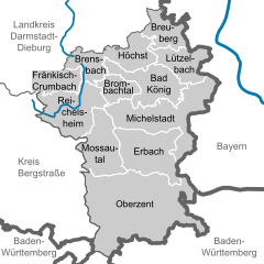
Odenwaldkreis
- district in Hesse, Germany
Hiking in Odenwaldkreis
Odenwaldkreis, located in the Odenwald mountain range in Germany, offers a variety of beautiful hiking opportunities. Known for its scenic landscapes, charming villages, and rich cultural heritage, it is a fantastic destination for nature enthusiasts and hikers....
- Country:
- Capital: Erbach
- Licence Plate Code: ERB
- Coordinates: 49° 39' 48" N, 8° 59' 38" E
- GPS tracks (wikiloc): [Link]
- AboveSeaLevel: 233 м m
- Area: 623.96 sq km
- Population: 96648
- Web site: [Link]
Shares border with regions:


Lower Franconia
- administrative region of Franconia in Bavaria, Germany
Hiking in Lower Franconia
Lower Franconia, located in the northern part of Bavaria, Germany, is a great destination for hiking enthusiasts. This region is known for its diverse landscapes that range from rolling hills to picturesque vineyards and nature reserves, offering a variety of trails suitable for different skill levels....
- Country:
- Capital: Würzburg
- Coordinates: 50° 1' 28" N, 9° 55' 55" E
- GPS tracks (wikiloc): [Link]
- AboveSeaLevel: 289 м m
- Area: 8530.99 sq km
- Population: 1298849
- Web site: [Link]