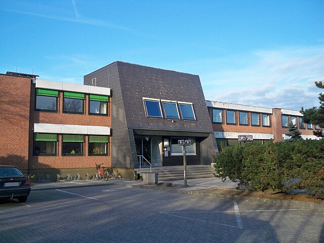
Wittingen (Wittingen)

- City in Lower Saxony, Germany
 Hiking in Wittingen
Wittingen is located in the Lower Saxony region of Germany and offers several opportunities for hiking enthusiasts to explore the natural beauty of the area. Here are some key points about hiking in Wittingen:
-
Scenic Routes: The region around Wittingen features a variety of scenic trails that range from easy walks to more challenging hikes. You can find routes that meander through forests, along rivers, and across open fields.
-
Nature Reserves: The nearby nature reserves and parks provide excellent hiking options. The area is home to diverse wildlife and vegetation, making it a great place for nature lovers.
-
Cultural Sites: While hiking, you may also encounter historical and cultural sites, such as old mills and traditional farms, which add an interesting element to your hiking experience.
-
Maps and Guides: It’s a good idea to obtain local hiking maps or guides that highlight the trails, points of interest, and difficulty levels. Local tourist information centers can be a valuable resource.
-
Community Events: Occasionally, there might be organized hiking events or guided tours in the Wittingen area. These can be a good way to experience the landscape while meeting fellow hiking enthusiasts.
-
Seasonal Considerations: Depending on the time of year, hiking conditions can vary. Spring and early autumn are particularly beautiful with blooming flowers and colorful foliage, whereas summer can be warmer.
Before heading out, ensure you have the appropriate gear, check the weather conditions, and stay informed about trail closures or regulations in the area. Enjoy your hike in Wittingen!
- Country:

- Postal Code: 29379; 29378
- Local Dialing Code: 05839; 05836; 05834; 05831
- Licence Plate Code: GF
- Coordinates: 52° 43' 0" N, 10° 44' 0" E


- GPS tracks (wikiloc): [Link]
- AboveSeaLevel: 79 м m
- Area: 225.08 sq km
- Population: 11589
- Web site: http://www.wittingen.de
- Wikipedia en: wiki(en)
- Wikipedia: wiki(de)
- Wikidata storage: Wikidata: Q552390
- Wikipedia Commons Category: [Link]
- Freebase ID: [/m/0c66wv]
- Freebase ID: [/m/0c66wv]
- GeoNames ID: Alt: [2807257]
- GeoNames ID: Alt: [2807257]
- VIAF ID: Alt: [246093209]
- VIAF ID: Alt: [246093209]
- OSM relation ID: [1392804]
- OSM relation ID: [1392804]
- GND ID: Alt: [4066662-1]
- GND ID: Alt: [4066662-1]
- archINFORM location ID: [11824]
- archINFORM location ID: [11824]
- MusicBrainz area ID: [34dceea4-455d-48fd-8419-229c8df2d5cd]
- MusicBrainz area ID: [34dceea4-455d-48fd-8419-229c8df2d5cd]
- German municipality key: 03151040
- German municipality key: 03151040
Shares border with regions:
Brome
- Joint municipality in Lower Saxony, Germany
Hiking in Brome
Brome, located in the Samtgemeinde of Brome in Lower Saxony, Germany, offers a blend of natural beauty and quite a few well-maintained hiking routes. The area is characterized by picturesque landscapes, forests, and agricultural fields, making it a great destination for outdoor enthusiasts....
- Country:
- Licence Plate Code: GF
- Coordinates: 52° 35' 56" N, 10° 55' 59" E
- GPS tracks (wikiloc): [Link]
- Area: 203.87 sq km
- Population: 17018
- Web site: [Link]

Dedelstorf
- A district and municipality in Germany
Hiking in Dedelstorf
Dedelstorf is a small village located in Lower Saxony, Germany, surrounded by beautiful natural landscapes that are perfect for hiking enthusiasts. While the immediate area is not as well-known as larger national parks, it offers a serene environment with various trails suitable for both novice and experienced hikers....
- Country:
- Postal Code: 29386
- Local Dialing Code: 05832
- Licence Plate Code: GF
- Coordinates: 52° 42' 0" N, 10° 30' 0" E
- GPS tracks (wikiloc): [Link]
- AboveSeaLevel: 93 м m
- Area: 76.03 sq km
- Population: 1209

Obernholz
- municipality of Germany
Hiking in Obernholz
Obernholz is a charming destination for outdoor enthusiasts, particularly hikers. Located in Germany, this area is known for its beautiful landscapes, dense forests, and scenic trails that cater to various skill levels. Here are some key points to consider if you're planning a hiking trip to Obernholz:...
- Country:
- Postal Code: 29386
- Local Dialing Code: 05832
- Licence Plate Code: GF
- Coordinates: 52° 45' 0" N, 10° 37' 0" E
- GPS tracks (wikiloc): [Link]
- AboveSeaLevel: 84 м m
- Area: 37.93 sq km
- Population: 843

Hankensbüttel
- A district and municipality in Germany
Hiking in Hankensbüttel
Hankensbüttel is a small town located in Lower Saxony, Germany, and is often associated with its scenic natural surroundings, making it a pleasant spot for hiking. The area is characterized by picturesque landscapes, including forests, fields, and rivers, providing various trails that cater to different hiking levels....
- Country:
- Postal Code: 29386
- Local Dialing Code: 05832
- Licence Plate Code: GF
- Coordinates: 52° 44' 0" N, 10° 36' 0" E
- GPS tracks (wikiloc): [Link]
- AboveSeaLevel: 95 м m
- Area: 34.82 sq km
- Population: 4491
- Web site: [Link]

Wahrenholz
- A district and municipality in Germany
Hiking in Wahrenholz
Wahrenholz is a small town located in Lower Saxony, Germany, surrounded by beautiful countryside and natural landscapes, making it a pleasant option for hiking enthusiasts. While Wahrenholz itself may not have extensive hiking trails specifically within the town, you can explore the surrounding areas that offer various hiking opportunities. Here are some key points to consider when hiking in and around Wahrenholz:...
- Country:
- Postal Code: 29399
- Local Dialing Code: 05835
- Licence Plate Code: GF
- Coordinates: 52° 37' 0" N, 10° 36' 0" E
- GPS tracks (wikiloc): [Link]
- AboveSeaLevel: 55 м m
- Area: 58 sq km
- Population: 3596

Ehra-Lessien
- municipality of Germany
Hiking in Ehra-Lessien
Ehra-Lessien is a small municipality located in Lower Saxony, Germany. While it may not be as well-known for hiking as some of the larger national parks or mountainous regions in Germany, there are still opportunities for outdoor activities in and around the area....
- Country:
- Postal Code: 38468
- Local Dialing Code: 05377
- Licence Plate Code: GF
- Coordinates: 52° 35' 49" N, 10° 47' 46" E
- GPS tracks (wikiloc): [Link]
- AboveSeaLevel: 63 м m
- Area: 56.08 sq km
- Population: 1931
- Web site: [Link]

Brome
- A district and municipality in Germany
Hiking in Brome
Brome, located in Lower Saxony, Germany, is a charming town surrounded by scenic landscapes, making it an ideal spot for hiking enthusiasts. While Brome itself is a small community, its proximity to natural reserves and parks enhances the hiking experience in the region....
- Country:
- Postal Code: 38465
- Local Dialing Code: 05833
- Licence Plate Code: GF
- Coordinates: 52° 36' 0" N, 10° 57' 0" E
- GPS tracks (wikiloc): [Link]
- AboveSeaLevel: 72 м m
- Area: 36.66 sq km
- Population: 3400
- Web site: [Link]

Schönewörde
- A district and municipality in Germany
Hiking in Schönewörde
Schönewörde, a quaint village in Germany, is not as commonly known for hiking as some larger national parks or well-established hiking areas, but it can offer some lovely outdoor experiences, especially if you're looking to enjoy the peaceful countryside and natural surroundings....
- Country:
- Postal Code: 29396
- Local Dialing Code: 05835
- Licence Plate Code: GF
- Coordinates: 52° 38' 0" N, 10° 38' 0" E
- GPS tracks (wikiloc): [Link]
- AboveSeaLevel: 63 м m
- Area: 17.73 sq km
- Population: 927