Wittinsburg (Wittinsburg)

- municipality in Switzerland
 Hiking in Wittinsburg
Wittinsburg is a picturesque area that offers a variety of hiking opportunities, surrounded by beautiful landscapes and natural scenery. While it may not be as popular as some well-known hiking destinations, it provides a great escape into nature for outdoor enthusiasts.
Here are a few things to consider when hiking in Wittinsburg:
Trails
-
Local Trails: Explore the local trails that range from easy walks to moderate hikes, suitable for families and experienced hikers alike. Look out for trail markers and maps to guide your journey.
-
Scenic Views: Many trails in the area offer stunning viewpoints, allowing hikers to appreciate the beauty of the region's natural surroundings.
-
Wildlife: Keep an eye out for the local wildlife along the trails. Birds, small mammals, and various plant species can often be spotted, especially in the quieter areas.
Preparation
- Gear: Wear appropriate hiking footwear and clothing suited for the weather. Layered clothing is recommended, especially in changing conditions.
- Safety: Carry a map or a GPS device, and let someone know your hiking plans. Cell service can be limited in some areas.
- Hydration and Snacks: Bring plenty of water and snacks to keep your energy up during your hike.
Best Times to Hike
- Spring and Fall: These seasons can be the most enjoyable due to mild temperatures and beautiful foliage.
- Summer: If you choose to hike in the summer, start early in the morning to avoid the heat and take plenty of breaks.
Environmental Considerations
- Follow Leave No Trace principles to minimize your impact on the natural environment. Stay on marked trails, pack out what you bring in, and respect wildlife.
Local Amenities
- Check for local amenities like parking, restrooms, or visitor centers that may enhance your hiking experience.
Before heading out, it’s always a good idea to check local resources or websites for any trail updates, weather conditions, and specific regulations that may apply to the area. Enjoy your hike in Wittinsburg!
- Country:

- Postal Code: 4443
- Local Dialing Code: 062
- Licence Plate Code: BL
- Coordinates: 47° 25' 48" N, 7° 50' 21" E


- GPS tracks (wikiloc): [Link]
- AboveSeaLevel: 599 м m
- Area: 321 sq km
- Population: 434
- Web site: http://www.wittinsburg.ch
- Wikipedia en: wiki(en)
- Wikipedia: wiki(de)
- Wikidata storage: Wikidata: Q68013
- Wikipedia Commons Category: [Link]
- Freebase ID: [/m/0g822s]
- GeoNames ID: Alt: [7287598]
- VIAF ID: Alt: [240574867]
- OSM relation ID: [1683723]
- HDS ID: [1242]
- Swiss municipality code: [2867]
Shares border with regions:


Känerkinden
- municipality in Switzerland
Hiking in Känerkinden
Känerkinden is a beautiful area located in the Swiss region of Aargau, offering a variety of hiking opportunities that showcase the stunning natural landscapes, lush forests, and panoramic views. The region is characterized by rolling hills and picturesque valleys, making it suitable for both novice and experienced hikers....
- Country:
- Postal Code: 4447
- Local Dialing Code: 062
- Licence Plate Code: BL
- Coordinates: 47° 24' 44" N, 7° 50' 14" E
- GPS tracks (wikiloc): [Link]
- AboveSeaLevel: 576 м m
- Area: 1.48 sq km
- Population: 530
- Web site: [Link]

Gelterkinden
- municipality in Switzerland
Hiking in Gelterkinden
Gelterkinden, located in the canton of Basel-Landschaft in Switzerland, is an excellent destination for hiking enthusiasts. The region is characterized by picturesque landscapes, diverse terrain, and a mix of forests, hills, and meadows. Here are some key points to consider when hiking in Gelterkinden:...
- Country:
- Postal Code: 4460
- Local Dialing Code: 061
- Licence Plate Code: BL
- Coordinates: 47° 27' 55" N, 7° 51' 10" E
- GPS tracks (wikiloc): [Link]
- AboveSeaLevel: 458 м m
- Area: 9.79 sq km
- Population: 6095
- Web site: [Link]

Buckten
- municipality in Switzerland
Hiking in Buckten
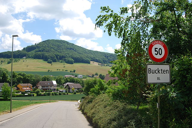
Buckten is a charming village located in the canton of Aargau, Switzerland, surrounded by stunning natural scenery that makes it a great destination for hiking enthusiasts. The region offers a variety of hiking trails suitable for different levels of experience. Here's what you might want to know about hiking in and around Buckten:...
- Country:
- Postal Code: 4446
- Local Dialing Code: 062
- Licence Plate Code: BL
- Coordinates: 47° 24' 43" N, 7° 50' 48" E
- GPS tracks (wikiloc): [Link]
- AboveSeaLevel: 516 м m
- Area: 1.99 sq km
- Population: 694
- Web site: [Link]
Diepflingen
- municipality in Switzerland
Hiking in Diepflingen
Diepflingen, located in the beautiful region of Switzerland, is a fantastic destination for hiking enthusiasts. Nestled near the Swiss-German border, the area is characterized by stunning landscapes, rolling hills, lush forests, and charming countryside. Here are some key highlights for hiking in Diepflingen:...
- Country:
- Postal Code: 4442
- Local Dialing Code: 061
- Licence Plate Code: BL
- Coordinates: 47° 26' 42" N, 7° 50' 25" E
- GPS tracks (wikiloc): [Link]
- AboveSeaLevel: 412 м m
- Area: 1.44 sq km
- Population: 738
- Web site: [Link]
Tenniken
- municipality in Switzerland
Hiking in Tenniken
Tenniken, while not widely recognized as a hiking destination, can refer to various hiking areas depending on the context. If you meant “Tennessee,” it is renowned for its beautiful landscapes and numerous hiking trails....
- Country:
- Postal Code: 4456
- Local Dialing Code: 061
- Licence Plate Code: BL
- Coordinates: 47° 26' 13" N, 7° 48' 40" E
- GPS tracks (wikiloc): [Link]
- AboveSeaLevel: 423 м m
- Area: 4.67 sq km
- Population: 916
- Web site: [Link]


Rümlingen
- municipality in Switzerland
Hiking in Rümlingen
Rümlingen is a small village in Switzerland known for its picturesque landscapes and access to nature, making it a great spot for hiking enthusiasts. The region is characterized by rolling hills, lush meadows, and peaceful forests, providing a variety of trails suitable for different skill levels....
- Country:
- Postal Code: 4444
- Local Dialing Code: 062
- Licence Plate Code: BL
- Coordinates: 47° 25' 31" N, 7° 50' 59" E
- GPS tracks (wikiloc): [Link]
- AboveSeaLevel: 459 м m
- Area: 2.28 sq km
- Population: 390
- Web site: [Link]