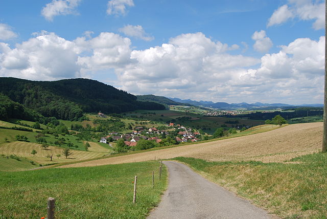
Rümlingen (Rümlingen)

- municipality in Switzerland
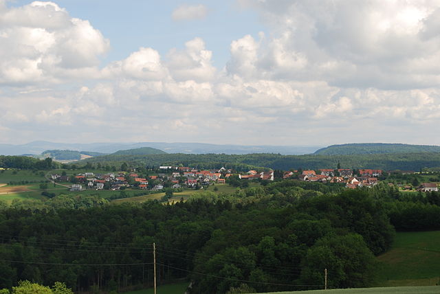
 Hiking in Rümlingen
Rümlingen is a small village in Switzerland known for its picturesque landscapes and access to nature, making it a great spot for hiking enthusiasts. The region is characterized by rolling hills, lush meadows, and peaceful forests, providing a variety of trails suitable for different skill levels.
Hiking Recommendations:
-
Scenic Trails: There are several well-marked hiking trails in and around Rümlingen, ranging from easy walks to more challenging routes. You can explore scenic paths that lead through vineyards, offer stunning views of the surrounding countryside, and even include some historical landmarks.
-
Regional Pathways: Utilize the Swiss hiking network, which involves both regional and national trails. Look for signs indicating the direction of specific trails; routes are often well marked and maintained.
-
Nature Observation: The area is rich in flora and fauna, making it a great destination for nature lovers. You may encounter local wildlife, including various bird species and if you're lucky, deer or other mammals.
-
Seasonal Hiking: Spring and autumn are particularly lovely times to hike in the region due to the mild weather and vibrant foliage. Winter hiking may also be an option in some areas, but be sure to check trail conditions and safety information.
-
Local Amenities: Being a small village, Rümlingen offers a cozy atmosphere with local accommodations and eateries. Plan a stop at a local restaurant to enjoy Swiss cuisine after a day of hiking.
-
Connecting Trails: If you're up for a longer adventure, consider connecting to nearby villages or paths that lead to larger hiking regions like the Jura mountains which are a bit further out but offer extensive trail systems.
Tips for Hiking in Rümlingen:
-
Preparation: Always check the weather conditions and trail maps before heading out. Bringing plenty of water and snacks is essential, as well as proper hiking gear.
-
Respect Nature: Follow Leave No Trace principles to preserve the natural beauty of Rümlingen and its surroundings.
-
Trail Safety: Stay on marked trails and be aware of your surroundings. If hiking during the off-season, be cautious of conditions such as snow or mud.
Overall, hiking in Rümlingen provides a great way to connect with nature and enjoy the tranquility of the Swiss countryside.
- Country:

- Postal Code: 4444
- Local Dialing Code: 062
- Licence Plate Code: BL
- Coordinates: 47° 25' 31" N, 7° 50' 59" E


- GPS tracks (wikiloc): [Link]
- AboveSeaLevel: 459 м m
- Area: 2.28 sq km
- Population: 390
- Web site: http://www.ruemlingen.ch
- Wikipedia en: wiki(en)
- Wikipedia: wiki(de)
- Wikidata storage: Wikidata: Q67954
- Wikipedia Commons Category: [Link]
- Freebase ID: [/m/0g81w3]
- GeoNames ID: Alt: [7286985]
- VIAF ID: Alt: [148778345]
- OSM relation ID: [1683701]
- HDS ID: [1235]
- Swiss municipality code: [2859]
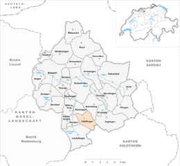
Shares border with regions:
Häfelfingen
- municipality in Switzerland
Hiking in Häfelfingen
Häfelfingen is a charming village located in the Basel-Landschaft region of Switzerland, offering beautiful landscapes and opportunities for hiking enthusiasts. The area is characterized by its rolling hills, picturesque vineyards, and stunning views of the surrounding Swiss countryside. Here are some key points about hiking in and around Häfelfingen:...
- Country:
- Postal Code: 4445
- Local Dialing Code: 062
- Licence Plate Code: BL
- Coordinates: 47° 24' 47" N, 7° 52' 13" E
- GPS tracks (wikiloc): [Link]
- AboveSeaLevel: 599 м m
- Area: 3.96 sq km
- Population: 271
- Web site: [Link]
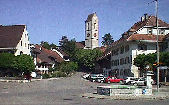

Gelterkinden
- municipality in Switzerland
Hiking in Gelterkinden
Gelterkinden, located in the canton of Basel-Landschaft in Switzerland, is an excellent destination for hiking enthusiasts. The region is characterized by picturesque landscapes, diverse terrain, and a mix of forests, hills, and meadows. Here are some key points to consider when hiking in Gelterkinden:...
- Country:
- Postal Code: 4460
- Local Dialing Code: 061
- Licence Plate Code: BL
- Coordinates: 47° 27' 55" N, 7° 51' 10" E
- GPS tracks (wikiloc): [Link]
- AboveSeaLevel: 458 м m
- Area: 9.79 sq km
- Population: 6095
- Web site: [Link]
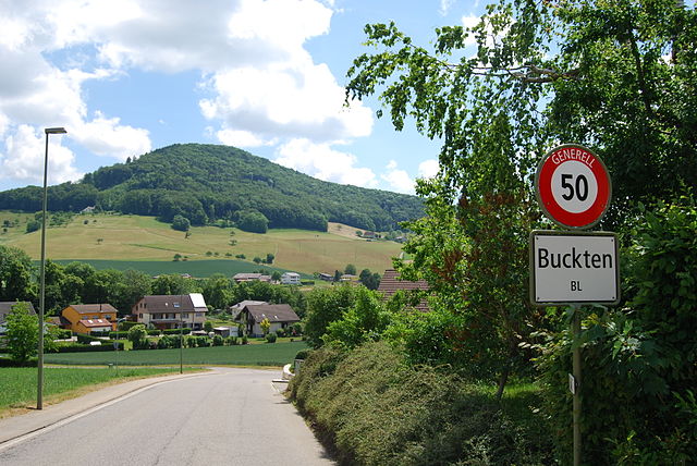

Buckten
- municipality in Switzerland
Hiking in Buckten
Buckten is a charming village located in the canton of Aargau, Switzerland, surrounded by stunning natural scenery that makes it a great destination for hiking enthusiasts. The region offers a variety of hiking trails suitable for different levels of experience. Here's what you might want to know about hiking in and around Buckten:...
- Country:
- Postal Code: 4446
- Local Dialing Code: 062
- Licence Plate Code: BL
- Coordinates: 47° 24' 43" N, 7° 50' 48" E
- GPS tracks (wikiloc): [Link]
- AboveSeaLevel: 516 м m
- Area: 1.99 sq km
- Population: 694
- Web site: [Link]

Rünenberg
- municipality in Switzerland
Hiking in Rünenberg
Rünenberg, located in the canton of Baselland in Switzerland, is an excellent area for hiking enthusiasts. The region offers picturesque landscapes, charming farms, and views of the rolling hills typical of the Swiss countryside. Here are some highlights to consider when hiking in Rünenberg:...
- Country:
- Postal Code: 4497
- Local Dialing Code: 061
- Licence Plate Code: BL
- Coordinates: 47° 25' 55" N, 7° 52' 49" E
- GPS tracks (wikiloc): [Link]
- AboveSeaLevel: 585 м m
- Area: 4.98 sq km
- Population: 777
- Web site: [Link]
Wittinsburg
- municipality in Switzerland
Hiking in Wittinsburg
Wittinsburg is a picturesque area that offers a variety of hiking opportunities, surrounded by beautiful landscapes and natural scenery. While it may not be as popular as some well-known hiking destinations, it provides a great escape into nature for outdoor enthusiasts....
- Country:
- Postal Code: 4443
- Local Dialing Code: 062
- Licence Plate Code: BL
- Coordinates: 47° 25' 48" N, 7° 50' 21" E
- GPS tracks (wikiloc): [Link]
- AboveSeaLevel: 599 м m
- Area: 321 sq km
- Population: 434
- Web site: [Link]