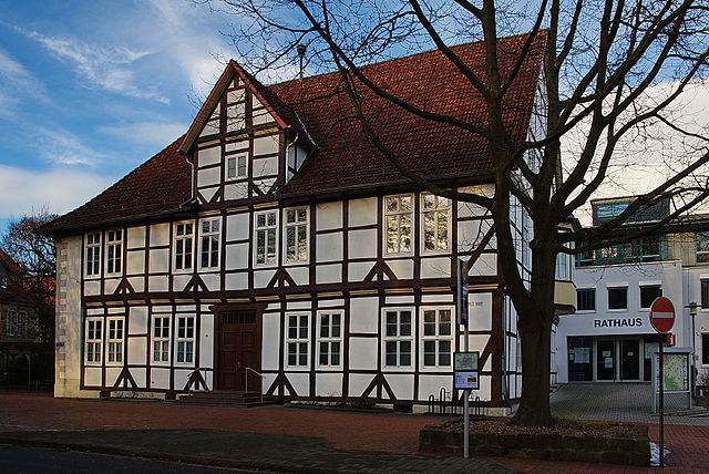
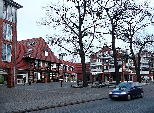
Wunstorf (Wunstorf)

- town in Lower Saxony, Germany
 Hiking in Wunstorf
Wunstorf, located in Lower Saxony, Germany, is surrounded by beautiful natural landscapes that offer various hiking opportunities. While the area may not be as mountainous as some other regions in Germany, it still has plenty to offer for hiking enthusiasts.
Popular Hiking Areas Around Wunstorf:
-
Lake Steinhude:
- Just a short distance from Wunstorf, Lake Steinhude is the largest lake in northern Germany. The area around the lake features well-marked trails with picturesque views of the water, marshes, and surrounding flora and fauna. You can enjoy a leisurely hike alongside the lakeshore or venture into the nearby nature reserves.
-
Steinhuder Meer Nature Park:
- This nature park is an excellent place for hiking, with various trails that offer a mix of walking paths, meadows, and wooded areas. Birdwatching is popular here, as the park is home to numerous species, especially during migration seasons.
-
Biosphere Reserve Niedersächsische Elbtalaue:
- Located a bit further from Wunstorf, this reserve showcases a unique landscape with a blend of rivers, wetlands, and woods. The hiking trails here range from easy to moderate and provide stunning views of the Elbe River.
-
The Deister Hills:
- A bit to the south, the Deister mountain range offers more challenging hikes. With elevation changes and well-marked trails, this area can provide a good workout along with beautiful views of the surrounding countryside.
Hiking Tips:
- Trail Maps: Make sure to bring a reliable map or download the relevant hiking apps, as trails can vary in difficulty and length.
- Weather Preparedness: Check the weather forecast and dress in layers, as conditions can change quickly. Waterproof gear is advisable, especially in spring and autumn.
- Leave No Trace: Respect the environment by sticking to marked trails and carrying any waste back with you.
- Safety: Carry a first-aid kit, plenty of water, and snacks to keep your energy up during your hikes.
Local Amenities:
Wunstorf has various amenities, such as cafes and restaurants, where you can enjoy local cuisine after your hike. It's also a good idea to check with local hiking clubs or tourism offices for organized hikes or guided tours, especially if you're unfamiliar with the area.
Overall, Wunstorf offers a charming blend of nature and ease of access for hikers of all skill levels. Enjoy your outdoor adventures!
- Country:

- Postal Code: 31515
- Local Dialing Code: 05723; 05033; 05031
- Licence Plate Code: H
- Coordinates: 52° 25' 26" N, 9° 26' 9" E


- GPS tracks (wikiloc): [Link]
- AboveSeaLevel: 43 м m
- Area: 126.60 sq km
- Population: 41532
- Web site: https://www.wunstorf.de/
- Wikipedia en: wiki(en)
- Wikipedia: wiki(de)
- Wikidata storage: Wikidata: Q14827
- Wikipedia Commons Category: [Link]
- Wikipedia Commons Maps Category: [Link]
- Freebase ID: [/m/0cmh06]
- GeoNames ID: Alt: [2805761]
- VIAF ID: Alt: [146576362]
- OSM relation ID: [73888]
- GND ID: Alt: [4067081-8]
- archINFORM location ID: [10771]
- Library of Congress authority ID: Alt: [n80032265]
- MusicBrainz area ID: [e9ae79e8-6e9d-4256-99f1-e37cb647955c]
- WOEID: [708224]
- Quora topic ID: [Wunstorf]
- German municipality key: 03241021
Shares border with regions:

Barsinghausen
- town in Lower Saxony, Germany
Hiking in Barsinghausen
Barsinghausen is a town in Lower Saxony, Germany, that is surrounded by beautiful landscapes, making it an excellent location for hiking enthusiasts. Here are some highlights and details regarding hiking in and around Barsinghausen:...
- Country:
- Postal Code: 30890
- Local Dialing Code: 05108; 05035; 05105
- Licence Plate Code: H
- Coordinates: 52° 18' 0" N, 9° 28' 52" E
- GPS tracks (wikiloc): [Link]
- AboveSeaLevel: 142 м m
- Area: 102.65 sq km
- Population: 33922
- Web site: [Link]

Seelze
- town in the district of Hanover, in Lower Saxony, Germany
Hiking in Seelze
Seelze is a town located in Lower Saxony, Germany, situated just southwest of Hanover. While Seelze itself might not be primarily known as a hiking destination, there are several opportunities for outdoor enthusiasts in and around the area....
- Country:
- Postal Code: 30926
- Local Dialing Code: 05137; 0511; 05031
- Licence Plate Code: H
- Coordinates: 52° 23' 46" N, 9° 35' 53" E
- GPS tracks (wikiloc): [Link]
- AboveSeaLevel: 50 м m
- Area: 54.08 sq km
- Population: 34036
- Web site: [Link]


Garbsen
- town near Hanover, Lower Saxony, Germany
Hiking in Garbsen
Garbsen, located in Lower Saxony, Germany, is an area that offers a variety of outdoor activities, including hiking. While it may not be as widely known for hiking as some of the more mountainous areas in Germany, it does provide numerous opportunities to explore nature and enjoy the scenic landscape. Here are a few things to know about hiking in and around Garbsen:...
- Country:
- Postal Code: 30827; 30826; 30823
- Local Dialing Code: 05031; 05137; 05131
- Licence Plate Code: H
- Coordinates: 52° 25' 6" N, 9° 35' 53" E
- GPS tracks (wikiloc): [Link]
- AboveSeaLevel: 50 м m
- Area: 79.32 sq km
- Population: 60590
- Web site: [Link]