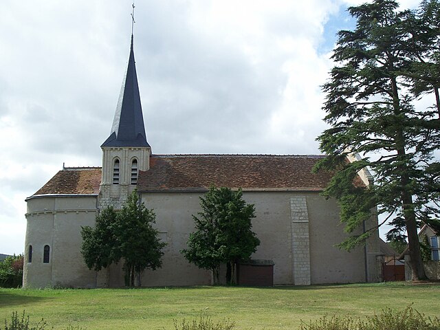
Yzeures-sur-Creuse (Yzeures-sur-Creuse)
- commune in Indre-et-Loire, France
- Country:

- Postal Code: 37290
- Coordinates: 46° 47' 8" N, 0° 52' 14" E


- GPS tracks (wikiloc): [Link]
- AboveSeaLevel: 84 м m
- Area: 55.42 sq km
- Population: 1421
- Web site: http://www.yzeuressurcreuse.com
- Wikipedia en: wiki(en)
- Wikipedia: wiki(fr)
- Wikidata storage: Wikidata: Q273886
- Wikipedia Commons Category: [Link]
- Freebase ID: [/m/067hpp]
- GeoNames ID: Alt: [2967165]
- SIREN number: [213702822]
- BnF ID: [152578302]
- VIAF ID: Alt: [190765528]
- PACTOLS thesaurus ID: [pcrti9cpd9XO2l]
- MusicBrainz area ID: [93292163-a88d-443b-a087-67c0e28b9738]
- SUDOC authorities ID: [115968768]
- Digital Atlas of the Roman Empire ID: [13418]
- INSEE municipality code: 37282
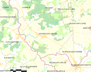
Shares border with regions:


Boussay
- commune in Indre-et-Loire, France
- Country:

- Postal Code: 37290
- Coordinates: 46° 50' 31" N, 0° 53' 18" E


- GPS tracks (wikiloc): [Link]
- Area: 27.54 sq km
- Population: 250


Chambon
- commune in Indre-et-Loire, France
- Country:

- Postal Code: 37290
- Coordinates: 46° 50' 34" N, 0° 48' 44" E


- GPS tracks (wikiloc): [Link]
- Area: 17.88 sq km
- Population: 322


Tournon-Saint-Pierre
- commune in Indre-et-Loire, France
- Country:

- Postal Code: 37290
- Coordinates: 46° 44' 21" N, 0° 57' 14" E


- GPS tracks (wikiloc): [Link]
- Area: 14.76 sq km
- Population: 451
Lésigny
- commune in Vienne, France
- Country:

- Postal Code: 86270
- Coordinates: 46° 50' 56" N, 0° 46' 3" E


- GPS tracks (wikiloc): [Link]
- Area: 13.21 sq km
- Population: 549


Vicq-sur-Gartempe
- commune in Vienne, France
- Country:

- Postal Code: 86260
- Coordinates: 46° 43' 16" N, 0° 51' 43" E


- GPS tracks (wikiloc): [Link]
- Area: 33.22 sq km
- Population: 634
- Web site: [Link]


La Roche-Posay
- commune in Vienne, France
- Country:

- Postal Code: 86270
- Coordinates: 46° 47' 11" N, 0° 48' 45" E


- GPS tracks (wikiloc): [Link]
- Area: 35.31 sq km
- Population: 1551
- Web site: [Link]


Preuilly-sur-Claise
- commune in Indre-et-Loire, France
- Country:

- Postal Code: 37290
- Coordinates: 46° 51' 17" N, 0° 55' 42" E


- GPS tracks (wikiloc): [Link]
- Area: 12 sq km
- Population: 1009
- Web site: [Link]


Bossay-sur-Claise
- commune in Indre-et-Loire, France
- Country:

- Postal Code: 37290
- Coordinates: 46° 49' 56" N, 0° 57' 44" E


- GPS tracks (wikiloc): [Link]
- Area: 65.56 sq km
- Population: 769
- Web site: [Link]


Néons-sur-Creuse
- commune in Indre, France
- Country:

- Postal Code: 36220
- Coordinates: 46° 44' 48" N, 0° 55' 44" E


- GPS tracks (wikiloc): [Link]
- Area: 19.85 sq km
- Population: 409
