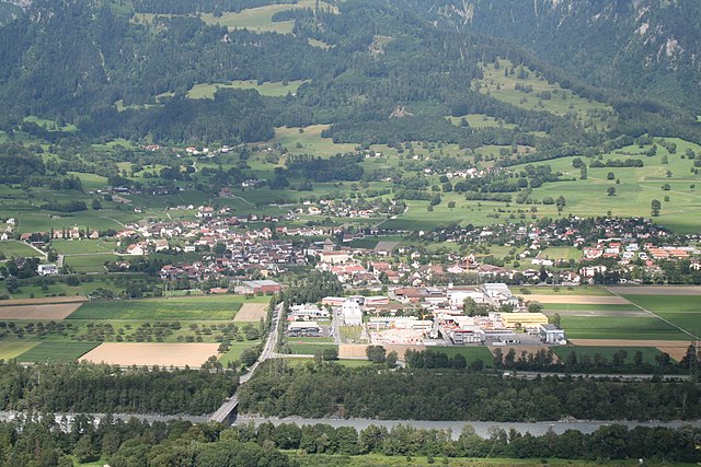
Zizers (Zizers)

- municipality in Switzerland
 Hiking in Zizers
Zizers, located in the Canton of Graubünden in Switzerland, is a beautiful destination for hiking enthusiasts. The region boasts stunning landscapes, offering a mix of lush valleys, alpine meadows, and impressive mountain vistas. Here are some highlights and tips for hiking in and around Zizers:
Hiking Trails:
-
Zizers to Chur: This popular trail offers picturesque views and a relatively easy walk, making it suitable for families and beginners. The route leads down to Chur, the oldest city in Switzerland, where you can explore the charming old town.
-
Heidiland Trails: The Heidiland region, which includes Zizers, features various hiking paths ranging from easy to challenging. These trails often lead you through beautiful meadows, forests, and offer wonderful panoramic views of the surrounding mountains.
-
Hiking around the Rhine Gorge: Known as the "Grand Canyon of Switzerland," the Rhine Gorge is a stunning geological formation. There are several trails that allow you to explore this natural wonder, with views of the dramatic cliffs and the river below.
-
Glaris Region: Accessible from Zizers, this area provides more strenuous hikes in the heart of the Alps, with routes that lead to higher altitudes and magnificent alpine scenery.
Difficulty Levels:
Trails in this region can accommodate all levels of hikers—from leisurely walks to more strenuous climbs. Be sure to check trail markers and maps for the difficulty ratings before setting out.
Best Time to Hike:
The ideal hiking season in Zizers is generally from late spring (May) to early autumn (October). The summer months offer pleasant weather, but always check the forecast, as mountain weather can be unpredictable.
Safety Tips:
- Always inform someone about your hiking plans.
- Carry a physical map, as GPS signals can be unreliable in remote areas.
- Bring plenty of water, snacks, and essential supplies including a first-aid kit.
- Wear appropriate hiking shoes and clothing for the changing weather conditions.
Local Amenities:
Zizers has local facilities such as trailheads, small eateries, and accommodations if you plan to stay overnight. It’s also close to other larger towns in Graubünden, like Chur, where you can find more extensive services and amenities.
Conservation:
As with any hiking destination, it's vital to respect the local environment. Stick to marked trails, avoid disturbing wildlife, and carry out whatever you bring in.
Whether you are looking for a peaceful stroll or a more adventurous hike, Zizers and its surrounding regions offer something for everyone. Enjoy your hiking adventures!
- Country:

- Postal Code: 7205
- Local Dialing Code: 081
- Licence Plate Code: GR
- Coordinates: 46° 56' 11" N, 9° 34' 15" E


- GPS tracks (wikiloc): [Link]
- AboveSeaLevel: 606 м m
- Area: 11.01 sq km
- Population: 3443
- Web site: http://www.zizers.ch
- Wikipedia en: wiki(en)
- Wikipedia: wiki(de)
- Wikidata storage: Wikidata: Q69616
- Wikipedia Commons Category: [Link]
- Freebase ID: [/m/026fdn_]
- GeoNames ID: Alt: [7287638]
- VIAF ID: Alt: [242624397]
- OSM relation ID: [1684212]
- GND ID: Alt: [4231983-3]
- MusicBrainz area ID: [72bc1945-3896-4383-adf5-86db0595d5ad]
- HDS ID: [1603]
- Swiss municipality code: [3947]
Shares border with regions:
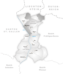
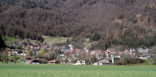
Maienfeld
- municipality in Switzerland
Hiking in Maienfeld
Maienfeld, located in the canton of Graubünden in Switzerland, is a picturesque village famous for its stunning landscapes and wine production, particularly its Bündner wine. The area offers a variety of hiking trails that cater to different skill levels, providing hikers with breathtaking views of the surrounding Alps, charming vineyards, and lush meadows....
- Country:
- Postal Code: 7304
- Local Dialing Code: 081
- Licence Plate Code: GR
- Coordinates: 47° 0' 28" N, 9° 31' 51" E
- GPS tracks (wikiloc): [Link]
- AboveSeaLevel: 1469 м m
- Area: 32.33 sq km
- Population: 2860
- Web site: [Link]

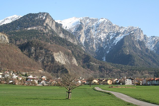
Untervaz
- municipality in Switzerland
Hiking in Untervaz
Untervaz is a picturesque village located in the Canton of Graubünden in Switzerland, known for its stunning landscapes, lush nature, and diverse hiking trails. Here are some key points about hiking in Untervaz:...
- Country:
- Postal Code: 7204
- Local Dialing Code: 081
- Licence Plate Code: GR
- Coordinates: 46° 55' 14" N, 9° 30' 57" E
- GPS tracks (wikiloc): [Link]
- AboveSeaLevel: 1145 м m
- Area: 27.72 sq km
- Population: 2512
- Web site: [Link]

Trimmis
- municipality in Switzerland
Hiking in Trimmis
Trimmis is a charming village located in the canton of Graubünden, Switzerland, known for its stunning landscapes and access to a variety of hiking trails. The area offers a range of hiking options that cater to different fitness levels and interests, from leisurely walks to more challenging mountain hikes....
- Country:
- Postal Code: 7203
- Local Dialing Code: 081
- Licence Plate Code: GR
- Coordinates: 46° 53' 43" N, 9° 35' 51" E
- GPS tracks (wikiloc): [Link]
- AboveSeaLevel: 1580 м m
- Area: 42.87 sq km
- Population: 3283
- Web site: [Link]