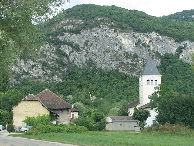
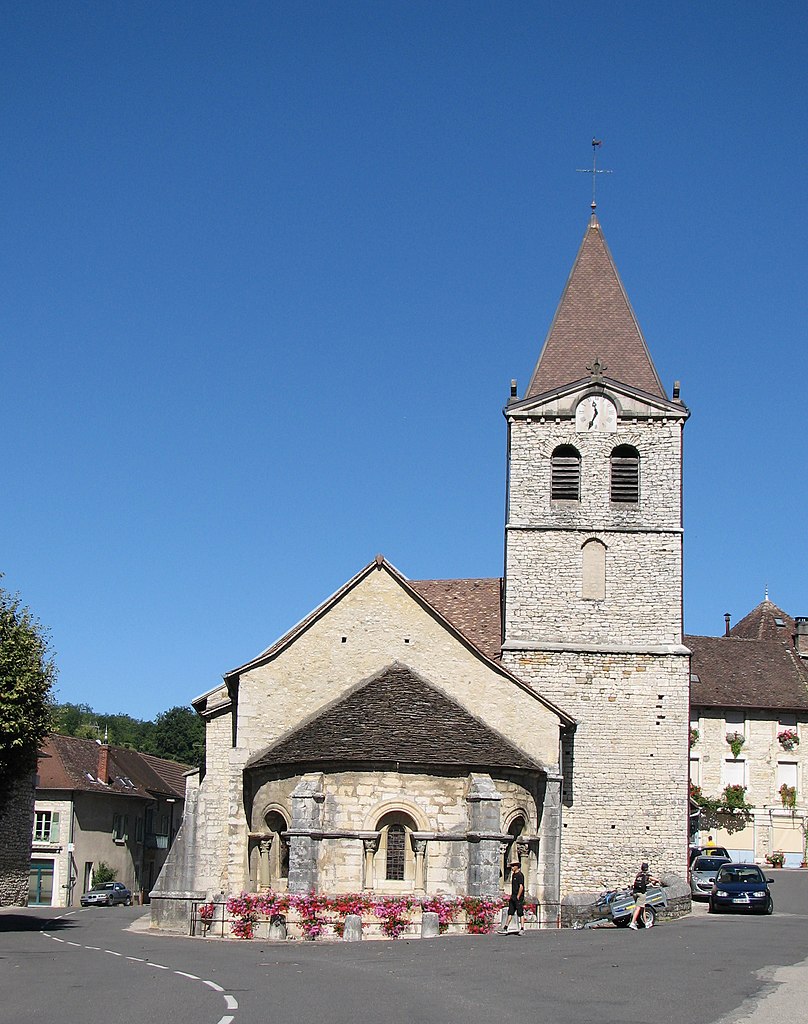
Бранг (Brangues, Brangues)

 Hiking in Бранг
Brangues is a charming village located in the Isère department of the Auvergne-Rhône-Alpes region in southeastern France. It's situated near the stunning Vercors Regional Natural Park, which offers a variety of hiking trails that cater to different skill levels.
Hiking Opportunities:
-
Vercors Regional Natural Park:
- Just a short distance from Brangues, the Vercors offers diverse landscapes including limestone cliffs, forests, and spectacular views. There are various marked trails ranging from easy walks to more challenging hikes.
-
Les Chemins de Grande Randonnée (GR Paths):
- The GR trails in this region provide long-distance hiking opportunities. GR9 and GR93 are examples of paths that pass through the Vercors and are accessible from Brangues.
-
Local Trails:
- Explore nearby trails that may be less crowded. Many local paths connect Brangues to surrounding picturesque villages and scenic viewpoints.
Tips for Hiking in Brangues:
-
Season: Spring and fall are ideal for hiking, with pleasant temperatures and beautiful scenery. Summers can be hot, while winters may lead to snow at higher elevations.
-
Preparation: Ensure you're well-prepared with appropriate gear, sufficient water, snacks, and navigation tools. Maps are available at local tourist information centers.
-
Wildlife & Nature: The area is rich in biodiversity. Keep an eye out for local wildlife and enjoy the natural beauty of the region.
-
Respect Nature: Follow the Leave No Trace principles to protect the environment. Stick to marked paths and avoid disturbing wildlife.
Additional Activities:
Besides hiking, you can explore cycling, rock climbing, and visiting historical sites in the vicinity. The village itself is also worth taking the time to wander through, with its quaint architecture and local charm.
Before setting out, always check the local weather conditions and trail information to ensure a safe and enjoyable hiking experience!
- Страна:

- Почтовый код: 38510
- Координаты: 45° 41' 35" N, 5° 31' 52" E


- GPS треки (wikiloc): [Ссылка]
- Площадь: 11.67 кв.км
- Население: 616
- Веб сайт: http://www.brangues.fr
- Википедия русская: wiki(ru)
- Википедия английская: wiki(en)
- Википедия национальная: wiki(fr)
- Хранилище Wikidata: Wikidata: Q1002989
- Катеория в википедии: [Ссылка]
- код Freebase: [/m/03g_6s8]
- код GeoNames: Альт: [6613012]
- номер SIREN: [213800550]
- код BNF: [152578840]
- код VIAF: Альт: [236582943]
- код Цифрового атласа Римской империи: [11284]
- код Pleiades: [167688]
- код муниципалитета INSEE: 38055
Граничит с регионами:


Ле-Бушаж
Hiking in Ле-Бушаж
Le Bouchage is a small commune located in the Isère department of the Auvergne-Rhône-Alpes region in southeastern France. While it might not be as well-known as some of the larger towns and national parks in the area, it offers a charming landscape that can appeal to hikers looking for quieter trails and scenic views....
- Страна:
- Почтовый код: 38510
- Координаты: 45° 40' 13" N, 5° 31' 33" E
- GPS треки (wikiloc): [Ссылка]
- Площадь: 11.2 кв.км
- Население: 625
- Веб сайт: [Ссылка]
Groslée-Saint-Benoit
Hiking in Groslée-Saint-Benoit
Groslée-Saint-Benoît is a picturesque commune located in the Auvergne-Rhône-Alpes region of France. Known for its stunning natural landscapes, it offers a variety of hiking opportunities that attract outdoor enthusiasts....
- Страна:
- Почтовый код: 01680; 01300
- Координаты: 45° 41' 42" N, 5° 35' 14" E
- GPS треки (wikiloc): [Ссылка]
- Площадь: 28.92 кв.км
Saint-Benoît
- коммуна во Франции
Hiking in Saint-Benoît
Saint-Benoît, located in the Ain department of France, offers a picturesque setting for hiking enthusiasts. Nestled in the foothills of the Jura Mountains, the area features a mix of lush forests, rolling hills, and stunning views of the surrounding landscape, making it an ideal location for both casual walkers and experienced hikers....
- Страна:
- Почтовый код: 01300
- Координаты: 45° 41' 40" N, 5° 35' 19" E
- GPS треки (wikiloc): [Ссылка]
- Площадь: 21.65 кв.км
- Население: 833
Люи
- коммуна во Франции, департамент Эн
Hiking in Люи
Lhuis is a charming commune located in the Ain department of the Auvergne-Rhône-Alpes region of France. Nestled near the foothills of the Alps, it provides a beautiful backdrop for outdoor activities, including hiking. While Lhuis itself might be more quiet and less well-known than larger hiking destinations, it offers access to a range of trails that cater to different skill levels and preferences....
- Страна:
- Почтовый код: 01680
- Координаты: 45° 44' 48" N, 5° 32' 0" E
- GPS треки (wikiloc): [Ссылка]
- Площадь: 24.43 кв.км
- Население: 887
- Веб сайт: [Ссылка]

Гроле
- коммуна во Франции
Hiking in Гроле
Groslée is a charming municipality located in the Auvergne-Rhône-Alpes region of France, nestled within the breathtaking landscapes of the French Alps. Hiking in this area offers a wonderful opportunity to explore scenic vistas, lush forests, and a variety of terrains....
- Страна:
- Почтовый код: 01680
- Координаты: 45° 42' 46" N, 5° 34' 0" E
- GPS треки (wikiloc): [Ссылка]
- Площадь: 7.27 кв.км
- Население: 360


Сен-Виктор-де-Морестель
- коммуна во Франции
Hiking in Сен-Виктор-де-Морестель
Saint-Victor-de-Morestel, located in the Auvergne-Rhône-Alpes region of France, is a charming commune that offers various opportunities for hiking and outdoor activities. The surrounding landscape is characterized by rolling hills, forests, and beautiful views of the Alps in the distance....
- Страна:
- Почтовый код: 38510
- Координаты: 45° 41' 47" N, 5° 30' 12" E
- GPS треки (wikiloc): [Ссылка]
- Площадь: 13.13 кв.км
- Население: 1101
- Веб сайт: [Ссылка]