Ле-Бушаж (Le Bouchage, Le Bouchage)

 Hiking in Ле-Бушаж
Le Bouchage is a small commune located in the Isère department of the Auvergne-Rhône-Alpes region in southeastern France. While it might not be as well-known as some of the larger towns and national parks in the area, it offers a charming landscape that can appeal to hikers looking for quieter trails and scenic views.
Hiking Opportunities
-
Scenic Trails: The region surrounding Le Bouchage features a picturesque landscape, including forests, rolling hills, and views of the surrounding mountains. Local trails can vary from easy walks to more challenging hikes, suitable for different skill levels.
-
Nearby Natural Attractions: The Isère department is known for its diverse natural landscapes. You can access trails that lead to lakes, rivers, and viewpoints that highlight the beauty of the region. The Vercors Regional Natural Park is not too far and is known for its stunning hiking opportunities.
-
Wildlife and Flora: Hikers may encounter a variety of native flora and fauna along the trails. The area's biodiversity can make your hiking experience quite enriching, especially for nature enthusiasts.
Tips
- Local Maps: It's advisable to obtain a local hiking map or guide to navigate the trails effectively. Many tourist offices in the region can provide these resources.
- Weather: Check the weather conditions before embarking on your hike. The mountainous terrain can lead to sudden weather changes.
- Safety: Always inform someone about your hiking plans, especially if you are exploring less-trafficked trails. Carry sufficient water and snacks, and ensure you have a basic first-aid kit.
Nearby Attractions
- Grenoble: A larger city not too far from Le Bouchage, offering additional hiking opportunities in the surrounding mountains.
- Vercors Massif: For those willing to travel a bit further, this area offers some spectacular trails with breathtaking vistas.
Hiking in and around Le Bouchage can provide a serene escape into nature, perfect for both beginners and experienced hikers looking for a less crowded experience. Enjoy your hiking adventure!
- Страна:

- Почтовый код: 38510
- Координаты: 45° 40' 13" N, 5° 31' 33" E


- GPS треки (wikiloc): [Ссылка]
- Площадь: 11.2 кв.км
- Население: 625
- Веб сайт: http://www.lebouchage38.fr/
- Википедия русская: wiki(ru)
- Википедия английская: wiki(en)
- Википедия национальная: wiki(fr)
- Хранилище Wikidata: Wikidata: Q1069638
- Катеория в википедии: [Ссылка]
- код Freebase: [/m/03g_6z3]
- код GeoNames: Альт: [6456870]
- номер SIREN: [213800501]
- код BNF: [15257879d]
- код муниципалитета INSEE: 38050
Граничит с регионами:


Бранг
Hiking in Бранг
Brangues is a charming village located in the Isère department of the Auvergne-Rhône-Alpes region in southeastern France. It's situated near the stunning Vercors Regional Natural Park, which offers a variety of hiking trails that cater to different skill levels....
- Страна:
- Почтовый код: 38510
- Координаты: 45° 41' 35" N, 5° 31' 52" E
- GPS треки (wikiloc): [Ссылка]
- Площадь: 11.67 кв.км
- Население: 616
- Веб сайт: [Ссылка]

Морестель
- коммуна во Франции
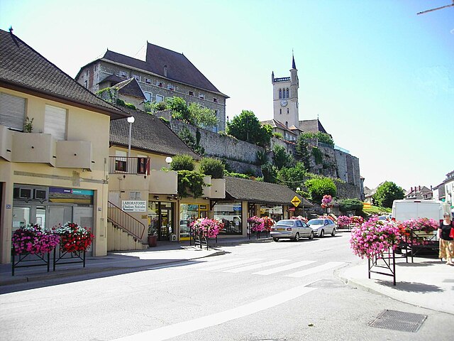
Hiking in Морестель
Morestel, a charming town in the Auvergne-Rhône-Alpes region of France, offers a variety of hiking opportunities that showcase its beautiful landscapes, historical sites, and natural surroundings. Here are some highlights for hiking in Morestel:...
- Страна:
- Почтовый код: 38510
- Координаты: 45° 40' 40" N, 5° 28' 12" E
- GPS треки (wikiloc): [Ссылка]
- Площадь: 8.03 кв.км
- Население: 4364
- Веб сайт: [Ссылка]
Groslée-Saint-Benoit
Hiking in Groslée-Saint-Benoit
Groslée-Saint-Benoît is a picturesque commune located in the Auvergne-Rhône-Alpes region of France. Known for its stunning natural landscapes, it offers a variety of hiking opportunities that attract outdoor enthusiasts....
- Страна:
- Почтовый код: 01680; 01300
- Координаты: 45° 41' 42" N, 5° 35' 14" E
- GPS треки (wikiloc): [Ссылка]
- Площадь: 28.92 кв.км

Везеронс-Кюртен
- коммуна во Франции
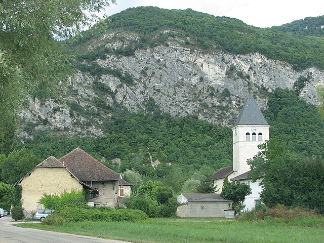
Hiking in Везеронс-Кюртен
Vézeronce-Curtin is a charming village located in the Auvergne-Rhône-Alpes region of France, known for its scenic landscapes and proximity to the beautiful natural areas surrounding it, including the Isère river valley. Here are some details about hiking in and around Vézeronce-Curtin:...
- Страна:
- Почтовый код: 38510
- Координаты: 45° 39' 2" N, 5° 28' 14" E
- GPS треки (wikiloc): [Ссылка]
- Высота над уровнем моря: 220 м m
- Площадь: 14.37 кв.км
- Население: 2065
- Веб сайт: [Ссылка]
Saint-Benoît
- коммуна во Франции
Hiking in Saint-Benoît
Saint-Benoît, located in the Ain department of France, offers a picturesque setting for hiking enthusiasts. Nestled in the foothills of the Jura Mountains, the area features a mix of lush forests, rolling hills, and stunning views of the surrounding landscape, making it an ideal location for both casual walkers and experienced hikers....
- Страна:
- Почтовый код: 01300
- Координаты: 45° 41' 40" N, 5° 35' 19" E
- GPS треки (wikiloc): [Ссылка]
- Площадь: 21.65 кв.км
- Население: 833


Сен-Виктор-де-Морестель
- коммуна во Франции
Hiking in Сен-Виктор-де-Морестель
Saint-Victor-de-Morestel, located in the Auvergne-Rhône-Alpes region of France, is a charming commune that offers various opportunities for hiking and outdoor activities. The surrounding landscape is characterized by rolling hills, forests, and beautiful views of the Alps in the distance....
- Страна:
- Почтовый код: 38510
- Координаты: 45° 41' 47" N, 5° 30' 12" E
- GPS треки (wikiloc): [Ссылка]
- Площадь: 13.13 кв.км
- Население: 1101
- Веб сайт: [Ссылка]

Верен-Тюэллен
- коммуна во Франции
Hiking in Верен-Тюэллен
Veyrins-Thuellin is a picturesque commune located in the Auvergne-Rhône-Alpes region of France. It offers several opportunities for hiking enthusiasts to enjoy the beautiful natural landscapes, rolling hills, and scenic views of the nearby mountains, particularly the Chartreuse and the Massif de Belledonne....
- Страна:
- Почтовый код: 38630
- Координаты: 45° 37' 32" N, 5° 32' 21" E
- GPS треки (wikiloc): [Ссылка]
- Высота над уровнем моря: 235 м m
- Площадь: 11.56 кв.км
- Население: 2060
- Веб сайт: [Ссылка]