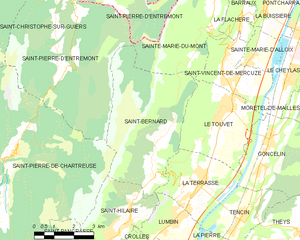
Ле-Туве (canton of Le Touvet, canton du Touvet)
 Hiking in Ле-Туве
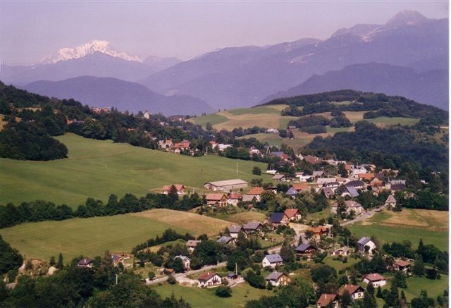
Canton du Touvet is a beautiful area located in the Chartreuse massif in the Auvergne-Rhône-Alpes region of France. It offers a variety of hiking opportunities surrounded by stunning alpine landscapes, rich flora and fauna, and breathtaking views of the surrounding mountains. Here are some highlights and tips for hiking in this region:
Hiking Trails
-
La Dent de Crolles: This is one of the most iconic hikes in the vicinity, providing spectacular panoramas. The trail can be challenging, with some steep sections, but the views from the summit make it worthwhile.
-
Népalais to Le Touvet: A moderate hike that takes you through lush forests and offers scenic vistas over the valley. It's suitable for families and those looking for a more leisurely hike.
-
Le Col de Belledonne: If you’re up for a longer trek, this trail leads through high alpine terrain with incredible views. It can be more technically demanding, so ensure you're well-prepared.
-
Gorges du Furon: This area features trails that take you through impressive gorges with beautiful rock formations and waterfalls. It’s a great option for a half-day hike.
Best Times to Hike
- The best hiking season is generally from late spring (May) to early autumn (September) when the weather is mild, and the trails are well-maintained. In winter, some trails might be inaccessible due to snow.
Tips for Hiking in Canton du Touvet
- Gear Up: Wear appropriate hiking shoes, as some trails can be rocky. Bring layers of clothing, as temperatures can vary significantly throughout the day.
- Stay Hydrated: Make sure to bring enough water, especially on longer hikes, and consider packing some snacks for energy.
- Trail Maps: It's recommended to have a good map or a GPS app, as some trails may not be well-marked.
- Wildlife Respect: This region is home to diverse fauna; be respectful of wildlife and adhere to local guidelines regarding interactions.
- Check Weather Conditions: Before you head out, check the local weather conditions and be prepared for changes.
Local Eco-Friendly Practices
Engaging in eco-friendly practices while hiking, such as leaving no trace, respecting wildlife, and using biodegradable products, is encouraged to help preserve the beauty of Canton du Touvet.
Overall, hiking in Canton du Touvet provides an enriching experience for nature lovers and adventure seekers alike, making it a must-visit destination in the French Alps.
- Страна:

- Столица: Ле-Туве
- Координаты: 45° 21' 45" N, 5° 56' 10" E


- GPS треки (wikiloc): [Ссылка]
- Хранилище Wikidata: Wikidata: Q1725838
- код кантона INSEE: [3834]
Включает регионы:

Шапареян
- коммуна во Франции
Hiking in Шапареян
Chapareillan is a charming commune located in the Auvergne-Rhône-Alpes region of France, known for its stunning natural landscapes and outdoor activities, including hiking. The area offers a variety of hiking trails suitable for different skill levels, making it a great destination for both beginners and experienced hikers....
- Страна:
- Почтовый код: 38530
- Координаты: 45° 27' 46" N, 5° 59' 28" E
- GPS треки (wikiloc): [Ссылка]
- Площадь: 30.28 кв.км
- Население: 2950
- Веб сайт: [Ссылка]


Ла-Флашер
- коммуна во Франции
Hiking in Ла-Флашер
La Flachère is a beautiful area located in the French Alps, specifically within the Savoie region. This region is renowned for its stunning landscapes, mountainous terrain, and diverse trails suitable for hikers of all skill levels....
- Страна:
- Почтовый код: 38530
- Координаты: 45° 23' 55" N, 5° 57' 47" E
- GPS треки (wikiloc): [Ссылка]
- Площадь: 2.85 кв.км
- Население: 479
- Веб сайт: [Ссылка]

Сен-Панкрасс
- коммуна во Франции
Hiking in Сен-Панкрасс
Saint-Pancrasse is a charming village located in the Isère department of the Auvergne-Rhône-Alpes region in southeastern France. Nestled in the foothills of the French Alps, it offers stunning scenery and a variety of hiking opportunities suitable for different skill levels....
- Страна:
- Почтовый код: 38660
- Координаты: 45° 17' 31" N, 5° 51' 35" E
- GPS треки (wikiloc): [Ссылка]
- Площадь: 6.71 кв.км
- Население: 442


Сент-Мари-д'Аллуа
- коммуна во Франции
Hiking in Сент-Мари-д'Аллуа
Sainte-Marie-d'Alloix is a charming village located in the French Alps, particularly well-known for its stunning natural landscapes and hiking opportunities. Here are some key aspects to consider when hiking in and around this area:...
- Страна:
- Почтовый код: 38660
- Координаты: 45° 22' 45" N, 5° 57' 59" E
- GPS треки (wikiloc): [Ссылка]
- Площадь: 3.04 кв.км
- Население: 482


Лембен
- коммуна во Франции
Hiking in Лембен
Lumbini, located in Nepal, is primarily known as the birthplace of Siddhartha Gautama, who became the Buddha. While it is mainly a pilgrimage site, it also offers a serene environment for hiking and exploring the natural beauty surrounding the area....
- Страна:
- Почтовый код: 38660
- Координаты: 45° 18' 24" N, 5° 54' 45" E
- GPS треки (wikiloc): [Ссылка]
- Площадь: 6.77 кв.км
- Население: 2143
- Веб сайт: [Ссылка]


Барро
Hiking in Барро
Barraux, a charming village located near Grenoble in the Isère department of France, offers several hiking opportunities that are suitable for different skill levels. The area is characterized by its beautiful natural scenery, including the nearby Chartreuse Mountains, which provide a stunning backdrop for outdoor activities....
- Страна:
- Почтовый код: 38530
- Координаты: 45° 26' 4" N, 5° 58' 40" E
- GPS треки (wikiloc): [Ссылка]
- Площадь: 11.13 кв.км
- Население: 1876
- Веб сайт: [Ссылка]


Сен-Венсан-де-Меркюз
- коммуна во Франции
Hiking in Сен-Венсан-де-Меркюз
Saint-Vincent-de-Mercuze, located in the Isère department of the Auvergne-Rhône-Alpes region in southeastern France, offers a variety of hiking opportunities amidst beautiful natural landscapes. Here are some highlights of hiking in this area:...
- Страна:
- Почтовый код: 38660
- Координаты: 45° 22' 27" N, 5° 56' 59" E
- GPS треки (wikiloc): [Ссылка]
- Площадь: 7.85 кв.км
- Население: 1481
- Веб сайт: [Ссылка]


Кроль
- коммуна во Франции
Hiking in Кроль
Crolles is a charming town located in the Auvergne-Rhône-Alpes region of France, nestled in the foothills of the Chartreuse mountains. It's a fantastic destination for hiking enthusiasts due to its stunning landscapes, diverse trails, and proximity to nature reserves....
- Страна:
- Почтовый код: 38920
- Координаты: 45° 17' 6" N, 5° 52' 58" E
- GPS треки (wikiloc): [Ссылка]
- Площадь: 14.21 кв.км
- Население: 8345
- Веб сайт: [Ссылка]

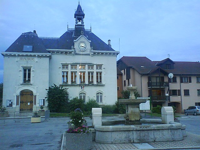
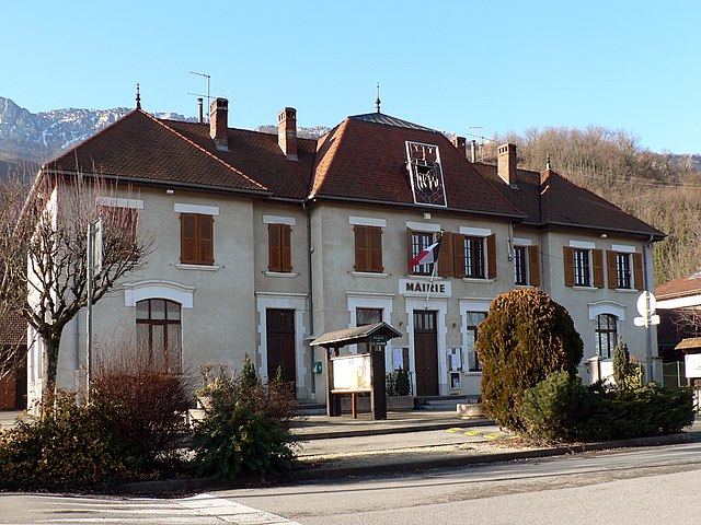
Ле-Туве
- коммуна во Франции
Hiking in Ле-Туве
Le Touvet is a charming village located in the French Alps, near the Belledonne mountain range, making it an excellent destination for hiking enthusiasts. The area offers a variety of trails that cater to different skill levels, from easy walks suitable for families to more challenging treks for experienced hikers....
- Страна:
- Почтовый код: 38660
- Координаты: 45° 21' 27" N, 5° 56' 53" E
- GPS треки (wikiloc): [Ссылка]
- Площадь: 11.56 кв.км
- Население: 3231
- Веб сайт: [Ссылка]

Ла-Бюисьер
- коммуна во Франции
Hiking in Ла-Бюисьер
La Buissière is a charming village located in France, often characterized by its scenic landscapes and proximity to nature, making it an excellent location for hiking enthusiasts. While the specific trails in La Buissière may not be widely documented, the surrounding regions typically offer various outdoor activities, including hiking paths that range from easy strolls to more challenging treks....
- Страна:
- Почтовый код: 38530
- Координаты: 45° 24' 9" N, 5° 58' 42" E
- GPS треки (wikiloc): [Ссылка]
- Площадь: 7.71 кв.км
- Население: 672
- Веб сайт: [Ссылка]

Сен-Бернар
Hiking in Сен-Бернар
Hiking in Saint-Bernard, Isère, offers numerous trails and breathtaking views that showcase the stunning landscape of the French Alps. The region is characterized by its diverse terrain, which includes mountains, forests, and valleys that provide a variety of hiking experiences for all skill levels....
- Страна:
- Почтовый код: 38660
- Координаты: 45° 19' 46" N, 5° 54' 12" E
- GPS треки (wikiloc): [Ссылка]
- Площадь: 21.59 кв.км
- Население: 623
- Веб сайт: [Ссылка]


Сент-Илер
Hiking in Сент-Илер
Saint-Hilaire, located in the Isère department of the Auvergne-Rhône-Alpes region in southeastern France, is a popular destination for hiking and outdoor activities. The area is renowned for its stunning landscapes, featuring a mix of mountains, forests, and scenic viewpoints, making it a fantastic spot for all levels of hikers....
- Страна:
- Почтовый код: 38660
- Координаты: 45° 18' 34" N, 5° 53' 14" E
- GPS треки (wikiloc): [Ссылка]
- Площадь: 8.61 кв.км
- Население: 1348
- Веб сайт: [Ссылка]


Сент-Мари-дю-Мон
Hiking in Сент-Мари-дю-Мон
Sainte-Marie-du-Mont is a charming village located in the Isère department of the Auvergne-Rhône-Alpes region in southeastern France. This area is known for its stunning natural landscapes and variety of outdoor activities, making it a great destination for hiking enthusiasts....
- Страна:
- Почтовый код: 38660
- Координаты: 45° 24' 22" N, 5° 56' 44" E
- GPS треки (wikiloc): [Ссылка]
- Площадь: 23.87 кв.км
- Население: 237
- Веб сайт: [Ссылка]


Ла-Террас
- коммуна во Франции
Hiking in Ла-Террас
La Terrasse is a charming town in the Auvergne-Rhône-Alpes region of France, known for its picturesque landscapes and access to various hiking trails. Here are some aspects to consider if you're planning to hike in La Terrasse:...
- Страна:
- Почтовый код: 38660
- Координаты: 45° 19' 25" N, 5° 55' 52" E
- GPS треки (wikiloc): [Ссылка]
- Площадь: 9.47 кв.км
- Население: 2567
- Веб сайт: [Ссылка]