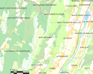
Ла-Террас (La Terrasse, La Terrasse)

- коммуна во Франции
 Hiking in Ла-Террас
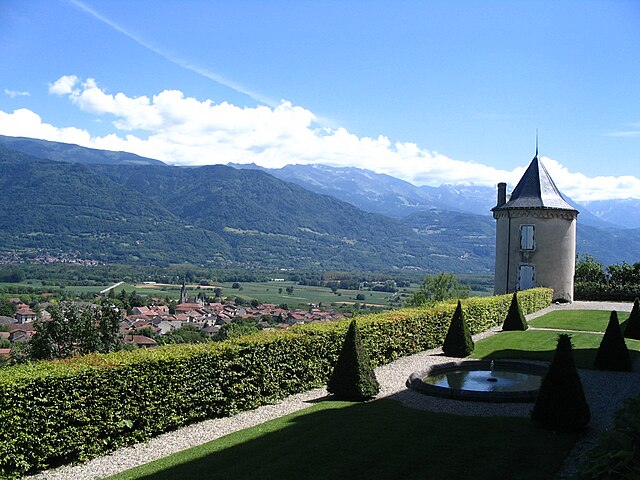
La Terrasse is a charming town in the Auvergne-Rhône-Alpes region of France, known for its picturesque landscapes and access to various hiking trails. Here are some aspects to consider if you're planning to hike in La Terrasse:
Hiking Trails
- Natural Diversity: The region boasts a variety of landscapes, from rolling hills to dense forests, offering trails suitable for both beginners and experienced hikers.
- Trail Difficulty: You can find trails with varying levels of difficulty. Be sure to check local maps or guides to find suitable routes based on your skill level.
- Nearby Trails: Many hikers use La Terrasse as a base to explore nearby areas, such as the Chartreuse Mountains and the Grésivaudan Valley, both of which offer stunning views and diverse trails.
Preparation
- Weather Conditions: Check the weather before heading out, as conditions can change rapidly in the mountains. The best times for hiking are usually late spring through early fall.
- Gear: Wear appropriate footwear and clothing. A good pair of hiking boots, comfortable clothing, and essentials like a map, water, snacks, and first aid supplies are crucial.
- Navigation: Familiarize yourself with the trails. Consider downloading offline maps or using a GPS device, as mobile service can be spotty in remote areas.
Safety
- Know Your Limits: Choose a route that aligns with your fitness level and experience.
- Wildlife Awareness: Be mindful of local wildlife. Familiarize yourself with the types of animals you might encounter and know how to react if you see them.
Local Amenities
- Accommodations: If you're looking to stay in La Terrasse, there are a variety of options, from hotels to guesthouses. Make reservations in advance, especially in peak seasons.
- Local Cuisine: Don’t miss the opportunity to enjoy local food after a long day of hiking. The region is known for its hearty mountain cuisine.
Community and Culture
- Engage with local hiking clubs or groups, which can enhance your experience by providing guided hikes and insights into the area’s ecology and history.
Whether you're looking for a leisurely stroll or a challenging hike, La Terrasse and its surroundings offer plenty of opportunities to enjoy nature and discover the beauty of the Auvergne-Rhône-Alpes region. Always remember to leave no trace and preserve the beauty of the area for future hikers!
- Страна:

- Почтовый код: 38660
- Координаты: 45° 19' 25" N, 5° 55' 52" E


- GPS треки (wikiloc): [Ссылка]
- Площадь: 9.47 кв.км
- Население: 2567
- Веб сайт: http://www.mairie-laterrasse.fr
- Википедия русская: wiki(ru)
- Википедия английская: wiki(en)
- Википедия национальная: wiki(fr)
- Хранилище Wikidata: Wikidata: Q815761
- Катеория в википедии: [Ссылка]
- код Freebase: [/m/09df8q]
- код GeoNames: Альт: [6455956]
- номер SIREN: [213805039]
- код BNF: [15258304c]
- код муниципалитета INSEE: 38503
Граничит с регионами:


Гонселен
- коммуна во Франции
Hiking in Гонселен
Goncelin is a small commune located in the Isère department in the Auvergne-Rhône-Alpes region of southeastern France. Nestled in the picturesque Belledonne mountain range, it offers various hiking opportunities that combine beautiful scenery, diverse landscapes, and the chance to explore the local flora and fauna....
- Страна:
- Почтовый код: 38570
- Координаты: 45° 20' 34" N, 5° 58' 45" E
- GPS треки (wikiloc): [Ссылка]
- Площадь: 14.36 кв.км
- Население: 2334
- Веб сайт: [Ссылка]


Тансен
- коммуна во Франции
Hiking in Тансен
Tencin, located in the Auvergne-Rhône-Alpes region of France near Grenoble, offers beautiful hiking opportunities amidst stunning natural landscapes. The area features diverse terrain, including hills, forests, and views of the Chartreuse Mountains, making it ideal for hikers of all skill levels....
- Страна:
- Почтовый код: 38570
- Координаты: 45° 18' 34" N, 5° 57' 37" E
- GPS треки (wikiloc): [Ссылка]
- Площадь: 6.75 кв.км
- Население: 1984
- Веб сайт: [Ссылка]


Лембен
- коммуна во Франции
Hiking in Лембен
Lumbini, located in Nepal, is primarily known as the birthplace of Siddhartha Gautama, who became the Buddha. While it is mainly a pilgrimage site, it also offers a serene environment for hiking and exploring the natural beauty surrounding the area....
- Страна:
- Почтовый код: 38660
- Координаты: 45° 18' 24" N, 5° 54' 45" E
- GPS треки (wikiloc): [Ссылка]
- Площадь: 6.77 кв.км
- Население: 2143
- Веб сайт: [Ссылка]

Ле-Туве
- коммуна во Франции
Hiking in Ле-Туве
Le Touvet is a charming village located in the French Alps, near the Belledonne mountain range, making it an excellent destination for hiking enthusiasts. The area offers a variety of trails that cater to different skill levels, from easy walks suitable for families to more challenging treks for experienced hikers....
- Страна:
- Почтовый код: 38660
- Координаты: 45° 21' 27" N, 5° 56' 53" E
- GPS треки (wikiloc): [Ссылка]
- Площадь: 11.56 кв.км
- Население: 3231
- Веб сайт: [Ссылка]

Сен-Бернар
Hiking in Сен-Бернар
Hiking in Saint-Bernard, Isère, offers numerous trails and breathtaking views that showcase the stunning landscape of the French Alps. The region is characterized by its diverse terrain, which includes mountains, forests, and valleys that provide a variety of hiking experiences for all skill levels....
- Страна:
- Почтовый код: 38660
- Координаты: 45° 19' 46" N, 5° 54' 12" E
- GPS треки (wikiloc): [Ссылка]
- Площадь: 21.59 кв.км
- Население: 623
- Веб сайт: [Ссылка]


Сент-Илер
Hiking in Сент-Илер
Saint-Hilaire, located in the Isère department of the Auvergne-Rhône-Alpes region in southeastern France, is a popular destination for hiking and outdoor activities. The area is renowned for its stunning landscapes, featuring a mix of mountains, forests, and scenic viewpoints, making it a fantastic spot for all levels of hikers....
- Страна:
- Почтовый код: 38660
- Координаты: 45° 18' 34" N, 5° 53' 14" E
- GPS треки (wikiloc): [Ссылка]
- Площадь: 8.61 кв.км
- Население: 1348
- Веб сайт: [Ссылка]