.jpg)
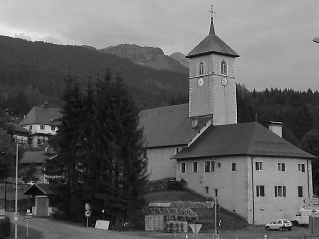
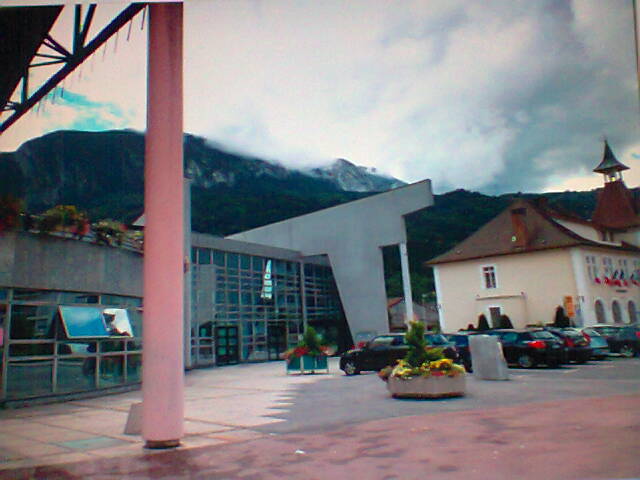
Клюз (Cluses, Cluses)

- коммуна во Франции
 Hiking in Клюз
Cluses, located in the Haute-Savoie region of France, is a beautiful destination for hiking enthusiasts. Nestled in the heart of the Alps, it offers a variety of trails that cater to different skill levels and preferences. Here’s what you can expect when hiking in and around Cluses:
Scenery and Terrain
- Mountain Views: The area is surrounded by stunning alpine scenery, including majestic peaks, lush valleys, and picturesque landscapes.
- Diverse Trails: You can find trails ranging from easy walks suitable for families to challenging alpine hikes that require more experience and preparation.
Popular Hiking Routes
- Le Mont d'Arbois: A moderate hike offering panoramic views of the Mont Blanc massif. This trail is suitable for experienced hikers and provides a rewarding summit experience.
- Les Fiz Mountains: A well-known area for various hiking trails, where you can explore alpine meadows, glacial lakes, and breathtaking vistas.
- Col de la Colombière: This area offers routes that vary in difficulty, with stunning views, particularly in summer when the wildflowers are in bloom.
Practical Tips
- Season: Summer is the most popular time for hiking, but fall can also offer beautiful foliage. Winter sports and snowshoeing are available in the colder months.
- Local Resources: The tourist office in Cluses can provide maps and information about current trail conditions, guided hikes, and local highlights.
- Safety: Always check weather forecasts before setting out, carry enough water and snacks, and wear appropriate hiking gear. Some trails may require proper hiking boots and equipment.
Additional Activities
Beyond hiking, Cluses is close to several outdoor activities, including mountain biking, rock climbing, and skiing in the winter. The area is also rich in local culture, so consider taking time to explore the town and its historial sites.
Overall, Cluses serves as an excellent base for exploring the stunning landscapes of the French Alps, making it a great choice for both casual walkers and experienced hikers alike!
- Страна:

- Почтовый код: 74300
- Координаты: 46° 3' 37" N, 6° 34' 43" E


- GPS треки (wikiloc): [Ссылка]
- Площадь: 10.46 кв.км
- Население: 17538
- Веб сайт: http://www.cluses.fr
- Википедия английская: wiki(en)
- Википедия национальная: wiki(fr)
- Хранилище Wikidata: Wikidata: Q654153
- Катеория в википедии: [Ссылка]
- код Freebase: [/m/08sff_]
- код GeoNames: Альт: [3024532]
- номер SIREN: [217400811]
- код BNF: [15274340p]
- код VIAF: Альт: [132083729]
- код GND: Альт: [5094124-0]
- код LCNAF: Альт: [n80158558]
- код темы Quora: [Cluses]
- код муниципалитета INSEE: 74081
Граничит с регионами:


Magland
- коммуна во Франции
Hiking in Magland
Magland, located in the Haute-Savoie region of France, is a beautiful destination for hiking enthusiasts. Nestled in the heart of the French Alps, this charming village offers stunning views, diverse terrains, and a range of hiking trails suitable for all skill levels. Here’s what you need to know about hiking in Magland:...
- Страна:
- Почтовый код: 74300
- Координаты: 46° 1' 19" N, 6° 37' 11" E
- GPS треки (wikiloc): [Ссылка]
- Площадь: 40.32 кв.км
- Население: 3301
- Веб сайт: [Ссылка]


Nancy-sur-Cluses
- коммуна во Франции
Hiking in Nancy-sur-Cluses
Nancy-sur-Cluses is a picturesque village located in the Haute-Savoie region of the French Alps, offering a variety of hiking opportunities for outdoor enthusiasts. The area's stunning mountainous landscapes, lush green valleys, and charming alpine atmosphere make it an appealing destination for hikers of all levels. Here are some highlights about hiking in Nancy-sur-Cluses:...
- Страна:
- Почтовый код: 74300
- Координаты: 46° 2' 36" N, 6° 34' 39" E
- GPS треки (wikiloc): [Ссылка]
- Площадь: 14.22 кв.км
- Население: 429
- Веб сайт: [Ссылка]

Arâches-la-Frasse
- коммуна во Франции
Hiking in Arâches-la-Frasse
Arâches-la-Frasse is a charming commune located in the Haute-Savoie region of the French Alps. It is known for its stunning landscapes and proximity to the Grand Massif ski area, which also offers numerous hiking opportunities during the warmer months....
- Страна:
- Почтовый код: 74300
- Координаты: 46° 2' 36" N, 6° 37' 53" E
- GPS треки (wikiloc): [Ссылка]
- Площадь: 37.69 кв.км
- Население: 1928

Scionzier
- коммуна во Франции
Hiking in Scionzier
Scionzier, located in the Haute-Savoie region of France, benefits from its proximity to the stunning French Alps, making it a great starting point for various hiking adventures. The area offers diverse trails suitable for different skill levels, from leisurely walks to more challenging treks....
- Страна:
- Почтовый код: 74950
- Координаты: 46° 3' 26" N, 6° 33' 0" E
- GPS треки (wikiloc): [Ссылка]
- Площадь: 10.62 кв.км
- Население: 8457
- Веб сайт: [Ссылка]


Châtillon-sur-Cluses
- коммуна во Франции
Hiking in Châtillon-sur-Cluses
Châtillon-sur-Cluses is a picturesque village in the Haute-Savoie region of France, nestled in the Alps. It provides a beautiful backdrop for hiking enthusiasts, offering a variety of trails that cater to different levels of experience. Here are some details about hiking in and around Châtillon-sur-Cluses:...
- Страна:
- Почтовый код: 74300
- Координаты: 46° 5' 14" N, 6° 34' 57" E
- GPS треки (wikiloc): [Ссылка]
- Площадь: 9.18 кв.км
- Население: 1258


Thyez
- коммуна во Франции
Hiking in Thyez
Thyez is a small commune located in the Haute-Savoie department in the Auvergne-Rhône-Alpes region of France. While it may not be as widely known for hiking as some of its neighboring areas, it is still surrounded by beautiful landscapes and offers opportunities for outdoor enthusiasts....
- Страна:
- Почтовый код: 74300
- Координаты: 46° 5' 1" N, 6° 32' 28" E
- GPS треки (wikiloc): [Ссылка]
- Площадь: 9.81 кв.км
- Население: 6011
- Веб сайт: [Ссылка]


Saint-Sigismond
- коммуна во Франции
Hiking in Saint-Sigismond
Saint-Sigismond, located in the Haute-Savoie region of the French Alps, offers a delightful experience for hikers and nature enthusiasts. This area is characterized by its stunning mountainous landscapes, lush greenery, and a variety of trails suitable for different skill levels. Here are some key points about hiking in Saint-Sigismond:...
- Страна:
- Почтовый код: 74300
- Координаты: 46° 4' 20" N, 6° 36' 52" E
- GPS треки (wikiloc): [Ссылка]
- Площадь: 7.92 кв.км
- Население: 595
- Веб сайт: [Ссылка]