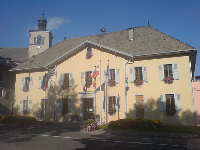
Châtillon-sur-Cluses (Châtillon-sur-Cluses)

- коммуна во Франции
 Hiking in Châtillon-sur-Cluses
Châtillon-sur-Cluses is a picturesque village in the Haute-Savoie region of France, nestled in the Alps. It provides a beautiful backdrop for hiking enthusiasts, offering a variety of trails that cater to different levels of experience. Here are some details about hiking in and around Châtillon-sur-Cluses:
Trail Options
-
Local Trails: There are several marked trails that start right in Châtillon-sur-Cluses, leading you through lush forests, past picturesque pastures, and offering stunning views of the surrounding mountains.
-
Sentier des Diligences: This historical trail connects Châtillon-sur-Cluses to neighboring villages, allowing hikers to explore the area while learning about its history. The path usually is gentle and suitable for families.
-
Higher Elevation Trails: If you're looking for more challenging hikes, you can explore trails that lead to higher altitudes, like the routes to the nearby Mont de Grange or the Col de la Ramaz. These trails will reward you with breathtaking panoramic views of the Mont Blanc Massif and the surrounding Alps.
Preparation and Safety
- Weather: Always check the weather conditions before setting out, as alpine weather can change rapidly.
- Gear: Wear sturdy hiking boots, and bring plenty of water, snacks, a map, and a first-aid kit.
- Guided Tours: If you're unfamiliar with the area, consider joining a guided hike. Local guides can provide insights into the natural environment and ensure that you stay safe on the trails.
Best Time to Hike
The best times to hike in Châtillon-sur-Cluses are typically during the late spring to early autumn months, from May to October. During these months, the weather is generally more stable, the trails are accessible, and the scenery is vibrant.
Additional Activities
In addition to hiking, the area offers various outdoor activities, such as mountain biking, paragliding, and in winter, skiing and snowshoeing in nearby resorts.
Conclusion
Overall, Châtillon-sur-Cluses is an excellent base for hiking, whether you are a beginner or an experienced hiker. Make sure to immerse yourself in the stunning Alpine scenery and enjoy the tranquility of this beautiful region.
- Страна:

- Почтовый код: 74300
- Координаты: 46° 5' 14" N, 6° 34' 57" E


- GPS треки (wikiloc): [Ссылка]
- Площадь: 9.18 кв.км
- Население: 1258
- Википедия английская: wiki(en)
- Википедия национальная: wiki(fr)
- Хранилище Wikidata: Wikidata: Q829210
- Катеория в википедии: [Ссылка]
- код Freebase: [/m/03nty0_]
- код GeoNames: Альт: [6451036]
- номер SIREN: [217400647]
- код BNF: [152743233]
- код муниципалитета INSEE: 74064
Граничит с регионами:

Taninges
- коммуна во Франции
Hiking in Taninges
Taninges, located in the Haute-Savoie region of the French Alps, is an excellent destination for hiking enthusiasts. The area is known for its breathtaking landscapes, including majestic mountains, lush valleys, and beautiful alpine meadows. Here are some highlights and tips for hiking in and around Taninges:...
- Страна:
- Почтовый код: 74440
- Координаты: 46° 6' 27" N, 6° 35' 29" E
- GPS треки (wikiloc): [Ссылка]
- Площадь: 42.66 кв.км
- Население: 3410

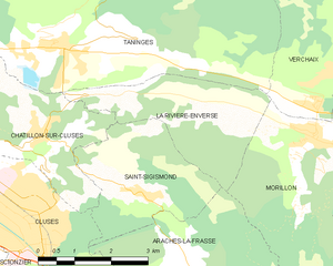
La Rivière-Enverse
- коммуна во Франции
Hiking in La Rivière-Enverse
La Rivière-Enverse is a picturesque village located in the Haute-Savoie region of France, offering stunning scenery and a range of hiking opportunities. Nestled in the French Alps, this area boasts a mix of lush valleys, dramatic peaks, and tranquil rivers. Here’s what you need to know about hiking in and around La Rivière-Enverse:...
- Страна:
- Почтовый код: 74440
- Координаты: 46° 5' 34" N, 6° 38' 11" E
- GPS треки (wikiloc): [Ссылка]
- Площадь: 7.98 кв.км
- Население: 457


Клюз
- коммуна во Франции
Hiking in Клюз
Cluses, located in the Haute-Savoie region of France, is a beautiful destination for hiking enthusiasts. Nestled in the heart of the Alps, it offers a variety of trails that cater to different skill levels and preferences. Here’s what you can expect when hiking in and around Cluses:...
- Страна:
- Почтовый код: 74300
- Координаты: 46° 3' 37" N, 6° 34' 43" E
- GPS треки (wikiloc): [Ссылка]
- Площадь: 10.46 кв.км
- Население: 17538
- Веб сайт: [Ссылка]


Mieussy
- коммуна во Франции
Hiking in Mieussy
Mieussy, located in the Haute-Savoie region of the French Alps, offers a variety of hiking opportunities that cater to different skill levels and preferences. Here are some highlights of hiking in Mieussy:...
- Страна:
- Почтовый код: 74440
- Координаты: 46° 8' 3" N, 6° 31' 22" E
- GPS треки (wikiloc): [Ссылка]
- Площадь: 44.45 кв.км
- Население: 2327
- Веб сайт: [Ссылка]


Thyez
- коммуна во Франции
Hiking in Thyez
Thyez is a small commune located in the Haute-Savoie department in the Auvergne-Rhône-Alpes region of France. While it may not be as widely known for hiking as some of its neighboring areas, it is still surrounded by beautiful landscapes and offers opportunities for outdoor enthusiasts....
- Страна:
- Почтовый код: 74300
- Координаты: 46° 5' 1" N, 6° 32' 28" E
- GPS треки (wikiloc): [Ссылка]
- Площадь: 9.81 кв.км
- Население: 6011
- Веб сайт: [Ссылка]


Saint-Sigismond
- коммуна во Франции
Hiking in Saint-Sigismond
Saint-Sigismond, located in the Haute-Savoie region of the French Alps, offers a delightful experience for hikers and nature enthusiasts. This area is characterized by its stunning mountainous landscapes, lush greenery, and a variety of trails suitable for different skill levels. Here are some key points about hiking in Saint-Sigismond:...
- Страна:
- Почтовый код: 74300
- Координаты: 46° 4' 20" N, 6° 36' 52" E
- GPS треки (wikiloc): [Ссылка]
- Площадь: 7.92 кв.км
- Население: 595
- Веб сайт: [Ссылка]