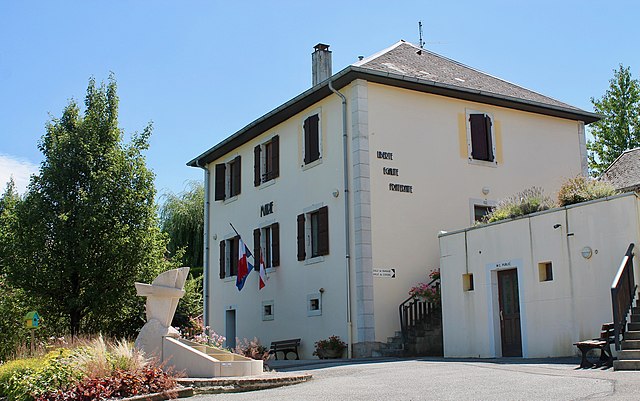
Hauteville-sur-Fier (Hauteville-sur-Fier)

- коммуна во Франции
 Hiking in Hauteville-sur-Fier
Hauteville-sur-Fier, located in the Auvergne-Rhône-Alpes region of France, offers a variety of hiking opportunities that appeal to outdoor enthusiasts. The area is characterized by its stunning natural landscapes, rolling hills, and proximity to the beautiful Lake Bourget.
Trails and Scenery
- Hiking Trails: While Hauteville-sur-Fier may not have extensive trekking routes directly within its boundaries, the nearby mountains and valleys, such as the Bauges and the Chartreuse, provide numerous trails for varying skill levels.
- Scenic Views: Hikes in this region often afford breathtaking views of the surrounding foothills, forests, and agricultural lands. Keep an eye out for the fauna and flora native to the area.
Accessibility
- Trail Difficulty: You can find trails that cater to both casual walkers and experienced hikers. It's advisable to check local maps and guides that detail the trails and their respective difficulties.
- Getting There: Hauteville-sur-Fier is accessible by road, and parking may be available at common trailheads.
Best Time to Hike
- Season: Late spring through early autumn is usually the best time for hiking, when the weather is mild and the trails are in good condition. However, late summer can be quite warm, so hydration and sun protection are essential.
Recommendations
- Local Guidance: Consider reaching out to local tourism offices or hiking clubs for information about guided hikes or organized events.
- Preparation: Always plan ahead, check the weather forecast, and carry proper gear, including a map, water, snacks, and a first aid kit.
Whether you're taking a leisurely stroll or embarking on a more challenging trek, hiking in and around Hauteville-sur-Fier can be a rewarding way to experience the beauty of this region of France.
- Страна:

- Почтовый код: 74150
- Координаты: 45° 54' 13" N, 5° 58' 30" E


- GPS треки (wikiloc): [Ссылка]
- Площадь: 4.9 кв.км
- Население: 922
- Веб сайт: http://www.hautevillesurfier.fr
- Википедия английская: wiki(en)
- Википедия национальная: wiki(fr)
- Хранилище Wikidata: Wikidata: Q845826
- Катеория в википедии: [Ссылка]
- код Freebase: [/m/03ntxp_]
- код GeoNames: Альт: [6442963]
- номер SIREN: [217401413]
- код BNF: [15274399b]
- код муниципалитета INSEE: 74141
Граничит с регионами:

Vaulx
Hiking in Vaulx
Vaulx is a charming village located in the Haute-Savoie region of the French Alps, known for its stunning natural landscapes and proximity to the majestic mountains. Hiking in this area can be a delightful experience for both beginners and seasoned hikers....
- Страна:
- Почтовый код: 74150
- Координаты: 45° 55' 48" N, 5° 59' 44" E
- GPS треки (wikiloc): [Ссылка]
- Площадь: 11.19 кв.км
- Население: 952
- Веб сайт: [Ссылка]


Étercy
- коммуна во Франции
Hiking in Étercy
Étercy seems to be a lesser-known location, and as of my last update, there isn’t extensive information specifically on hiking routes or trails there. However, if Étercy is a place you’re interested in hiking, I can offer general tips and advice that may be helpful for hiking in any new area:...
- Страна:
- Почтовый код: 74150
- Координаты: 45° 53' 27" N, 6° 0' 34" E
- GPS треки (wikiloc): [Ссылка]
- Площадь: 4.55 кв.км
- Население: 788


Sales
- коммуна во Франции
Hiking in Sales
Sales, located in the Haute-Savoie region of the French Alps, offers an array of hiking opportunities set against a stunning mountainous backdrop. This area is known for its picturesque villages, lush landscapes, and accessible trails suitable for various skill levels. Here are some highlights and tips for hiking in Sales:...
- Страна:
- Почтовый код: 74150
- Координаты: 45° 52' 30" N, 5° 57' 37" E
- GPS треки (wikiloc): [Ссылка]
- Площадь: 9.21 кв.км
- Население: 1881
- Веб сайт: [Ссылка]


Marcellaz-Albanais
- коммуна во Франции
Hiking in Marcellaz-Albanais
Marcellaz-Albanais is a charming commune located in the Haute-Savoie department in the Auvergne-Rhône-Alpes region of southeastern France. Nestled in the foothills of the Alps, it offers beautiful landscapes and a variety of hiking opportunities for outdoor enthusiasts....
- Страна:
- Почтовый код: 74150
- Координаты: 45° 52' 29" N, 6° 0' 4" E
- GPS треки (wikiloc): [Ссылка]
- Площадь: 14.54 кв.км
- Население: 1861
- Веб сайт: [Ссылка]


Vallières
- коммуна во Франции
Hiking in Vallières
Vallières, located in Haute-Savoie, offers a stunning backdrop for hiking enthusiasts. Nestled in the French Alps, this region is known for its picturesque landscapes, including lush valleys, rugged mountains, and charming alpine villages. Here are some key points to consider when hiking in Vallières:...
- Страна:
- Почтовый код: 74150
- Координаты: 45° 54' 1" N, 5° 56' 10" E
- GPS треки (wikiloc): [Ссылка]
- Площадь: 9.03 кв.км
- Население: 1781


Saint-Eusèbe
- коммуна во Франции
Hiking in Saint-Eusèbe
Saint-Eusèbe, located in the Haute-Savoie region of the French Alps, offers beautiful hiking opportunities with stunning views of the surrounding mountains and valleys. Here are some key points to consider if you're planning a hike in this area:...
- Страна:
- Почтовый код: 74150
- Координаты: 45° 55' 46" N, 5° 57' 46" E
- GPS треки (wikiloc): [Ссылка]
- Площадь: 6.88 кв.км
- Население: 525