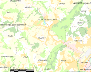
Vaulx (Vaulx)

 Hiking in Vaulx
Vaulx is a charming village located in the Haute-Savoie region of the French Alps, known for its stunning natural landscapes and proximity to the majestic mountains. Hiking in this area can be a delightful experience for both beginners and seasoned hikers.
Key Highlights for Hiking in Vaulx:
-
Scenic Trails: The region offers a range of hiking trails that vary in difficulty and length. You'll find paths that take you through lush forests, past alpine meadows, and up to panoramic viewpoints that showcase the breathtaking landscapes of the Alps.
-
Accessibility: Vaulx is positioned conveniently, making it easy to access trails leading to nearby peaks such as Mont Blanc or the Aravis Range. Depending on the season, you can find well-marked hiking routes.
-
Wildlife and Flora: The area is rich in biodiversity, and hikers may encounter various species of wildlife, including deer, chamois, and numerous bird species. The flora is also diverse, with wildflowers blooming in summer and vibrant fall colors.
-
Seasonal Considerations: The best time for hiking in Vaulx is typically from late spring to early fall. In winter, certain trails may be covered in snow, making them difficult or dangerous to navigate without appropriate gear.
-
Local Guidance: For those unfamiliar with the area or seeking a more immersive experience, it may be beneficial to hire a local guide who can provide insights into the terrain, safety tips, and enhance your overall hiking experience.
-
Cultural Experience: Hiking in Vaulx also allows you to immerse yourself in local culture. Take the time to enjoy some traditional Savoyard cuisine in nearby villages after your hikes, and explore the rich history of the region.
Recommended Trails:
- Col de la Croix Fry: A moderate hike that rewards you with panoramic views of the surrounding mountains.
- Lac de l'Accoire: A picturesque lake hike that is great for families and offers a serene atmosphere.
- Sentier des Pèlerins: A more challenging route that follows paths historically used by pilgrims, adding a historical dimension to your hike.
Preparation Tips:
- Equipment: Make sure to wear sturdy hiking shoes, carry plenty of water, snacks, and sun protection. A map or a navigation app can be handy.
- Weather Awareness: The weather can change rapidly in the mountains, so check forecasts before heading out and be prepared for sudden changes.
Enjoy your hiking adventures in Vaulx and embrace the beauty of the Haute-Savoie region!
- Страна:

- Почтовый код: 74150
- Координаты: 45° 55' 48" N, 5° 59' 44" E


- GPS треки (wikiloc): [Ссылка]
- Площадь: 11.19 кв.км
- Население: 952
- Веб сайт: http://www.vaulx74.fr
- Википедия английская: wiki(en)
- Википедия национальная: wiki(fr)
- Хранилище Wikidata: Wikidata: Q284988
- Катеория в википедии: [Ссылка]
- код Freebase: [/m/03ntzq8]
- код GeoNames: Альт: [6454675]
- номер SIREN: [217402924]
- код BNF: [15274545z]
- код муниципалитета INSEE: 74292
Граничит с регионами:


Étercy
- коммуна во Франции
Hiking in Étercy
Étercy seems to be a lesser-known location, and as of my last update, there isn’t extensive information specifically on hiking routes or trails there. However, if Étercy is a place you’re interested in hiking, I can offer general tips and advice that may be helpful for hiking in any new area:...
- Страна:
- Почтовый код: 74150
- Координаты: 45° 53' 27" N, 6° 0' 34" E
- GPS треки (wikiloc): [Ссылка]
- Площадь: 4.55 кв.км
- Население: 788


Nonglard
- коммуна во Франции
Hiking in Nonglard
Nonglard is not widely recognized in popular hiking destinations, so it may refer to a less-known area or community. However, if you are looking for hiking opportunities in a specific region such as a national park, forest reserve, or mountainous area in or near Nonglard, please provide more details....
- Страна:
- Почтовый код: 74330
- Координаты: 45° 55' 5" N, 6° 1' 10" E
- GPS треки (wikiloc): [Ссылка]
- Площадь: 4.12 кв.км
- Население: 608
- Веб сайт: [Ссылка]


Lovagny
- коммуна во Франции
Hiking in Lovagny
Lovagny, located in the Haute-Savoie region of France, is a picturesque destination for hiking enthusiasts. Nestled near the edge of the French Alps and close to Annecy, it offers a variety of trails suitable for different skill levels, from leisurely walks to challenging hikes....
- Страна:
- Почтовый код: 74330
- Координаты: 45° 54' 15" N, 6° 1' 59" E
- GPS треки (wikiloc): [Ссылка]
- Площадь: 5.55 кв.км
- Население: 1248
- Веб сайт: [Ссылка]


Hauteville-sur-Fier
- коммуна во Франции
Hiking in Hauteville-sur-Fier
Hauteville-sur-Fier, located in the Auvergne-Rhône-Alpes region of France, offers a variety of hiking opportunities that appeal to outdoor enthusiasts. The area is characterized by its stunning natural landscapes, rolling hills, and proximity to the beautiful Lake Bourget....
- Страна:
- Почтовый код: 74150
- Координаты: 45° 54' 13" N, 5° 58' 30" E
- GPS треки (wikiloc): [Ссылка]
- Площадь: 4.9 кв.км
- Население: 922
- Веб сайт: [Ссылка]

Sillingy
- коммуна во Франции
Hiking in Sillingy
Sillingy, located in the Haute-Savoie region of France, offers a variety of hiking opportunities for outdoor enthusiasts. Nestled near the picturesque Annecy and surrounded by the stunning Alps, Sillingy provides breathtaking views and a range of trails suitable for different skill levels....
- Страна:
- Почтовый код: 74330
- Координаты: 45° 56' 45" N, 6° 2' 7" E
- GPS треки (wikiloc): [Ссылка]
- Площадь: 14.84 кв.км
- Население: 5045
- Веб сайт: [Ссылка]


Thusy
- коммуна во Франции
Hiking in Thusy
Thusy is a picturesque village located in the Haute-Savoie region of the French Alps. It serves as an excellent base for hikers seeking both stunning landscapes and a variety of trails. Here are some highlights and information about hiking in the Thusy area:...
- Страна:
- Почтовый код: 74150
- Координаты: 45° 56' 51" N, 5° 56' 56" E
- GPS треки (wikiloc): [Ссылка]
- Площадь: 10.74 кв.км
- Население: 1076
- Веб сайт: [Ссылка]


Saint-Eusèbe
- коммуна во Франции
Hiking in Saint-Eusèbe
Saint-Eusèbe, located in the Haute-Savoie region of the French Alps, offers beautiful hiking opportunities with stunning views of the surrounding mountains and valleys. Here are some key points to consider if you're planning a hike in this area:...
- Страна:
- Почтовый код: 74150
- Координаты: 45° 55' 46" N, 5° 57' 46" E
- GPS треки (wikiloc): [Ссылка]
- Площадь: 6.88 кв.км
- Население: 525