Jarrier (Jarrier)

- коммуна во Франции
 Hiking in Jarrier
Jarrier is a picturesque village located in the Savoie region of the French Alps, nestled at an altitude of around 1,500 meters. It's an excellent base for hiking enthusiasts, offering stunning views, diverse trails, and a chance to experience the natural beauty of the Alps.
Hiking Trails
-
Col du Glandon: This popular route takes you to the Col de Glandon, providing breathtaking panoramic views of the surrounding peaks. It's a moderate hike and offers options for extending your trek.
-
Le Grand Lac: A beautiful hike that leads you to the Grand Lac, perfect for a relaxing picnic. The trail can be a bit steep in sections, but the scenery is worth the effort.
-
Les Aiguilles d'Arves: More challenging hikes can be found near the Aiguilles d'Arves range. The paths here offer a good mix of difficulties and stunning views.
-
Circuit des 7 lacs: This circuit takes you past several mountain lakes, showcasing the serene beauty of the alpine landscape. It's a fantastic option for those wanting to enjoy multiple scenic spots in one hike.
Tips for Hiking in Jarrier
- Weather: Always check the weather before setting out, as conditions can change quickly in the mountains.
- Gear: Wear sturdy hiking boots and bring appropriate clothing layers, as temperatures can vary at different altitudes.
- Hydration and Nutrition: Carry enough water and snacks to keep your energy up during your hikes.
- Navigation: Familiarize yourself with the trails and carry a map or a GPS device, as some paths may not be well marked.
Best Times to Hike
The best time to hike in Jarrier is typically from late spring to early autumn (May to October) when the weather is more stable, and the trails are generally clearer of snow.
Hiking in Jarrier can be a rewarding experience, allowing you to immerse yourself in the stunning alpine scenery and enjoy the tranquility of the French Alps. Always remember to follow local guidelines and practice Leave No Trace principles to preserve the natural beauty of the area.
- Страна:

- Почтовый код: 73300
- Координаты: 45° 16' 49" N, 6° 19' 0" E


- GPS треки (wikiloc): [Ссылка]
- Площадь: 17.79 кв.км
- Население: 497
- Веб сайт: http://www.jarrier.fr/
- Википедия английская: wiki(en)
- Википедия национальная: wiki(fr)
- Хранилище Wikidata: Wikidata: Q1222495
- Катеория в википедии: [Ссылка]
- код Freebase: [/m/03qlml0]
- код GeoNames: Альт: [6442809]
- номер SIREN: [217301381]
- код BNF: [152740714]
- код тезауруса PACTOLS: [pcrtDqwEAi8lSi]
- WOEID: [595445]
- код муниципалитета INSEE: 73138
Граничит с регионами:


Saint-Alban-des-Villards
- коммуна во Франции
Hiking in Saint-Alban-des-Villards
Saint-Alban-des-Villards is a charming village located in the French Alps, specifically in the Savoie department of the Auvergne-Rhône-Alpes region. Hiking in this area offers stunning views, diverse landscapes, and a variety of trails suitable for different skill levels. Here are some highlights and tips for hiking in and around Saint-Alban-des-Villards:...
- Страна:
- Почтовый код: 73130
- Координаты: 45° 18' 33" N, 6° 14' 57" E
- GPS треки (wikiloc): [Ссылка]
- Площадь: 24.02 кв.км
- Население: 103

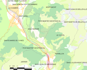
Pontamafrey-Montpascal
- коммуна во Франции
Hiking in Pontamafrey-Montpascal
Pontamafrey-Montpascal is a scenic area in the Savoie region of France, known for its beautiful landscapes, diverse trails, and rich natural flora and fauna. While specific trails can vary, here are some general guidelines and tips for hiking in this region:...
- Страна:
- Почтовый код: 73300
- Координаты: 45° 18' 45" N, 6° 20' 29" E
- GPS треки (wikiloc): [Ссылка]
- Площадь: 11.59 кв.км
- Население: 312
- Веб сайт: [Ссылка]


Сен-Жан-де-Морьен
- коммуна во Франции
Hiking in Сен-Жан-де-Морьен
Saint-Jean-de-Maurienne, located in the Savoie region of the French Alps, is a fantastic destination for hiking enthusiasts, offering a mix of stunning natural landscapes, rich cultural heritage, and a variety of trails suitable for different skill levels....
- Страна:
- Почтовый код: 73300
- Координаты: 45° 16' 36" N, 6° 20' 42" E
- GPS треки (wikiloc): [Ссылка]
- Площадь: 11.51 кв.км
- Население: 7809
- Веб сайт: [Ссылка]
Saint-Pancrace, Savoie
Hiking in Saint-Pancrace, Savoie
Saint-Pancrace, located in the Savoie region of the French Alps, offers a variety of hiking experiences that are suitable for a wide range of skill levels. The breathtaking scenery, characterized by alpine meadows, dense forests, and stunning mountain views, make it an attractive destination for outdoor enthusiasts. Here’s what you need to know about hiking in this area:...
- Страна:
- Почтовый код: 73300
- Координаты: 45° 16' 11" N, 6° 19' 32" E
- GPS треки (wikiloc): [Ссылка]
- Площадь: 5.59 кв.км
- Население: 295

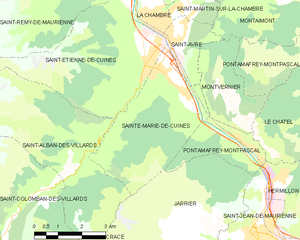
Sainte-Marie-de-Cuines
- коммуна во Франции
Hiking in Sainte-Marie-de-Cuines
Sainte-Marie-de-Cuines is a beautiful destination for hiking enthusiasts, nestled in the Auvergne-Rhône-Alpes region of France, specifically in Savoie. The area offers breathtaking landscapes, from rolling hills to the majestic alpine terrain, making it ideal for various hiking levels. Here are some highlights and tips for hiking in this region:...
- Страна:
- Почтовый код: 73130
- Координаты: 45° 20' 24" N, 6° 18' 6" E
- GPS треки (wikiloc): [Ссылка]
- Площадь: 14.95 кв.км
- Население: 812
- Веб сайт: [Ссылка]