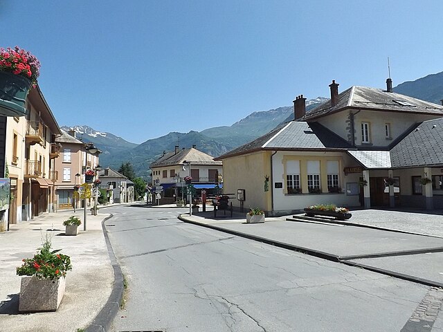
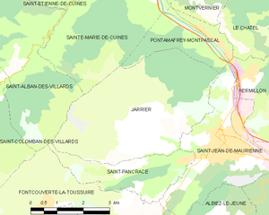
Sainte-Marie-de-Cuines (Sainte-Marie-de-Cuines)

- коммуна во Франции
 Hiking in Sainte-Marie-de-Cuines
Sainte-Marie-de-Cuines is a beautiful destination for hiking enthusiasts, nestled in the Auvergne-Rhône-Alpes region of France, specifically in Savoie. The area offers breathtaking landscapes, from rolling hills to the majestic alpine terrain, making it ideal for various hiking levels. Here are some highlights and tips for hiking in this region:
Trails
-
Local Trails: There are several marked hiking trails around Sainte-Marie-de-Cuines that cater to different skill levels. You can find easier walks suitable for families and more challenging routes for experienced hikers.
-
GR (Grande Randonnée) Routes: The region features parts of the GR trails, which are long-distance footpaths that traverse some of the most scenic areas in France. These trails can provide a multi-day hiking experience if you're up for an adventure.
-
Elevation: The trails offer diverse elevation changes. Be prepared for some steep ascents, especially if you venture into the alpine areas.
Scenic Highlights
- Alpine Views: The hikes around Sainte-Marie-de-Cuines often provide stunning views of the surrounding mountains and valleys, especially in clear weather.
- Flora and Fauna: The region is rich in biodiversity, with opportunities to observe local wildlife and unique alpine plant species.
Gear and Safety
- Appropriate Footwear: Sturdy hiking boots are essential due to varied terrain.
- Weather Considerations: The weather can change rapidly in the mountains, so layered clothing and rain gear are advisable.
- Trail Maps: Make sure to carry a trail map or use a reliable GPS app to stay on track.
Best Times to Hike
- Spring and Fall: These seasons are generally the best for hiking, as the weather is mild and the trails are less crowded.
- Summer: While popular for hiking, it can get hot, so plan early morning or late afternoon hikes to avoid high temperatures.
Local Culture
- After a day of hiking, you might enjoy visiting local cafés or restaurants to try Savoyard specialties such as fondue or tartiflette.
Remember to respect the environment and follow "Leave No Trace" principles to preserve the natural beauty of Sainte-Marie-de-Cuines for future hikers. Happy hiking!
- Страна:

- Почтовый код: 73130
- Координаты: 45° 20' 24" N, 6° 18' 6" E


- GPS треки (wikiloc): [Ссылка]
- Площадь: 14.95 кв.км
- Население: 812
- Веб сайт: http://www.stemariedecuines.fr
- Википедия английская: wiki(en)
- Википедия национальная: wiki(fr)
- Хранилище Wikidata: Wikidata: Q777073
- Катеория в википедии: [Ссылка]
- код Freebase: [/m/03npghq]
- код GeoNames: Альт: [6442885]
- номер SIREN: [217302553]
- код BNF: [15274186f]
- код муниципалитета INSEE: 73255
Граничит с регионами:
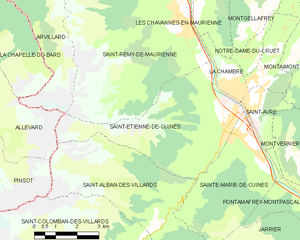
Saint-Étienne-de-Cuines
- коммуна во Франции
Hiking in Saint-Étienne-de-Cuines
Saint-Étienne-de-Cuines, located in the Savoie region of the French Alps, offers beautiful hiking opportunities amidst stunning mountain scenery. The area is characterized by picturesque landscapes, including forests, alpine meadows, and views of the surrounding peaks....
- Страна:
- Почтовый код: 73130
- Координаты: 45° 20' 32" N, 6° 17' 30" E
- GPS треки (wikiloc): [Ссылка]
- Площадь: 20.5 кв.км
- Население: 1190


Saint-Alban-des-Villards
- коммуна во Франции
Hiking in Saint-Alban-des-Villards
Saint-Alban-des-Villards is a charming village located in the French Alps, specifically in the Savoie department of the Auvergne-Rhône-Alpes region. Hiking in this area offers stunning views, diverse landscapes, and a variety of trails suitable for different skill levels. Here are some highlights and tips for hiking in and around Saint-Alban-des-Villards:...
- Страна:
- Почтовый код: 73130
- Координаты: 45° 18' 33" N, 6° 14' 57" E
- GPS треки (wikiloc): [Ссылка]
- Площадь: 24.02 кв.км
- Население: 103

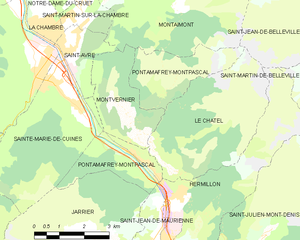
Pontamafrey-Montpascal
- коммуна во Франции
Hiking in Pontamafrey-Montpascal
Pontamafrey-Montpascal is a scenic area in the Savoie region of France, known for its beautiful landscapes, diverse trails, and rich natural flora and fauna. While specific trails can vary, here are some general guidelines and tips for hiking in this region:...
- Страна:
- Почтовый код: 73300
- Координаты: 45° 18' 45" N, 6° 20' 29" E
- GPS треки (wikiloc): [Ссылка]
- Площадь: 11.59 кв.км
- Население: 312
- Веб сайт: [Ссылка]
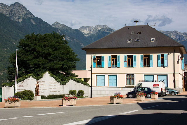

Saint-Avre
- коммуна во Франции
Hiking in Saint-Avre
Saint-Avre is a charming commune located in the Savoie region of the French Alps. Nestled in a picturesque valley, it offers a variety of hiking opportunities that cater to different skill levels and preferences. Here are some key points to consider for hiking in and around Saint-Avre:...
- Страна:
- Почтовый код: 73130
- Координаты: 45° 21' 9" N, 6° 18' 36" E
- GPS треки (wikiloc): [Ссылка]
- Площадь: 3.64 кв.км
- Население: 868

Jarrier
- коммуна во Франции
Hiking in Jarrier
Jarrier is a picturesque village located in the Savoie region of the French Alps, nestled at an altitude of around 1,500 meters. It's an excellent base for hiking enthusiasts, offering stunning views, diverse trails, and a chance to experience the natural beauty of the Alps....
- Страна:
- Почтовый код: 73300
- Координаты: 45° 16' 49" N, 6° 19' 0" E
- GPS треки (wikiloc): [Ссылка]
- Площадь: 17.79 кв.км
- Население: 497
- Веб сайт: [Ссылка]


Montvernier
- коммуна во Франции
Hiking in Montvernier
Montvernier, located in the Savoie region of the French Alps, is a hidden gem for hikers. The area is renowned for its stunning landscapes, featuring charming alpine villages, lush valleys, and breathtaking mountain views. Here are some key points to consider if you’re planning a hiking trip in Montvernier:...
- Страна:
- Почтовый код: 73300
- Координаты: 45° 19' 17" N, 6° 20' 36" E
- GPS треки (wikiloc): [Ссылка]
- Площадь: 6.68 кв.км
- Население: 223