Мон-Сен-Мартен (Mont-Saint-Martin, Mont-Saint-Martin)

- коммуна - Рона — Альпы, Изер, Гренобль
 Hiking in Мон-Сен-Мартен
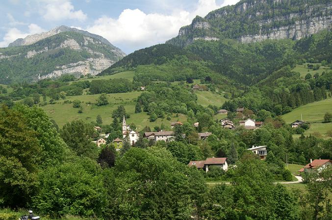
Mont-Saint-Martin, located in the Isère department of the Auvergne-Rhône-Alpes region in southeastern France, offers a variety of hiking opportunities that showcase the beautiful landscapes and natural features of the Alps. Here are some highlights and tips for hiking in the area:
Scenic Trails
-
Panoramic Views: Many trails in the Mont-Saint-Martin area provide stunning panoramic views of the surrounding mountains and valleys. Don’t forget your camera to capture the breathtaking scenery.
-
Diverse Terrain: The trails vary in difficulty, making it suitable for both beginners and experienced hikers. You can find routes that take you through forests, meadows, and rocky terrains.
-
Local Flora and Fauna: The region is home to diverse wildlife and plant species, especially during spring and summer when wildflowers bloom.
Popular Hikes
-
Montée au Mont-Saint-Martin: A popular hike that leads to the summit of Mont-Saint-Martin, offering rewarding views at the top. This hike is moderately challenging and is well-marked.
-
Tour du Mont Saint-Martin: This is a circular route that allows hikers to explore the area surrounding the mountain, providing a good mix of elevation gain and scenic beauty.
Practical Information
-
Best Seasons: The best times to hike in this area are during the spring (May to June) and early fall (September to October) when conditions are typically mild, and the trails are less crowded.
-
Weather Conditions: Always check the weather forecast before heading out, as mountain weather can change rapidly. Be prepared for variations in temperature and potential rain.
-
Safety: It's advisable to inform someone of your hiking plans and expected return time. Carry a map or a GPS device, sufficient water, snacks, and a basic first-aid kit.
-
Local Regulations: Respect local wildlife and plant life. Stay on marked trails to preserve the natural environment.
Access and Transportation
-
Getting There: Mont-Saint-Martin can be accessed by car, and there are parking areas available near common trailheads. Public transport options may be limited, so check local services ahead of your visit.
-
Resources: Consider visiting local tourist information centers for maps and advice on trail conditions during your hike.
Hiking in Mont-Saint-Martin provides a fantastic opportunity to explore the natural beauty of the French Alps while enjoying the serenity of the outdoors. Ensure you're well-prepared, and have a wonderful hiking experience!
- Страна:

- Почтовый код: 38120
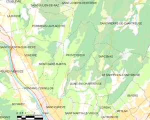
- Координаты: 45° 16' 17" N, 5° 40' 31" E


- GPS треки (wikiloc): [Ссылка]
- Площадь: 5.31 кв.км
- Население: 80
- Википедия русская: wiki(ru)
- Википедия английская: wiki(en)
- Википедия национальная: wiki(fr)
- Хранилище Wikidata: Wikidata: Q1154604
- Катеория в википедии: [Ссылка]
- код Freebase: [/m/03nw77k]
- код GeoNames: Альт: [6454077]
- номер SIREN: [213802580]
- код BNF: [15258070b]
- код муниципалитета INSEE: 38258
Граничит с регионами:

Помье-ла-Пласетт
- коммуна во Франции
Hiking in Помье-ла-Пласетт
Pommiers-la-Placette is a charming village located in the picturesque Grenoble region of France, nestled in the heart of the French Alps. This area is known for its breathtaking landscapes, offering a plethora of hiking opportunities for outdoor enthusiasts of all skill levels....
- Страна:
- Почтовый код: 38340
- Координаты: 45° 19' 3" N, 5° 39' 26" E
- GPS треки (wikiloc): [Ссылка]
- Площадь: 16.92 кв.км
- Население: 554
- Веб сайт: [Ссылка]

Провезьё
- коммуна во Франции
Hiking in Провезьё
Proveysieux is a charming village located in the Grenoble area of the French Alps. It's a fantastic destination for hiking enthusiasts looking to explore the natural beauty of the region. Here are some key points about hiking in Proveysieux:...
- Страна:
- Почтовый код: 38120
- Координаты: 45° 15' 46" N, 5° 41' 58" E
- GPS треки (wikiloc): [Ссылка]
- Площадь: 20.37 кв.км
- Население: 503


Фонтаний-Корнийон
- коммуна во Франции
Hiking in Фонтаний-Корнийон
Fontanil-Cornillon, located near Grenoble in the Auvergne-Rhône-Alpes region of France, offers a variety of hiking opportunities for outdoor enthusiasts. The area is characterized by its beautiful landscapes, charming villages, and proximity to the Chartreuse Mountains and the Vercors Regional Natural Park....
- Страна:
- Почтовый код: 38120
- Координаты: 45° 15' 20" N, 5° 39' 55" E
- GPS треки (wikiloc): [Ссылка]
- Площадь: 5.5 кв.км
- Население: 2735
- Веб сайт: [Ссылка]


Вореп
- коммуна во Франции
Hiking in Вореп
Voreppe, located in the Isère department of southeastern France, is a picturesque area that offers various hiking opportunities amid stunning natural landscapes. The proximity to the Chartreuse and Vercors mountain ranges makes it an ideal base for outdoor enthusiasts....
- Страна:
- Почтовый код: 38340
- Координаты: 45° 17' 52" N, 5° 38' 13" E
- GPS треки (wikiloc): [Ссылка]
- Площадь: 28.65 кв.км
- Население: 9441
- Веб сайт: [Ссылка]