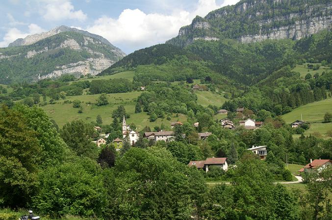
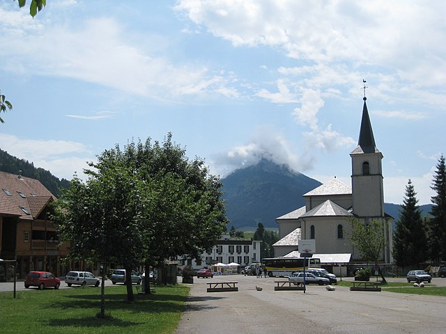
Провезьё (Proveysieux, Proveysieux)

- коммуна во Франции
 Hiking in Провезьё
Proveysieux is a charming village located in the Grenoble area of the French Alps. It's a fantastic destination for hiking enthusiasts looking to explore the natural beauty of the region. Here are some key points about hiking in Proveysieux:
Trails and Scenery
-
Variety of Trails: There are numerous trails around Proveysieux, ranging in difficulty from easy walks to more challenging hikes. You can find short loops suitable for families as well as longer hikes for seasoned trekkers.
-
Stunning Views: Hiking in Proveysieux offers breathtaking views of the surrounding mountains and the city of Grenoble below. The diverse landscapes include forests, meadows, and rocky outcrops.
-
Alpine Flora and Fauna: The area is home to a rich variety of plant and animal life. Depending on the season, you may spot wildflowers, alpine animals, and various bird species.
Popular Hikes
-
Pointe de la Grande Moucherolle: This hike is a great option for experienced hikers, offering panoramic views at the summit.
-
Belvédère d'Arcens: A less difficult option, this trail allows hikers to appreciate the local flora and the stunning vantage points along the way.
-
Local Historical Trails: Some trails may also lead to historical sites or scenic overlooks that connect with the local culture and history.
Practical Tips
-
Timing: The best times for hiking in this region are late spring to early fall, as winter conditions can make hiking difficult due to snow and ice.
-
Guided Tours: If you're unfamiliar with the area, consider joining a guided hiking tour. Local guides can provide insights into the ecology and history of the region, enhancing your experience.
-
Safety: Always check the weather conditions before heading out, wear proper hiking boots, and carry enough water and snacks. It’s also a good idea to inform someone about your hiking plans.
-
Maps and Navigation: Ensure you have a good map or a GPS device, as some trails may not be well-marked.
Proveysieux is an ideal spot for both casual walkers and serious hikers alike, providing a peaceful retreat into nature while being close to the urban amenities of Grenoble. Enjoy your hiking adventure!
- Страна:

- Почтовый код: 38120
- Координаты: 45° 15' 46" N, 5° 41' 58" E


- GPS треки (wikiloc): [Ссылка]
- Площадь: 20.37 кв.км
- Население: 503
- Википедия русская: wiki(ru)
- Википедия английская: wiki(en)
- Википедия национальная: wiki(fr)
- Хранилище Wikidata: Wikidata: Q580608
- Катеория в википедии: [Ссылка]
- код Freebase: [/m/03nvj8l]
- код GeoNames: Альт: [6433299]
- номер SIREN: [213803257]
- код BNF: [15258137s]
- код муниципалитета INSEE: 38325
Граничит с регионами:

Помье-ла-Пласетт
- коммуна во Франции
Hiking in Помье-ла-Пласетт
Pommiers-la-Placette is a charming village located in the picturesque Grenoble region of France, nestled in the heart of the French Alps. This area is known for its breathtaking landscapes, offering a plethora of hiking opportunities for outdoor enthusiasts of all skill levels....
- Страна:
- Почтовый код: 38340
- Координаты: 45° 19' 3" N, 5° 39' 26" E
- GPS треки (wikiloc): [Ссылка]
- Площадь: 16.92 кв.км
- Население: 554
- Веб сайт: [Ссылка]


Сент-Эгрев
- коммуна во Франции
Hiking in Сент-Эгрев
Saint-Égrève is a commune located in the Isère department in the Auvergne-Rhône-Alpes region of southeastern France, close to the city of Grenoble. It offers a variety of hiking opportunities for outdoor enthusiasts, particularly due to its proximity to the breathtaking Chartreuse and Vercors mountains....
- Страна:
- Почтовый код: 38120
- Координаты: 45° 13' 54" N, 5° 40' 59" E
- GPS треки (wikiloc): [Ссылка]
- Высота над уровнем моря: 202 м m
- Площадь: 10.88 кв.км
- Население: 15738
- Веб сайт: [Ссылка]


Ке-ан-Шартрёз
- коммуна во Франции
Hiking in Ке-ан-Шартрёз
Hiking in Quaix-en-Chartreuse, located in the Chartreuse mountain range of France, offers stunning landscapes, diverse trails, and a rich natural heritage. Here are some key highlights for hikers in the area:...
- Страна:
- Почтовый код: 38950
- Координаты: 45° 15' 10" N, 5° 43' 7" E
- GPS треки (wikiloc): [Ссылка]
- Высота над уровнем моря: 525 м m
- Площадь: 18.09 кв.км
- Население: 906
- Веб сайт: [Ссылка]


Мон-Сен-Мартен
- коммуна - Рона — Альпы, Изер, Гренобль
Hiking in Мон-Сен-Мартен
Mont-Saint-Martin, located in the Isère department of the Auvergne-Rhône-Alpes region in southeastern France, offers a variety of hiking opportunities that showcase the beautiful landscapes and natural features of the Alps. Here are some highlights and tips for hiking in the area:...
- Страна:
- Почтовый код: 38120
- Координаты: 45° 16' 17" N, 5° 40' 31" E
- GPS треки (wikiloc): [Ссылка]
- Площадь: 5.31 кв.км
- Население: 80


Фонтаний-Корнийон
- коммуна во Франции
Hiking in Фонтаний-Корнийон
Fontanil-Cornillon, located near Grenoble in the Auvergne-Rhône-Alpes region of France, offers a variety of hiking opportunities for outdoor enthusiasts. The area is characterized by its beautiful landscapes, charming villages, and proximity to the Chartreuse Mountains and the Vercors Regional Natural Park....
- Страна:
- Почтовый код: 38120
- Координаты: 45° 15' 20" N, 5° 39' 55" E
- GPS треки (wikiloc): [Ссылка]
- Площадь: 5.5 кв.км
- Население: 2735
- Веб сайт: [Ссылка]

Сен-Пьер-де-Шартрёз
- коммуна во Франции
Hiking in Сен-Пьер-де-Шартрёз
Saint-Pierre-de-Chartreuse is a picturesque village located in the Chartreuse Mountains, in the Auvergne-Rhône-Alpes region of France. It's a popular destination for outdoor enthusiasts, particularly hikers, due to its stunning landscapes, diverse trails, and rich natural heritage. Here are some highlights and tips for hiking in this beautiful area:...
- Страна:
- Почтовый код: 38380
- Координаты: 45° 20' 33" N, 5° 48' 56" E
- GPS треки (wikiloc): [Ссылка]
- Площадь: 80.12 кв.км
- Население: 1028
- Веб сайт: [Ссылка]


Сарсена
- коммуна во Франции
Hiking in Сарсена
Sarcenas, located in the French Alps near Grenoble, is a fantastic destination for hiking enthusiasts. The area offers a variety of trails that cater to different experience levels, from gentle walks to challenging hikes, making it an excellent spot for both beginners and seasoned hikers....
- Страна:
- Почтовый код: 38700
- Координаты: 45° 16' 26" N, 5° 45' 29" E
- GPS треки (wikiloc): [Ссылка]
- Площадь: 7.76 кв.км
- Население: 196
- Веб сайт: [Ссылка]