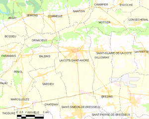
Орнасьё (Ornacieux, Ornacieux)

- коммуна во Франции
 Hiking in Орнасьё
Ornacieux is a charming village located in the Rhône-Alpes region of France, surrounded by beautiful natural landscapes, making it a great destination for hiking enthusiasts. The area offers a variety of trails that cater to different skill levels, from leisurely walks to more challenging hikes.
Trails and Areas to Explore:
-
Local Trails: The village and its surroundings feature several marked hiking paths that allow you to explore the diverse flora and fauna. Look for trails that take you through forests, meadows, and vineyards.
-
Monts du Lyonnais: Just a short distance from Ornacieux, the Monts du Lyonnais offer more extensive hiking opportunities. Here, you can find trails that lead to higher elevations, providing panoramic views of the surrounding valleys and countryside.
-
Vineyard Walks: The region around Ornacieux is known for its wines, particularly the Côtes du Rhône. Many trails pass through vineyards, and you may have the chance to enjoy wine tasting experiences at local wineries.
Tips for Hiking in Ornacieux:
- Check Trail Conditions: Before heading out, check the local conditions of the trails, especially during winter or after heavy rains.
- Bring Water and Snacks: Ensure that you have enough water and nutritious snacks to sustain you during your hike.
- Dress Appropriately: Wear comfortable hiking boots and dress in layers, as weather can change quickly in mountainous areas.
- Respect Nature: Stay on marked trails and carry out any litter to preserve the natural beauty of the region.
Recommended Hiking Resources:
- Local Hiking Maps: Visit the tourist office in Ornacieux or check online for downloadable hiking maps that detail local trails.
- Guided Tours: If you're unfamiliar with the area or prefer a structured experience, consider joining a guided hiking tour to learn more about the local ecology and history.
Overall, hiking in and around Ornacieux offers a wonderful way to experience the natural beauty and tranquility of the Rhône-Alpes region. Whether you're a beginner or an experienced hiker, there's something for everyone to enjoy!
- Страна:

- Почтовый код: 38260
- Координаты: 45° 24' 2" N, 5° 12' 40" E


- GPS треки (wikiloc): [Ссылка]
- Площадь: 4.89 кв.км
- Население: 416
- Википедия русская: wiki(ru)
- Википедия английская: wiki(en)
- Википедия национальная: wiki(fr)
- Хранилище Wikidata: Wikidata: Q1069033
- Катеория в википедии: [Ссылка]
- код Freebase: [/m/03nvgr2]
- код GeoNames: Альт: [6433270]
- номер SIREN: [213802846]
- код BNF: [152580961]
- код муниципалитета INSEE: 38284
Граничит с регионами:


Коммель
- коммуна во Франции
Hiking in Коммель
Commelle is a lesser-known hiking destination, but if you're referring to a specific region or trail system, I would need a bit more clarity, as there may be multiple locations with similar names around the world....
- Страна:
- Почтовый код: 38260
- Координаты: 45° 25' 41" N, 5° 13' 35" E
- GPS треки (wikiloc): [Ссылка]
- Площадь: 14.04 кв.км
- Население: 927
- Веб сайт: [Ссылка]

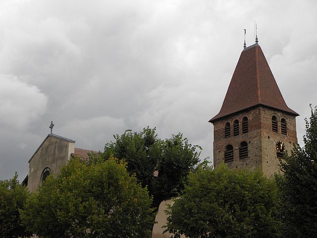
Босье
- коммуна во Франции
Hiking in Босье
Bossieu, a small commune in the Isère department of southeastern France, offers some charming opportunities for hiking enthusiasts. The region is characterized by its picturesque landscapes, which include rolling hills, forests, and views of the surrounding mountains....
- Страна:
- Почтовый код: 38260
- Координаты: 45° 25' 1" N, 5° 8' 53" E
- GPS треки (wikiloc): [Ссылка]
- Площадь: 13.48 кв.км
- Население: 281
- Веб сайт: [Ссылка]

Бальбен
- коммуна во Франции
Hiking in Бальбен
It seems like you might be referring to a specific location, but "Balbins" isn't widely recognized as a hiking destination. If you meant a different place, please clarify the name or provide more details....
- Страна:
- Почтовый код: 38260
- Координаты: 45° 23' 54" N, 5° 12' 51" E
- GPS треки (wikiloc): [Ссылка]
- Площадь: 7.26 кв.км
- Население: 432
- Веб сайт: [Ссылка]


Семон
- коммуна во Франции
Hiking in Семон
It seems like there may be a slight misspelling or misunderstanding regarding the location "Semons." If you meant "Semon," "Semon Mountain," or perhaps a different location known for hiking (like the area around Semons or another name similar), please clarify....
- Страна:
- Почтовый код: 38260
- Координаты: 45° 25' 56" N, 5° 11' 41" E
- GPS треки (wikiloc): [Ссылка]
- Площадь: 10.55 кв.км
- Население: 362
- Веб сайт: [Ссылка]


Пеноль
- коммуна во Франции
Hiking in Пеноль
Penol is a scenic destination in Colombia, particularly known for its stunning landscape dominated by the iconic El Peñol Rock (La Piedra del Peñol), which offers incredible views and challenging hikes. Here are some key points about hiking in the Penol area:...
- Страна:
- Почтовый код: 38260
- Координаты: 45° 23' 25" N, 5° 11' 27" E
- GPS треки (wikiloc): [Ссылка]
- Площадь: 12.16 кв.км
- Население: 340

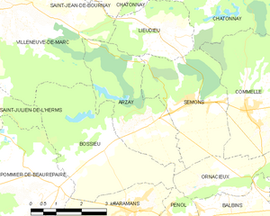
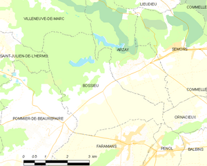
Арзе
- коммуна во Франции
Hiking in Арзе
As of my last update, there's limited information specifically about "Arzay" as a hiking destination. It's possible that you might be referring to a less-known area or there might be a misspelling. However, I can provide general hiking tips and suggestions for exploring regions that might include areas like Arzay if they are situated near popular hiking destinations....
- Страна:
- Почтовый код: 38260
- Координаты: 45° 25' 32" N, 5° 10' 13" E
- GPS треки (wikiloc): [Ссылка]
- Площадь: 9.79 кв.км
- Население: 226
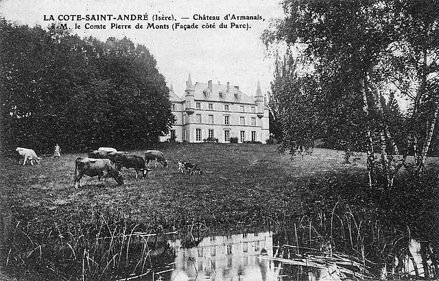
Ла-Кот-Сент-Андре
- коммуна во Франции
Hiking in Ла-Кот-Сент-Андре
La Côte-Saint-André is a charming commune located in the Isère department in the Auvergne-Rhône-Alpes region of southeastern France. It offers beautiful landscapes and a variety of hiking opportunities, making it a great destination for outdoor enthusiasts. Here are some highlights about hiking in and around La Côte-Saint-André:...
- Страна:
- Почтовый код: 38260
- Координаты: 45° 23' 37" N, 5° 15' 38" E
- GPS треки (wikiloc): [Ссылка]
- Площадь: 27.93 кв.км
- Население: 4745
- Веб сайт: [Ссылка]