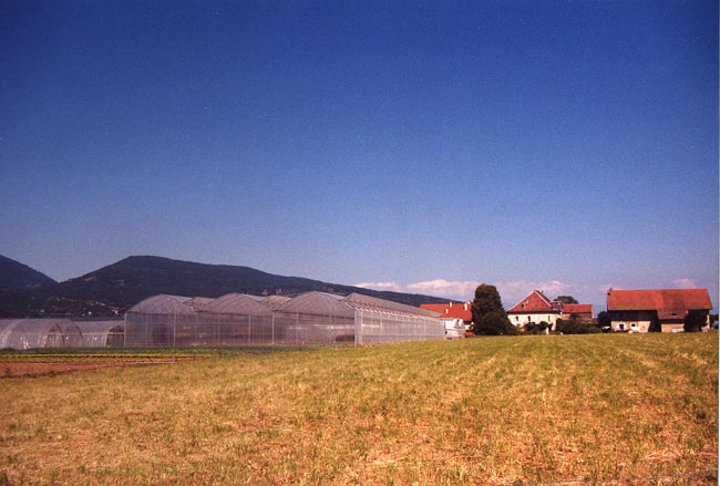
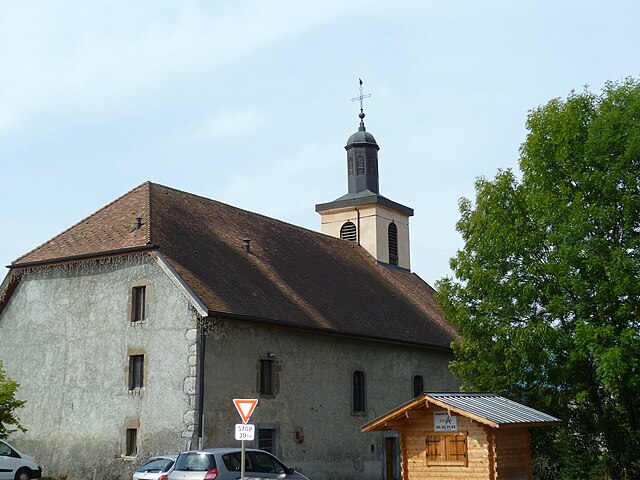
Reignier-Esery (Reignier-Ésery)

- коммуна во Франции
 Hiking in Reignier-Esery
Reignier-Ésery is a charming commune located in the Haute-Savoie region of France, nestled between the city of Annecy and the French Alps. The area offers a variety of hiking opportunities, perfect for both beginners and experienced hikers. Here are some details and tips for hiking in and around Reignier-Ésery:
Trails and Natural Features
-
Scenic Views: The surrounding mountains, including Mont Salève and the Aravis range, provide breathtaking views. Many trails lead you through picturesque landscapes featuring forests, alpine meadows, and mountain streams.
-
Local Trails: Various marked hiking trails cater to different skill levels. Popular routes often start from Reignier-Ésery and can take you to nearby attractions such as:
- La Pointe de la Chevrette: Offers a beautiful view of the surrounding peaks.
- Mont Salève: A short drive away, this mountain has well-marked paths and is popular for its panoramic views of Geneva and the surrounding area.
-
Nature Reserves: The area is rich in biodiversity. Keep an eye out for local flora and fauna along the trails, particularly in protected areas or nature reserves.
Hiking Tips
- Seasonal Considerations: Spring and early autumn are ideal for hiking in this region, as summer can be hot, and winter may require specific gear for snowy conditions.
- Trail Maps: Before heading out, check local resources for trail maps and updates on conditions. Local tourism offices can provide detailed information on trail difficulty, length, and suggested gear.
- Safety: Always carry sufficient water, snacks, and a basic first-aid kit. Inform someone of your hiking plan and return time. Mobile coverage can be spotty in remote areas.
- Respect Nature: Follow Leave No Trace principles to protect the environment. Stay on marked trails and dispose of waste properly.
Nearby Attractions
If you’re looking to extend your trip, consider visiting nearby locations:
- Geneva: Just a short drive away, where you can enjoy the city's cultural attractions and beautiful lakeside scenery.
- Annecy: Known as the "Venice of the Alps," it offers stunning lakeside views and charming streets to explore.
Hiking in Reignier-Ésery provides a fantastic way to connect with nature and enjoy the majestic beauty of the Alps. Whether you're taking a leisurely stroll or embarking on a more challenging hike, you're sure to have a rewarding experience.
- Страна:

- Почтовый код: 74930
- Координаты: 46° 8' 4" N, 6° 16' 6" E


- GPS треки (wikiloc): [Ссылка]
- Площадь: 25.08 кв.км
- Население: 7585
- Веб сайт: http://www.reignier-esery.com
- Википедия английская: wiki(en)
- Википедия национальная: wiki(fr)
- Хранилище Wikidata: Wikidata: Q567863
- Катеория в википедии: [Ссылка]
- код Freebase: [/m/03nt_0y]
- код GeoNames: Альт: [6443029]
- номер SIREN: [217402205]
- код LCNAF: Альт: [n89110523]
- идентификатор HDS: [7364]
- код муниципалитета INSEE: 74220
Граничит с регионами:


Pers-Jussy
- коммуна во Франции
Hiking in Pers-Jussy
Pers-Jussy is a charming commune in the Haute-Savoie department of France, located near the city of Geneva, Switzerland. While it isn't as widely known as some major hiking destinations in the Alps, it offers access to beautiful landscapes and trails. Here's what you need to consider for hiking in and around Pers-Jussy:...
- Страна:
- Почтовый код: 74930
- Координаты: 46° 6' 26" N, 6° 16' 2" E
- GPS треки (wikiloc): [Ссылка]
- Площадь: 18.68 кв.км
- Население: 2997

Arthaz-Pont-Notre-Dame
- коммуна во Франции
Hiking in Arthaz-Pont-Notre-Dame
Arthaz-Pont-Notre-Dame is a small commune located in the Haute-Savoie department in the Auvergne-Rhône-Alpes region of southeastern France. While it may not be as widely known as some of the larger tourist destinations in the Alps, it offers some charming hiking opportunities in a picturesque setting....
- Страна:
- Почтовый код: 74380
- Координаты: 46° 9' 32" N, 6° 16' 1" E
- GPS треки (wikiloc): [Ссылка]
- Площадь: 5.96 кв.км
- Население: 1440
- Веб сайт: [Ссылка]


Arbusigny
- коммуна во Франции
Hiking in Arbusigny
Arbusigny, located in the Haute-Savoie region of France, offers a variety of hiking opportunities that cater to different skill levels. The area is characterized by beautiful landscapes, including rolling hills, forests, and breathtaking views of the surrounding mountains....
- Страна:
- Почтовый код: 74930
- Координаты: 46° 5' 30" N, 6° 13' 6" E
- GPS треки (wikiloc): [Ссылка]
- Площадь: 12.25 кв.км
- Население: 1098
- Веб сайт: [Ссылка]


La Muraz
- коммуна во Франции
Hiking in La Muraz
La Muraz is a charming village located in the Swiss Alps, often known for its stunning landscapes and serene hiking routes. Situated close to the border between Switzerland and France, it offers an array of hiking opportunities that cater to different skill levels. Here are some key points to consider if you’re planning to hike in La Muraz:...
- Страна:
- Почтовый код: 74560
- Координаты: 46° 7' 24" N, 6° 12' 20" E
- GPS треки (wikiloc): [Ссылка]
- Площадь: 14.38 кв.км
- Население: 1059

Nangy
- коммуна во Франции
Hiking in Nangy
Nangy, located in the Haute-Savoie department in the Auvergne-Rhône-Alpes region of France, offers a variety of hiking options that showcase stunning landscapes, charming alpine scenery, and a taste of the local culture....
- Страна:
- Почтовый код: 74380
- Координаты: 46° 9' 15" N, 6° 18' 23" E
- GPS треки (wikiloc): [Ссылка]
- Площадь: 4.35 кв.км
- Население: 1695
- Веб сайт: [Ссылка]


Monnetier-Mornex
- коммуна во Франции
Hiking in Monnetier-Mornex
Monnetier-Mornex is a charming commune located in the Haute-Savoie region of France, nestled in the foothills of the French Alps. It offers numerous hiking opportunities, featuring stunning views of the surrounding mountains and beautiful landscapes....
- Страна:
- Почтовый код: 74560
- Координаты: 46° 9' 42" N, 6° 13' 52" E
- GPS треки (wikiloc): [Ссылка]
- Площадь: 11.4 кв.км
- Население: 2310
- Веб сайт: [Ссылка]


Scientrier
- коммуна во Франции
Hiking in Scientrier
Scientrier is a commune located in the Haute-Savoie department in the Auvergne-Rhône-Alpes region of southeastern France, near Lake Geneva. While it may not be as widely known as other hiking destinations in the region, it offers a variety of outdoor activities and trails that can appeal to hikers of all levels....
- Страна:
- Почтовый код: 74930
- Координаты: 46° 7' 8" N, 6° 18' 56" E
- GPS треки (wikiloc): [Ссылка]
- Площадь: 7.21 кв.км
- Население: 1156