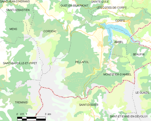
Сен-Бодий-э-Пипе (Saint-Baudille-et-Pipet, Saint-Baudille-et-Pipet)

- коммуна во Франции
 Hiking in Сен-Бодий-э-Пипе
Saint-Baudille-et-Pipet is a charming commune located in the Auvergne-Rhône-Alpes region of France, surrounded by beautiful natural landscapes that are perfect for hiking enthusiasts. The area offers a variety of trails that cater to different skill levels, making it an excellent destination for both novices and experienced hikers.
Hiking Trails:
-
Local Trails: The countryside around Saint-Baudille-et-Pipet features numerous marked trails. These routes often take you through lush forests, rolling hills, and offer stunning views of the surrounding landscape, including the Vercors mountains.
-
GR Trails: The region is close to several Grande Randonnée (GR) paths, which are long-distance hiking trails that traverse significant areas of France. These trails can provide a more challenging hiking experience for those looking to spend multiple days on the trail.
-
Wildlife and Nature: While hiking in this area, you may encounter diverse wildlife and plant species, thanks to its rich biodiversity. Keep an eye out for birds, deer, and various endemic flora.
Tips for Hiking in Saint-Baudille-et-Pipet:
- Prepare for Varying Weather: The weather can change quickly in the mountains, so it's essential to check the forecast and dress in layers. Always bring a waterproof jacket and sturdy footwear.
- Stay Hydrated and Nourished: Bring plenty of water and snacks to keep your energy up during hikes, especially on longer trails.
- Maps and Navigation: It's a good practice to have a physical map or GPS device, as some trails might not be well-marked. Familiarize yourself with the area beforehand.
- Respect Nature: Follow Leave No Trace principles to preserve the natural beauty of the area. Stay on marked trails, dispose of waste properly, and avoid disturbing wildlife.
Accessibility:
Saint-Baudille-et-Pipet is accessible by car, and there are often local transport options for accessing more remote trailheads. Be sure to check local resources or visitor information centers for the latest trail conditions and safety information.
Whether you're looking for a leisurely walk in nature or a more challenging hike, Saint-Baudille-et-Pipet offers a scenic backdrop for your outdoor adventures! Happy hiking!
- Страна:

- Почтовый код: 38710
- Координаты: 44° 47' 3" N, 5° 46' 7" E


- GPS треки (wikiloc): [Ссылка]
- Площадь: 35.97 кв.км
- Население: 257
- Википедия русская: wiki(ru)
- Википедия английская: wiki(en)
- Википедия национальная: wiki(fr)
- Хранилище Wikidata: Wikidata: Q1151343
- Катеория в википедии: [Ссылка]
- код Freebase: [/m/03g_4xg]
- код GeoNames: Альт: [6433325]
- номер SIREN: [213803661]
- код BNF: [152581771]
- код муниципалитета INSEE: 38366
Граничит с регионами:


Кордеак
- коммуна во Франции
Hiking in Кордеак
Cordéac is a small village located in the French Alps, offering stunning natural landscapes ideal for hiking. The region is well-suited for both experienced hikers and those looking for gentler trails. Here are some highlights to consider when hiking in Cordéac:...
- Страна:
- Почтовый код: 38710
- Координаты: 44° 49' 38" N, 5° 50' 17" E
- GPS треки (wikiloc): [Ссылка]
- Площадь: 26.62 кв.км
- Население: 200

Пеллафоль
- коммуна во Франции
Hiking in Пеллафоль
Pellafol, a picturesque village located in the Isère department of the Auvergne-Rhône-Alpes region in France, is a hidden gem for hiking enthusiasts. Nestled in the foothills of the French Alps, it offers stunning landscapes, diverse flora and fauna, and a variety of trails suitable for all skill levels....
- Страна:
- Почтовый код: 38970
- Координаты: 44° 47' 51" N, 5° 54' 27" E
- GPS треки (wikiloc): [Ссылка]
- Площадь: 34.73 кв.км
- Население: 137

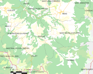
Пребуа
- коммуна во Франции
Hiking in Пребуа
Prébois is a scenic area located in the French Alps, known for its stunning landscapes, diverse flora and fauna, and hiking opportunities. Here are some key points to consider if you're planning a hike in Prébois:...
- Страна:
- Почтовый код: 38710
- Координаты: 44° 47' 22" N, 5° 41' 42" E
- GPS треки (wikiloc): [Ссылка]
- Площадь: 16.03 кв.км
- Население: 165
- Веб сайт: [Ссылка]


Манс
Hiking in Манс
Hiking in the Vercors region of Isère, particularly around Mens, offers a fantastic blend of natural beauty, diverse terrain, and rich cultural heritage. Here are some highlights and tips for hiking in the area:...
- Страна:
- Почтовый код: 38710
- Координаты: 44° 49' 1" N, 5° 45' 1" E
- GPS треки (wikiloc): [Ссылка]
- Площадь: 28.29 кв.км
- Население: 1379
- Веб сайт: [Ссылка]


Треминис
- коммуна во Франции
Hiking in Треминис
Tréminis is a charming village located in the Isère department of the Auvergne-Rhône-Alpes region in southeastern France. It’s known for its beautiful landscapes and outdoor activities, making it a great spot for hiking enthusiasts....
- Страна:
- Почтовый код: 38710
- Координаты: 44° 44' 51" N, 5° 46' 8" E
- GPS треки (wikiloc): [Ссылка]
- Площадь: 49.4 кв.км
- Население: 180