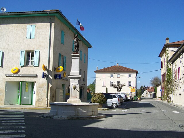
Сент-Илер-дю-Розье (Saint-Hilaire-du-Rosier, Saint-Hilaire-du-Rosier)

- коммуна во Франции
 Hiking in Сент-Илер-дю-Розье
Saint-Hilaire-du-Rosier is a small commune located in the Drôme department of southeastern France. It is situated in a picturesque region that features a mix of natural beauty, charming rural landscapes, and proximity to various hiking opportunities.
Hiking Opportunities:
-
Local Trails: The area around Saint-Hilaire-du-Rosier is crisscrossed with walking and hiking trails that showcase its scenic beauty. These trails often pass through forests, fields, and hills, offering a peaceful hiking experience.
-
Chartreuse Regional Natural Park: Located to the east of Saint-Hilaire-du-Rosier, this natural park is home to numerous trails. The park’s rugged terrain, limestone cliffs, and diverse flora and fauna make it a fantastic location for both experienced hikers and beginners. There are several marked trails, varying in difficulty and length.
-
Vercors Regional Natural Park: A bit further to the south, this park offers stunning mountain scenery and an extensive network of hiking paths. Hikes here can range from easier walks to more challenging climbs, making it suitable for all levels of hikers. You may also encounter caves, gorges, and panoramic viewpoints.
-
Local Nature Reserves: Depending on the season, you may find marked paths in the nearby nature reserves where you can observe local wildlife and enjoy the natural scenery.
Recommendations:
-
Best Time to Hike: In general, spring and autumn are ideal times for hiking in the region due to mild temperatures and fewer crowds. Summer can get hot, and winter may bring snow to higher elevations.
-
Safety and Preparation: Always check the weather before heading out, wear appropriate clothing and footwear, and consider bringing a map or GPS device, as some trails may not be well marked.
-
Local Amenities: Saint-Hilaire-du-Rosier offers basic amenities including local shops and restaurants where you can refuel after a day of hiking. Always check in advance for any seasonal opening hours.
Whether you’re looking for a leisurely hike or a more rigorous outdoor adventure, the area around Saint-Hilaire-du-Rosier provides a beautiful backdrop for enjoying nature and staying active.
- Страна:

- Почтовый код: 38840
- Координаты: 45° 6' 3" N, 5° 14' 53" E


- GPS треки (wikiloc): [Ссылка]
- Площадь: 16.42 кв.км
- Население: 1921
- Веб сайт: http://www.saint-hilaire-du-rosier.fr
- Википедия русская: wiki(ru)
- Википедия английская: wiki(en)
- Википедия национальная: wiki(fr)
- Хранилище Wikidata: Wikidata: Q1150691
- Катеория в википедии: [Ссылка]
- код Freebase: [/m/03nvhg3]
- код GeoNames: Альт: [6433347]
- номер SIREN: [213803943]
- код BNF: [152582043]
- код муниципалитета INSEE: 38394
Граничит с регионами:


Ла-Сон
Hiking in Ла-Сон
La Sône is a charming commune located in the Auvergne-Rhône-Alpes region of France, surrounded by beautiful natural landscapes. While it may not be as widely known as some of the larger hiking destinations in the Alps, it offers a variety of scenic trails that cater to different skill levels....
- Страна:
- Почтовый код: 38840
- Координаты: 45° 6' 41" N, 5° 16' 41" E
- GPS треки (wikiloc): [Ссылка]
- Площадь: 2.95 кв.км
- Население: 579
- Веб сайт: [Ссылка]


Сен-Бонне-де-Шавань
- коммуна во Франции
Hiking in Сен-Бонне-де-Шавань
Saint-Bonnet-de-Chavagne is a charming village located in the Isère department of the Auvergne-Rhône-Alpes region in France. It is surrounded by the natural beauty of the Vercors and Chartreuse mountain ranges, making it a great destination for hiking enthusiasts....
- Страна:
- Почтовый код: 38840
- Координаты: 45° 7' 33" N, 5° 13' 55" E
- GPS треки (wikiloc): [Ссылка]
- Площадь: 15.18 кв.км
- Население: 631
- Веб сайт: [Ссылка]


Сен-Жюст-де-Кле
- коммуна во Франции
Hiking in Сен-Жюст-де-Кле
Saint-Just-de-Claix is a charming village located in the Drôme department of the Auvergne-Rhône-Alpes region of southeastern France. It sits at the foothills of the Vercors Massif, a stunning area known for its dramatic landscapes, limestone cliffs, and extensive hiking trails. Here are some highlights of hiking in and around Saint-Just-de-Claix:...
- Страна:
- Почтовый код: 38680
- Координаты: 45° 4' 29" N, 5° 17' 2" E
- GPS треки (wikiloc): [Ссылка]
- Площадь: 11.59 кв.км
- Население: 1178


Сен-Латье
- коммуна во Франции
Hiking in Сен-Латье
Saint-Lattier is a charming town located in the Isère department of the Auvergne-Rhône-Alpes region in southeastern France. It's surrounded by beautiful natural landscapes, which makes it an excellent destination for hiking enthusiasts....
- Страна:
- Почтовый код: 38840
- Координаты: 45° 5' 16" N, 5° 12' 4" E
- GPS треки (wikiloc): [Ссылка]
- Площадь: 18.17 кв.км
- Население: 1280
- Веб сайт: [Ссылка]


Saint-Nazaire-en-Royans
- коммуна во Франции
Hiking in Saint-Nazaire-en-Royans
Saint-Nazaire-en-Royans is a charming village located in the Drôme department of France, nestled in the stunning Vercors Regional Natural Park. This area is known for its breathtaking landscapes, diverse ecosystems, and rich cultural heritage, making it an attractive destination for hikers....
- Страна:
- Почтовый код: 26190
- Координаты: 45° 3' 33" N, 5° 14' 56" E
- GPS треки (wikiloc): [Ссылка]
- Площадь: 3.54 кв.км
- Население: 794


La Baume-d'Hostun
- коммуна во Франции
Hiking in La Baume-d'Hostun
La Baume-d'Hostun is a charming village located in the Drôme department of southeastern France, surrounded by beautiful natural landscapes that are perfect for hiking. The area features a mix of rolling hills, forests, and scenic views of the surrounding mountains, making it an excellent destination for hikers of all levels....
- Страна:
- Почтовый код: 26730
- Координаты: 45° 3' 19" N, 5° 13' 38" E
- GPS треки (wikiloc): [Ссылка]
- Площадь: 8.46 кв.км
- Население: 562

Шат
- коммуна во Франции
Hiking in Шат
It seems like you might be referring to a location that could be spelled differently or may not be widely recognized as a hiking destination. If you meant "Chattahoochee" or other known areas, please clarify. However, if you are referring to a lesser-known area, here's a general guide on how to approach hiking in any location:...
- Страна:
- Почтовый код: 38160
- Координаты: 45° 8' 37" N, 5° 16' 59" E
- GPS треки (wikiloc): [Ссылка]
- Площадь: 22.81 кв.км
- Население: 2496
- Веб сайт: [Ссылка]