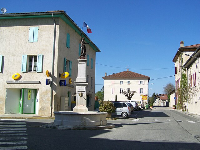
Сен-Марселлен (canton of Saint-Marcellin, canton de Saint-Marcellin)
- кантон во Франции
 Hiking in Сен-Марселлен
Canton de Saint-Marcellin is nestled in the Isère department in the Auvergne-Rhône-Alpes region of southeastern France, and it offers some fantastic hiking opportunities amidst stunning natural landscapes. The area is characterized by diverse terrains, including rolling hills, valleys, and moderately challenging mountainous areas, making it suitable for hikers of various levels.
Highlights of Hiking in Canton de Saint-Marcellin:
-
Scenic Landscapes: The region is adorned with beautiful scenery, featuring vineyards, forests, and breathtaking views of the Chartreuse and Vercors mountain ranges. These landscapes provide great photo opportunities and a peaceful atmosphere.
-
Trail Variety: There are numerous hiking trails, ranging from easy walks to more challenging routes. Some popular trails include paths around the Taillefer Massif and along the Isère River. The GR9 long-distance trail also passes through the area, offering longer hiking experiences.
-
Flora and Fauna: The region is rich in biodiversity. Hikers can enjoy the sight of various plants and wildlife, particularly in protected areas such as the Vercors Regional Natural Park. Keep your eyes peeled for rare species and beautiful wildflowers, especially during springtime.
-
Cultural Richness: While hiking, you can also explore charming villages, historical sites, and cultural landmarks. This adds a unique aspect to your hiking experience, allowing you to combine physical activity with cultural exploration.
-
Local Advice and Guides: If you’re new to the area or want to explore some hidden gems, consider joining a guided hike. Local guides often provide valuable insights into the landscape, history, and ecology of the region.
-
Seasonal Hiking: The best hiking seasons are typically late spring through early autumn. However, some trails may be accessible in winter for snowshoeing or cross-country skiing, depending on snow conditions.
Preparation Tips:
- Maps and Information: Always carry a detailed map of the area, or download a reliable hiking app to keep track of your route.
- Proper Gear: Wear sturdy hiking boots and bring weather-appropriate clothing, as conditions can change quickly in mountainous regions.
- Hydration and Snacks: Bring plenty of water and some snacks to keep your energy up during your hike.
- Local Regulations: Be aware of local regulations regarding wildlife and trail use, especially in protected areas.
Whether you're looking for a peaceful day hike or a more challenging trek, Canton de Saint-Marcellin has something to offer for everyone. Enjoy your hiking adventure!
- Страна:

- Столица: Сен-Марселлен
- Координаты: 45° 9' 39" N, 5° 16' 50" E


- GPS треки (wikiloc): [Ссылка]
- Хранилище Wikidata: Wikidata: Q1727257
- код кантона INSEE: [3830]
Включает регионы:


Дьоне
- коммуна во Франции
Hiking in Дьоне
Dionay, located in the Auvergne-Rhône-Alpes region of France, is a picturesque area that offers beautiful hiking opportunities, particularly for those who enjoy nature, mountainous landscapes, and the tranquility of the countryside....
- Страна:
- Почтовый код: 38160
- Координаты: 45° 12' 11" N, 5° 13' 11" E
- GPS треки (wikiloc): [Ссылка]
- Площадь: 14.01 кв.км
- Население: 117
- Веб сайт: [Ссылка]


Шевриер
- коммуна во Франции
Hiking in Шевриер
Chevrières is a small village in the Isère department of the Auvergne-Rhône-Alpes region in southeastern France. While it may not be as well-known as some larger hiking destinations, it is surrounded by beautiful landscapes and offers opportunities for outdoor activities, including hiking....
- Страна:
- Почтовый код: 38160
- Координаты: 45° 11' 15" N, 5° 17' 25" E
- GPS треки (wikiloc): [Ссылка]
- Площадь: 16.62 кв.км
- Население: 710
- Веб сайт: [Ссылка]
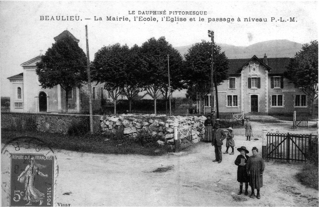

Больё
Hiking in Больё
Beaulieu in Isère is a charming destination for hiking enthusiasts, nestled in the foothills of the French Alps. The area is known for its beautiful landscapes, rolling hills, and proximity to the Chartreuse Mountains. Here are some highlights to consider if you're planning to hike in Beaulieu:...
- Страна:
- Почтовый код: 38470
- Координаты: 45° 11' 33" N, 5° 23' 32" E
- GPS треки (wikiloc): [Ссылка]
- Площадь: 8.79 кв.км
- Население: 623


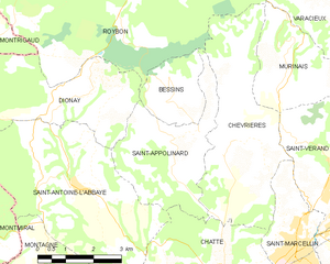
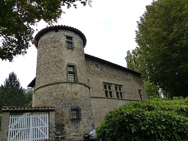
Бессен
Hiking in Бессен
Bessins, a small village in the scenic region of the French Alps, offers a variety of hiking opportunities for outdoor enthusiasts. While it might not be as widely known as some larger hiking destinations, the area around Bessins is rich in natural beauty, with breathtaking alpine landscapes, lush forests, and clear mountain streams....
- Страна:
- Почтовый код: 38160
- Координаты: 45° 12' 9" N, 5° 15' 53" E
- GPS треки (wikiloc): [Ссылка]
- Площадь: 4.65 кв.км
- Население: 123
- Веб сайт: [Ссылка]


Ла-Сон
Hiking in Ла-Сон
La Sône is a charming commune located in the Auvergne-Rhône-Alpes region of France, surrounded by beautiful natural landscapes. While it may not be as widely known as some of the larger hiking destinations in the Alps, it offers a variety of scenic trails that cater to different skill levels....
- Страна:
- Почтовый код: 38840
- Координаты: 45° 6' 41" N, 5° 16' 41" E
- GPS треки (wikiloc): [Ссылка]
- Площадь: 2.95 кв.км
- Население: 579
- Веб сайт: [Ссылка]


Теш
- коммуна во Франции
Hiking in Теш
Têche is a beautiful region that is often celebrated for its picturesque landscapes, diverse ecosystems, and extensive trail networks, making it an excellent destination for hiking enthusiasts. Although specific details may vary, here are general aspects to consider when hiking in Têche:...
- Страна:
- Почтовый код: 38470
- Координаты: 45° 10' 58" N, 5° 22' 53" E
- GPS треки (wikiloc): [Ссылка]
- Площадь: 5.03 кв.км
- Население: 578
- Веб сайт: [Ссылка]


Сен-Бонне-де-Шавань
- коммуна во Франции
Hiking in Сен-Бонне-де-Шавань
Saint-Bonnet-de-Chavagne is a charming village located in the Isère department of the Auvergne-Rhône-Alpes region in France. It is surrounded by the natural beauty of the Vercors and Chartreuse mountain ranges, making it a great destination for hiking enthusiasts....
- Страна:
- Почтовый код: 38840
- Координаты: 45° 7' 33" N, 5° 13' 55" E
- GPS треки (wikiloc): [Ссылка]
- Площадь: 15.18 кв.км
- Население: 631
- Веб сайт: [Ссылка]
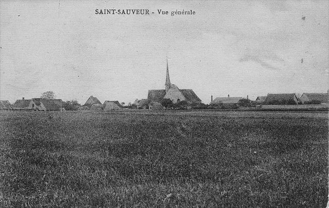
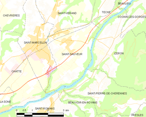
Сен-Совёр
Hiking in Сен-Совёр
Saint-Sauveur is a charming village located in the Isère department of the Auvergne-Rhône-Alpes region in southeastern France. It's known for its beautiful natural landscapes, making it a great destination for hiking enthusiasts....
- Страна:
- Почтовый код: 38160
- Координаты: 45° 9' 9" N, 5° 20' 31" E
- GPS треки (wikiloc): [Ссылка]
- Площадь: 9.42 кв.км
- Население: 2100
- Веб сайт: [Ссылка]

Сент-Апполинар
- коммуна во Франции
Hiking in Сент-Апполинар
Saint-Appolinard is a charming commune located in the Isère department in the Auvergne-Rhône-Alpes region of southeastern France. Known for its picturesque landscapes, it offers a variety of hiking opportunities suitable for different skill levels. Here are some highlights and tips for hiking in the area:...
- Страна:
- Почтовый код: 38160
- Координаты: 45° 11' 20" N, 5° 15' 45" E
- GPS треки (wikiloc): [Ссылка]
- Высота над уровнем моря: 380 м m
- Площадь: 10.76 кв.км
- Население: 400
- Веб сайт: [Ссылка]


Сен-Латье
- коммуна во Франции
Hiking in Сен-Латье
Saint-Lattier is a charming town located in the Isère department of the Auvergne-Rhône-Alpes region in southeastern France. It's surrounded by beautiful natural landscapes, which makes it an excellent destination for hiking enthusiasts....
- Страна:
- Почтовый код: 38840
- Координаты: 45° 5' 16" N, 5° 12' 4" E
- GPS треки (wikiloc): [Ссылка]
- Площадь: 18.17 кв.км
- Население: 1280
- Веб сайт: [Ссылка]
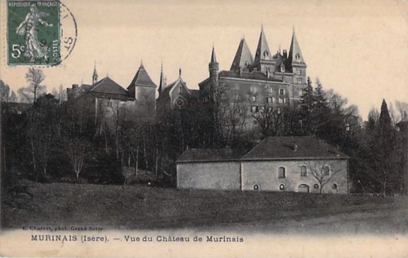

Мюрине
- коммуна во Франции
Hiking in Мюрине
Murinais is a lesser-known destination for hiking enthusiasts, offering beautiful landscapes and a chance to experience nature away from the more crowded trails. While specific information about Murinais might be limited, here are some general tips and highlights you can consider for hiking in such regions:...
- Страна:
- Почтовый код: 38160
- Координаты: 45° 12' 47" N, 5° 18' 54" E
- GPS треки (wikiloc): [Ссылка]
- Площадь: 8.22 кв.км
- Население: 384
- Веб сайт: [Ссылка]


Монтань
Hiking in Монтань
Montagne, located in the Isère department of the Auvergne-Rhône-Alpes region in France, offers a variety of beautiful hiking opportunities suitable for different skill levels. This area is characterized by its stunning mountain landscapes, lush valleys, and diverse flora and fauna....
- Страна:
- Почтовый код: 38160
- Координаты: 45° 8' 28" N, 5° 11' 32" E
- GPS треки (wikiloc): [Ссылка]
- Площадь: 8.78 кв.км
- Население: 265


Сент-Илер-дю-Розье
- коммуна во Франции
Hiking in Сент-Илер-дю-Розье
Saint-Hilaire-du-Rosier is a small commune located in the Drôme department of southeastern France. It is situated in a picturesque region that features a mix of natural beauty, charming rural landscapes, and proximity to various hiking opportunities....
- Страна:
- Почтовый код: 38840
- Координаты: 45° 6' 3" N, 5° 14' 53" E
- GPS треки (wikiloc): [Ссылка]
- Площадь: 16.42 кв.км
- Население: 1921
- Веб сайт: [Ссылка]


Сен-Марселлен
- коммуна во Франции
Hiking in Сен-Марселлен
Saint-Marcellin, located in the Isère department of the Auvergne-Rhône-Alpes region in southeastern France, is surrounded by beautiful natural landscapes, making it an excellent destination for hiking enthusiasts. The area features a mix of rolling hills, lush forests, and stunning views of the Vercors and Chartreuse mountains....
- Страна:
- Почтовый код: 38160
- Координаты: 45° 9' 6" N, 5° 19' 11" E
- GPS треки (wikiloc): [Ссылка]
- Высота над уровнем моря: 300 м m
- Площадь: 7.81 кв.км
- Население: 8133
- Веб сайт: [Ссылка]

Шат
- коммуна во Франции
Hiking in Шат
It seems like you might be referring to a location that could be spelled differently or may not be widely recognized as a hiking destination. If you meant "Chattahoochee" or other known areas, please clarify. However, if you are referring to a lesser-known area, here's a general guide on how to approach hiking in any location:...
- Страна:
- Почтовый код: 38160
- Координаты: 45° 8' 37" N, 5° 16' 59" E
- GPS треки (wikiloc): [Ссылка]
- Площадь: 22.81 кв.км
- Население: 2496
- Веб сайт: [Ссылка]
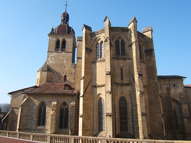

Сент-Антуан-л'Аббеи
- коммуна во Франции
Hiking in Сент-Антуан-л'Аббеи
Saint-Antoine-l'Abbaye, located in the Isère department of France, offers some wonderful hiking opportunities set against a backdrop of historical architecture and picturesque landscapes. The region is known for its medieval abbey, which adds cultural significance to your outdoor adventures....
- Страна:
- Почтовый код: 38160
- Координаты: 45° 10' 30" N, 5° 13' 0" E
- GPS треки (wikiloc): [Ссылка]
- Площадь: 22.21 кв.км
- Население: 1053
- Веб сайт: [Ссылка]

Сен-Веран
Hiking in Сен-Веран
Saint-Vérand is a charming village located in the Isère department of the Auvergne-Rhône-Alpes region in southeastern France. It is nestled in the foothills of the Alps and offers a variety of hiking opportunities that showcase the stunning natural landscapes of the area....
- Страна:
- Почтовый код: 38160
- Координаты: 45° 10' 23" N, 5° 19' 54" E
- GPS треки (wikiloc): [Ссылка]
- Высота над уровнем моря: 290 м m
- Площадь: 17.83 кв.км
- Население: 1727
- Веб сайт: [Ссылка]