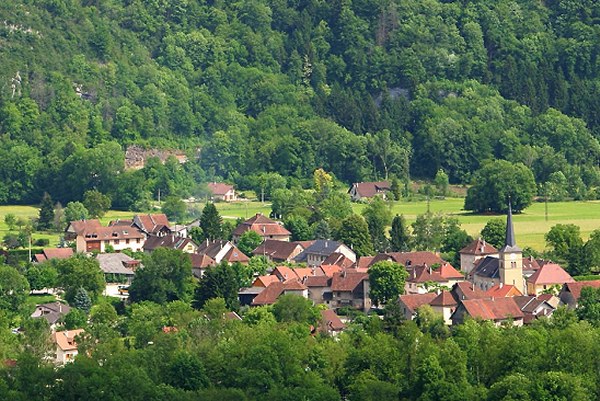
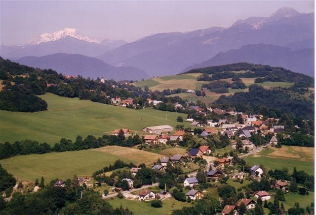
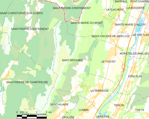
Сен-Пьер-де-Шартрёз (Saint-Pierre-de-Chartreuse, Saint-Pierre-de-Chartreuse)

- коммуна во Франции
 Hiking in Сен-Пьер-де-Шартрёз
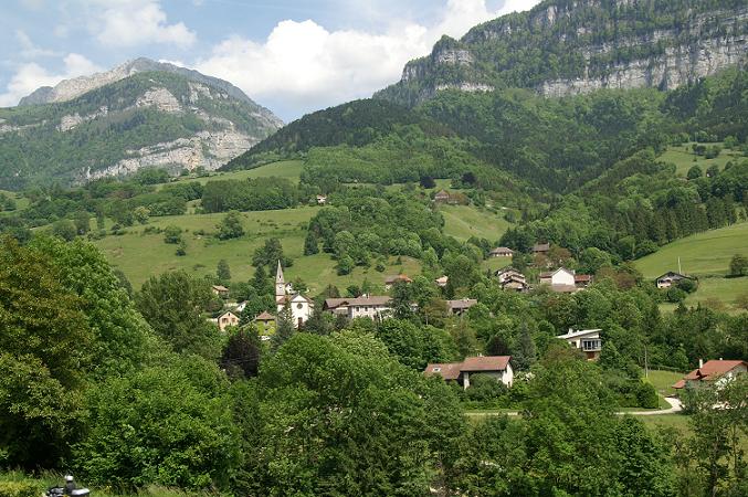
Saint-Pierre-de-Chartreuse is a picturesque village located in the Chartreuse Mountains, in the Auvergne-Rhône-Alpes region of France. It's a popular destination for outdoor enthusiasts, particularly hikers, due to its stunning landscapes, diverse trails, and rich natural heritage. Here are some highlights and tips for hiking in this beautiful area:
Hiking Trails
-
Grands Sentiers: There are several marked trails ranging from easy to challenging. The GR (Grande Randonnée) 9 is an excellent long-distance hiking route that passes through the region, offering breathtaking views of the surrounding mountains.
-
Col de la Sure: This hike leads to the Col de la Sure, which is accessible and provides beautiful views of the Chartreuse Mountains and valleys below. It’s a popular route for less experienced hikers.
-
Les Sétives: A moderately challenging hike that provides stunning panoramas and a chance to explore the rich flora and fauna of the region.
-
La Dent de Crolles: For more experienced hikers, this trail offers a challenging ascent to the summit of La Dent de Crolles. The views from the top are rewarding, showcasing the beauty of the Chartreuse and surrounding areas.
Natural Features
-
Flora and Fauna: The national park is home to diverse wildlife, including deer, chamois, and numerous bird species. The flora includes beech and fir forests, wildflowers, and alpine plants.
-
Scenic Views: Expect to encounter breathtaking vistas, plateaus, rocky peaks, and lush valleys. Picnicking at scenic viewpoints is highly recommended.
Best Time to Hike
- Spring (April - June): Wildflowers bloom, and the weather begins to warm up.
- Summer (July - August): The most popular time for hiking, with longer days and more stable weather. However, it can get crowded.
- Autumn (September - October): The fall colors are stunning, making it a beautiful time to hike, with fewer crowds.
- Winter (November - March): For winter hiking, snowshoes or crampons may be necessary, and trails can be less accessible.
Safety and Tips
- Prepare Adequately: Bring enough water, snacks, and a map or GPS device. Some trails may not have facilities.
- Check Weather: Weather can change quickly in the mountains, so always check the forecast before heading out.
- Dress Appropriately: Wear layered clothing, good hiking boots, and be prepared for changing conditions.
- Respect Nature: Follow the Leave No Trace principles to protect the environment.
Accessibility
Saint-Pierre-de-Chartreuse is accessible from major cities like Grenoble. Public transport options may be available, but having a car can provide more flexibility for reaching trailheads.
Overall, hiking in Saint-Pierre-de-Chartreuse offers a wonderful blend of natural beauty, solitude, and adventure. Whether you're a beginner or an experienced hiker, you’ll find trails that suit your skill level and provide unforgettable experiences.
- Страна:

- Почтовый код: 38380
- Координаты: 45° 20' 33" N, 5° 48' 56" E


- GPS треки (wikiloc): [Ссылка]
- Площадь: 80.12 кв.км
- Население: 1028
- Веб сайт: http://saintpierredechartreuse.fr
- Википедия русская: wiki(ru)
- Википедия английская: wiki(en)
- Википедия национальная: wiki(fr)
- Хранилище Wikidata: Wikidata: Q638647
- Катеория в википедии: [Ссылка]
- код Freebase: [/m/09cgd0]
- код GeoNames: Альт: [2977529]
- номер SIREN: [213804420]
- код BNF: [152582508]
- код VIAF: Альт: [146082211]
- код GND: Альт: [4470766-6]
- идентификатор местоположения ArchINFORM: [15646]
- код LCNAF: Альт: [n82166581]
- код тезауруса PACTOLS: [pcrtjHSTX4dMZF]
- код муниципалитета INSEE: 38442
Граничит с регионами:

Сен-Кристоф-сюр-Гьер
- коммуна во Франции
Hiking in Сен-Кристоф-сюр-Гьер
Saint-Christophe-sur-Guiers is a charming village located in the Isère department of the Auvergne-Rhône-Alpes region in southeastern France. The area is surrounded by stunning natural landscapes, making it a great destination for hiking enthusiasts....
- Страна:
- Почтовый код: 38380
- Координаты: 45° 26' 19" N, 5° 46' 26" E
- GPS треки (wikiloc): [Ссылка]
- Площадь: 23.54 кв.км
- Население: 858
- Веб сайт: [Ссылка]

Помье-ла-Пласетт
- коммуна во Франции
Hiking in Помье-ла-Пласетт
Pommiers-la-Placette is a charming village located in the picturesque Grenoble region of France, nestled in the heart of the French Alps. This area is known for its breathtaking landscapes, offering a plethora of hiking opportunities for outdoor enthusiasts of all skill levels....
- Страна:
- Почтовый код: 38340
- Координаты: 45° 19' 3" N, 5° 39' 26" E
- GPS треки (wikiloc): [Ссылка]
- Площадь: 16.92 кв.км
- Население: 554
- Веб сайт: [Ссылка]


Сент-Исмье
- коммуна во Франции
Hiking in Сент-Исмье
Saint-Ismier is a charming village located in the Auvergne-Rhône-Alpes region of southeastern France, near the Isère River and the picturesque city of Grenoble. The surrounding area offers a variety of hiking options, making it an excellent destination for both novice and experienced hikers. Here are some key points to consider if you're planning to hike in and around Saint-Ismier:...
- Страна:
- Почтовый код: 38330
- Координаты: 45° 14' 55" N, 5° 49' 37" E
- GPS треки (wikiloc): [Ссылка]
- Площадь: 14.9 кв.км
- Население: 6857
- Веб сайт: [Ссылка]


Сен-Пьер-д'Антремон
- коммуна во Франции
Hiking in Сен-Пьер-д'Антремон
Saint-Pierre-d'Entremont, located in the Isère department of the Auvergne-Rhône-Alpes region in France, is a picturesque village surrounded by the Chartreuse mountains. It offers a variety of hiking opportunities that cater to different skill levels and preferences. Here are some highlights of hiking in this beautiful area:...
- Страна:
- Почтовый код: 73670
- Координаты: 45° 24' 55" N, 5° 51' 14" E
- GPS треки (wikiloc): [Ссылка]
- Площадь: 32.31 кв.км
- Население: 557
- Веб сайт: [Ссылка]

Сен-Панкрасс
- коммуна во Франции
Hiking in Сен-Панкрасс
Saint-Pancrasse is a charming village located in the Isère department of the Auvergne-Rhône-Alpes region in southeastern France. Nestled in the foothills of the French Alps, it offers stunning scenery and a variety of hiking opportunities suitable for different skill levels....
- Страна:
- Почтовый код: 38660
- Координаты: 45° 17' 31" N, 5° 51' 35" E
- GPS треки (wikiloc): [Ссылка]
- Площадь: 6.71 кв.км
- Население: 442


Сен-Лоран-дю-Пон
- коммуна во Франции
Hiking in Сен-Лоран-дю-Пон
Saint-Laurent-du-Pont is a charming commune located in the Isère department of the Auvergne-Rhône-Alpes region in France. It is surrounded by stunning natural landscapes, including the Chartreuse Mountains, making it an excellent destination for hiking enthusiasts....
- Страна:
- Почтовый код: 38380
- Координаты: 45° 23' 15" N, 5° 44' 5" E
- GPS треки (wikiloc): [Ссылка]
- Площадь: 35.25 кв.км
- Население: 4543
- Веб сайт: [Ссылка]


Ле-Саппе-ан-Шартрёз
- коммуна во Франции
Hiking in Ле-Саппе-ан-Шартрёз
Le Sappey-en-Chartreuse is a charming village located in the Chartreuse mountain range of the French Alps. This region is known for its stunning natural landscapes, rich biodiversity, and a variety of outdoor activities, making it an excellent destination for hiking enthusiasts. Here are some highlights for hiking in Le Sappey-en-Chartreuse:...
- Страна:
- Почтовый код: 38700
- Координаты: 45° 15' 45" N, 5° 46' 41" E
- GPS треки (wikiloc): [Ссылка]
- Площадь: 15.13 кв.км
- Население: 1119

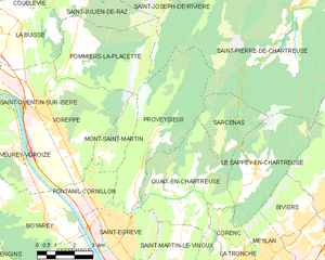
Провезьё
- коммуна во Франции
Hiking in Провезьё
Proveysieux is a charming village located in the Grenoble area of the French Alps. It's a fantastic destination for hiking enthusiasts looking to explore the natural beauty of the region. Here are some key points about hiking in Proveysieux:...
- Страна:
- Почтовый код: 38120
- Координаты: 45° 15' 46" N, 5° 41' 58" E
- GPS треки (wikiloc): [Ссылка]
- Площадь: 20.37 кв.км
- Население: 503


Сен-Назер-лез-Эйм
- коммуна во Франции
Hiking in Сен-Назер-лез-Эйм
Saint-Nazaire-les-Eymes is a charming commune situated in the Auvergne-Rhône-Alpes region of southeastern France, near the French Alps. It offers a variety of hiking opportunities, making it a great destination for outdoor enthusiasts....
- Страна:
- Почтовый код: 38330
- Координаты: 45° 14' 58" N, 5° 51' 12" E
- GPS треки (wikiloc): [Ссылка]
- Высота над уровнем моря: 283 м m
- Площадь: 8.49 кв.км
- Население: 2961
- Веб сайт: [Ссылка]

Сен-Бернар
Hiking in Сен-Бернар
Hiking in Saint-Bernard, Isère, offers numerous trails and breathtaking views that showcase the stunning landscape of the French Alps. The region is characterized by its diverse terrain, which includes mountains, forests, and valleys that provide a variety of hiking experiences for all skill levels....
- Страна:
- Почтовый код: 38660
- Координаты: 45° 19' 46" N, 5° 54' 12" E
- GPS треки (wikiloc): [Ссылка]
- Площадь: 21.59 кв.км
- Население: 623
- Веб сайт: [Ссылка]


Сент-Илер
Hiking in Сент-Илер
Saint-Hilaire, located in the Isère department of the Auvergne-Rhône-Alpes region in southeastern France, is a popular destination for hiking and outdoor activities. The area is renowned for its stunning landscapes, featuring a mix of mountains, forests, and scenic viewpoints, making it a fantastic spot for all levels of hikers....
- Страна:
- Почтовый код: 38660
- Координаты: 45° 18' 34" N, 5° 53' 14" E
- GPS треки (wikiloc): [Ссылка]
- Площадь: 8.61 кв.км
- Население: 1348
- Веб сайт: [Ссылка]


Сен-Жозеф-де-Ривьер
- коммуна во Франции
Hiking in Сен-Жозеф-де-Ривьер
Saint-Joseph-de-Rivière is a charming village located in the Isère department in the Auvergne-Rhône-Alpes region of France. This area is surrounded by beautiful natural landscapes, making it an appealing destination for hiking enthusiasts....
- Страна:
- Почтовый код: 38134
- Координаты: 45° 22' 33" N, 5° 41' 49" E
- GPS треки (wikiloc): [Ссылка]
- Площадь: 17.39 кв.км
- Население: 1218
- Веб сайт: [Ссылка]


Сарсена
- коммуна во Франции
Hiking in Сарсена
Sarcenas, located in the French Alps near Grenoble, is a fantastic destination for hiking enthusiasts. The area offers a variety of trails that cater to different experience levels, from gentle walks to challenging hikes, making it an excellent spot for both beginners and seasoned hikers....
- Страна:
- Почтовый код: 38700
- Координаты: 45° 16' 26" N, 5° 45' 29" E
- GPS треки (wikiloc): [Ссылка]
- Площадь: 7.76 кв.км
- Население: 196
- Веб сайт: [Ссылка]