Sollières-Sardières (Sollières-Sardières)

- коммуна во Франции
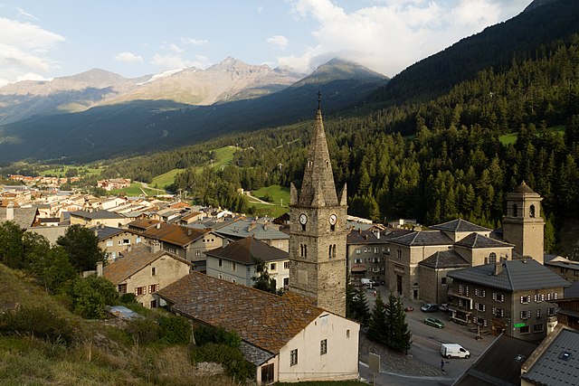
 Hiking in Sollières-Sardières
Sollières-Sardières is a charming village located in the French Alps, nestled between the Vanoise National Park and the Italian border. This region is known for its stunning mountain landscapes, rich biodiversity, and extensive hiking trails, making it an excellent destination for hikers of all levels.
Hiking Trails
-
Lac de l'Orgere: This moderately difficult hike leads you to a beautiful alpine lake surrounded by mountains. The path takes you through lush forests and offers plenty of spots for photography along the way.
-
Les Aiguilles d'Arves: More experienced hikers can tackle the trails leading to these iconic peaks. The routes offer breathtaking views and a challenging experience, with options for both day hikes and multi-day treks.
-
Sentier des Cimes: This is a scenic trail that winds through the high alpine environment, providing panoramic views of the surrounding peaks. It’s suitable for families and can often be enjoyed in a few hours.
-
Refuge de la Dent Parrachée: A popular destination for those looking to experience the local wildlife and stunning landscapes. This hike usually involves some elevation gain and can lead to beautiful vistas of the surrounding area.
Tips for Hiking in Sollières-Sardières
- Navigation: While many trails are well-marked, it’s always a good idea to carry a detailed map or have a GPS device for navigation.
- Weather: Be sure to check the weather before heading out. The mountain weather can change rapidly, so wearing layers is advisable.
- Equipment: Proper hiking boots, poles, and a daypack with essentials (water, snacks, first aid, etc.) are recommended for a pleasant hiking experience.
- Leave No Trace: Respect the natural environment by following the Leave No Trace principles—pack out what you pack in.
Local Amenities
In Sollières-Sardières, you’ll find local accommodations, restaurants, and shops where you can replenish supplies after a day of hiking. The region is also known for its local cuisine, so don’t miss out on trying traditional dishes.
Conclusion
Hiking in Sollières-Sardières offers an incredible opportunity to explore the natural beauty of the French Alps while enjoying a peaceful environment. Whether you’re a novice hiker or an experienced mountaineer, there’s something here for everyone. Be sure to plan ahead, stay safe, and enjoy the breathtaking landscapes!
- Страна:

- Почтовый код: 73500
- Координаты: 45° 15' 51" N, 6° 48' 30" E


- GPS треки (wikiloc): [Ссылка]
- Площадь: 33.31 кв.км
- Население: 189
- Веб сайт: http://www.sollieres-sardieres-mairie.com
- Википедия английская: wiki(en)
- Википедия национальная: wiki(fr)
- Хранилище Wikidata: Wikidata: Q682027
- Катеория в википедии: [Ссылка]
- код Freebase: [/m/0dsh26]
- код GeoNames: Альт: [2974339]
- код BNF: [15274217w]
- код VIAF: Альт: [248263607]
- код тезауруса PACTOLS: [pcrtxb86HfsAvD]
- код муниципалитета INSEE: 73287
Граничит с регионами:


Bramans
- коммуна во Франции
Hiking in Bramans
Bramans is a charming village located in the Savoie region of the French Alps, known for its stunning natural landscapes and outdoor activities, including hiking. The area offers a variety of hiking trails that cater to different skill levels, making it a great destination for both beginner and experienced hikers....
- Страна:
- Почтовый код: 73500
- Координаты: 45° 13' 25" N, 6° 46' 34" E
- GPS треки (wikiloc): [Ссылка]
- Площадь: 92.26 кв.км
- Население: 435
- Веб сайт: [Ссылка]


Aussois
- коммуна во Франции
Hiking in Aussois
Aussois is a charming village located in the heart of the French Alps, specifically in the Savoie region. It's often considered a hidden gem for outdoor enthusiasts, especially hikers. The area is part of the Vanoise National Park and offers stunning views, diverse trails, and a rich natural environment....
- Страна:
- Почтовый код: 73500
- Координаты: 45° 13' 39" N, 6° 44' 30" E
- GPS треки (wikiloc): [Ссылка]
- Площадь: 41.94 кв.км
- Население: 659
- Веб сайт: [Ссылка]


Termignon
- коммуна во Франции
Hiking in Termignon
Termignon is a charming village located in the Maurienne Valley in the French Alps, part of the Savoie region. It offers a variety of hiking opportunities for outdoor enthusiasts, ranging from leisurely walks to challenging treks with stunning views of the surrounding mountains and valleys. Here are some highlights of hiking in and around Termignon:...
- Страна:
- Почтовый код: 73500
- Координаты: 45° 16' 39" N, 6° 49' 1" E
- GPS треки (wikiloc): [Ссылка]
- Площадь: 149.03 кв.км
- Население: 400
- Веб сайт: [Ссылка]

Ланлебур-Мон-Сени
- коммуна во Франции
Hiking in Ланлебур-Мон-Сени
Lanslebourg-Mont-Cenis, located in the Savoie region of France, is a stunning destination for hiking enthusiasts. Nestled in the French Alps, this area offers a variety of trails that cater to different levels of hiking experience, from gentle walks to more challenging climbs....
- Страна:
- Почтовый код: 73480
- Координаты: 45° 17' 9" N, 6° 52' 45" E
- GPS треки (wikiloc): [Ссылка]
- Площадь: 93.61 кв.км
- Население: 649
- Веб сайт: [Ссылка]