.jpg)
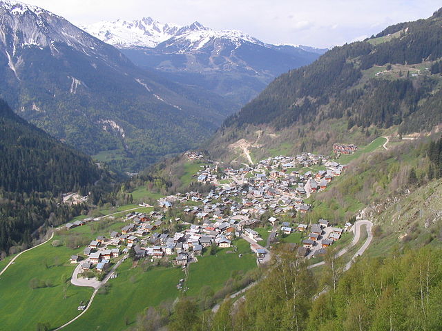
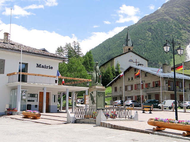
Termignon (Termignon)

- коммуна во Франции
 Hiking in Termignon
Termignon is a charming village located in the Maurienne Valley in the French Alps, part of the Savoie region. It offers a variety of hiking opportunities for outdoor enthusiasts, ranging from leisurely walks to challenging treks with stunning views of the surrounding mountains and valleys. Here are some highlights of hiking in and around Termignon:
Trails and Routes
-
Les Etroits Pass: This trail offers breathtaking views of the surrounding mountains and valleys. It is a moderate hike that can typically be completed in a few hours.
-
The Vanoise National Park: Just a short distance from Termignon, this park is famous for its diverse flora and fauna as well as its stunning mountain scenery. Trails here range in difficulty, and you can spot marmots and ibexes along the way.
-
Col de Montbré and Col de la Vanoise: These challenging hikes are rewarding for their panoramic views. They are perfect for experienced hikers looking for a day-long adventure.
-
Lac de la Plagne: A more accessible hike leads to this beautiful lake. It’s ideal for families or those looking for a shorter trek while still enjoying the scenic beauty of the Alps.
Tips for Hiking in Termignon
- Weather Conditions: Always check the weather forecast before heading out, as conditions can change rapidly in the mountains.
- Gear: Wear proper hiking boots and bring layers of clothing to adjust to temperature changes. A good backpack with water and snacks is essential.
- Maps and Guides: Utilize local hiking maps and guides to navigate the trails effectively. It's often a good idea to consult with local tourism offices for the most up-to-date trail conditions and recommendations.
- Respect Nature: Stay on marked trails, carry out any waste, and respect wildlife.
Access
Termignon is accessible by car or public transport from larger towns in the region. It is well-connected to other hiking destinations in the Vanoise area, making it a great base for your hiking adventures.
Other Activities
In addition to hiking, Termignon offers opportunities for cycling, paragliding, and enjoying local cuisine, which can complement your outdoor experiences.
Whether you are a novice or an experienced hiker, Termignon and its picturesque surroundings provide a wonderful setting for outdoor exploration in the heart of the French Alps.
- Страна:

- Почтовый код: 73500
- Координаты: 45° 16' 39" N, 6° 49' 1" E


- GPS треки (wikiloc): [Ссылка]
- Площадь: 149.03 кв.км
- Население: 400
- Веб сайт: http://www.termignon-la-vanoise.com
- Википедия английская: wiki(en)
- Википедия национальная: wiki(fr)
- Хранилище Wikidata: Wikidata: Q569751
- Катеория в википедии: [Ссылка]
- код Freebase: [/m/03qln49]
- код GeoNames: Альт: [2973138]
- код BNF: [15274220s]
- код муниципалитета INSEE: 73290
Граничит с регионами:


Lanslevillard
- коммуна во Франции
Hiking in Lanslevillard
Lanslevillard, located in the Savoie region of France, is a beautiful destination for hiking enthusiasts. Nestled in the heart of the French Alps, this charming alpine village offers a range of hiking trails that cater to all experience levels, from beginners to seasoned hikers. Here are some key highlights about hiking in Lanslevillard:...
- Страна:
- Почтовый код: 73480
- Координаты: 45° 17' 22" N, 6° 54' 42" E
- GPS треки (wikiloc): [Ссылка]
- Площадь: 39.84 кв.км
- Население: 468
- Веб сайт: [Ссылка]

Champagny-en-Vanoise
- коммуна во Франции
Hiking in Champagny-en-Vanoise
Champagny-en-Vanoise is a picturesque village located in the Savoie region of the French Alps, and it serves as a fantastic base for hiking enthusiasts exploring the Vanoise National Park. The area is known for its stunning mountain scenery, diverse flora and fauna, and well-marked hiking trails suitable for all skill levels. Here are some key points about hiking in Champagny-en-Vanoise:...
- Страна:
- Почтовый код: 73350
- Координаты: 45° 27' 16" N, 6° 41' 33" E
- GPS треки (wikiloc): [Ссылка]
- Площадь: 84.96 кв.км
- Население: 605
- Веб сайт: [Ссылка]


Валь-д'Изер
- коммуна во Франции
Hiking in Валь-д'Изер
Val-d'Isère, located in the French Alps, is a renowned ski resort that also offers spectacular hiking opportunities during the summer months. The area is known for its breathtaking mountain scenery, alpine meadows, and a variety of hiking trails suitable for different skill levels. Here are some highlights to consider if you plan to hike in Val-d'Isère:...
- Страна:
- Почтовый код: 73150
- Координаты: 45° 26' 59" N, 6° 58' 38" E
- GPS треки (wikiloc): [Ссылка]
- Высота над уровнем моря: 1850 м m
- Площадь: 94.39 кв.км
- Население: 1583
- Веб сайт: [Ссылка]


Тинь
- коммуна во Франции
Hiking in Тинь
Tignes is a beautiful alpine resort located in the French Alps, renowned for both its skiing and summer hiking opportunities. Here are some insights into hiking in Tignes:...
- Страна:
- Почтовый код: 73320
- Координаты: 45° 28' 11" N, 6° 54' 34" E
- GPS треки (wikiloc): [Ссылка]
- Площадь: 81.63 кв.км
- Население: 2569
- Веб сайт: [Ссылка]


Aussois
- коммуна во Франции
Hiking in Aussois
Aussois is a charming village located in the heart of the French Alps, specifically in the Savoie region. It's often considered a hidden gem for outdoor enthusiasts, especially hikers. The area is part of the Vanoise National Park and offers stunning views, diverse trails, and a rich natural environment....
- Страна:
- Почтовый код: 73500
- Координаты: 45° 13' 39" N, 6° 44' 30" E
- GPS треки (wikiloc): [Ссылка]
- Площадь: 41.94 кв.км
- Население: 659
- Веб сайт: [Ссылка]


Pralognan-la-Vanoise
- коммуна во Франции
Hiking in Pralognan-la-Vanoise
Pralognan-la-Vanoise is a charming village located in the heart of the Vanoise National Park in the French Alps. It is an excellent destination for hiking enthusiasts, offering a diverse range of trails suitable for varying skill levels, as well as breathtaking scenery....
- Страна:
- Почтовый код: 73710
- Координаты: 45° 22' 53" N, 6° 43' 17" E
- GPS треки (wikiloc): [Ссылка]
- Площадь: 88.57 кв.км
- Население: 744
- Веб сайт: [Ссылка]


Sollières-Sardières
- коммуна во Франции
Hiking in Sollières-Sardières
Sollières-Sardières is a charming village located in the French Alps, nestled between the Vanoise National Park and the Italian border. This region is known for its stunning mountain landscapes, rich biodiversity, and extensive hiking trails, making it an excellent destination for hikers of all levels....
- Страна:
- Почтовый код: 73500
- Координаты: 45° 15' 51" N, 6° 48' 30" E
- GPS треки (wikiloc): [Ссылка]
- Площадь: 33.31 кв.км
- Население: 189
- Веб сайт: [Ссылка]

Bessans
- коммуна во Франции
Hiking in Bessans
Bessans is a picturesque village located in the Savoie region of the French Alps, known for its stunning landscapes and outdoor activities, including hiking. Nestled at an altitude of about 1,740 meters, it offers a range of trails suitable for various skill levels, making it a great destination for both experienced hikers and families....
- Страна:
- Почтовый код: 73480
- Координаты: 45° 19' 12" N, 6° 59' 37" E
- GPS треки (wikiloc): [Ссылка]
- Высота над уровнем моря: 1750 м m
- Площадь: 128.08 кв.км
- Население: 338
- Веб сайт: [Ссылка]

Ланлебур-Мон-Сени
- коммуна во Франции
Hiking in Ланлебур-Мон-Сени
Lanslebourg-Mont-Cenis, located in the Savoie region of France, is a stunning destination for hiking enthusiasts. Nestled in the French Alps, this area offers a variety of trails that cater to different levels of hiking experience, from gentle walks to more challenging climbs....
- Страна:
- Почтовый код: 73480
- Координаты: 45° 17' 9" N, 6° 52' 45" E
- GPS треки (wikiloc): [Ссылка]
- Площадь: 93.61 кв.км
- Население: 649
- Веб сайт: [Ссылка]