.JPG)
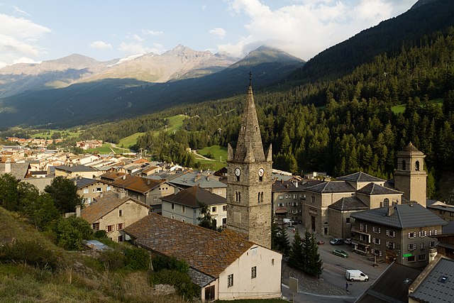
Bramans (Bramans)

- коммуна во Франции
 Hiking in Bramans
Bramans is a charming village located in the Savoie region of the French Alps, known for its stunning natural landscapes and outdoor activities, including hiking. The area offers a variety of hiking trails that cater to different skill levels, making it a great destination for both beginner and experienced hikers.
Hiking Trails:
-
Chalet de la Coche:
- Difficulty: Moderate
- Distance: Approximately 10 km round trip
- Highlights: This trail takes you through beautiful alpine meadows and offers stunning views of the surrounding mountains. It’s a great option for a half-day hike.
-
Refuge de l'Étendard:
- Difficulty: Moderate to Challenging
- Distance: About 15 km round trip
- Highlights: A scenic hike that leads to the Refuge, where you can enjoy panoramic views and potentially spot local wildlife. The trail features some elevation gain, so prepare accordingly.
-
Lac de la Plagne:
- Difficulty: Easy
- Distance: 5 km round trip
- Highlights: Perfect for families and beginners, this trail provides a serene walk around the lake, with opportunities for picnicking and photography.
Best Time to Hike:
The best time to hike in Bramans is typically from late spring to early autumn (May to September), when the weather is milder and the trails are clear of snow. However, always check local conditions before setting out, as the weather in the mountains can change rapidly.
Safety Tips:
- Always wear appropriate hiking gear, including sturdy boots and layered clothing to accommodate changes in temperature.
- Carry sufficient water and snacks, as well as a basic first aid kit.
- Be mindful of trail markings and maps, and consider using a GPS device or smartphone app for navigation.
- Let someone know your hiking plans and expected return time.
Local Attractions:
In addition to hiking, Bramans offers other activities such as mountain biking, fishing, and exploring local cultural sites. After a day of hiking, you can enjoy some delicious Savoie cuisine at local restaurants.
Feel free to ask for more specific information about trails or other activities in the area!
- Страна:

- Почтовый код: 73500
- Координаты: 45° 13' 25" N, 6° 46' 34" E


- GPS треки (wikiloc): [Ссылка]
- Площадь: 92.26 кв.км
- Население: 435
- Веб сайт: http://www.bramans.fr
- Википедия английская: wiki(en)
- Википедия национальная: wiki(fr)
- Хранилище Wikidata: Wikidata: Q1231210
- Катеория в википедии: [Ссылка]
- код Freebase: [/m/03npgc7]
- код GeoNames: Альт: [3030587]
- код BNF: [152739910]
- код VIAF: Альт: [143047341]
- код LCNAF: Альт: [n78058191]
- код муниципалитета INSEE: 73056
Граничит с регионами:


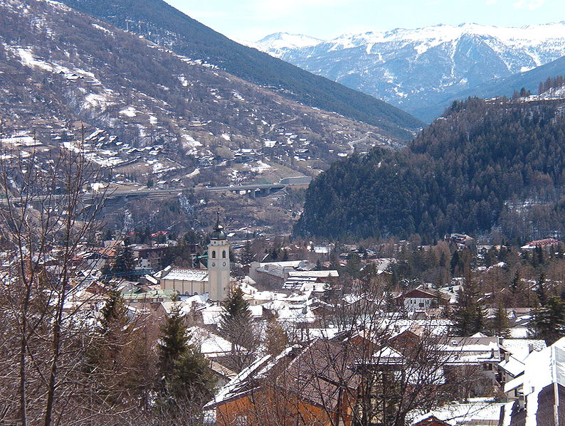
Венаус
- коммуна в Италии
Hiking in Венаус
Venaus is a small village located in the Susa Valley of the Piedmont region in Italy. It is surrounded by the beautiful Alps, making it an excellent destination for hiking enthusiasts. Here are some highlights about hiking in and around Venaus:...
- Страна:

- Почтовый код: 10050
- Телефонный код: 0122
- Код автомобильного номера: TO
- Координаты: 45° 9' 0" N, 7° 1' 0" E
- GPS треки (wikiloc): [Ссылка]
- Высота над уровнем моря: 604 м m
- Площадь: 19.14 кв.км
- Население: 879
- Веб сайт: [Ссылка]


Aussois
- коммуна во Франции
Hiking in Aussois
Aussois is a charming village located in the heart of the French Alps, specifically in the Savoie region. It's often considered a hidden gem for outdoor enthusiasts, especially hikers. The area is part of the Vanoise National Park and offers stunning views, diverse trails, and a rich natural environment....
- Страна:
- Почтовый код: 73500
- Координаты: 45° 13' 39" N, 6° 44' 30" E
- GPS треки (wikiloc): [Ссылка]
- Площадь: 41.94 кв.км
- Население: 659
- Веб сайт: [Ссылка]


Sollières-Sardières
- коммуна во Франции
Hiking in Sollières-Sardières
Sollières-Sardières is a charming village located in the French Alps, nestled between the Vanoise National Park and the Italian border. This region is known for its stunning mountain landscapes, rich biodiversity, and extensive hiking trails, making it an excellent destination for hikers of all levels....
- Страна:
- Почтовый код: 73500
- Координаты: 45° 15' 51" N, 6° 48' 30" E
- GPS треки (wikiloc): [Ссылка]
- Площадь: 33.31 кв.км
- Население: 189
- Веб сайт: [Ссылка]


Аврие
- коммуна во Франции
Hiking in Аврие
Avrieux is a charming commune located in the Savoie department of the Auvergne-Rhône-Alpes region in southeastern France. Nestled in the French Alps, it offers beautiful landscapes and a variety of hiking opportunities....
- Страна:
- Почтовый код: 73500
- Координаты: 45° 12' 55" N, 6° 43' 15" E
- GPS треки (wikiloc): [Ссылка]
- Площадь: 37.85 кв.км
- Население: 397
- Веб сайт: [Ссылка]

Ланлебур-Мон-Сени
- коммуна во Франции
Hiking in Ланлебур-Мон-Сени
Lanslebourg-Mont-Cenis, located in the Savoie region of France, is a stunning destination for hiking enthusiasts. Nestled in the French Alps, this area offers a variety of trails that cater to different levels of hiking experience, from gentle walks to more challenging climbs....
- Страна:
- Почтовый код: 73480
- Координаты: 45° 17' 9" N, 6° 52' 45" E
- GPS треки (wikiloc): [Ссылка]
- Площадь: 93.61 кв.км
- Население: 649
- Веб сайт: [Ссылка]

Бардонеккия
- коммуна Италии
Hiking in Бардонеккия
Bardonecchia, located in the Susa Valley of the Piedmont region of Italy, is a popular destination for hiking enthusiasts, offering a range of trails that cater to different skill levels and preferences. The area is known for its stunning alpine scenery, diverse ecosystems, and rich cultural heritage....
- Страна:
- Почтовый код: 10052
- Телефонный код: 0122
- Код автомобильного номера: TO
- Координаты: 45° 4' 42" N, 6° 42' 14" E
- GPS треки (wikiloc): [Ссылка]
- Высота над уровнем моря: 1312 м m
- Площадь: 132.2 кв.км
- Население: 3155
- Веб сайт: [Ссылка]
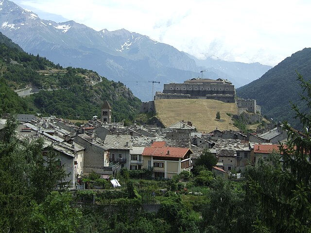

Эксиллес
- коммуна Италии
Hiking in Эксиллес
Exilles, located in the Susa Valley in the Piedmont region of Italy, is surrounded by the stunning landscapes of the Alps, making it an excellent destination for hiking enthusiasts. Here are some highlights and tips for hiking in and around Exilles:...
- Страна:
- Почтовый код: 10050
- Телефонный код: 0122
- Код автомобильного номера: TO
- Координаты: 45° 6' 0" N, 6° 56' 0" E
- GPS треки (wikiloc): [Ссылка]
- Высота над уровнем моря: 870 м m
- Площадь: 46.55 кв.км
- Население: 260
- Веб сайт: [Ссылка]


Джальоне
- коммуна Италии
Hiking in Джальоне
Giaglione is a picturesque village located in the Susa Valley of the Piedmont region in northwest Italy. It’s an ideal location for hiking enthusiasts, offering stunning views of the surrounding alpine landscape and numerous trails suitable for various skill levels....
- Страна:
- Почтовый код: 10050
- Телефонный код: 0122
- Код автомобильного номера: TO
- Координаты: 45° 8' 23" N, 7° 0' 51" E
- GPS треки (wikiloc): [Ссылка]
- Высота над уровнем моря: 774 м m
- Площадь: 33.38 кв.км
- Население: 619
- Веб сайт: [Ссылка]