
Валь-д'Изер (Val-d'Isère, Val-d'Isère)

- коммуна во Франции
 Hiking in Валь-д'Изер
Val-d'Isère, located in the French Alps, is a renowned ski resort that also offers spectacular hiking opportunities during the summer months. The area is known for its breathtaking mountain scenery, alpine meadows, and a variety of hiking trails suitable for different skill levels. Here are some highlights to consider if you plan to hike in Val-d'Isère:
Trails:
-
Easy Trails: For beginners or those looking for a leisurely hike, there are several well-marked paths that weave through beautiful alpine landscapes. The area around the village often has shorter trails suitable for families.
-
Moderate Trails: Intermediate hikers can enjoy trails that lead to stunning viewpoints. One popular route is the hike to the Col de l'Iseran, where hikers can enjoy panoramic views of the surrounding peaks.
-
Challenging Trails: For seasoned hikers, there are more demanding routes that can take you to higher altitudes or through more rugged terrain. The hike to the Grande Sassière Nature Reserve offers a chance to see varied wildlife and beautiful glacial landscapes.
Scenic Highlights:
- Panoramic Views: Many trails provide stunning vistas of the Alps, including iconic peaks such as the Grande Motte.
- Alpine Flora and Fauna: Hikers can encounter a rich variety of plant life, including wildflowers, and may spot local wildlife like ibex, chamois, and marmots.
- Lakes and Rivers: Various trails lead to alpine lakes, which are particularly picturesque and ideal for breaks or picnics.
Tips for Hiking in Val-d'Isère:
- Season: The best time for hiking in Val-d'Isère is generally from late June to early September when the weather is mild, and trails are accessible.
- Weather: Always check the weather forecast before heading out, as conditions can change rapidly in the mountains.
- Equipment: Wear suitable hiking boots and bring necessary gear such as trekking poles, a backpack, water, snacks, and a first-aid kit.
- Guides: If you're unfamiliar with the area, consider hiring a local guide who can provide insights about the trails and ensure a safe experience.
Additional Activities:
Aside from hiking, Val-d'Isère offers various other outdoor activities such as mountain biking, paragliding, and rock climbing for those looking to explore more of the stunning alpine environment.
With its dramatic landscapes and diverse range of trails, Val-d'Isère is a fantastic destination for hiking enthusiasts. Whether you're looking for a peaceful stroll or an adventurous trek, there's something for every outdoor lover in this beautiful alpine region.
- Страна:

- Почтовый код: 73150
- Координаты: 45° 26' 59" N, 6° 58' 38" E


- GPS треки (wikiloc): [Ссылка]
- Высота над уровнем моря: 1850 м m
- Площадь: 94.39 кв.км
- Население: 1583
- Веб сайт: http://www.valdisere.com
- Википедия русская: wiki(ru)
- Википедия английская: wiki(en)
- Википедия национальная: wiki(fr)
- Хранилище Wikidata: Wikidata: Q207589
- Катеория в википедии: [Ссылка]
- код Freebase: [/m/01z38z]
- код GeoNames: Альт: [2971074]
- номер SIREN: [217303049]
- код BNF: [15274234g]
- код VIAF: Альт: [143752566]
- код LCNAF: Альт: [n80104551]
- код темы Quora: [Val-dIsere-France]
- учётная запись в Твиттере: Альт: [valdisere]
- код в Большой российской энциклопедии онлайн: [1897646]
- код Trismegistos: [22460]
- код муниципалитета INSEE: 73304
- код US National Archives: 10037971
Граничит с регионами:


Тинь
- коммуна во Франции
Hiking in Тинь
Tignes is a beautiful alpine resort located in the French Alps, renowned for both its skiing and summer hiking opportunities. Here are some insights into hiking in Tignes:...
- Страна:
- Почтовый код: 73320
- Координаты: 45° 28' 11" N, 6° 54' 34" E
- GPS треки (wikiloc): [Ссылка]
- Площадь: 81.63 кв.км
- Население: 2569
- Веб сайт: [Ссылка]


Рем-Нотр-Дам
- коммуна Италии
Hiking in Рем-Нотр-Дам
Rhêmes-Notre-Dame is a charming village located in the Aosta Valley of Italy, nestled in the heart of the Gran Paradiso National Park. This picturesque area is known for its stunning landscapes, diverse wildlife, and an extensive network of hiking trails that cater to all levels of experience....
- Страна:

- Почтовый код: 11010
- Телефонный код: 0165
- Код автомобильного номера: AO
- Координаты: 45° 34' 11" N, 7° 7' 7" E
- GPS треки (wikiloc): [Ссылка]
- Высота над уровнем моря: 1725 м m
- Площадь: 86.84 кв.км
- Население: 82
- Веб сайт: [Ссылка]


Termignon
- коммуна во Франции
Hiking in Termignon
Termignon is a charming village located in the Maurienne Valley in the French Alps, part of the Savoie region. It offers a variety of hiking opportunities for outdoor enthusiasts, ranging from leisurely walks to challenging treks with stunning views of the surrounding mountains and valleys. Here are some highlights of hiking in and around Termignon:...
- Страна:
- Почтовый код: 73500
- Координаты: 45° 16' 39" N, 6° 49' 1" E
- GPS треки (wikiloc): [Ссылка]
- Площадь: 149.03 кв.км
- Население: 400
- Веб сайт: [Ссылка]

Bessans
- коммуна во Франции
Hiking in Bessans
Bessans is a picturesque village located in the Savoie region of the French Alps, known for its stunning landscapes and outdoor activities, including hiking. Nestled at an altitude of about 1,740 meters, it offers a range of trails suitable for various skill levels, making it a great destination for both experienced hikers and families....
- Страна:
- Почтовый код: 73480
- Координаты: 45° 19' 12" N, 6° 59' 37" E
- GPS треки (wikiloc): [Ссылка]
- Высота над уровнем моря: 1750 м m
- Площадь: 128.08 кв.км
- Население: 338
- Веб сайт: [Ссылка]
Bonneval-sur-Arc
- коммуна во Франции
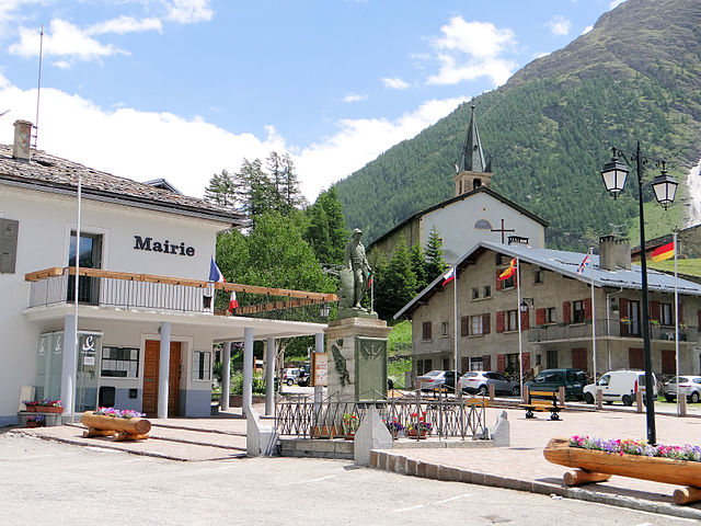
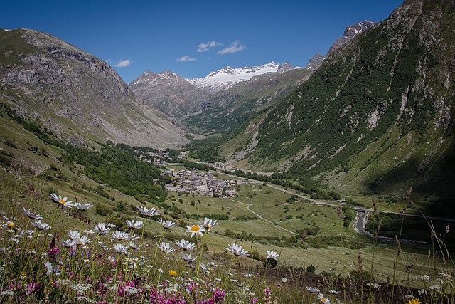
Hiking in Bonneval-sur-Arc
Bonneval-sur-Arc is a stunning location for hiking, situated in the French Alps within the Vanoise National Park. Known for its picturesque landscapes, high peaks, and well-preserved alpine environment, it offers a range of trails suitable for different levels of hikers....
- Страна:
- Почтовый код: 73480
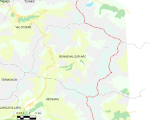
- Координаты: 45° 22' 16" N, 7° 2' 47" E
- GPS треки (wikiloc): [Ссылка]
- Площадь: 82.72 кв.км
- Население: 255
- Веб сайт: [Ссылка]


Черезоле-Реале
- коммуна Италии
Hiking in Черезоле-Реале
Ceresole Reale is a stunning area located in the Italian Piedmont region, within the Gran Paradiso National Park. It's a fantastic destination for hiking enthusiasts, offering a combination of breathtaking landscapes, diverse flora and fauna, and a variety of trails suitable for different skill levels....
- Страна:
- Почтовый код: 10080
- Телефонный код: 0124
- Код автомобильного номера: TO
- Координаты: 45° 26' 0" N, 7° 14' 0" E
- GPS треки (wikiloc): [Ссылка]
- Высота над уровнем моря: 1620 м m
- Площадь: 99.82 кв.км
- Население: 164
- Веб сайт: [Ссылка]