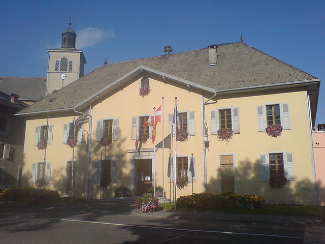
Verchaix (Verchaix)

- коммуна во Франции
 Hiking in Verchaix
Verchaix is a beautiful destination located in the French Alps, in the Haute-Savoie region. This picturesque village offers a range of hiking opportunities, making it an excellent choice for both casual hikers and experienced trekkers.
Hiking Trails and Areas
-
Grand Massif: Verchaix is part of the Grand Massif ski area, which also offers hiking trails in the summer. Trails vary in difficulty and length, providing options for all fitness levels. You can hike along well-marked paths that offer stunning views of Mont Blanc and the surrounding mountains.
-
Lacs de Fontaine: This scenic hike takes you to charming alpine lakes. The route is generally moderate, making it suitable for families. The lakes are particularly beautiful in the warmer months and provide a perfect spot for picnicking.
-
Sentier des Pèlerins: This is a spiritual hiking route that leads to various chapels around the area. Not only do you get to enjoy the natural beauty, but you also have the opportunity to see local culture and history along the way.
-
Biodiversity Walks: Some trails focus on the local flora and fauna, allowing you to appreciate the biodiversity of the region. Guided tours may be available for a more informative experience.
Tips for Hiking in Verchaix
- Check the Weather: Mountain weather can change rapidly, so it’s essential to check forecasts before setting out.
- Proper Gear: Wear sturdy hiking shoes and bring appropriate clothing for varying temperatures and conditions.
- Hydration and Nutrition: Carry enough water and snacks, especially on longer hikes.
- Maps and Guides: Obtain a trail map or use a hiking app for navigation, as some trails may not be well marked.
- Respect Nature: As always, practice Leave No Trace principles to help preserve the beauty of the area.
Nearby Attractions
After your hike, consider exploring the local village of Verchaix, where you can enjoy traditional Savoyard cuisine at local restaurants or visit nearby towns like Samoëns and Sixt-Fer-à-Cheval for additional hiking options and cultural experiences.
Conclusion
Verchaix offers a delightful hiking experience with its stunning natural landscapes and a variety of trails. Whether you're seeking a leisurely stroll or an adventurous trek, there's something for every outdoor enthusiast in this beautiful Alpine setting.
- Страна:

- Почтовый код: 74440
- Координаты: 46° 5' 47" N, 6° 40' 35" E


- GPS треки (wikiloc): [Ссылка]
- Площадь: 15.89 кв.км
- Население: 715
- Википедия английская: wiki(en)
- Википедия национальная: wiki(fr)
- Хранилище Wikidata: Wikidata: Q733983
- Катеория в википедии: [Ссылка]
- код Freebase: [/m/027x7fb]
- код GeoNames: Альт: [6443073]
- номер SIREN: [217402940]
- код BNF: [15274547n]
- код муниципалитета INSEE: 74294
Граничит с регионами:

Taninges
- коммуна во Франции
Hiking in Taninges
Taninges, located in the Haute-Savoie region of the French Alps, is an excellent destination for hiking enthusiasts. The area is known for its breathtaking landscapes, including majestic mountains, lush valleys, and beautiful alpine meadows. Here are some highlights and tips for hiking in and around Taninges:...
- Страна:
- Почтовый код: 74440
- Координаты: 46° 6' 27" N, 6° 35' 29" E
- GPS треки (wikiloc): [Ссылка]
- Площадь: 42.66 кв.км
- Население: 3410
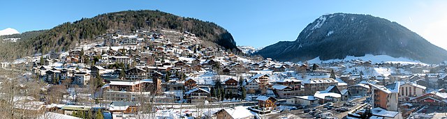

Morzine
- коммуна во Франции
Hiking in Morzine
Morzine is a beautiful alpine town located in the French Alps, part of the Portes du Soleil ski area, which is well-known for both winter sports and summer hiking opportunities. The region offers a diverse range of trails and breathtaking landscapes, making it ideal for hikers of all levels. Here’s what you need to know about hiking in Morzine:...
- Страна:
- Почтовый код: 74110
- Координаты: 46° 10' 48" N, 6° 42' 33" E
- GPS треки (wikiloc): [Ссылка]
- Высота над уровнем моря: 1000 м m
- Площадь: 44.1 кв.км
- Население: 2870
- Веб сайт: [Ссылка]

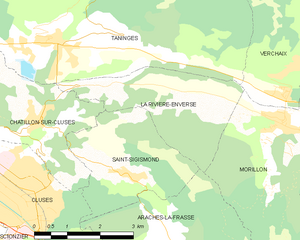
La Rivière-Enverse
- коммуна во Франции
Hiking in La Rivière-Enverse
La Rivière-Enverse is a picturesque village located in the Haute-Savoie region of France, offering stunning scenery and a range of hiking opportunities. Nestled in the French Alps, this area boasts a mix of lush valleys, dramatic peaks, and tranquil rivers. Here’s what you need to know about hiking in and around La Rivière-Enverse:...
- Страна:
- Почтовый код: 74440
- Координаты: 46° 5' 34" N, 6° 38' 11" E
- GPS треки (wikiloc): [Ссылка]
- Площадь: 7.98 кв.км
- Население: 457


Самоэнс
- коммуна во Франции
Hiking in Самоэнс
Samoëns is a beautiful village located in the Haute-Savoie region of the French Alps. It is known for its stunning scenery, traditional architecture, and excellent outdoor recreational opportunities, making it a fantastic destination for hiking enthusiasts. Here are some key points to consider when hiking in Samoëns:...
- Страна:
- Почтовый код: 74340
- Координаты: 46° 5' 2" N, 6° 43' 38" E
- GPS треки (wikiloc): [Ссылка]
- Высота над уровнем моря: 710 м m
- Площадь: 97.29 кв.км
- Население: 2396
- Веб сайт: [Ссылка]


Ле-Же
- коммуна во Франции
Hiking in Ле-Же
Les Gets is a charming mountain resort located in the French Alps, part of the Portes du Soleil ski area. While it's well-known for its winter sports, it also offers fantastic hiking opportunities throughout the summer months. Here are some key details about hiking in Les Gets:...
- Страна:
- Почтовый код: 74260
- Координаты: 46° 9' 35" N, 6° 40' 13" E
- GPS треки (wikiloc): [Ссылка]
- Высота над уровнем моря: 1172 м m
- Площадь: 29.98 кв.км
- Население: 1251
- Веб сайт: [Ссылка]


Morillon
- коммуна во Франции
Hiking in Morillon
Morillon, a charming village in the French Alps, is part of the larger Grand Massif ski area, which is known not only for skiing but also for a variety of outdoor activities in the warmer months, including hiking. Here are some key points about hiking in Morillon:...
- Страна:
- Почтовый код: 74440
- Координаты: 46° 5' 2" N, 6° 40' 32" E
- GPS треки (wikiloc): [Ссылка]
- Площадь: 14.51 кв.км
- Население: 632
- Веб сайт: [Ссылка]