Taninges (Taninges)

- коммуна во Франции
 Hiking in Taninges
Taninges, located in the Haute-Savoie region of the French Alps, is an excellent destination for hiking enthusiasts. The area is known for its breathtaking landscapes, including majestic mountains, lush valleys, and beautiful alpine meadows. Here are some highlights and tips for hiking in and around Taninges:
Hiking Trails
-
Le Retour du Praz: This is a popular hiking route that offers stunning views of the surrounding peaks. The trail is well-marked and suited for various skill levels.
-
Domaine de la Praz: This area provides several trails ranging from easy walks to more challenging hikes. Many trails offer scenic views of Mount Blanc and the surrounding mountains.
-
Col de la Ramaz: A great hike that takes you through beautiful landscapes and is accessible during the summer months. It features diverse flora and fauna and offers spectacular views.
-
Les Chalets de l'Essert: This moderate hike leads you to charming alpine chalets and provides opportunities to appreciate the local wildlife and plant life.
Tips for Hiking in Taninges
-
Season Considerations: The best time for hiking in Taninges is during late spring to early autumn (May to October). Check the local weather conditions, as mountain weather can change rapidly.
-
Maps and Navigation: Carry a detailed hiking map of the area or use a GPS device. Trails are generally well-marked, but it’s always good to have a backup.
-
Gear Up: Wear proper hiking boots, and ensure you dress in layers suitable for changing temperatures. Bringing a backpack with snacks, water, and a first-aid kit is essential.
-
Local Gastronomy: After a day of hiking, enjoy the local cuisine. The region is known for its Savoyard specialties such as fondue and tartiflette.
-
Respect Nature: Stay on marked trails, pack out what you pack in, and be mindful of wildlife and flora.
Additional Activities
Besides hiking, Taninges offers other outdoor activities, such as mountain biking, paragliding, and skiing in the winter months. The region is also rich in cultural experiences, including visits to local markets and historical sites.
Conclusion
Hiking in Taninges provides a delightful experience for outdoor lovers, combining natural beauty with local culture. Whether you're a seasoned hiker or a beginner, the trails in and around Taninges cater to all levels of experience. Enjoy your adventure in the French Alps!
- Страна:

- Почтовый код: 74440
- Координаты: 46° 6' 27" N, 6° 35' 29" E


- GPS треки (wikiloc): [Ссылка]
- Площадь: 42.66 кв.км
- Население: 3410
- Википедия английская: wiki(en)
- Википедия национальная: wiki(fr)
- Хранилище Wikidata: Wikidata: Q369188
- Катеория в википедии: [Ссылка]
- код Freebase: [/m/03ntznk]
- код GeoNames: Альт: [6443060]
- номер SIREN: [217402767]
- код BNF: [15274530x]
- код VIAF: Альт: [237025287]
- код муниципалитета INSEE: 74276
Граничит с регионами:

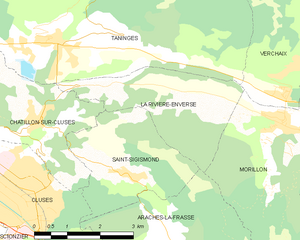
La Rivière-Enverse
- коммуна во Франции
Hiking in La Rivière-Enverse
La Rivière-Enverse is a picturesque village located in the Haute-Savoie region of France, offering stunning scenery and a range of hiking opportunities. Nestled in the French Alps, this area boasts a mix of lush valleys, dramatic peaks, and tranquil rivers. Here’s what you need to know about hiking in and around La Rivière-Enverse:...
- Страна:
- Почтовый код: 74440
- Координаты: 46° 5' 34" N, 6° 38' 11" E
- GPS треки (wikiloc): [Ссылка]
- Площадь: 7.98 кв.км
- Население: 457


Mieussy
- коммуна во Франции
Hiking in Mieussy
Mieussy, located in the Haute-Savoie region of the French Alps, offers a variety of hiking opportunities that cater to different skill levels and preferences. Here are some highlights of hiking in Mieussy:...
- Страна:
- Почтовый код: 74440
- Координаты: 46° 8' 3" N, 6° 31' 22" E
- GPS треки (wikiloc): [Ссылка]
- Площадь: 44.45 кв.км
- Население: 2327
- Веб сайт: [Ссылка]


Verchaix
- коммуна во Франции
Hiking in Verchaix
Verchaix is a beautiful destination located in the French Alps, in the Haute-Savoie region. This picturesque village offers a range of hiking opportunities, making it an excellent choice for both casual hikers and experienced trekkers....
- Страна:
- Почтовый код: 74440
- Координаты: 46° 5' 47" N, 6° 40' 35" E
- GPS треки (wikiloc): [Ссылка]
- Площадь: 15.89 кв.км
- Население: 715


La Côte-d'Arbroz
- коммуна во Франции
Hiking in La Côte-d'Arbroz
La Côte-d'Arbroz is a charming commune located in the Haute-Savoie region of the French Alps. Known for its stunning landscapes and proximity to the Portes du Soleil ski area, it also offers fantastic hiking opportunities, particularly in the summer months when the snow melts and the meadows bloom....
- Страна:
- Почтовый код: 74110
- Координаты: 46° 11' 16" N, 6° 40' 5" E
- GPS треки (wikiloc): [Ссылка]
- Площадь: 12.24 кв.км
- Население: 323
- Веб сайт: [Ссылка]


Châtillon-sur-Cluses
- коммуна во Франции
Hiking in Châtillon-sur-Cluses
Châtillon-sur-Cluses is a picturesque village in the Haute-Savoie region of France, nestled in the Alps. It provides a beautiful backdrop for hiking enthusiasts, offering a variety of trails that cater to different levels of experience. Here are some details about hiking in and around Châtillon-sur-Cluses:...
- Страна:
- Почтовый код: 74300
- Координаты: 46° 5' 14" N, 6° 34' 57" E
- GPS треки (wikiloc): [Ссылка]
- Площадь: 9.18 кв.км
- Население: 1258


Ле-Же
- коммуна во Франции
Hiking in Ле-Же
Les Gets is a charming mountain resort located in the French Alps, part of the Portes du Soleil ski area. While it's well-known for its winter sports, it also offers fantastic hiking opportunities throughout the summer months. Here are some key details about hiking in Les Gets:...
- Страна:
- Почтовый код: 74260
- Координаты: 46° 9' 35" N, 6° 40' 13" E
- GPS треки (wikiloc): [Ссылка]
- Высота над уровнем моря: 1172 м m
- Площадь: 29.98 кв.км
- Население: 1251
- Веб сайт: [Ссылка]