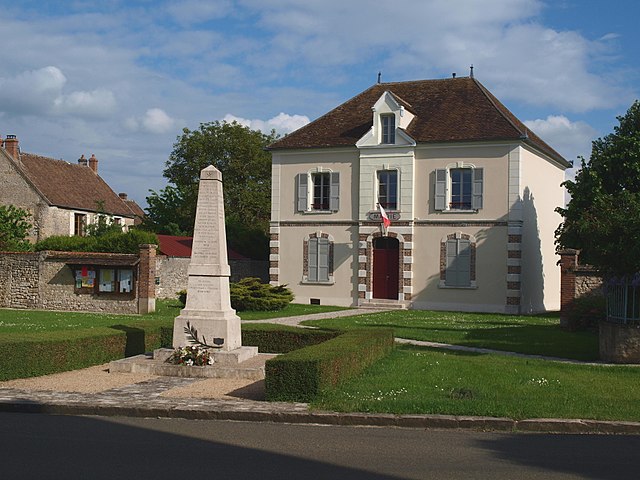
Égreville (Égreville)

- commune in Seine-et-Marne, France
- Country:

- Postal Code: 77620
- Coordinates: 48° 10' 38" N, 2° 52' 17" E


- GPS tracks (wikiloc): [Link]
- Area: 31.84 sq km
- Population: 2159
- Web site: http://www.egreville.fr
- Wikipedia en: wiki(en)
- Wikipedia: wiki(fr)
- Wikidata storage: Wikidata: Q1453306
- Wikipedia Commons Category: [Link]
- Freebase ID: [/m/02qghn8]
- Freebase ID: [/m/02qghn8]
- GeoNames ID: Alt: [3020335]
- GeoNames ID: Alt: [3020335]
- SIREN number: [217701689]
- SIREN number: [217701689]
- BnF ID: [152755080]
- BnF ID: [152755080]
- PACTOLS thesaurus ID: [pcrtk2fobT9Qow]
- PACTOLS thesaurus ID: [pcrtk2fobT9Qow]
- INSEE municipality code: 77168
- INSEE municipality code: 77168
Shares border with regions:

Le Bignon-Mirabeau
- commune in Loiret, France
- Country:
- Postal Code: 45210
- Coordinates: 48° 8' 53" N, 2° 55' 22" E
- GPS tracks (wikiloc): [Link]
- Area: 12.83 sq km
- Population: 324
- Web site: [Link]

Bransles
- commune in Seine-et-Marne, France
- Country:
- Postal Code: 77620
- Coordinates: 48° 9' 7" N, 2° 50' 5" E
- GPS tracks (wikiloc): [Link]
- Area: 13.85 sq km
- Population: 553


Lorrez-le-Bocage-Préaux
- commune in Seine-et-Marne, France
- Country:
- Postal Code: 77710
- Coordinates: 48° 14' 13" N, 2° 54' 3" E
- GPS tracks (wikiloc): [Link]
- Area: 19.9 sq km
- Population: 1291
- Web site: [Link]


Chevannes
- commune in Loiret, France
- Country:
- Postal Code: 45210
- Coordinates: 48° 8' 5" N, 2° 51' 34" E
- GPS tracks (wikiloc): [Link]
- Area: 11.99 sq km
- Population: 320

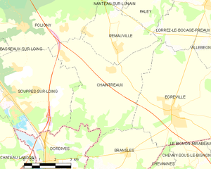
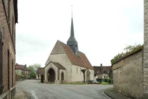
Chaintreaux
- commune in Seine-et-Marne, France
- Country:
- Postal Code: 77460
- Coordinates: 48° 11' 59" N, 2° 49' 10" E
- GPS tracks (wikiloc): [Link]
- Area: 23.92 sq km
- Population: 918

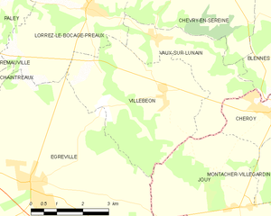
Villebéon
- commune in Seine-et-Marne, France
- Country:
- Postal Code: 77710
- Coordinates: 48° 12' 31" N, 2° 56' 24" E
- GPS tracks (wikiloc): [Link]
- Area: 16.45 sq km
- Population: 480


Chevry-sous-le-Bignon
- commune in Loiret, France
- Country:
- Postal Code: 45210
- Coordinates: 48° 8' 27" N, 2° 53' 50" E
- GPS tracks (wikiloc): [Link]
- Area: 7.4 sq km
- Population: 227
- Web site: [Link]


Jouy
- commune in Yonne, France
- Country:
- Postal Code: 89150
- Coordinates: 48° 10' 2" N, 2° 58' 27" E
- GPS tracks (wikiloc): [Link]
- Area: 17.6 sq km
- Population: 525