Étobon (Étobon)

- commune in Haute-Saône, France
- Country:

- Postal Code: 70400
- Coordinates: 47° 38' 36" N, 6° 40' 35" E


- GPS tracks (wikiloc): [Link]
- Area: 12.26 sq km
- Population: 298
- Wikipedia en: wiki(en)
- Wikipedia: wiki(fr)
- Wikidata storage: Wikidata: Q290357
- Wikipedia Commons Category: [Link]
- Freebase ID: [/m/03nvt8c]
- GeoNames ID: Alt: [3019398]
- SIREN number: [217002211]
- BnF ID: [15272614g]
- INSEE municipality code: 70221
Shares border with regions:

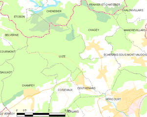
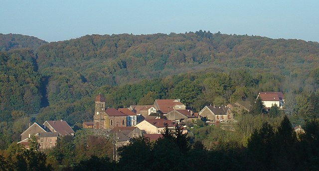
Luze, Haute-Saône
- commune in Haute-Saône, France
 Hiking in Luze, Haute-Saône
Luze is a charming commune located in the Haute-Saône department in eastern France, known for its picturesque landscapes and opportunities for outdoor activities, including hiking. The area is characterized by rolling hills, lush forests, and scenic countryside, making it a great destination for hiking enthusiasts....
- Country:
- Postal Code: 70400
- Coordinates: 47° 35' 49" N, 6° 44' 23" E
- GPS tracks (wikiloc): [Link]
- Area: 10.69 sq km
- Population: 711
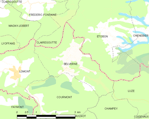
Belverne
- commune in Haute-Saône, France
- Country:
- Postal Code: 70400
- Coordinates: 47° 37' 51" N, 6° 39' 3" E
- GPS tracks (wikiloc): [Link]
- Area: 6.15 sq km
- Population: 144
- Web site: [Link]


Clairegoutte
- commune in Haute-Saône, France
- Country:
- Postal Code: 70200
- Coordinates: 47° 39' 49" N, 6° 37' 17" E
- GPS tracks (wikiloc): [Link]
- Area: 10.48 sq km
- Population: 386
- Web site: [Link]


Champagney
- commune in Haute-Saône, France
- Country:
- Postal Code: 70290
- Coordinates: 47° 42' 21" N, 6° 40' 56" E
- GPS tracks (wikiloc): [Link]
- AboveSeaLevel: 388 м m
- Area: 36.71 sq km
- Population: 3811
- Web site: [Link]

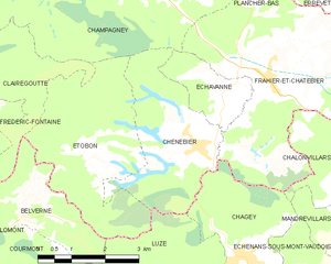
Chenebier
- commune in Haute-Saône, France
- Country:
- Postal Code: 70400
- Coordinates: 47° 38' 30" N, 6° 43' 7" E
- GPS tracks (wikiloc): [Link]
- Area: 9.05 sq km
- Population: 706
- Web site: [Link]