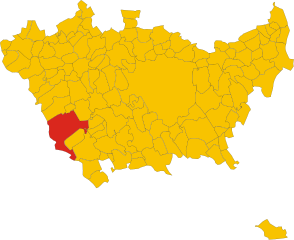
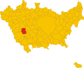
Abbiategrasso (Abbiategrasso)
- Italian comune
Abbiategassso, a charming town located in the Lombardy region of Italy, offers a variety of hiking opportunities, particularly for those who enjoy scenic trails that meander through beautiful landscapes and cultural sites. Here are some key highlights for hiking in and around Abbiategrasso:
Trails and Routes:
-
Naviglio Grande: The Naviglio Grande is a historic canal that flows through Abbiategrasso, offering picturesque walking and biking paths. The trail along the canal is relatively flat and suitable for all skill levels, making it ideal for a leisurely hike. You can enjoy views of the water, quaint bridges, and local flora.
-
Parco della Valle dei Mulini: This park features various trails that wind through natural environments, ideal for those looking to immerse themselves in nature. The park is home to historical mills and offers a peaceful hiking experience.
-
Cultural and Historical Sites: Many hikes around Abbiategrasso can lead you to historical landmarks such as the Castello Visconteo. Incorporate these cultural stops into your hike for a richer experience.
-
Lombardy Paths: The region is part of a larger network of hiking trails in Lombardy, including routes that connect Abbiategrasso to other nearby towns and natural areas. The Francesca and Ciclovia del Naviglio routes can be great options if you’re looking for longer excursions.
Tips for Hikers:
- Footwear: Wear comfortable, sturdy hiking shoes as trails can vary in terrain.
- Weather: Check the weather before you go, as conditions can change quickly. Spring and fall are often ideal for hiking with mild temperatures.
- Hydration and Snacks: Carry enough water and some light snacks to keep your energy up on the trail.
- Map and Navigation: While many trails in the area are well-marked, having a map or using a hiking app can help you navigate and explore more efficiently.
Local Attractions:
- After your hike, consider exploring the town of Abbiategrasso itself. It features local restaurants where you can savor traditional Lombard cuisine, as well as charming shops and cafes.
Safety:
- Hike with a buddy if possible, tell someone your plans, and be mindful of trail conditions, especially after rain.
Whether you're looking for an easy walk along the canal or a more challenging route through the countryside, Abbiategrasso offers a pleasant hiking experience for nature lovers and adventure seekers alike.
- Country:

- Postal Code: 20081
- Local Dialing Code: 02
- Licence Plate Code: MI
- Coordinates: 45° 24' 3" N, 8° 55' 7" E


- GPS tracks (wikiloc): [Link]
- AboveSeaLevel: 120 м m
- Area: 47.78 sq km
- Population: 32295
- Web site: http://www.comune.abbiategrasso.mi.it
- Wikipedia en: wiki(en)
- Wikipedia: wiki(it)
- Wikidata storage: Wikidata: Q42777
- Wikipedia Commons Category: [Link]
- Freebase ID: [/m/07phz3]
- GeoNames ID: Alt: [6540167]
- BnF ID: [14413753v]
- VIAF ID: Alt: [133769225]
- OSM relation ID: [44773]
- GND ID: Alt: [4606162-9]
- archINFORM location ID: [971]
- Library of Congress authority ID: Alt: [n85381405]
- Quora topic ID: [Abbiategrasso]
- UN/LOCODE: [ITATR]
- Gran Enciclopèdia Catalana ID: [0000094]
- ISTAT ID: 015002
- Italian cadastre code: A010
- LombardiaBeniCulturali toponym ID: 8000001
Shares border with regions:

Cerano
- Italian comune
Cerano is a charming village located in the Piedmont region of Italy, specifically in the province of Novara. While it may not be as well-known as other hiking destinations, the surrounding areas offer picturesque landscapes and opportunities for outdoor activities....
- Country:

- Postal Code: 28065
- Local Dialing Code: 0321
- Licence Plate Code: NO
- Coordinates: 45° 24' 0" N, 8° 47' 0" E


- GPS tracks (wikiloc): [Link]
- AboveSeaLevel: 134 м m
- Area: 32.64 sq km
- Population: 6813
- Web site: [Link]


Vigevano
- Italian comune
Vigevano, located in the Lombardy region of Italy, is primarily known for its historical architecture and cultural heritage, particularly the stunning Piazza Ducale and the Castello Sforzesco. While Vigevano itself is not predominantly a hiking destination, it is surrounded by beautiful countryside and offers opportunities for various outdoor activities, including walking and cycling....
- Country:

- Postal Code: 27029
- Local Dialing Code: 0381
- Licence Plate Code: PV
- Coordinates: 45° 19' 0" N, 8° 52' 0" E


- GPS tracks (wikiloc): [Link]
- AboveSeaLevel: 116 м m
- Area: 82.27 sq km
- Population: 63505
- Web site: [Link]
Cassolnovo
- Italian comune
Cassolnovo is a small town located in the Lombardy region of Italy, and while it may not be widely recognized as a hiking destination, it can still offer some opportunities for outdoor enthusiasts. Here are a few things to consider when hiking around Cassolnovo:...
- Country:

- Postal Code: 27023
- Local Dialing Code: 0381
- Licence Plate Code: PV
- Coordinates: 45° 22' 0" N, 8° 48' 0" E


- GPS tracks (wikiloc): [Link]
- AboveSeaLevel: 120 м m
- Area: 31.74 sq km
- Population: 6976
- Web site: [Link]

Morimondo
- Italian comune
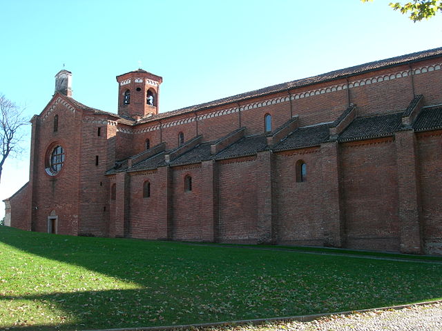
Morimondo is a charming small town located in Lombardy, Italy, known for its historical abbey and serene countryside. While Morimondo is not primarily recognized as a hiking destination, the surrounding area offers beautiful trails that cater to hikers of various skill levels....
- Country:

- Postal Code: 20081
- Local Dialing Code: 02
- Licence Plate Code: MI
- Coordinates: 45° 21' 0" N, 8° 57' 0" E


- GPS tracks (wikiloc): [Link]
- AboveSeaLevel: 109 м m
- Area: 26 sq km
- Population: 1138
- Web site: [Link]
Ozzero
- Italian comune
Ozzero, a scenic area potentially located within a region known for its natural beauty, would typically offer a variety of hiking opportunities depending on the local geography and climate. While I don't have specific data about a place called Ozzero, I can help you with general advice on what to expect when hiking in a picturesque area:...
- Country:

- Postal Code: 20080
- Local Dialing Code: 02
- Licence Plate Code: MI
- Coordinates: 45° 22' 0" N, 8° 55' 0" E


- GPS tracks (wikiloc): [Link]
- AboveSeaLevel: 107 м m
- Area: 10.97 sq km
- Population: 1489
- Web site: [Link]


Cassinetta di Lugagnano
- Italian comune
 Hiking in Cassinetta di Lugagnano
Cassinetta di Lugagnano is a charming small village located in the Lombardy region of Italy, nestled near the banks of the Naviglio Grande canal. It offers a picturesque setting and a great opportunity for hiking enthusiasts to explore both the natural beauty and historical aspects of the area....
- Country:

- Postal Code: 20081
- Local Dialing Code: 02
- Licence Plate Code: MI
- Coordinates: 45° 25' 27" N, 8° 54' 31" E


- GPS tracks (wikiloc): [Link]
- AboveSeaLevel: 125 м m
- Area: 3.32 sq km
- Population: 1911
- Web site: [Link]

Robecco sul Naviglio
- Italian comune
 Hiking in Robecco sul Naviglio
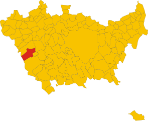
Robecco sul Naviglio is a charming town located in the Lombardy region of Italy, near the banks of the Naviglio Grande canal. While it's not a major hiking destination compared to some of the larger Italian national parks, it does offer some pleasant walking and hiking opportunities, especially along the waterways and in the surrounding rural landscapes....
- Country:

- Postal Code: 20087
- Local Dialing Code: 02
- Licence Plate Code: MI
- Coordinates: 45° 26' 0" N, 8° 53' 0" E


- GPS tracks (wikiloc): [Link]
- AboveSeaLevel: 120 м m
- Area: 19.79 sq km
- Population: 6766
- Web site: [Link]

Vermezzo
- settlement in the italian municipality of Vermezzo con Zelo
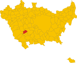
Vermezzo is a small town located in the Lombardy region of Italy, known more for its proximity to larger cities like Milan than for extensive hiking networks. However, the surrounding areas offer some opportunities for outdoor activities, including hiking....
- Country:

- Postal Code: 20080
- Local Dialing Code: 02
- Licence Plate Code: MI
- Coordinates: 45° 24' 0" N, 8° 58' 0" E


- GPS tracks (wikiloc): [Link]
- AboveSeaLevel: 111 м m
- Area: 6.31 sq km
- Population: 3931
- Web site: [Link]

Albairate
- Italian comune
Albaitare, a small municipality located in the Lombardy region of Italy, is known for its beautiful landscapes and proximity to nature, making it a delightful place for hiking. Here are some key points to guide you about hiking in this area:...
- Country:

- Postal Code: 20080
- Local Dialing Code: 02
- Licence Plate Code: MI
- Coordinates: 45° 25' 0" N, 8° 56' 0" E


- GPS tracks (wikiloc): [Link]
- AboveSeaLevel: 124 м m
- Area: 14.98 sq km
- Population: 4708
- Web site: [Link]
