Aigurande (Aigurande)
- commune in Indre, France
- Country:

- Postal Code: 36140
- Coordinates: 46° 26' 3" N, 1° 49' 44" E


- GPS tracks (wikiloc): [Link]
- Area: 27.77 sq km
- Population: 1458
- Web site: http://www.aigurande.fr
- Wikipedia en: wiki(en)
- Wikipedia: wiki(fr)
- Wikidata storage: Wikidata: Q211643
- Wikipedia Commons Category: [Link]
- Freebase ID: [/m/0b_76m]
- GeoNames ID: Alt: [3038458]
- SIREN number: [213600018]
- BnF ID: [15257305g]
- VIAF ID: Alt: [168399448]
- Library of Congress authority ID: Alt: [n90708112]
- PACTOLS thesaurus ID: [pcrto9pkiwS49e]
- WOEID: [575540]
- INSEE municipality code: 36001
Shares border with regions:


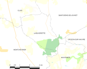
La Buxerette
- commune in Indre, France
- Country:

- Postal Code: 36140
- Coordinates: 46° 29' 41" N, 1° 48' 8" E


- GPS tracks (wikiloc): [Link]
- Area: 10.99 sq km
- Population: 104


Lourdoueix-Saint-Pierre
- commune in Creuse, France
- Country:

- Postal Code: 23360
- Coordinates: 46° 24' 35" N, 1° 49' 20" E


- GPS tracks (wikiloc): [Link]
- Area: 44.73 sq km
- Population: 779


Crozon-sur-Vauvre
- commune in Indre, France
- Country:

- Postal Code: 36140
- Coordinates: 46° 29' 19" N, 1° 52' 13" E


- GPS tracks (wikiloc): [Link]
- Area: 27.69 sq km
- Population: 345


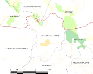
La Forêt-du-Temple
- commune in Creuse, France
- Country:

- Postal Code: 23360
- Coordinates: 46° 25' 15" N, 1° 54' 10" E


- GPS tracks (wikiloc): [Link]
- Area: 7.72 sq km
- Population: 141
Méasnes
- commune in Creuse, France
- Country:

- Postal Code: 23360
- Coordinates: 46° 24' 59" N, 1° 46' 40" E


- GPS tracks (wikiloc): [Link]
- Area: 27.63 sq km
- Population: 552


Montchevrier
- commune in Indre, France
- Country:

- Postal Code: 36140
- Coordinates: 46° 28' 50" N, 1° 44' 33" E


- GPS tracks (wikiloc): [Link]
- Area: 34.7 sq km
- Population: 459
