Aillon-le-Jeune (Aillon-le-Jeune)

- commune in Savoie, France
 Hiking in Aillon-le-Jeune
Aillon-le-Jeune is a charming mountain village located in the Savoie region of the French Alps, known for its stunning natural landscapes and outdoor activities, particularly hiking. The area is part of the Bauges Regional Natural Park, offering a diverse range of trails ranging from easy walks to challenging hikes.
Hiking Highlights in Aillon-le-Jeune:
-
Varied Trails: There are numerous hiking trails suitable for all levels, from family-friendly paths to more strenuous mountain routes. The trails are often well-marked and provide access to breathtaking views of the surrounding mountains and the Lac du Bourget.
-
Flora and Fauna: Hikers can enjoy an array of flora and fauna, including alpine meadows, forests, and possibly sighting local wildlife such as chamois and deer. Spring and early summer are especially beautiful with wildflowers in bloom.
-
Panoramic Views: Many hikes in Aillon-le-Jeune reward you with stunning panoramic views of the Alps. Look for trails that lead to viewpoints or summits, such as the Aillon Peak or Mont Margériaz.
-
Cultural Heritage: Some trails may also lead you to quaint hamlets or historical sites, allowing you to experience the local culture and heritage of the region.
-
Accessibility: Aillon-le-Jeune is easily accessible from nearby cities, making it a great spot for day hikes or weekend getaways. The local tourist office can provide maps, guidebooks, and advice on current trail conditions.
-
Winter Hiking: In the winter months, some trails are suitable for snowshoeing, offering a different way to experience the snowy landscapes.
Safety Tips:
- Check Weather Conditions: The weather can change quickly in the mountains, so it's important to check forecasts and be prepared for varying conditions.
- Wear Appropriate Gear: Good hiking boots and layered clothing are essential. Bring plenty of water and snacks, along with a map or GPS device.
- Trail Etiquette: Stay on marked trails, respect wildlife, and carry out any trash.
Overall, hiking in Aillon-le-Jeune offers a fantastic opportunity to connect with nature, enjoy stunning views, and immerse yourself in the beautiful alpine environment of the French Alps.
- Country:

- Postal Code: 73340
- Coordinates: 45° 37' 5" N, 6° 4' 50" E


- GPS tracks (wikiloc): [Link]
- Area: 34.09 sq km
- Population: 435
- Wikipedia en: wiki(en)
- Wikipedia: wiki(fr)
- Wikidata storage: Wikidata: Q405261
- Wikipedia Commons Category: [Link]
- Freebase ID: [/m/03cb_yy]
- GeoNames ID: Alt: [6452506]
- SIREN number: [217300045]
- BnF ID: [152739403]
- VIAF ID: Alt: [248315411]
- GND ID: Alt: [7598495-7]
- PACTOLS thesaurus ID: [pcrtzEZPeI2RWz]
- INSEE municipality code: 73004
Shares border with regions:


Saint-Jean-de-la-Porte
- commune in Savoie, France
Hiking in Saint-Jean-de-la-Porte
Saint-Jean-de-la-Porte is a charming village in the Savoie region of the French Alps, known for its beautiful landscapes and outdoor activities, including hiking. Here are some highlights and tips for hiking in this area:...
- Country:
- Postal Code: 73250
- Coordinates: 45° 33' 24" N, 6° 7' 41" E
- GPS tracks (wikiloc): [Link]
- Area: 16.01 sq km
- Population: 902
- Web site: [Link]


Sainte-Reine, Savoie
- commune in Savoie, France
Hiking in Sainte-Reine, Savoie
Sainte-Reine is a charming commune in the Savoie region of the French Alps, known for its beautiful landscapes and rich natural heritage. Hiking in this area can be a delightful experience for outdoor enthusiasts, offering a variety of trails suitable for different skill levels. Here are some highlights and tips for hiking in Sainte-Reine, Savoie:...
- Country:
- Postal Code: 73630
- Coordinates: 45° 36' 42" N, 6° 8' 23" E
- GPS tracks (wikiloc): [Link]
- Area: 14.62 sq km
- Population: 153
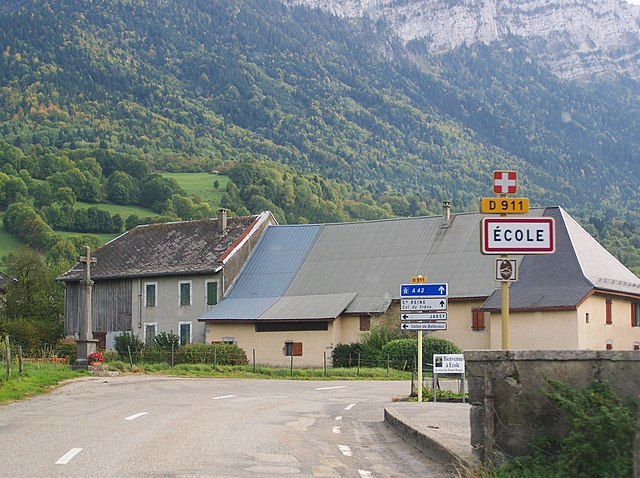

École, Savoie
- commune in Savoie, France
Hiking in École, Savoie
École in Savoie, located in the Auvergne-Rhône-Alpes region of France, offers a picturesque setting for hiking enthusiasts. Nestled in the heart of the French Alps, this area is known for its stunning natural landscapes, including mountains, valleys, and beautiful lakes. Here are some key points to consider if you're planning to hike around École:...
- Country:
- Postal Code: 73630
- Coordinates: 45° 39' 2" N, 6° 10' 3" E
- GPS tracks (wikiloc): [Link]
- Area: 29.65 sq km
- Population: 271


Aillon-le-Vieux
- commune in Savoie, France
Hiking in Aillon-le-Vieux
Aillon-le-Vieux is a picturesque commune located in the Savoie department of the Auvergne-Rhône-Alpes region in southeastern France. The area is known for its stunning natural beauty, characterized by lush forests, rocky landscapes, and panoramic mountain views, making it a great destination for hiking enthusiasts....
- Country:
- Postal Code: 73340
- Coordinates: 45° 39' 3" N, 6° 5' 37" E
- GPS tracks (wikiloc): [Link]
- Area: 21.63 sq km
- Population: 177


La Thuile, Savoie
- commune in Savoie, France
Hiking in La Thuile, Savoie
La Thuile is a beautiful alpine village located in the Aosta Valley region of Italy, near the French border. It’s an excellent destination for hiking enthusiasts, offering a range of trails that cater to different skill levels, from leisurely walks to more challenging treks. Here’s what you need to know about hiking in La Thuile, Savoie:...
- Country:
- Postal Code: 73190
- Coordinates: 45° 31' 58" N, 6° 3' 22" E
- GPS tracks (wikiloc): [Link]
- Area: 18.26 sq km
- Population: 331
- Web site: [Link]


Thoiry
- commune in Savoie, France
Hiking in Thoiry
Thoiry, located in the Savoie region of France, offers a variety of beautiful hiking opportunities that cater to different skill levels. This picturesque area is surrounded by stunning alpine landscapes, forests, and scenic trails that provide both challenging hikes and easier walks for families or beginners....
- Country:
- Postal Code: 73230
- Coordinates: 45° 35' 28" N, 6° 1' 45" E
- GPS tracks (wikiloc): [Link]
- Area: 17.75 sq km
- Population: 465


Les Déserts
- commune in Savoie, France
Hiking in Les Déserts
Les Déserts is a beautiful region in the French Alps, located near the town of Albertville in the Savoie department. This area is known for its stunning landscapes, rich flora and fauna, and several hiking trails that offer a range of difficulties for outdoor enthusiasts....
- Country:
- Postal Code: 73230
- Coordinates: 45° 37' 17" N, 6° 0' 40" E
- GPS tracks (wikiloc): [Link]
- Area: 33.59 sq km
- Population: 758