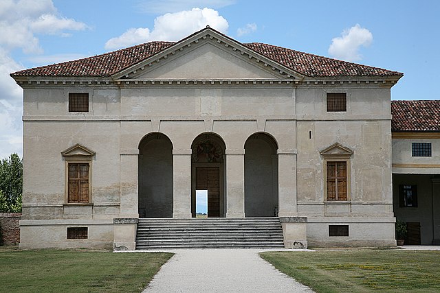
Albettone (Albettone)
.svg)
- Italian comune
 Hiking in Albettone
Albettone is a small town located in the Veneto region of Italy, and while it may not be as well-known as other hiking destinations, it is surrounded by beautiful landscapes that offer opportunities for hiking and outdoor activities. Here are some aspects of hiking in and around Albettone:
Scenic Trails
-
Local Trails: The area features rustic trails that wind through vineyards, olive groves, and rolling hills, providing a chance to immerse yourself in the local culture and natural beauty.
-
Vicenza Hills: Nearby, you can explore trails in the Vicenza Hills, which offer a variety of hiking options with panoramic views of the surrounding countryside.
-
Monte Berico: A popular nearby destination, Monte Berico, provides a more challenging hike with rewarding views of the city of Vicenza and its remarkable architecture.
Nature and Wildlife
- The region is home to diverse flora and fauna. Hikers may encounter various plant species, birds, and other wildlife while exploring the trails.
Tips for Hiking in Albettone
-
Weather: Check the local weather forecast before heading out, as conditions can change quickly, especially in hilly areas.
-
Footwear: Wear sturdy hiking boots for comfort and support, as some trails may be uneven or rocky.
-
Hydration and Snacks: Carry plenty of water and snacks, especially if you plan on spending several hours hiking.
-
Maps and Guides: Consider using local maps or guides to navigate the trails effectively, as some paths may not be well marked.
-
Respect Nature: Follow Leave No Trace principles to help protect the environment. Stay on marked trails to minimize your impact.
Nearby Attractions
- In addition to hiking, you can explore local vineyards, historic towns, and cultural sites in the Veneto region, which is rich in history and art.
Make sure to enjoy the stunning views and the peaceful surroundings while hiking in and around Albettone!
- Country:

- Postal Code: 36020
- Local Dialing Code: 0444
- Licence Plate Code: VI
- Coordinates: 45° 22' 0" N, 11° 35' 0" E


- GPS tracks (wikiloc): [Link]
- AboveSeaLevel: 19 м m
- Area: 20.21 sq km
- Population: 2051
- Web site: http://www.comune.albettone.vi.it
- Wikipedia en: wiki(en)
- Wikipedia: wiki(it)
- Wikidata storage: Wikidata: Q46833
- Wikipedia Commons Category: [Link]
- Freebase ID: [/m/0g8m2p]
- GeoNames ID: Alt: [6538250]
- VIAF ID: Alt: [244777724]
- OSM relation ID: [44789]
- UN/LOCODE: [ITABT]
- ISTAT ID: 024002
- Italian cadastre code: A154
Shares border with regions:

Rovolon
- Italian comune
Hiking in Rovolon
Rovolon is a charming town located in the Veneto region of Italy, not far from the city of Vicenza. Surrounded by the beautiful landscapes of the Colli Euganei, Rovolon offers a variety of hiking opportunities for outdoor enthusiasts....
- Country:
- Postal Code: 35030
- Local Dialing Code: 049
- Licence Plate Code: PD
- Coordinates: 45° 21' 0" N, 11° 40' 0" E
- GPS tracks (wikiloc): [Link]
- AboveSeaLevel: 152 м m
- Area: 27.69 sq km
- Population: 4950
- Web site: [Link]

Vò
- Italian commune
Hiking in Vò
Vò, located in the Veneto region of Italy, offers several hiking opportunities amidst beautiful landscapes and historical sites. The area is known for its rolling hills, vineyards, and charming countryside....
- Country:
- Postal Code: 35030
- Local Dialing Code: 049
- Licence Plate Code: PD
- Coordinates: 45° 20' 0" N, 11° 38' 0" E
- GPS tracks (wikiloc): [Link]
- AboveSeaLevel: 19 м m
- Area: 20.37 sq km
- Population: 3341
- Web site: [Link]


Campiglia dei Berici
- Italian comune
Hiking in Campiglia dei Berici
Campiglia dei Berici is a charming village located in the Veneto region of Italy, surrounded by the picturesque Berici Hills. This area offers wonderful opportunities for hiking, allowing outdoor enthusiasts to explore beautiful landscapes, rolling hills, vineyards, and forests....
- Country:
- Postal Code: 36020
- Local Dialing Code: 0444
- Licence Plate Code: VI
- Coordinates: 45° 20' 0" N, 11° 32' 0" E
- GPS tracks (wikiloc): [Link]
- AboveSeaLevel: 16 м m
- Area: 11.04 sq km
- Population: 1698
- Web site: [Link]
Villaga
- Italian comune
Hiking in Villaga
Villaga is a charming town located in the Veneto region of Italy, which is known for its picturesque landscapes and opportunities for outdoor activities, including hiking. Although Villaga itself may not be a widely known hiking hotspot, its proximity to various natural attractions makes it a great base for hiking enthusiasts. Here are some considerations and recommendations for hiking in and around Villaga:...
- Country:
- Postal Code: 36021
- Local Dialing Code: 0444
- Licence Plate Code: VI
- Coordinates: 45° 24' 10" N, 11° 32' 5" E
- GPS tracks (wikiloc): [Link]
- AboveSeaLevel: 45 м m
- Area: 23.23 sq km
- Population: 1905
- Web site: [Link]
Sossano
- Italian comune
Hiking in Sossano
Sossano is a charming town located in the province of Vicenza in Italy, nestled in the beautiful region of Veneto. While Sossano itself is not widely known specifically for hiking, there are plenty of opportunities for outdoor enthusiasts in the surrounding areas....
- Country:
- Postal Code: 36040
- Local Dialing Code: 0444
- Licence Plate Code: VI
- Coordinates: 45° 22' 0" N, 11° 31' 0" E
- GPS tracks (wikiloc): [Link]
- AboveSeaLevel: 19 м m
- Area: 20.9 sq km
- Population: 4296
- Web site: [Link]

Agugliaro
- Italian comune
Hiking in Agugliaro
Agugliaro is a charming municipality located in the Province of Vicenza, Italy. While it may not be as widely known as some other hiking destinations, it offers beautiful landscapes and opportunities for outdoor activities, especially for those looking to enjoy trails in a less commercialized setting....
- Country:
- Postal Code: 36020
- Local Dialing Code: 0444
- Licence Plate Code: VI
- Coordinates: 45° 20' 0" N, 11° 35' 0" E
- GPS tracks (wikiloc): [Link]
- AboveSeaLevel: 13 м m
- Area: 14.7 sq km
- Population: 1403
- Web site: [Link]