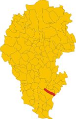
Rovolon (Rovolon)
.svg)
- Italian comune
 Hiking in Rovolon
Rovolon is a charming town located in the Veneto region of Italy, not far from the city of Vicenza. Surrounded by the beautiful landscapes of the Colli Euganei, Rovolon offers a variety of hiking opportunities for outdoor enthusiasts.
Hiking Trails
Here are some key points to consider when hiking in and around Rovolon:
-
Colli Euganei Regional Park: This park is a prominent feature of the area, offering numerous trails that vary in difficulty. The landscape is characterized by rolling hills, volcanic formations, and lush vegetation.
-
Trail Options: You can find trails that cater to both beginners and experienced hikers. Some popular routes include:
- Monte Duca: A moderate hike that rewards you with stunning panoramic views of the surrounding countryside.
- Sentiero del Monte Lozzo: A longer route offering the chance to explore diverse flora and fauna.
- Biking Trails: Some trails are also suitable for mountain biking, allowing for a different way to explore the area.
-
Scenic Features: Along the trails, you'll encounter historic sites such as ancient churches, old vineyards, and picturesque viewpoints. The region is known for its natural beauty, so keep your camera handy!
-
Flora and Fauna: The park is home to a rich variety of plant and animal species. Birdwatchers and nature lovers will find it particularly rewarding, as you may spot rare birds and unique vegetation.
Hiking Tips
- Preparation: Make sure to wear proper hiking footwear and carry enough water and snacks for your trip. The weather can be unpredictable, so check forecasts and dress in layers.
- Maps and Guides: While many trails are well-marked, it’s always a good idea to have a map or a local guide. You can often find visitor centers in the area that provide maps and additional information.
- Respect the Environment: Follow Leave No Trace principles to help preserve the natural beauty of the region.
Best Time to Hike
The best time for hiking in Rovolon and the Colli Euganei is during the spring and fall, when temperatures are mild and the trails are less crowded. Summers can be hot, and winters may bring rain or snow, so be prepared for varying conditions.
Enjoy your hiking adventure in Rovolon! If you have more specific questions or need recommendations tailored to your preferences, feel free to ask!
- Country:

- Postal Code: 35030
- Local Dialing Code: 049
- Licence Plate Code: PD
- Coordinates: 45° 21' 0" N, 11° 40' 0" E


- GPS tracks (wikiloc): [Link]
- AboveSeaLevel: 152 м m
- Area: 27.69 sq km
- Population: 4950
- Web site: http://www.comune.rovolon.pd.it/
- Wikipedia en: wiki(en)
- Wikipedia: wiki(it)
- Wikidata storage: Wikidata: Q34445
- Wikipedia Commons Category: [Link]
- Freebase ID: [/m/0gk53w]
- GeoNames ID: Alt: [6536288]
- VIAF ID: Alt: [233876421]
- OSM relation ID: [44798]
- GND ID: Alt: [4540982-1]
- TGN ID: [7042362]
- UN/LOCODE: [ITRVN]
- ISTAT ID: 028071
- Italian cadastre code: H622
Shares border with regions:
Cervarese Santa Croce
- Italian comune
Hiking in Cervarese Santa Croce
Cervarese Santa Croce is a charming municipality in the province of Padua, Italy, nestled at the foot of the Euganean Hills. This area offers a variety of hiking opportunities, set against a backdrop of beautiful landscapes, rolling hills, and lush greenery....
- Country:
- Postal Code: 35030
- Local Dialing Code: 049
- Licence Plate Code: PD
- Coordinates: 45° 24' 11" N, 11° 41' 32" E
- GPS tracks (wikiloc): [Link]
- AboveSeaLevel: 30 м m
- Area: 17.71 sq km
- Population: 5779
- Web site: [Link]

Teolo
- Italian comune
Hiking in Teolo
Teolo is a charming town located in the Veneto region of Italy, situated near the Euganean Hills, which are known for their beautiful landscapes, rich history, and diverse flora and fauna. Hiking in Teolo offers a variety of trails and paths that cater to different skill levels and preferences....
- Country:
- Postal Code: 35037
- Local Dialing Code: 049
- Licence Plate Code: PD
- Coordinates: 45° 21' 0" N, 11° 40' 0" E
- GPS tracks (wikiloc): [Link]
- AboveSeaLevel: 175 м m
- Area: 31.2 sq km
- Population: 9014
- Web site: [Link]

Vò
- Italian commune
Hiking in Vò
Vò, located in the Veneto region of Italy, offers several hiking opportunities amidst beautiful landscapes and historical sites. The area is known for its rolling hills, vineyards, and charming countryside....
- Country:
- Postal Code: 35030
- Local Dialing Code: 049
- Licence Plate Code: PD
- Coordinates: 45° 20' 0" N, 11° 38' 0" E
- GPS tracks (wikiloc): [Link]
- AboveSeaLevel: 19 м m
- Area: 20.37 sq km
- Population: 3341
- Web site: [Link]


Montegaldella
- Italian comune
Hiking in Montegaldella
Montegaldella is a charming area located in the Veneto region of Italy, known for its beautiful natural landscapes and hiking opportunities. The region offers a range of trails that cater to various skill levels, making it a great destination for both beginners and experienced hikers....
- Country:
- Postal Code: 36047
- Local Dialing Code: 0444
- Licence Plate Code: VI
- Coordinates: 45° 26' 0" N, 11° 40' 0" E
- GPS tracks (wikiloc): [Link]
- AboveSeaLevel: 23 м m
- Area: 13.57 sq km
- Population: 1774
- Web site: [Link]

Nanto
- Italian comune
Hiking in Nanto
Nanto, located in the Veneto region of Italy, offers a delightful experience for hikers, featuring beautiful landscapes, scenic trails, and cultural landmarks. The area is characterized by rolling hills, vineyards, and stunning views of the surrounding countryside, making it a picturesque destination for outdoor enthusiasts....
- Country:
- Postal Code: 36024
- Local Dialing Code: 0444
- Licence Plate Code: VI
- Coordinates: 45° 26' 0" N, 11° 35' 0" E
- GPS tracks (wikiloc): [Link]
- AboveSeaLevel: 20 м m
- Area: 14.35 sq km
- Population: 3091
- Web site: [Link]


Albettone
- Italian comune
Hiking in Albettone
Albettone is a small town located in the Veneto region of Italy, and while it may not be as well-known as other hiking destinations, it is surrounded by beautiful landscapes that offer opportunities for hiking and outdoor activities. Here are some aspects of hiking in and around Albettone:...
- Country:
- Postal Code: 36020
- Local Dialing Code: 0444
- Licence Plate Code: VI
- Coordinates: 45° 22' 0" N, 11° 35' 0" E
- GPS tracks (wikiloc): [Link]
- AboveSeaLevel: 19 м m
- Area: 20.21 sq km
- Population: 2051
- Web site: [Link]