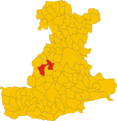
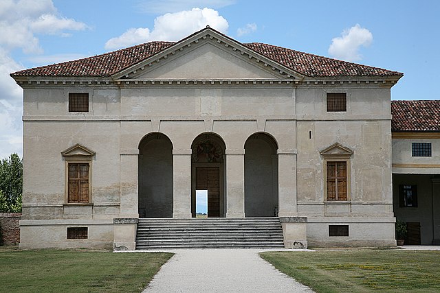
Vò (Vo')
- Italian commune
Vò, located in the Veneto region of Italy, offers several hiking opportunities amidst beautiful landscapes and historical sites. The area is known for its rolling hills, vineyards, and charming countryside.
-
Trails and Routes: While Vò itself may not have extensive hiking trails, the surrounding Euganean Hills Regional Park offers numerous hiking and walking paths. These trails vary in difficulty and provide stunning views of the hills, valleys, and nearby towns.
-
Natural Features: The Euganean Hills are volcanic in origin, so hikers can explore unique geological formations, lush forests, and diverse flora and fauna. The area is also dotted with thermal springs, which are popular in the nearby towns.
-
Cultural Attractions: While hiking, you can also discover historical sites, such as ancient ruins and medieval towns like Monselice and Este, which are not far from Vò. This adds a cultural aspect to your hiking experience.
-
Preparation: If planning a hiking trip in this area, consider the season and weather conditions. Spring and fall are usually the best times to hike due to milder weather. Always wear appropriate footwear, carry water, and check trail maps in advance.
-
Local Cuisine: After a day of hiking, you can enjoy local Veneto cuisine in the nearby towns, featuring delicious wines, cheeses, and traditional dishes.
Before heading out, it's a good idea to check local resources or visitor centers for updated information on trails, maps, and safety guidelines to ensure a safe and enjoyable hiking experience in and around Vò.
- Country:

- Postal Code: 35030
- Local Dialing Code: 049
- Licence Plate Code: PD
- Coordinates: 45° 20' 0" N, 11° 38' 0" E


- GPS tracks (wikiloc): [Link]
- AboveSeaLevel: 19 м m
- Area: 20.37 sq km
- Population: 3341
- Web site: http://www.comune.vo.pd.it
- Wikipedia en: wiki(en)
- Wikipedia: wiki(it)
- Wikidata storage: Wikidata: Q34545
- Wikipedia Commons Category: [Link]
- Freebase ID: [/m/0gk67d]
- GeoNames ID: Alt: [6542674]
- VIAF ID: Alt: [234713294]
- OSM relation ID: [44698]
- UN/LOCODE: [ITVOP]
- ISTAT ID: 028105
- Italian cadastre code: M103
Shares border with regions:


Rovolon
- Italian comune
Rovolon is a charming town located in the Veneto region of Italy, not far from the city of Vicenza. Surrounded by the beautiful landscapes of the Colli Euganei, Rovolon offers a variety of hiking opportunities for outdoor enthusiasts....
- Country:

- Postal Code: 35030
- Local Dialing Code: 049
- Licence Plate Code: PD
- Coordinates: 45° 21' 0" N, 11° 40' 0" E


- GPS tracks (wikiloc): [Link]
- AboveSeaLevel: 152 м m
- Area: 27.69 sq km
- Population: 4950
- Web site: [Link]


Galzignano Terme
- Italian comune
Galzignano Terme is a picturesque town located in the Euganean Hills in the Veneto region of Italy. Known for its thermal baths and beautiful landscapes, the area offers a variety of hiking opportunities for outdoor enthusiasts....
- Country:

- Postal Code: 35030
- Local Dialing Code: 049
- Licence Plate Code: PD
- Coordinates: 45° 18' 29" N, 11° 43' 53" E


- GPS tracks (wikiloc): [Link]
- AboveSeaLevel: 22 м m
- Area: 18.2 sq km
- Population: 4321
- Web site: [Link]


Teolo
- Italian comune
Teolo is a charming town located in the Veneto region of Italy, situated near the Euganean Hills, which are known for their beautiful landscapes, rich history, and diverse flora and fauna. Hiking in Teolo offers a variety of trails and paths that cater to different skill levels and preferences....
- Country:

- Postal Code: 35037
- Local Dialing Code: 049
- Licence Plate Code: PD
- Coordinates: 45° 21' 0" N, 11° 40' 0" E


- GPS tracks (wikiloc): [Link]
- AboveSeaLevel: 175 м m
- Area: 31.2 sq km
- Population: 9014
- Web site: [Link]


Lozzo Atestino
- Italian comune
Lozzo Atestino is a charming municipality located in the province of Vicenza, in the Veneto region of northern Italy. It is surrounded by lush landscapes and offers stunning views of the surrounding hills and mountains, making it a fantastic destination for hiking enthusiasts....
- Country:

- Postal Code: 35034
- Local Dialing Code: 0429
- Licence Plate Code: PD
- Coordinates: 45° 17' 0" N, 11° 38' 0" E


- GPS tracks (wikiloc): [Link]
- AboveSeaLevel: 19 м m
- Area: 24.07 sq km
- Population: 3095
- Web site: [Link]
Cinto Euganeo
- Italian comune
Cinto Euganeo, located in the Colli Euganei Regional Park in Italy, is a delightful destination for hiking enthusiasts. Known for its picturesque landscapes, rolling hills, and lush vegetation, this area offers a variety of trails that cater to different skill levels....
- Country:

- Postal Code: 35030
- Local Dialing Code: 0429
- Licence Plate Code: PD
- Coordinates: 45° 17' 0" N, 11° 40' 0" E


- GPS tracks (wikiloc): [Link]
- AboveSeaLevel: 35 м m
- Area: 19.76 sq km
- Population: 1973
- Web site: [Link]


Albettone
- Italian comune
Albettone is a small town located in the Veneto region of Italy, and while it may not be as well-known as other hiking destinations, it is surrounded by beautiful landscapes that offer opportunities for hiking and outdoor activities. Here are some aspects of hiking in and around Albettone:...
- Country:

- Postal Code: 36020
- Local Dialing Code: 0444
- Licence Plate Code: VI
- Coordinates: 45° 22' 0" N, 11° 35' 0" E


- GPS tracks (wikiloc): [Link]
- AboveSeaLevel: 19 м m
- Area: 20.21 sq km
- Population: 2051
- Web site: [Link]


Agugliaro
- Italian comune
Agugliaro is a charming municipality located in the Province of Vicenza, Italy. While it may not be as widely known as some other hiking destinations, it offers beautiful landscapes and opportunities for outdoor activities, especially for those looking to enjoy trails in a less commercialized setting....
- Country:

- Postal Code: 36020
- Local Dialing Code: 0444
- Licence Plate Code: VI
- Coordinates: 45° 20' 0" N, 11° 35' 0" E


- GPS tracks (wikiloc): [Link]
- AboveSeaLevel: 13 м m
- Area: 14.7 sq km
- Population: 1403
- Web site: [Link]

